

<< Our Photo Pages >> Cringle Park - Modern Stone Circle etc in England in Greater Manchester
Submitted by TimPrevett on Friday, 19 September 2025 Page Views: 2625
Modern SitesSite Name: Cringle Park Alternative Name: LevyhengeCountry: England
NOTE: This site is 0.7 km away from the location you searched for.
County: Greater Manchester Type: Modern Stone Circle etc
Nearest Town: Levenshulme
Map Ref: SJ87399347
Latitude: 53.437854N Longitude: 2.191286W
Condition:
| 5 | Perfect |
| 4 | Almost Perfect |
| 3 | Reasonable but with some damage |
| 2 | Ruined but still recognisable as an ancient site |
| 1 | Pretty much destroyed, possibly visible as crop marks |
| 0 | No data. |
| -1 | Completely destroyed |
| 5 | Superb |
| 4 | Good |
| 3 | Ordinary |
| 2 | Not Good |
| 1 | Awful |
| 0 | No data. |
| 5 | Can be driven to, probably with disabled access |
| 4 | Short walk on a footpath |
| 3 | Requiring a bit more of a walk |
| 2 | A long walk |
| 1 | In the middle of nowhere, a nightmare to find |
| 0 | No data. |
| 5 | co-ordinates taken by GPS or official recorded co-ordinates |
| 4 | co-ordinates scaled from a detailed map |
| 3 | co-ordinates scaled from a bad map |
| 2 | co-ordinates of the nearest village |
| 1 | co-ordinates of the nearest town |
| 0 | no data |
Internal Links:
External Links:
I have visited· I would like to visit
TimPrevett visited on 19th Sep 2025 - their rating: Cond: 4 Amb: 4 Access: 5 A modern stone circle of fourteen stones built in 2003, finely landscaped to rise within the park as a focal point. Designed to be a sundial, parts of that device remain in the centre, but no interpretive panel as of September 19 2025 on my visit. Also known as Levyhenge. The library sells a Tote bag to celebrate the landmark.
I spent some time pondering possible alignments to solsticial and equinoctal events. Two pairs of stones on the west and north west side are close but not close enough in my reckoning to give an accurate alignment for any key date, but are certainly sympathetic enough in intention to suggest paying attention to the solar transit through the year.
")
A modern stone circle of fourteen stones built in 2003, finely landscaped to rise within the park as a focal point. Designed to be a sundial, parts of that device remain in the centre, but no interpretive panel as of September 19 2025 on my visit. Also known as Levyhenge. The library sells a Tote bag to celebrate the landmark.
I spent some time pondering possible alignments to solsticial and equinoctal events. Two pairs of stones on the west and north west side are close but not close enough in my reckoning to give an accurate alignment for any key date, but are certainly sympathetic enough in intention to suggest paying attention to the solar transit through the year.
You may be viewing yesterday's version of this page. To see the most up to date information please register for a free account.
")
")
")
Do not use the above information on other web sites or publications without permission of the contributor.
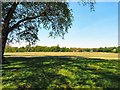
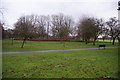
Nearby Images from Geograph Britain and Ireland:
©2013(licence)
©2013(licence)
©2013(licence)
©2013(licence)
©2013(licence)
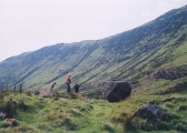
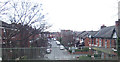
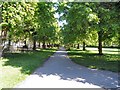
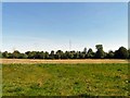
The above images may not be of the site on this page, they are loaded from Geograph.
Please Submit an Image of this site or go out and take one for us!
Click here to see more info for this site
Nearby sites
Key: Red: member's photo, Blue: 3rd party photo, Yellow: other image, Green: no photo - please go there and take one, Grey: site destroyed
Download sites to:
KML (Google Earth)
GPX (GPS waypoints)
CSV (Garmin/Navman)
CSV (Excel)
To unlock full downloads you need to sign up as a Contributory Member. Otherwise downloads are limited to 50 sites.
Turn off the page maps and other distractions
Nearby sites listing. In the following links * = Image available
4.3km NW 317° Manchester Museum* Museum (SJ845966)
5.1km SSW 200° St Mary (Cheadle, Stockport) Ancient Cross (SJ85668864)
7.3km WNW 287° The Great Stone (Trafford)* Natural Stone / Erratic / Other Natural Feature (SJ8043395580)
7.3km ESE 116° St Chad's Well (Chadkirk)* Holy Well or Sacred Spring (SJ93979027)
8.5km E 94° Werneth Low (Hyde) Ancient Village or Settlement (SJ959928)
8.7km E 90° Lower Higham Farm Cairn (SJ961935)
9.1km E 90° Hangingbank, Werneth Low* Ancient Village or Settlement (SJ96479352)
9.5km E 93° Werneth Low Cairn Cairn (SJ969929)
9.7km E 92° Werneth Low Enclosure Ancient Village or Settlement (SJ97099315)
10.8km WNW 299° St Mary the Virgin (Eccles) Ancient Cross (SJ77899868)
11.7km ESE 103° Brown Low* Round Barrow(s) (SJ988909)
11.7km ESE 113° Mellor Hillfort* Hillfort (SJ982889)
11.8km E 100° Ludworth Intake* Round Barrow(s) (SJ98989131)
12.1km SSW 197° Manchester Ship Canal Stone* Marker Stone (SJ83898193)
12.1km ENE 72° Buckton Edge Cairn (SJ989972)
12.3km ENE 72° Hobson Moor Cairn II Cairn (SJ991972)
12.3km ENE 68° Stalybridge Cairn* Cairn (SJ989980)
12.4km ENE 68° Hobson Moor Cairn I Cairn (SJ990980)
12.8km N 359° St Leonard (Rochdale)* Ancient Cross (SD872063)
12.9km ESE 119° Mellor Moor* Cairn (SJ9867187246)
13.4km E 101° Robin Hood's Picking Rods* Ancient Cross (SK0060990941)
13.4km SE 132° St Mary (Disley)* Ancient Cross (SJ97388444)
13.5km E 101° Chisworth Cupmarked stone* Rock Art (SK007909)
13.6km ENE 62° Harridge Pike Cairn (SJ994999)
13.7km ESE 106° Ringstones (Derbyshire)* Stone Circle (SK006896)
View more nearby sites and additional images


 We would like to know more about this location. Please feel free to add a brief description and any relevant information in your own language.
 Wir möchten mehr über diese Stätte erfahren. Bitte zögern Sie nicht, eine kurze Beschreibung und relevante Informationen in Deutsch hinzuzufügen.
 Nous aimerions en savoir encore un peu sur les lieux. S'il vous plaît n'hesitez pas à ajouter une courte description et tous les renseignements pertinents dans votre propre langue.
 Quisieramos informarnos un poco más de las lugares. No dude en añadir una breve descripción y otros datos relevantes en su propio idioma.