<< Our Photo Pages >> Steinsjordene sacrificial marsh - Natural Stone / Erratic / Other Natural Feature in Norway in Telemark
Submitted by kenntha88 on Monday, 24 September 2012 Page Views: 1424
Natural PlacesSite Name: Steinsjordene sacrificial marshCountry: Norway
NOTE: This site is 20.689 km away from the location you searched for.
Fylke: Telemark Type: Natural Stone / Erratic / Other Natural Feature
Nearest Town: Larvik Nearest Village: Bamble
Latitude: 59.004765N Longitude: 9.655437E
Condition:
| 5 | Perfect |
| 4 | Almost Perfect |
| 3 | Reasonable but with some damage |
| 2 | Ruined but still recognisable as an ancient site |
| 1 | Pretty much destroyed, possibly visible as crop marks |
| 0 | No data. |
| -1 | Completely destroyed |
| 5 | Superb |
| 4 | Good |
| 3 | Ordinary |
| 2 | Not Good |
| 1 | Awful |
| 0 | No data. |
| 5 | Can be driven to, probably with disabled access |
| 4 | Short walk on a footpath |
| 3 | Requiring a bit more of a walk |
| 2 | A long walk |
| 1 | In the middle of nowhere, a nightmare to find |
| 0 | No data. |
| 5 | co-ordinates taken by GPS or official recorded co-ordinates |
| 4 | co-ordinates scaled from a detailed map |
| 3 | co-ordinates scaled from a bad map |
| 2 | co-ordinates of the nearest village |
| 1 | co-ordinates of the nearest town |
| 0 | no data |
Internal Links:
External Links:
")
This flat, grassy field that once was a swampy area, is believed to have been a marsh in ancient times. Here there has been found a lot of artefacts from the stone age and up to the bronze age. It had not been used for agriculture until the 1700s.
Among the finds in the field were two very large flint axes, they were too large to have been for human use. It is believed they had been made to be a sacrifice to ancient gods. They are believed to be around 5000 years old. Several other flint blades have also been found in this once marshy area.
A number of charcoal pits have been found just next to the marsh. It is not known, however, what these pits have been used for. In the bottom of the pits was found a large quantity of charcoal.
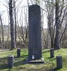
Close to the narrow country road is a round barrow. It is around 18 metres in diameter and around 2 metres in height. It is locally called "Eikehaugen" (the oak mound) because of a large oak tree growing on top. It has never been excavated.
You may be viewing yesterday's version of this page. To see the most up to date information please register for a free account.
")
")
Do not use the above information on other web sites or publications without permission of the contributor.
Nearby Images from Flickr


The above images may not be of the site on this page, but were taken nearby. They are loaded from Flickr so please click on them for image credits.
Click here to see more info for this site
Nearby sites
Click here to view sites on an interactive map of the areaKey: Red: member's photo, Blue: 3rd party photo, Yellow: other image, Green: no photo - please go there and take one, Grey: site destroyed
Download sites to:
KML (Google Earth)
GPX (GPS waypoints)
CSV (Garmin/Navman)
CSV (Excel)
To unlock full downloads you need to sign up as a Contributory Member. Otherwise downloads are limited to 50 sites.
Turn off the page maps and other distractions
Nearby sites listing. In the following links * = Image available
590m NE 50° Bamble standing stone* Standing Stone (Menhir)
901m NE 52° Bamble Offerlund* Timber Circle
3.5km NNE 22° Rugtvedt Settlement* Ancient Village or Settlement
9.0km NNE 25° Lerstang* Stone Circle
9.1km NNE 25° Rødvik-Slottet* Hillfort
10.3km ESE 109° Mølen* Cairn
12.6km NE 42° Landgangen* Rock Art
12.8km NNE 12° Eidanger Prestegård* Barrow Cemetery
15.3km E 88° Sannisteinen* Standing Stone (Menhir)
15.9km ESE 102° Hummerbakken-Høgvik* Ancient Village or Settlement
16.1km E 84° Kongerødhaugen Barrow* Round Barrow(s)
16.1km N 354° Østre Klyve* Barrow Cemetery
16.3km NNE 17° Bjørkedalen-Flogstad* Barrow Cemetery
17.2km E 85° Hvatum Standing Stone* Standing Stone (Menhir)
17.3km E 85° Bratthaugåsen* Barrow Cemetery
17.7km N 359° Borgestad* Stone Circle
18.1km N 352° Lyngbakken* Barrow Cemetery
18.1km E 83° Presteåsen* Standing Stone (Menhir)
18.3km NNW 343° Findal Nordre* Barrow Cemetery
18.7km NE 41° Omsland* Barrow Cemetery
18.9km NNW 340° Holtan* Barrow Cemetery
20.2km NNW 347° Gimsø Kloster* Barrow Cemetery
20.8km E 89° Brunla cemetery* Barrow Cemetery
21.6km N 351° Galgeholmen* Round Barrow(s)
21.7km E 87° Agnes stones* Stone Circle
View more nearby sites and additional images


 We would like to know more about this location. Please feel free to add a brief description and any relevant information in your own language.
 Wir möchten mehr über diese Stätte erfahren. Bitte zögern Sie nicht, eine kurze Beschreibung und relevante Informationen in Deutsch hinzuzufügen.
 Nous aimerions en savoir encore un peu sur les lieux. S'il vous plaît n'hesitez pas à ajouter une courte description et tous les renseignements pertinents dans votre propre langue.
 Quisieramos informarnos un poco más de las lugares. No dude en añadir una breve descripción y otros datos relevantes en su propio idioma.