<< Our Photo Pages >> Naustvollen - Standing Stone (Menhir) in Norway in Møre og Romsdal
Submitted by kenntha88 on Friday, 08 September 2017 Page Views: 1952
Neolithic and Bronze AgeSite Name: NaustvollenCountry: Norway
NOTE: This site is 16.856 km away from the location you searched for.
Fylke: Møre og Romsdal Type: Standing Stone (Menhir)
Nearest Town: Molde Nearest Village: Vestnes
Latitude: 62.640339N Longitude: 6.820230E
Condition:
| 5 | Perfect |
| 4 | Almost Perfect |
| 3 | Reasonable but with some damage |
| 2 | Ruined but still recognisable as an ancient site |
| 1 | Pretty much destroyed, possibly visible as crop marks |
| 0 | No data. |
| -1 | Completely destroyed |
| 5 | Superb |
| 4 | Good |
| 3 | Ordinary |
| 2 | Not Good |
| 1 | Awful |
| 0 | No data. |
| 5 | Can be driven to, probably with disabled access |
| 4 | Short walk on a footpath |
| 3 | Requiring a bit more of a walk |
| 2 | A long walk |
| 1 | In the middle of nowhere, a nightmare to find |
| 0 | No data. |
| 5 | co-ordinates taken by GPS or official recorded co-ordinates |
| 4 | co-ordinates scaled from a detailed map |
| 3 | co-ordinates scaled from a bad map |
| 2 | co-ordinates of the nearest village |
| 1 | co-ordinates of the nearest town |
| 0 | no data |
Internal Links:
External Links:
")
A two metre high coat of concrete has been put on the side of the stone in an attempt to fix it. The concrete layer is around 10cm thick. The stone is on a artificial round hill and also has a concrete base.
You may be viewing yesterday's version of this page. To see the most up to date information please register for a free account.
")
")
")
")
Do not use the above information on other web sites or publications without permission of the contributor.
Nearby Images from Flickr

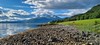

The above images may not be of the site on this page, but were taken nearby. They are loaded from Flickr so please click on them for image credits.
Click here to see more info for this site
Nearby sites
Click here to view sites on an interactive map of the areaKey: Red: member's photo, Blue: 3rd party photo, Yellow: other image, Green: no photo - please go there and take one, Grey: site destroyed
Download sites to:
KML (Google Earth)
GPX (GPS waypoints)
CSV (Garmin/Navman)
CSV (Excel)
To unlock full downloads you need to sign up as a Contributory Member. Otherwise downloads are limited to 50 sites.
Turn off the page maps and other distractions
Nearby sites listing. In the following links * = Image available
15.5km NNE 16° Tangen (Aukra)* Round Barrow(s)
16.2km ESE 104° Kråkneset Cairns* Cairn
16.5km NNE 17° Prestegardsskogen* Round Barrow(s)
18.7km N 357° Korsbø-Smøla* Standing Stones
21.5km NNE 18° Hoksnes* Standing Stone (Menhir)
22.3km NNE 27° Reithaugen Round Barrow(s)
25.0km E 99° Reiestad Standing Stone* Standing Stone (Menhir)
26.3km E 99° Grandan Mounds* Round Barrow(s)
27.8km ENE 69° The Troll's Arrow* Standing Stone (Menhir)
27.9km ESE 102° Våge standing stone* Standing Stone (Menhir)
28.0km ENE 69° Jutahaugen* Stone Circle
28.8km ENE 78° Nesje Standing Stones* Standing Stones
29.7km NNE 14° Gule* Standing Stone (Menhir)
36.6km ENE 77° Horga Pagan Altar* Sculptured Stone
38.4km NNE 20° Malefeten* Barrow Cemetery
39.1km WSW 250° Skjonghelleren* Cave or Rock Shelter
39.9km WSW 258° Blimshaugen mound* Round Barrow(s)
40.1km WSW 259° Sjøskardet standing stone* Standing Stone (Menhir)
41.8km WSW 249° Mjeltehaugen Barrow* Artificial Mound
42.0km WSW 255° Synes standing stone* Standing Stone (Menhir)
42.4km NNE 25° Sandvikshagen* Barrow Cemetery
42.5km WSW 249° Giske standing stone* Standing Stone (Menhir)
44.8km WSW 245° Eilifrøysa Gravhaug* Cairn
44.8km WSW 245° Hogsteinneset standing stones* Standing Stones
46.7km WSW 249° Alnestrøya standing stone* Standing Stone (Menhir)
View more nearby sites and additional images

")
 We would like to know more about this location. Please feel free to add a brief description and any relevant information in your own language.
 Wir möchten mehr über diese Stätte erfahren. Bitte zögern Sie nicht, eine kurze Beschreibung und relevante Informationen in Deutsch hinzuzufügen.
 Nous aimerions en savoir encore un peu sur les lieux. S'il vous plaît n'hesitez pas à ajouter une courte description et tous les renseignements pertinents dans votre propre langue.
 Quisieramos informarnos un poco más de las lugares. No dude en añadir una breve descripción y otros datos relevantes en su propio idioma.