


<< Our Photo Pages >> Hunsbury - Hillfort in England in Northamptonshire
Submitted by LizH on Friday, 08 September 2017 Page Views: 25262
Iron Age and Later PrehistorySite Name: Hunsbury Alternative Name: Danes CampCountry: England County: Northamptonshire Type: Hillfort
Nearest Town: Northampton
Map Ref: SP738584 Landranger Map Number: 152
Latitude: 52.218877N Longitude: 0.921148W
Condition:
| 5 | Perfect |
| 4 | Almost Perfect |
| 3 | Reasonable but with some damage |
| 2 | Ruined but still recognisable as an ancient site |
| 1 | Pretty much destroyed, possibly visible as crop marks |
| 0 | No data. |
| -1 | Completely destroyed |
| 5 | Superb |
| 4 | Good |
| 3 | Ordinary |
| 2 | Not Good |
| 1 | Awful |
| 0 | No data. |
| 5 | Can be driven to, probably with disabled access |
| 4 | Short walk on a footpath |
| 3 | Requiring a bit more of a walk |
| 2 | A long walk |
| 1 | In the middle of nowhere, a nightmare to find |
| 0 | No data. |
| 5 | co-ordinates taken by GPS or official recorded co-ordinates |
| 4 | co-ordinates scaled from a detailed map |
| 3 | co-ordinates scaled from a bad map |
| 2 | co-ordinates of the nearest village |
| 1 | co-ordinates of the nearest town |
| 0 | no data |
Internal Links:
External Links:
I have visited· I would like to visit
SolarMegalith would like to visit
lizh has visited here
")
It is of course a misnomer (as is the local name for parts of the area as ‘Danes camp’ because it is in fact an Iron age hillfort. Interest was regained in it when the area around it was used for ironstone mining in the nineteenth century. This certainly means that the internal floor of the camp has fallen considerably (by more than two metres) which makes the ramparts appear larger since then.
During the quarrying and in subsequent excavations, iron age pits containing tools, pottery and weapons were found. Hunsbury is surrounded by a ditch and a bank. Some ‘restoration’ was probably done when the ironstone mining was finished. The names of roads in the area reflect the names of the engines used for the ironstone tramway ‘Hunslet’ and ‘Sentinel’.
One mile north, towards the bottom of the hill and now completely covered by modern housing, a Neolithic causewayed camp was found. Nothing now remains of it except street names which reflect some of the findings such as ‘Axehead’, and ‘Arrowhead’, along with other names of camps ‘Cissbury’ and ‘Hembury’ and ‘Rainsborough’.
Hunsbury Hill is now in a country park. Inside the bank it is surprisingly peaceful, although the M1 can be heard at almost all times of day and night. There isn’t much of a sense of atmosphere however in my opinion, possibly because it is also used by teenaged bikers and other TWOCers (as I know to my cost) and the inside can be churned up and muddy.
From inside the country park it is relatively easy to find, if you are looking for ramparts, although all signage and information have been kindly removed – presumably by local youth who have nothing better to do. The country park car park is notorious for break ins – if you visit don’t leave anything of value in your car.
Note: Hunsbury Hill Fort Tours and Open Day, Sat/Sun 9/10th September
You may be viewing yesterday's version of this page. To see the most up to date information please register for a free account.
")
")
Do not use the above information on other web sites or publications without permission of the contributor.
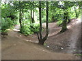
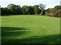
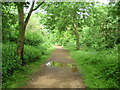
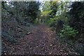
Nearby Images from Geograph Britain and Ireland:
©2012(licence)
©2006(licence)
©2012(licence)
©2018(licence)
©2018(licence)
The above images may not be of the site on this page, they are loaded from Geograph.
Please Submit an Image of this site or go out and take one for us!
Click here to see more info for this site
Nearby sites
Key: Red: member's photo, Blue: 3rd party photo, Yellow: other image, Green: no photo - please go there and take one, Grey: site destroyed
Download sites to:
KML (Google Earth)
GPX (GPS waypoints)
CSV (Garmin/Navman)
CSV (Excel)
To unlock full downloads you need to sign up as a Contributory Member. Otherwise downloads are limited to 50 sites.
Turn off the page maps and other distractions
Nearby sites listing. In the following links * = Image available
1.6km WNW 296° Upton Bowl Barrow Barrow Cemetery (SP72355909)
2.7km NE 43° Northampton Museum and Art Gallery* Museum (SP7559260400)
2.9km NE 53° Becket's Well* Holy Well or Sacred Spring (SP761602)
7.5km N 8° Boughton bowl barrow* Round Barrow(s) (SP74706589)
7.6km NNE 21° Shepherd's Race (Boughton) Turf Maze (SP764655)
7.7km NNE 21° St John's Well (Boughton)* Holy Well or Sacred Spring (SP765656)
9.4km N 9° Longmans Hill Long Barrow* Long Barrow (SP751677)
9.8km NW 314° Great Brington Medieval Cross Ancient Cross (SP6667765176)
10.6km W 262° The Larches Ancient Village or Settlement (SP633567)
12.2km ENE 56° Mears Ashby Tumulus* Misc. Earthwork (SP839653)
13.3km SE 125° Holy Well (Ravenstone)* Holy Well or Sacred Spring (SP849510)
13.5km ESE 112° Holy Well (Olney)* Holy Well or Sacred Spring (SP864535)
13.8km ENE 77° Grendon Cursus Cursus (SP87256174)
15.5km WNW 287° Borough Hill (Daventry)* Hillfort (SP588626)
16.2km NW 324° Oster Hill (West Haddon) Cairn (SP64157145)
17.2km SSE 163° St. Vincent's Well Holy Well or Sacred Spring (SP7942)
17.9km SE 140° Gayhurst Barrow cemetery Barrow Cemetery (SP855448)
19.7km SSE 166° Gorrick’s Well Holy Well or Sacred Spring (SP78803930)
19.7km W 272° Arbury hill Hillfort (SP540587)
21.1km ESE 108° Nell's Well* Holy Well or Sacred Spring (SP941523)
21.4km E 95° Harrold Barrows* Barrow Cemetery (SP95245702)
21.5km WNW 292° Holy Well, Braunston* Holy Well or Sacred Spring (SP537662)
22.3km NE 54° Finedon Stone Marker Stone (SP9161871928)
22.6km SE 143° Millennium Medicine Wheel* Stone Circle (SP8758740483)
22.7km WSW 258° Byfield Cross Plinth Ancient Cross (SP516532)
View more nearby sites and additional images


 We would like to know more about this location. Please feel free to add a brief description and any relevant information in your own language.
 Wir möchten mehr über diese Stätte erfahren. Bitte zögern Sie nicht, eine kurze Beschreibung und relevante Informationen in Deutsch hinzuzufügen.
 Nous aimerions en savoir encore un peu sur les lieux. S'il vous plaît n'hesitez pas à ajouter une courte description et tous les renseignements pertinents dans votre propre langue.
 Quisieramos informarnos un poco más de las lugares. No dude en añadir una breve descripción y otros datos relevantes en su propio idioma.