<< Our Photo Pages >> Korsneset standing stone - Standing Stone (Menhir) in Norway in Sogn og Fjordane
Submitted by kenntha88 on Sunday, 23 September 2012 Page Views: 2041
Neolithic and Bronze AgeSite Name: Korsneset standing stoneCountry: Norway
NOTE: This site is 11.978 km away from the location you searched for.
Fylke: Sogn og Fjordane Type: Standing Stone (Menhir)
Latitude: 61.998112N Longitude: 5.304165E
Condition:
| 5 | Perfect |
| 4 | Almost Perfect |
| 3 | Reasonable but with some damage |
| 2 | Ruined but still recognisable as an ancient site |
| 1 | Pretty much destroyed, possibly visible as crop marks |
| 0 | No data. |
| -1 | Completely destroyed |
| 5 | Superb |
| 4 | Good |
| 3 | Ordinary |
| 2 | Not Good |
| 1 | Awful |
| 0 | No data. |
| 5 | Can be driven to, probably with disabled access |
| 4 | Short walk on a footpath |
| 3 | Requiring a bit more of a walk |
| 2 | A long walk |
| 1 | In the middle of nowhere, a nightmare to find |
| 0 | No data. |
| 5 | co-ordinates taken by GPS or official recorded co-ordinates |
| 4 | co-ordinates scaled from a detailed map |
| 3 | co-ordinates scaled from a bad map |
| 2 | co-ordinates of the nearest village |
| 1 | co-ordinates of the nearest town |
| 0 | no data |
Internal Links:
External Links:
")
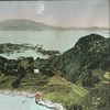
On the small Island of Barmen, on a small hill close to the sea on the southernmost point of the island is a small and pretty standing stone.
The stone is located in a small forest with large pine trees. The trees are blocking the beautiful view over the sea and the mountains to the south. The stone is around 2 metres in height and around 30cm wide and about 10cm thick. It has a very nice smooth surface. The stone had fallen down many years ago, but was re-erected in modern times. Some smaller round stones are found at the base of the stone.
The stone is inside a fenced grazing area for sheep. The hill is surrounded by barbed wire. It is difficult to get to! The site is said to have had several small round barrow cairns around the stone, but these were not possible to locate. A number of them have been destroyed in later years because of agricultural activity.
You may be viewing yesterday's version of this page. To see the most up to date information please register for a free account.
")
")
")
Do not use the above information on other web sites or publications without permission of the contributor.
Nearby Images from Flickr

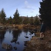
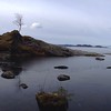
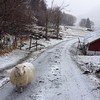
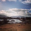
The above images may not be of the site on this page, but were taken nearby. They are loaded from Flickr so please click on them for image credits.
Click here to see more info for this site
Nearby sites
Click here to view sites on an interactive map of the areaKey: Red: member's photo, Blue: 3rd party photo, Yellow: other image, Green: no photo - please go there and take one, Grey: site destroyed
Download sites to:
KML (Google Earth)
GPX (GPS waypoints)
CSV (Garmin/Navman)
CSV (Excel)
To unlock full downloads you need to sign up as a Contributory Member. Otherwise downloads are limited to 50 sites.
Turn off the page maps and other distractions
Nearby sites listing. In the following links * = Image available
1.0km NNE 24° Hornsetra standing stone* Standing Stone (Menhir)
1.2km NNE 24° Barmen Runestone* Carving
6.1km NNE 22° Selje barrow cemetery* Barrow Cemetery
20.2km S 181° Vingen* Rock Art
26.9km NNE 31° Larsnes Standing Stones* Standing Stones
29.8km ESE 108° Naustdal standing stone* Standing Stone (Menhir)
29.9km ESE 107° Viljane standing stone* Standing Stone (Menhir)
37.2km ESE 105° Myklebust Round Barrows* Round Barrow(s)
40.4km NE 45° Selvåg standing stone* Standing Stone (Menhir)
43.6km NE 54° Steinneset standing stones* Standing Stones
44.0km ESE 112° Heksesteinen* Carving
47.1km NE 35° Osnes Standing Stone* Standing Stone (Menhir)
47.2km NE 35° Oshaugen cairn* Cairn
48.2km NNE 34° Ryssholmen Standing Stone* Standing Stone (Menhir)
48.3km NNE 33° Laberget standing stone* Standing Stone (Menhir)
48.9km ESE 115° Vereide barrow cemetery* Barrow Cemetery
49.6km ESE 116° Tystad Standing Stone* Standing Stone (Menhir)
50.8km S 181° Ausevik Rock Art* Rock Art
51.7km ESE 117° Karnil's Mound* Round Barrow(s)
52.0km ESE 116° Austrheim standing stone* Standing Stone (Menhir)
53.3km ESE 119° Trondehaugen* Round Barrow(s)
53.7km ESE 119° Mardal* Barrow Cemetery
55.7km NE 42° Hareid standing stones* Standing Stones
55.8km NE 45° Hjørungavåg standing stones* Standing Stones
64.2km NE 36° Hogsteinneset standing stones* Standing Stones
View more nearby sites and additional images


 We would like to know more about this location. Please feel free to add a brief description and any relevant information in your own language.
 Wir möchten mehr über diese Stätte erfahren. Bitte zögern Sie nicht, eine kurze Beschreibung und relevante Informationen in Deutsch hinzuzufügen.
 Nous aimerions en savoir encore un peu sur les lieux. S'il vous plaît n'hesitez pas à ajouter une courte description et tous les renseignements pertinents dans votre propre langue.
 Quisieramos informarnos un poco más de las lugares. No dude en añadir una breve descripción y otros datos relevantes en su propio idioma.