<< Text Pages >> Birkleyn Caves - Cave or Rock Shelter in Turkey
Submitted by davidmorgan on Saturday, 21 September 2013 Page Views: 2468
Natural PlacesSite Name: Birkleyn CavesCountry: Turkey
NOTE: This site is 16.295 km away from the location you searched for.
Type: Cave or Rock Shelter
Nearest Town: Diyarbakır
Latitude: 38.531088N Longitude: 40.555412E
Condition:
| 5 | Perfect |
| 4 | Almost Perfect |
| 3 | Reasonable but with some damage |
| 2 | Ruined but still recognisable as an ancient site |
| 1 | Pretty much destroyed, possibly visible as crop marks |
| 0 | No data. |
| -1 | Completely destroyed |
| 5 | Superb |
| 4 | Good |
| 3 | Ordinary |
| 2 | Not Good |
| 1 | Awful |
| 0 | No data. |
| 5 | Can be driven to, probably with disabled access |
| 4 | Short walk on a footpath |
| 3 | Requiring a bit more of a walk |
| 2 | A long walk |
| 1 | In the middle of nowhere, a nightmare to find |
| 0 | No data. |
| 5 | co-ordinates taken by GPS or official recorded co-ordinates |
| 4 | co-ordinates scaled from a detailed map |
| 3 | co-ordinates scaled from a bad map |
| 2 | co-ordinates of the nearest village |
| 1 | co-ordinates of the nearest town |
| 0 | no data |
Be the first person to rate this site - see the 'Contribute!' box in the right hand menu.
Internal Links:
External Links:
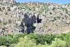
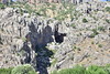
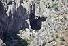
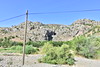
Cave or Rock Shelter in Diyarbakır Province, Turkey
A Late Neolithic settlement in several caves: "The discovery of neolithic Hassuna-Samarra pottery in the entrance halls; which open towards the canyon; suggests that they may have been used seasonally." TAY Project.
The Assyrians believed that this was the source of the River Tigris and "there still exist four small rock inscriptions made by the Assyrian kings Tiglath-pileser I (1114-1076 BC) and Shalmaneser III (858-824 BC): three in the lower cave from which the Dibni flows, and one in an upper cave a few hundred feet so higher up in the mountains." Dr. Matney, University of Akron.
You may be viewing yesterday's version of this page. To see the most up to date information please register for a free account.
Do not use the above information on other web sites or publications without permission of the contributor.
Nearby Images from Flickr
The above images may not be of the site on this page, but were taken nearby. They are loaded from Flickr so please click on them for image credits.
Click here to see more info for this site
Nearby sites
Click here to view sites on an interactive map of the areaKey: Red: member's photo, Blue: 3rd party photo, Yellow: other image, Green: no photo - please go there and take one, Grey: site destroyed
Download sites to:
KML (Google Earth)
GPX (GPS waypoints)
CSV (Garmin/Navman)
CSV (Excel)
To unlock full downloads you need to sign up as a Contributory Member. Otherwise downloads are limited to 50 sites.
Turn off the page maps and other distractions
Nearby sites listing. In the following links * = Image available
50.3km SW 233° Fortress Egil Ancient Temple
57.7km WNW 292° Cinaz III Ancient Village or Settlement
65.4km SW 229° Girikihaciyan Ancient Village or Settlement
68.5km ESE 119° Hallan Cemi Tepe Ancient Village or Settlement
70.3km WSW 248° Kötekan Ancient Village or Settlement
73.0km NE 49° Ashtishat Site Ancient Temple
74.0km WSW 248° Gölbent Mevkii Ancient Village or Settlement
76.1km WSW 249° Papazgölü Ancient Village or Settlement
77.6km WSW 244° Yayvantepe Ancient Village or Settlement
80.2km SE 142° Demircitepe Ancient Village or Settlement
80.3km WSW 245° Cayonu Ancient Village or Settlement
82.6km SSE 169° Hakemi Use Tepe Ancient Village or Settlement
82.6km SSE 158° Salat Tepe Ancient Village or Settlement
84.6km SSE 166° Ziyaret Tepe Ancient Village or Settlement
84.9km WSW 245° Kikan Harabesi Ancient Village or Settlement
85.6km WSW 247° Gri Havsarik Ancient Village or Settlement
85.8km SSE 158° Müslümantepe Ancient Village or Settlement
88.1km SSE 155° Körtik Tepe Ancient Village or Settlement
89.2km W 275° Boytepe Ancient Village or Settlement
103.4km NE 53° Tepekoy* Ancient Village or Settlement
105.8km NE 55° Kayalidere Ancient Village or Settlement
111.5km SE 127° Ayngerm Yani Ancient Village or Settlement
116.2km W 280° Harput Relief* Sculptured Stone
117.8km SE 140° Hasankeyf* Ancient Village or Settlement
118.3km SE 139° Hasankeyf Hoyuk Ancient Village or Settlement
View more nearby sites and additional images


 We would like to know more about this location. Please feel free to add a brief description and any relevant information in your own language.
 Wir möchten mehr über diese Stätte erfahren. Bitte zögern Sie nicht, eine kurze Beschreibung und relevante Informationen in Deutsch hinzuzufügen.
 Nous aimerions en savoir encore un peu sur les lieux. S'il vous plaît n'hesitez pas à ajouter une courte description et tous les renseignements pertinents dans votre propre langue.
 Quisieramos informarnos un poco más de las lugares. No dude en añadir una breve descripción y otros datos relevantes en su propio idioma.