


<< Text Pages >> Abuja Cup Mark Stone - Rock Art in Nigeria
Submitted by KaiHofmann on Tuesday, 24 September 2013 Page Views: 2763
Rock ArtSite Name: Abuja Cup Mark StoneCountry: Nigeria Type: Rock Art
Nearest Town: Abuja
Latitude: 9.188432N Longitude: 7.412254E
Condition:
| 5 | Perfect |
| 4 | Almost Perfect |
| 3 | Reasonable but with some damage |
| 2 | Ruined but still recognisable as an ancient site |
| 1 | Pretty much destroyed, possibly visible as crop marks |
| 0 | No data. |
| -1 | Completely destroyed |
| 5 | Superb |
| 4 | Good |
| 3 | Ordinary |
| 2 | Not Good |
| 1 | Awful |
| 0 | No data. |
| 5 | Can be driven to, probably with disabled access |
| 4 | Short walk on a footpath |
| 3 | Requiring a bit more of a walk |
| 2 | A long walk |
| 1 | In the middle of nowhere, a nightmare to find |
| 0 | No data. |
| 5 | co-ordinates taken by GPS or official recorded co-ordinates |
| 4 | co-ordinates scaled from a detailed map |
| 3 | co-ordinates scaled from a bad map |
| 2 | co-ordinates of the nearest village |
| 1 | co-ordinates of the nearest town |
| 0 | no data |
Be the first person to rate this site - see the 'Contribute!' box in the right hand menu.
Internal Links:
External Links:
Rock Art in Nigeria
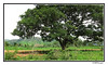
Cup marked stone on a hill above Lower Usuma lake.
You may be viewing yesterday's version of this page. To see the most up to date information please register for a free account.
Do not use the above information on other web sites or publications without permission of the contributor.
Nearby Images from Flickr
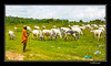
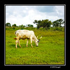
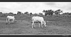
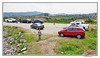

The above images may not be of the site on this page, but were taken nearby. They are loaded from Flickr so please click on them for image credits.
Click here to see more info for this site
Nearby sites
Click here to view sites on an interactive map of the areaKey: Red: member's photo, Blue: 3rd party photo, Yellow: other image, Green: no photo - please go there and take one, Grey: site destroyed
Download sites to:
KML (Google Earth)
GPX (GPS waypoints)
CSV (Garmin/Navman)
CSV (Excel)
To unlock full downloads you need to sign up as a Contributory Member. Otherwise downloads are limited to 50 sites.
Turn off the page maps and other distractions
Nearby sites listing. In the following links * = Image available
11.9km S 191° Jabi Cup Mark Stone Rock Art
32.0km SSE 163° Waru Cup Mark Stone Rock Art
73.2km ENE 62° Taruga* Ancient Village or Settlement
374.3km SSE 161° Ikom Monoliths* Standing Stones
857.8km N 10° Gobero Barrow Cemetery
903.4km NNE 17° Gobero Barrow Cemetery
1012.2km N 2° Air Giraffe Rock Art Rock Art
1099.6km NNE 15° Adrar Madet (Massif) Stone Circle Stone Circle
1261.1km NNW 332° Adrar des Ifoghas petroglyphs Rock Art
1310.5km SW 219° Announcing the Megalithic Portal photo competiton winners for October 2011 NOT SET
1310.5km SW 219° Shepherd's shed gives clues to ancient Alp life Ancient Village or Settlement
1310.5km SW 219° Book Review: Stonehenge - Solving the Neolithic Universe by Jonathan Morris Henge
1310.5km SW 219° The Celtic Way - a walk through the prehistoric sites of western Britain NOT SET
1310.5km SW 219° Pleiades alignments in Wales? Archaoastronomy at Twmbarlwm and South Gwent Hillfort
1310.5km SW 219° Megafauna - Extinction While Humans Peopled NA - Fungus Tells the Tale NOT SET
1310.5km SW 219° Announcing the Megalithic Portal photo competition winners for May 2012 NOT SET
1310.5km SW 219° The Top Reasons why you Should get a Business Loan NOT SET
1310.5km SW 219° Pergola covers and sun shades that enhance outdoor comfort NOT SET
1310.5km SW 219° Set of Ancient Britain Stamps out 17th January 2017 NOT SET
1310.5km SW 219° University of Pennsylvania Archaeologist Recreates Ancient Brews NOT SET
1310.5km SW 219° Utah Sting Nets Two Dozen for Stealing Artifacts from Federal, Tribal Land NOT SET
1310.5km SW 219° Some controversial archaeoastronomy from Colorado NOT SET
1310.5km SW 219° NY lawyer gets jail in Dead Sea Scrolls case NOT SET
1310.5km SW 219° Stonehenge Winter Solstice Open Access 22nd Dec 2009 Henge
1310.5km SW 219° Five Miami Hotels Perfect For A Romantic Getaway NOT SET
View more nearby sites and additional images


 We would like to know more about this location. Please feel free to add a brief description and any relevant information in your own language.
 Wir möchten mehr über diese Stätte erfahren. Bitte zögern Sie nicht, eine kurze Beschreibung und relevante Informationen in Deutsch hinzuzufügen.
 Nous aimerions en savoir encore un peu sur les lieux. S'il vous plaît n'hesitez pas à ajouter une courte description et tous les renseignements pertinents dans votre propre langue.
 Quisieramos informarnos un poco más de las lugares. No dude en añadir una breve descripción y otros datos relevantes en su propio idioma.