<< Our Photo Pages >> Tammispea rändrahn - Natural Stone / Erratic / Other Natural Feature in Estonia
Submitted by Alta-Falisa on Sunday, 13 May 2018 Page Views: 1690
Natural PlacesSite Name: Tammispea rändrahn Alternative Name: Tammispea hiidrahnCountry: Estonia
NOTE: This site is 1.559 km away from the location you searched for.
Type: Natural Stone / Erratic / Other Natural Feature
Nearest Town: Rakvere Nearest Village: Viinistu
Latitude: 59.559900N Longitude: 25.816900E
Condition:
| 5 | Perfect |
| 4 | Almost Perfect |
| 3 | Reasonable but with some damage |
| 2 | Ruined but still recognisable as an ancient site |
| 1 | Pretty much destroyed, possibly visible as crop marks |
| 0 | No data. |
| -1 | Completely destroyed |
| 5 | Superb |
| 4 | Good |
| 3 | Ordinary |
| 2 | Not Good |
| 1 | Awful |
| 0 | No data. |
| 5 | Can be driven to, probably with disabled access |
| 4 | Short walk on a footpath |
| 3 | Requiring a bit more of a walk |
| 2 | A long walk |
| 1 | In the middle of nowhere, a nightmare to find |
| 0 | No data. |
| 5 | co-ordinates taken by GPS or official recorded co-ordinates |
| 4 | co-ordinates scaled from a detailed map |
| 3 | co-ordinates scaled from a bad map |
| 2 | co-ordinates of the nearest village |
| 1 | co-ordinates of the nearest town |
| 0 | no data |
Internal Links:
External Links:
")
"Tammispea" is the name of small hamlet nearby (off the main road and hardly noticeable by a foreign visitor).
"Rändrahn" means boulder -- you would be perfectly understood by saying "kivi" (stone) ou "suurkivi" (big stone), provided you would come across anybody to talk to, that is.
"Hiidrahn" means haunted stone.
Better come from the road 210 (from 59.5578, 25.8292) to limit the stretch on gravel road.
NOTE : as everybody has noticed, there is a 10 to 20 meters discrepancy between the coordinates provided by Google Street Views, ACME Mapper/Google Maps and your navigator. The coordinates I give are the ones I use to find a site. Similarly, I most generally take a picture of whatever landmark can be useful to find a site. In this particular case, a signpost (see photo) helps to locate the stone -- as long as it is upright.
You may be viewing yesterday's version of this page. To see the most up to date information please register for a free account.
")
")
Do not use the above information on other web sites or publications without permission of the contributor.
Nearby Images from Flickr


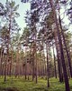
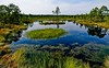
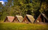

The above images may not be of the site on this page, but were taken nearby. They are loaded from Flickr so please click on them for image credits.
Click here to see more info for this site
Nearby sites
Click here to view sites on an interactive map of the areaKey: Red: member's photo, Blue: 3rd party photo, Yellow: other image, Green: no photo - please go there and take one, Grey: site destroyed
Download sites to:
KML (Google Earth)
GPX (GPS waypoints)
CSV (Garmin/Navman)
CSV (Excel)
To unlock full downloads you need to sign up as a Contributory Member. Otherwise downloads are limited to 50 sites.
Turn off the page maps and other distractions
Nearby sites listing. In the following links * = Image available
5.2km NNW 331° Jaani-Tooma Suurkivi* Natural Stone / Erratic / Other Natural Feature
6.3km NE 55° Saadumetsa suurkivi* Natural Stone / Erratic / Other Natural Feature
18.5km WSW 248° Hundikangrud* Cist
24.9km WSW 241° Lauritsakivi* Natural Stone / Erratic / Other Natural Feature
26.0km E 85° Kaarnakivi* Natural Stone / Erratic / Other Natural Feature
29.7km WSW 258° Augusuurkivi* Natural Stone / Erratic / Other Natural Feature
40.7km WSW 251° Jõelähtme* Barrow Cemetery
42.6km WSW 255° Rebala* Barrow Cemetery
42.7km WSW 250° Kostivere Sliding Stone* Natural Stone / Erratic / Other Natural Feature
43.4km E 91° Ehalkivi* Natural Stone / Erratic / Other Natural Feature
58.2km SW 229° Blue Springs of Saula* Holy Well or Sacred Spring
60.2km WSW 255° Linda Kivi* Natural Stone / Erratic / Other Natural Feature
84.4km NW 325° National Museum of Finland Museum
85.7km NE 48° Megaliths of Hogland Island* Standing Stones
86.4km NW 324° Pronssikautinen hauta Meilahti (1)* Cairn
87.3km NW 322° Pronssikautinen hauta Lehtisaari (2)* Cairn
87.3km NW 323° Pronssikautinen hauta Lehtisaari (1)* Cairn
87.7km NNW 327° Käpylä Hiidenkirnu* Natural Stone / Erratic / Other Natural Feature
88.1km NNW 329° Pihlajamäki Hiidenkirnu Natural Stone / Erratic / Other Natural Feature
99.2km ESE 121° Iisaku Muuseum* Museum
109.5km SSE 157° Kalevipoja lingukivi* Natural Stone / Erratic / Other Natural Feature
110.9km NNE 19° Ahvenkoski Harbour Ancient Village or Settlement
140.8km SSE 158° Toomemäe ohvrikivi* Holed Stone
152.7km NE 47° Labyrinth Krutoyar* Turf Maze
165.3km WNW 296° Lupaja* Barrow Cemetery
View more nearby sites and additional images


 We would like to know more about this location. Please feel free to add a brief description and any relevant information in your own language.
 Wir möchten mehr über diese Stätte erfahren. Bitte zögern Sie nicht, eine kurze Beschreibung und relevante Informationen in Deutsch hinzuzufügen.
 Nous aimerions en savoir encore un peu sur les lieux. S'il vous plaît n'hesitez pas à ajouter une courte description et tous les renseignements pertinents dans votre propre langue.
 Quisieramos informarnos un poco más de las lugares. No dude en añadir una breve descripción y otros datos relevantes en su propio idioma.