<< Text Pages >> Grodzisko Przystronie - Promontory Fort / Cliff Castle in Poland in Dolnoslaskie
Submitted by SolarMegalith on Friday, 26 October 2018 Page Views: 625
Iron Age and Later PrehistorySite Name: Grodzisko PrzystronieCountry: Poland
NOTE: This site is 20.194 km away from the location you searched for.
Voivodeship: Dolnoslaskie Type: Promontory Fort / Cliff Castle
Nearest Town: Niemcza
Latitude: 50.762956N Longitude: 16.814060E
Condition:
| 5 | Perfect |
| 4 | Almost Perfect |
| 3 | Reasonable but with some damage |
| 2 | Ruined but still recognisable as an ancient site |
| 1 | Pretty much destroyed, possibly visible as crop marks |
| 0 | No data. |
| -1 | Completely destroyed |
| 5 | Superb |
| 4 | Good |
| 3 | Ordinary |
| 2 | Not Good |
| 1 | Awful |
| 0 | No data. |
| 5 | Can be driven to, probably with disabled access |
| 4 | Short walk on a footpath |
| 3 | Requiring a bit more of a walk |
| 2 | A long walk |
| 1 | In the middle of nowhere, a nightmare to find |
| 0 | No data. |
| 5 | co-ordinates taken by GPS or official recorded co-ordinates |
| 4 | co-ordinates scaled from a detailed map |
| 3 | co-ordinates scaled from a bad map |
| 2 | co-ordinates of the nearest village |
| 1 | co-ordinates of the nearest town |
| 0 | no data |
Internal Links:
External Links:
Promontory Fort in Dolnoslaskie
An early medieval promontory fort includes a 30m long and 8m wide rampart which protects it from the south. From the west and north the fort is protected by cliffs. In the 1950s and 1960s pottery sherds, coins and iron points were found here.
Read more at atlasgrodzisk.pl
You may be viewing yesterday's version of this page. To see the most up to date information please register for a free account.
Do not use the above information on other web sites or publications without permission of the contributor.
Nearby Images from Flickr
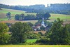
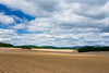
The above images may not be of the site on this page, but were taken nearby. They are loaded from Flickr so please click on them for image credits.
Click here to see more info for this site
Nearby sites
Click here to view sites on an interactive map of the areaKey: Red: member's photo, Blue: 3rd party photo, Yellow: other image, Green: no photo - please go there and take one, Grey: site destroyed
Download sites to:
KML (Google Earth)
GPX (GPS waypoints)
CSV (Garmin/Navman)
CSV (Excel)
To unlock full downloads you need to sign up as a Contributory Member. Otherwise downloads are limited to 50 sites.
Turn off the page maps and other distractions
Nearby sites listing. In the following links * = Image available
13.7km NNW 331° Niedźwiedź i Panna z Rybą* Sculptured Stone
15.3km NNW 339° Sobótka Mnich II* Sculptured Stone
15.4km SE 145° Grobowce Megalityczne Muszkowice* Long Barrow
15.4km SE 146° Kurhany Muszkowice (2)* Barrow Cemetery
15.9km SE 143° Kurhany Muszkowice (3)* Barrow Cemetery
16.0km NNW 342° Sobótka sculptered stone I* Sculptured Stone
16.0km SSE 152° Kurhany Muszkowice (1)* Barrow Cemetery
22.1km NNE 24° Kurhan Kuklice Round Barrow(s)
27.2km NNE 22° Grodzisko Magnice Hillfort
30.7km ESE 115° Grodzisko Jagielnica* Hillfort
32.6km WNW 298° Grodzisko Nowy Jaworów* Hillfort
40.3km WNW 284° Krzyż Pokutny Cisów* Ancient Cross
44.9km S 180° Jaskinia Radochowska Cave or Rock Shelter
45.3km NNE 16° Grodzisko Góra Kapliczna - Osobowice* Hillfort
45.4km ENE 66° Grodzisko Ryczyn Mały* Hillfort
45.6km NNE 15° Grodzisko Szwedzki Szaniec - Osobowice* Hillfort
45.6km ENE 66° Grodzisko Ryczyn Wielki* Hillfort
45.7km ENE 69° Grodzisko Lipki* Hillfort
50.2km NW 317° Grodzisko Mierczyce* Hillfort
53.7km NE 38° Kurhany Oleśniczka* Barrow Cemetery
58.8km N 9° Kurhany Oborniki Slaskie (1)* Round Barrow(s)
59.9km N 9° Grodzisko Oborniki Śląskie* Hillfort
61.7km N 5° Kurhany Oborniki Slaskie (2)* Round Barrow(s)
64.6km N 359° Grodzisko Bagno* Hillfort
69.3km NNE 26° Kurhany Niedary* Barrow Cemetery
View more nearby sites and additional images


 We would like to know more about this location. Please feel free to add a brief description and any relevant information in your own language.
 Wir möchten mehr über diese Stätte erfahren. Bitte zögern Sie nicht, eine kurze Beschreibung und relevante Informationen in Deutsch hinzuzufügen.
 Nous aimerions en savoir encore un peu sur les lieux. S'il vous plaît n'hesitez pas à ajouter une courte description et tous les renseignements pertinents dans votre propre langue.
 Quisieramos informarnos un poco más de las lugares. No dude en añadir una breve descripción y otros datos relevantes en su propio idioma.