

<< Our Photo Pages >> Gruta da Furninha - Cave or Rock Shelter in Portugal in Leiria
Submitted by KaiHofmann on Monday, 26 December 2011 Page Views: 4770
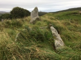
Natural PlacesSite Name: Gruta da FurninhaCountry: Portugal
NOTE: This site is 11.416 km away from the location you searched for.
Distrito: Leiria Type: Cave or Rock Shelter
Nearest Town: Peniche
Latitude: 39.356000N Longitude: 9.401W
Condition:
| 5 | Perfect |
| 4 | Almost Perfect |
| 3 | Reasonable but with some damage |
| 2 | Ruined but still recognisable as an ancient site |
| 1 | Pretty much destroyed, possibly visible as crop marks |
| 0 | No data. |
| -1 | Completely destroyed |
| 5 | Superb |
| 4 | Good |
| 3 | Ordinary |
| 2 | Not Good |
| 1 | Awful |
| 0 | No data. |
| 5 | Can be driven to, probably with disabled access |
| 4 | Short walk on a footpath |
| 3 | Requiring a bit more of a walk |
| 2 | A long walk |
| 1 | In the middle of nowhere, a nightmare to find |
| 0 | No data. |
| 5 | co-ordinates taken by GPS or official recorded co-ordinates |
| 4 | co-ordinates scaled from a detailed map |
| 3 | co-ordinates scaled from a bad map |
| 2 | co-ordinates of the nearest village |
| 1 | co-ordinates of the nearest town |
| 0 | no data |
Be the first person to rate this site - see the 'Contribute!' box in the right hand menu.
Internal Links:
External Links:
")
You may be viewing yesterday's version of this page. To see the most up to date information please register for a free account.
Do not use the above information on other web sites or publications without permission of the contributor.
Nearby Images from Flickr


The above images may not be of the site on this page, but were taken nearby. They are loaded from Flickr so please click on them for image credits.
Click here to see more info for this site
Nearby sites
Click here to view sites on an interactive map of the areaKey: Red: member's photo, Blue: 3rd party photo, Yellow: other image, Green: no photo - please go there and take one, Grey: site destroyed
Download sites to:
KML (Google Earth)
GPX (GPS waypoints)
CSV (Garmin/Navman)
CSV (Excel)
To unlock full downloads you need to sign up as a Contributory Member. Otherwise downloads are limited to 50 sites.
Turn off the page maps and other distractions
Nearby sites listing. In the following links * = Image available
14.8km SSE 149° Museu da Lourinhã* Museum
22.4km E 88° Cidade Romana de Eburobritium Ancient Village or Settlement
32.9km SSE 162° Castro do Zambujal* Castro or Chafurdão
34.2km SSE 160° Tholos do Barro* Chambered Tomb
34.3km ESE 121° Castro de Pragança* Castro or Chafurdão
40.4km NE 53° Estação Arqueológica de Parreitas Ancient Village or Settlement
43.3km E 81° Anta-Capela de Alcobertas* Burial Chamber or Dolmen
49.0km SSE 160° Tholos da Tituaria* Chambered Tomb
50.6km ESE 107° Castro de Vila Nova de São Pedro* Castro or Chafurdão
51.9km S 177° Conjunto Megalítico de Barreira* Standing Stones
54.7km SSE 163° Anta de Carcavelos* Burial Chamber or Dolmen
56.1km SSE 162° Gruta de Salemas* Cave or Rock Shelter
56.2km SSE 162° Anta do Alto da Toupeira* Burial Chamber or Dolmen
56.5km SSE 159° Anta de Casaínhos* Burial Chamber or Dolmen
58.2km SSE 152° Dólmen de Monte Serves* Burial Chamber or Dolmen
61.9km S 178° Sintra Menhir* Standing Stone (Menhir)
62.0km ENE 62° Miradouro Jurássico de Alqueidão da Serra* Modern Stone Circle etc
62.7km S 179° Castelo dos Mouros, Sintra* Cave or Rock Shelter
63.1km SSE 165° Anta das Pedras Grandes* Burial Chamber or Dolmen
64.5km S 185° Anta de Adrenunes* Burial Chamber or Dolmen
64.8km S 183° Tholos do Monge* Chambered Tomb
65.5km S 171° Anta da Agualva* Burial Chamber or Dolmen
65.9km S 170° Anta do Senhor da Serra* Burial Chamber or Dolmen
66.2km SSE 168° Necrópole de Carenque* Rock Cut Tomb
66.2km S 170° Anta da Estria* Burial Chamber or Dolmen
View more nearby sites and additional images


 We would like to know more about this location. Please feel free to add a brief description and any relevant information in your own language.
 Wir möchten mehr über diese Stätte erfahren. Bitte zögern Sie nicht, eine kurze Beschreibung und relevante Informationen in Deutsch hinzuzufügen.
 Nous aimerions en savoir encore un peu sur les lieux. S'il vous plaît n'hesitez pas à ajouter une courte description et tous les renseignements pertinents dans votre propre langue.
 Quisieramos informarnos un poco más de las lugares. No dude en añadir una breve descripción y otros datos relevantes en su propio idioma.