


<< Text Pages >> Cabeço de Alfarela - Castro or Chafurdão in Portugal in Bragança
Submitted by TheCaptain on Wednesday, 08 September 2010 Page Views: 2344
Iron Age and Later PrehistorySite Name: Cabeço de AlfarelaCountry: Portugal
NOTE: This site is 6.581 km away from the location you searched for.
Distrito: Bragança Type: Castro or Chafurdão
Nearest Town: Torre de Moncorvo Nearest Village: Torre de Moncorvo
Latitude: 41.199000N Longitude: 7.051W
Condition:
| 5 | Perfect |
| 4 | Almost Perfect |
| 3 | Reasonable but with some damage |
| 2 | Ruined but still recognisable as an ancient site |
| 1 | Pretty much destroyed, possibly visible as crop marks |
| 0 | No data. |
| -1 | Completely destroyed |
| 5 | Superb |
| 4 | Good |
| 3 | Ordinary |
| 2 | Not Good |
| 1 | Awful |
| 0 | No data. |
| 5 | Can be driven to, probably with disabled access |
| 4 | Short walk on a footpath |
| 3 | Requiring a bit more of a walk |
| 2 | A long walk |
| 1 | In the middle of nowhere, a nightmare to find |
| 0 | No data. |
| 5 | co-ordinates taken by GPS or official recorded co-ordinates |
| 4 | co-ordinates scaled from a detailed map |
| 3 | co-ordinates scaled from a bad map |
| 2 | co-ordinates of the nearest village |
| 1 | co-ordinates of the nearest town |
| 0 | no data |
Be the first person to rate this site - see the 'Contribute!' box in the right hand menu.
Internal Links:
External Links:
Castro in North Portugal
Cabeço de Alfarela is a Castro in the community of Torre de Moncorvo near the town of Torre de Moncorvo, District of Braganca
You may be viewing yesterday's version of this page. To see the most up to date information please register for a free account.
Do not use the above information on other web sites or publications without permission of the contributor.
Nearby Images from Flickr
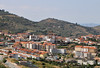
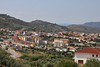

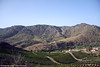
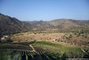

The above images may not be of the site on this page, but were taken nearby. They are loaded from Flickr so please click on them for image credits.
Click here to see more info for this site
Nearby sites
Click here to view sites on an interactive map of the areaKey: Red: member's photo, Blue: 3rd party photo, Yellow: other image, Green: no photo - please go there and take one, Grey: site destroyed
Download sites to:
KML (Google Earth)
GPX (GPS waypoints)
CSV (Garmin/Navman)
CSV (Excel)
To unlock full downloads you need to sign up as a Contributory Member. Otherwise downloads are limited to 50 sites.
Turn off the page maps and other distractions
Nearby sites listing. In the following links * = Image available
8.3km N 0° Povoado de Baldoeiro Castro or Chafurdão
11.6km W 270° Anta de Vilarinho da Castanheira* Burial Chamber or Dolmen
14.0km SSW 201° Vila Nova de Foz Côa* Rock Art
14.2km SSW 201° Parque Arqueologico do Côa Museum* Museum
14.9km SSW 210° Côa Valley* Rock Art
16.9km SSW 198° Gravuras de Rego da Vide* Rock Art
18.4km SW 220° Castelo Velho de Freixo de Numão* Henge
21.6km SW 228° Prazo Menhir* Standing Stone (Menhir)
21.7km SW 228° Estação Arqueológica do Prazo* Ancient Village or Settlement
21.8km SSW 192° Gravuras de Penascosa* Rock Art
22.0km WNW 293° Anta de Zedes* Burial Chamber or Dolmen
22.1km SSW 192° Núcleo de Gravuras da Penascosa* Rock Art
26.7km NE 41° Castro Vicente Castro or Chafurdão
28.1km SSE 147° Pena Redonda Castro or Chafurdão
32.1km ENE 61° Sala Museu de Arqueologia - Mogadouro* Museum
35.6km NW 310° Castro de Palheiros Castro or Chafurdão
36.5km WSW 238° Sepultura antropomórfica de Cômbaros Rock Cut Tomb
36.7km WSW 238° Sepulturas antropomórficas de Fonte Fria Rock Cut Tomb
37.1km WSW 241° Anta do Turgal* Burial Chamber or Dolmen
37.7km WSW 238° Sepulturas antropomórficas da Vale de Perdieiros* Rock Cut Tomb
38.1km SW 229° Menir de Penedono* Standing Stone (Menhir)
38.1km WSW 239° Dolmen do Carvalhal* Burial Chamber or Dolmen
38.1km WSW 239° Monte Penedono Dolmen* Burial Chamber or Dolmen
38.3km WNW 293° Anta da Fonte Coberta* Burial Chamber or Dolmen
38.3km WSW 239° Dólmens de Lapinhas* Burial Chamber or Dolmen
View more nearby sites and additional images


 We would like to know more about this location. Please feel free to add a brief description and any relevant information in your own language.
 Wir möchten mehr über diese Stätte erfahren. Bitte zögern Sie nicht, eine kurze Beschreibung und relevante Informationen in Deutsch hinzuzufügen.
 Nous aimerions en savoir encore un peu sur les lieux. S'il vous plaît n'hesitez pas à ajouter une courte description et tous les renseignements pertinents dans votre propre langue.
 Quisieramos informarnos un poco más de las lugares. No dude en añadir una breve descripción y otros datos relevantes en su propio idioma.