<< Our Photo Pages >> Saint Catherine's Well (Leixlip) - Holy Well or Sacred Spring in Ireland (Republic of) in Co. Kildare
Submitted by feorag on Monday, 28 August 2006 Page Views: 10822
Springs and Holy WellsSite Name: Saint Catherine's Well (Leixlip)Country: Ireland (Republic of)
NOTE: This site is 8.339 km away from the location you searched for.
County: Co. Kildare Type: Holy Well or Sacred Spring
Nearest Town: Leixlip
Map Ref: O018363
Latitude: 53.367326N Longitude: 6.471431W
Condition:
| 5 | Perfect |
| 4 | Almost Perfect |
| 3 | Reasonable but with some damage |
| 2 | Ruined but still recognisable as an ancient site |
| 1 | Pretty much destroyed, possibly visible as crop marks |
| 0 | No data. |
| -1 | Completely destroyed |
| 5 | Superb |
| 4 | Good |
| 3 | Ordinary |
| 2 | Not Good |
| 1 | Awful |
| 0 | No data. |
| 5 | Can be driven to, probably with disabled access |
| 4 | Short walk on a footpath |
| 3 | Requiring a bit more of a walk |
| 2 | A long walk |
| 1 | In the middle of nowhere, a nightmare to find |
| 0 | No data. |
| 5 | co-ordinates taken by GPS or official recorded co-ordinates |
| 4 | co-ordinates scaled from a detailed map |
| 3 | co-ordinates scaled from a bad map |
| 2 | co-ordinates of the nearest village |
| 1 | co-ordinates of the nearest town |
| 0 | no data |
Internal Links:
External Links:
I have visited· I would like to visit
SolarMegalith would like to visit
feorag has visited here
 (PID:23589)")
Two wells, each covered with a stone canopy, one larger than the other. The smaller of the two has a reputation for curing sore eyes. Both wells are said to never run dry.
The larger well once had a wooden door, of which no trace remains. The roof of its canopy is also quite badly damaged, and has been poorly repaired with corrugated iron at some point. Also missing is a statue of the saint that once adorned the well.
The Canons of the Congregation of St. Victor were assaigned the lands on which the wells are located in 1219, by Sir Adam de Hereford. That community's posessions passed to the Abbot of St. Thomas, Dublin, in 1323.
When I visited, there were traces of contemporary reverence, possibly neopagan, in the form of offerings.
References:
St. John Joyce, W., 1920. The Neighbourhood of Dublin, Chapter 34, Dublin.
Donegan, W.S., 1902. Lucania: Topographical, Biographical, Historical, chapter 10 and 11, Dublin.
You may be viewing yesterday's version of this page. To see the most up to date information please register for a free account.
 (PID:23592)")
 (PID:23591)")
 (PID:23590)")
Do not use the above information on other web sites or publications without permission of the contributor.
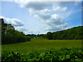
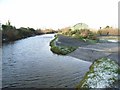
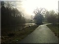
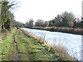
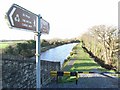
Nearby Images from Geograph Britain and Ireland:
©2012(licence)
©2009(licence)
©2012(licence)
©2009(licence)
©2009(licence)
The above images may not be of the site on this page, they are loaded from Geograph.
Please Submit an Image of this site or go out and take one for us!
Click here to see more info for this site
Nearby sites
Click here to view sites on an interactive map of the areaKey: Red: member's photo, Blue: 3rd party photo, Yellow: other image, Green: no photo - please go there and take one, Grey: site destroyed
Download sites to:
KML (Google Earth)
GPX (GPS waypoints)
CSV (Garmin/Navman)
CSV (Excel)
To unlock full downloads you need to sign up as a Contributory Member. Otherwise downloads are limited to 50 sites.
Turn off the page maps and other distractions
Nearby sites listing. In the following links * = Image available
912m E 97° Knockmaree dolmen* Portal Tomb
6.9km NE 48° Lady's Well (Mulhuddart)* Holy Well or Sacred Spring (O069410)
10.6km SSE 168° Boherboy* Standing Stones
11.8km S 174° Lugg Timber Circle Timber Circle (O032246)
13.4km S 181° Slievethoul Barrow* Round Barrow(s) (O0186022839)
13.9km SSE 164° Knockanvinidee Stone Circle (O060230)
14.7km ESE 102° National Museum of Ireland* Museum
17.0km SSE 151° St Anne's Well (Kilmesantan) Holy Well or Sacred Spring
17.5km SSE 148° Piperstown Stone Circle Stone Circle (O115217)
17.7km SSW 209° Forenaghts Great* Standing Stone (Menhir) (N936206)
18.4km S 174° Ballyfolan Stone Circle (O0418)
18.4km NNW 339° Moybologue Cemetery Artificial Mound
19.1km SE 138° Tibradden Chambered Cairn (O1486922266)
20.0km ENE 74° St Doulagh's Holy Well (Balgriffin) Holy Well or Sacred Spring (SG2230999210)
20.1km NNW 347° Moyer Carns Cairn
20.4km SSE 162° Seefin Passage Grave* Passage Grave
20.4km SSE 162° Seefingan* Cairn
21.2km ESE 111° Blackrock Dolmen* Modern Stone Circle etc
21.2km N 2° Kilbrew Henge
21.3km S 178° Ballyfoyle Stone Circle (O0315)
22.1km SSW 208° Punchestown* Standing Stone (Menhir) (N9172816558)
22.2km SE 135° Ballyedmundaff Stone Circle (O1821)
22.5km SE 133° Ballyedmonduff* Wedge Tomb (O185212)
22.6km SE 129° Kiltiernan Portal Tomb (O197224)
22.6km SSW 209° Craddockstown West* Standing Stone (Menhir) (N9116416282)
View more nearby sites and additional images


 We would like to know more about this location. Please feel free to add a brief description and any relevant information in your own language.
 Wir möchten mehr über diese Stätte erfahren. Bitte zögern Sie nicht, eine kurze Beschreibung und relevante Informationen in Deutsch hinzuzufügen.
 Nous aimerions en savoir encore un peu sur les lieux. S'il vous plaît n'hesitez pas à ajouter une courte description et tous les renseignements pertinents dans votre propre langue.
 Quisieramos informarnos un poco más de las lugares. No dude en añadir una breve descripción y otros datos relevantes en su propio idioma.