


<< Text Pages >> St Anne's Well (Kilmesantan) - Holy Well or Sacred Spring in Ireland (Republic of) in Co. Dublin
Submitted by Anne T on Friday, 11 January 2019 Page Views: 841
Springs and Holy WellsSite Name: St Anne's Well (Kilmesantan)Country: Ireland (Republic of) County: Co. Dublin Type: Holy Well or Sacred Spring
Nearest Town: Tallaght
Latitude: 53.233488N Longitude: 6.349069W
Condition:
| 5 | Perfect |
| 4 | Almost Perfect |
| 3 | Reasonable but with some damage |
| 2 | Ruined but still recognisable as an ancient site |
| 1 | Pretty much destroyed, possibly visible as crop marks |
| 0 | No data. |
| -1 | Completely destroyed |
| 5 | Superb |
| 4 | Good |
| 3 | Ordinary |
| 2 | Not Good |
| 1 | Awful |
| 0 | No data. |
| 5 | Can be driven to, probably with disabled access |
| 4 | Short walk on a footpath |
| 3 | Requiring a bit more of a walk |
| 2 | A long walk |
| 1 | In the middle of nowhere, a nightmare to find |
| 0 | No data. |
| 5 | co-ordinates taken by GPS or official recorded co-ordinates |
| 4 | co-ordinates scaled from a detailed map |
| 3 | co-ordinates scaled from a bad map |
| 2 | co-ordinates of the nearest village |
| 1 | co-ordinates of the nearest town |
| 0 | no data |
Be the first person to rate this site - see the 'Contribute!' box in the right hand menu.
Internal Links:
External Links:
Holy Well or Sacred Spring in Co. Dublin
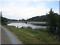
Information about this holy well comes from The Journal of Antiquities - see their entry for St Anne’s Well, Kilmesantan, Co.Dublin, which tells us this well is located to the east of the Upper Bohernabreen Lake/Reservoir, along a path which winds through fields that are often muddy and rough, some 250 yards to the north of Kilmesantan, in the Glensamole Valley.
Some 250 yards to the south at Glassmucky is the old graveyard of Kilmesantan, which dates to the 13th century, although stands on the site of an earlier Celtic church dedicated to St. Santan.
Slightly different information, together with photographs, can be found at Megalithamania, St. Anne's Well, which adds: "The well lies beneath the roots of a large ash tree and is almost invisible until you are right by it. Look for the small caged figurine of St. Anne and a worn sign on the tree trunk. Underneath the tree the well is protected by an arched stone-built roof. I was expecting to see a rag-tree over the well, but there are no offerings. A mug hangs on a bush next to the well so that you can 'atek the waters', but I don't know what properties they may have."
The Journal adds: "The well was always visited on St Anne’s feast-day 26th July for its curative properties; the water was known to be clear and cold coming from deep in the ground. It was regarded as a cure for soreness of the eyes and stomach aches etc."
Note: Have you visited this site? Do you have any photographs or information to add?
You may be viewing yesterday's version of this page. To see the most up to date information please register for a free account.
Do not use the above information on other web sites or publications without permission of the contributor.
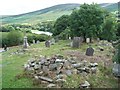
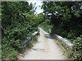
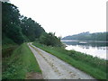
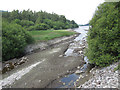
Nearby Images from Geograph Britain and Ireland:
©2007(licence)
©2018(licence)
©2007(licence)
©2018(licence)
©2018(licence)
The above images may not be of the site on this page, they are loaded from Geograph.
Please Submit an Image of this site or go out and take one for us!
Click here to see more info for this site
Nearby sites
Click here to view sites on an interactive map of the areaKey: Red: member's photo, Blue: 3rd party photo, Yellow: other image, Green: no photo - please go there and take one, Grey: site destroyed
Download sites to:
KML (Google Earth)
GPX (GPS waypoints)
CSV (Garmin/Navman)
CSV (Excel)
To unlock full downloads you need to sign up as a Contributory Member. Otherwise downloads are limited to 50 sites.
Turn off the page maps and other distractions
Nearby sites listing. In the following links * = Image available
1.2km E 86° Piperstown Stone Circle Stone Circle (O115217)
4.5km WNW 290° Knockanvinidee Stone Circle (O060230)
4.6km E 83° Tibradden Chambered Cairn (O1486922266)
4.9km SSW 203° Seefin Passage Grave* Passage Grave
4.9km SSW 203° Seefingan* Cairn
7.2km WSW 242° Ballyfolan Stone Circle (O0418)
7.4km NW 308° Boherboy* Standing Stones
7.7km WNW 294° Lugg Timber Circle Timber Circle (O032246)
7.7km E 96° Ballyedmundaff Stone Circle (O1821)
8.2km E 94° Ballyedmonduff* Wedge Tomb (O185212)
8.5km W 280° Slievethoul Barrow* Round Barrow(s) (O0186022839)
8.9km E 100° Glencullen* Standing Stone (Menhir)
9.4km E 86° Kiltiernan Portal Tomb (O197224)
9.8km SW 229° Ballyfoyle Stone Circle (O0315)
11.4km SE 146° Baltynanima* Rock Art (O170123)
11.8km ESE 111° Parknasilloge* Burial Chamber or Dolmen
12.8km E 80° Brennanstown* Portal Tomb (O2286824182)
13.5km NNE 28° National Museum of Ireland* Museum
13.7km ENE 58° Blackrock Dolmen* Modern Stone Circle etc
15.2km E 85° Ballybrack* Portal Tomb (O2542223277)
15.8km WSW 238° Blessington Desmesne Stone Circle (N9713)
16.4km NNW 334° Knockmaree dolmen* Portal Tomb
16.7km W 268° Forenaghts Great* Standing Stone (Menhir) (N936206)
17.0km NNW 331° Saint Catherine's Well (Leixlip)* Holy Well or Sacred Spring (O018363)
19.2km WSW 256° Punchestown* Standing Stone (Menhir) (N9172816558)
View more nearby sites and additional images


 We would like to know more about this location. Please feel free to add a brief description and any relevant information in your own language.
 Wir möchten mehr über diese Stätte erfahren. Bitte zögern Sie nicht, eine kurze Beschreibung und relevante Informationen in Deutsch hinzuzufügen.
 Nous aimerions en savoir encore un peu sur les lieux. S'il vous plaît n'hesitez pas à ajouter une courte description et tous les renseignements pertinents dans votre propre langue.
 Quisieramos informarnos un poco más de las lugares. No dude en añadir una breve descripción y otros datos relevantes en su propio idioma.