


<< Our Photo Pages >> Dun Leigh - Stone Fort or Dun in Scotland in Argyll
Submitted by SolarMegalith on Thursday, 09 February 2023 Page Views: 616
Iron Age and Later PrehistorySite Name: Dun LeighCountry: Scotland
NOTE: This site is 5.466 km away from the location you searched for.
County: Argyll Type: Stone Fort or Dun
Nearest Town: Taynuilt
Map Ref: NN01813243
Latitude: 56.442279N Longitude: 5.21673W
Condition:
| 5 | Perfect |
| 4 | Almost Perfect |
| 3 | Reasonable but with some damage |
| 2 | Ruined but still recognisable as an ancient site |
| 1 | Pretty much destroyed, possibly visible as crop marks |
| 0 | No data. |
| -1 | Completely destroyed |
| 5 | Superb |
| 4 | Good |
| 3 | Ordinary |
| 2 | Not Good |
| 1 | Awful |
| 0 | No data. |
| 5 | Can be driven to, probably with disabled access |
| 4 | Short walk on a footpath |
| 3 | Requiring a bit more of a walk |
| 2 | A long walk |
| 1 | In the middle of nowhere, a nightmare to find |
| 0 | No data. |
| 5 | co-ordinates taken by GPS or official recorded co-ordinates |
| 4 | co-ordinates scaled from a detailed map |
| 3 | co-ordinates scaled from a bad map |
| 2 | co-ordinates of the nearest village |
| 1 | co-ordinates of the nearest town |
| 0 | no data |
Internal Links:
External Links:
I have visited· I would like to visit
SolarMegalith visited on 4th Sep 2022 - their rating: Cond: 3 Amb: 5 Access: 4 Wonderful location, Dun Leigh was one of the highlights of my 2022 trip to Scotland.
")
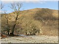
A reasonably preserved dun is located on a rocky ridge by the mouth of River Awe. The outer wall-face can be traced at most of the structure’s perimeter, it is most spectacular in the North-Eastern part where three courses of large stones survived. No stretch of the inner wall-face is visible.
Canmore entry
You may be viewing yesterday's version of this page. To see the most up to date information please register for a free account.
")
")
")
")
Do not use the above information on other web sites or publications without permission of the contributor.
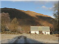
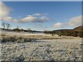
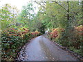
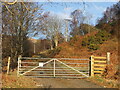
Nearby Images from Geograph Britain and Ireland:
©2022(licence)
©2022(licence)
©2020(licence)
©2022(licence)
©2022(licence)
The above images may not be of the site on this page, they are loaded from Geograph.
Please Submit an Image of this site or go out and take one for us!
Click here to see more info for this site
Nearby sites
Key: Red: member's photo, Blue: 3rd party photo, Yellow: other image, Green: no photo - please go there and take one, Grey: site destroyed
Download sites to:
KML (Google Earth)
GPX (GPS waypoints)
CSV (Garmin/Navman)
CSV (Excel)
To unlock full downloads you need to sign up as a Contributory Member. Otherwise downloads are limited to 50 sites.
Turn off the page maps and other distractions
Nearby sites listing. In the following links * = Image available
1.4km SSW 203° Taynault (Lorn)* Standing Stone (Menhir) (NN01203115)
1.9km SW 221° Nelson's monument, Taynuilt* Standing Stone (Menhir) (NN00513109)
2.4km S 189° Dun Mhuirageul* Stone Fort or Dun (NN01323008)
5.3km WNW 285° Dun Chathach (Connel) Hillfort (NM96743401)
5.3km WNW 295° Ardchattan Priory* Sculptured Stone (NM971349)
6.7km NNE 26° Muirheadstone* Natural Stone / Erratic / Other Natural Feature (NN050383)
8.2km WNW 295° Achnaba B* Cairn (NM94533626)
8.2km WNW 296° Achnaba E* Cairn (NM94593639)
8.2km WNW 294° Achnaba A* Cairn (NM94453616)
8.4km WNW 295° Achnaba D* Cairn (NM94283631)
8.6km WNW 294° Achnaba C* Cairn (NM94093630)
9.0km WSW 238° Clachadow* Cairn (NM93932806)
9.5km SSE 155° Holy stone* Rock Art (NN0539923584)
9.7km WNW 291° Achnacreebeag* Chambered Cairn (NM92963639)
9.8km WSW 243° Glenamacrie Dun* Stone Fort or Dun (NM92862836)
10.0km WSW 245° Clenamacrie Stone Row* Stone Row / Alignment (NM9251128550)
10.1km WSW 245° Glenamacrie Farm* Cairn (NM92452854)
10.2km W 277° Connel Station (Oban) Standing Stone (Menhir) (NM91693408)
10.3km W 261° Kilvaree standing stone* Standing Stone (Menhir) (NM91553124)
10.3km WNW 289° Achnacree Cairn* Round Cairn (NM922363)
10.3km WSW 246° Glenamachrie Cairn* Cairn (NM92132870)
10.5km WNW 289° Dalvule* Cairn (NM92043626)
11.1km NW 316° Achacha standing stone* Standing Stone (Menhir) (NM94444075)
11.1km W 279° North Connel Barrow* Round Barrow(s) (NM90923471)
11.1km NNW 328° Barcaldine* Standing Stones (NM96374213)
View more nearby sites and additional images


 We would like to know more about this location. Please feel free to add a brief description and any relevant information in your own language.
 Wir möchten mehr über diese Stätte erfahren. Bitte zögern Sie nicht, eine kurze Beschreibung und relevante Informationen in Deutsch hinzuzufügen.
 Nous aimerions en savoir encore un peu sur les lieux. S'il vous plaît n'hesitez pas à ajouter une courte description et tous les renseignements pertinents dans votre propre langue.
 Quisieramos informarnos un poco más de las lugares. No dude en añadir una breve descripción y otros datos relevantes en su propio idioma.