

<< Our Photo Pages >> Clenamacrie Stone Row - Stone Row / Alignment in Scotland in Argyll
Submitted by enkidu41 on Tuesday, 01 October 2002 Page Views: 7068
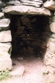
Neolithic and Bronze AgeSite Name: Clenamacrie Stone Row Alternative Name: Glenamacrie Stone RowCountry: Scotland County: Argyll Type: Stone Row / Alignment
Nearest Village: Glenlonan
Map Ref: NM9251128550 Landranger Map Number: 49
Latitude: 56.403483N Longitude: 5.364218W
Condition:
| 5 | Perfect |
| 4 | Almost Perfect |
| 3 | Reasonable but with some damage |
| 2 | Ruined but still recognisable as an ancient site |
| 1 | Pretty much destroyed, possibly visible as crop marks |
| 0 | No data. |
| -1 | Completely destroyed |
| 5 | Superb |
| 4 | Good |
| 3 | Ordinary |
| 2 | Not Good |
| 1 | Awful |
| 0 | No data. |
| 5 | Can be driven to, probably with disabled access |
| 4 | Short walk on a footpath |
| 3 | Requiring a bit more of a walk |
| 2 | A long walk |
| 1 | In the middle of nowhere, a nightmare to find |
| 0 | No data. |
| 5 | co-ordinates taken by GPS or official recorded co-ordinates |
| 4 | co-ordinates scaled from a detailed map |
| 3 | co-ordinates scaled from a bad map |
| 2 | co-ordinates of the nearest village |
| 1 | co-ordinates of the nearest town |
| 0 | no data |
Internal Links:
External Links:
I have visited· I would like to visit
hidebasket visited on 19th Feb 2023 - their rating: Cond: 3 Amb: 3 Access: 5
Anne T visited on 17th Jul 2018 - their rating: Cond: 3 Amb: 3 Access: 5 Glenamacrie/Clenamacrie Stone Row: After An Dun, we headed off a few hundreds yards west back down the road. I took two lots of photos here, because I think I mistook an outcrop (an unmown area of the field with stones protruding, at NM 92745 28409). Andrew had mentioned both a ‘stone row’ and ‘four stones forming a chamber’, so I thought I had photographed the right thing. Driving down to the farm, I spotted the right three standing stones in a field nearer the farm, which I also photographed. Andrew said the ‘lump’ in the field behind was also a cairn, but this was the closest I could get, so we’ve got these standing stones with the cairn behind.
I wish now I’d had the courage to go and ask to see these up close, but I felt intimidated because the farm was so big and the gate into the field seemed to be along the far end of the track. I can’t get used to the ‘responsible right to roam’ act in Scotland, but it still feels like trespassing at times, especially when you are going doing someone’s driveway.
SandyG visited on 13th Mar 2017 - their rating: Cond: 3 Amb: 3 Access: 5 The row can be viewed from the public highway, but to access to the stones permission should be sought at the nearby farm.
coin tom_bullock have visited here
Average ratings for this site from all visit loggers: Condition: 3 Ambience: 3 Access: 5
")
For more information see Canmore ID 23182, which says: "About 100 metres east of Clenamcrie farmhouse there is a four-sided monolith situated on level ground immediately south of the public road. It measures 0.7 metres by 0.6 metres at the base and is 1.45 metres in height. Close beside it, to the west, there are two large boulders, but without excavation it is impossible to tell whether or not they are associated with the standing stone."
Update October 2019: This row is featured on the Stone Rows of Great Britain website - see their entry for Glenamachrie, which includes a description, a plan of the row from a recent survey in March 2017, photographs of the alignment and the individual stones, plus links to other online resources for more information.
You may be viewing yesterday's version of this page. To see the most up to date information please register for a free account.
")
")
")
")
")
")
")
")
")
")
")
")
")
")
")
")
")
Do not use the above information on other web sites or publications without permission of the contributor.
Click here to see more info for this site
Nearby sites
Key: Red: member's photo, Blue: 3rd party photo, Yellow: other image, Green: no photo - please go there and take one, Grey: site destroyed
Download sites to:
KML (Google Earth)
GPX (GPS waypoints)
CSV (Garmin/Navman)
CSV (Excel)
To unlock full downloads you need to sign up as a Contributory Member. Otherwise downloads are limited to 50 sites.
![]()
Turn off the page maps and other distractions
Nearby sites listing. In the following links * = Image available
62m WSW 258° Glenamacrie Farm* Cairn (NM92452854)
396m ESE 116° Glenamacrie Dun* Stone Fort or Dun (NM92862836)
408m WNW 289° Glenamachrie Cairn* Cairn (NM92132870)
1.5km ESE 106° Clachadow* Cairn (NM93932806)
1.8km W 280° Diarmid's Grave* Cairn (NM9077828950)
1.8km W 280° Clach na Carraig* Standing Stone (Menhir) (NM9076728957)
1.8km WNW 283° Strontoiller Large Cairn* Cairn (NM90732907)
1.9km WNW 285° Strontoiller circle* Stone Circle (NM90672914)
2.7km WSW 257° Rubha Na Moine* Crannog (NM89812807)
2.9km NNW 338° Kilvaree standing stone* Standing Stone (Menhir) (NM91553124)
3.1km W 264° Skull Shaped Stone - Loch Nell* Natural Stone / Erratic / Other Natural Feature (NM8939628383)
4.6km WSW 242° Barnacarry* Crannog (NM88362662)
4.6km WSW 252° Killiechonich* Rock Art (NM88082736)
4.7km SSW 194° Dun Iadain* Stone Fort or Dun (NM91122404)
4.8km WSW 246° Dalinaneun Farm Cairn 3 Cairn (NM880268)
4.8km WSW 246° Serpent Mound - Loch Nell* Artificial Mound (NM880268)
4.9km WSW 245° Dalineun* Chambered Tomb (NM8799326710)
4.9km SSW 208° Dalnacabaig* Cairn (NM90002429)
4.9km WSW 240° Moleigh* Cairn (NM88082631)
5.0km WSW 238° Possible cairn at Kilmore* Cairn (NM88092609)
5.1km WSW 237° Cleigh* Misc. Earthwork (NM88112602)
5.1km WSW 237° Dalinaneun Farm Cairn 2* Cairn (NM881260)
5.4km SW 231° Kilmore Cairn* Cairn (NM88172533)
5.4km SW 228° Kilmore House* Cairn (NM88292515)
5.5km SW 231° Cnoc Buidhe* Cairn (NM88032532)
View more nearby sites and additional images


 We would like to know more about this location. Please feel free to add a brief description and any relevant information in your own language.
 Wir möchten mehr über diese Stätte erfahren. Bitte zögern Sie nicht, eine kurze Beschreibung und relevante Informationen in Deutsch hinzuzufügen.
 Nous aimerions en savoir encore un peu sur les lieux. S'il vous plaît n'hesitez pas à ajouter une courte description et tous les renseignements pertinents dans votre propre langue.
 Quisieramos informarnos un poco más de las lugares. No dude en añadir una breve descripción y otros datos relevantes en su propio idioma.