<< Our Photo Pages >> Achnaba E - Cairn in Scotland in Argyll
Submitted by caradoc68 on Sunday, 04 March 2012 Page Views: 2992
Neolithic and Bronze AgeSite Name: Achnaba ECountry: Scotland County: Argyll Type: Cairn
Nearest Town: Oban Nearest Village: connel
Map Ref: NM94593639
Latitude: 56.474707N Longitude: 5.336752W
Condition:
| 5 | Perfect |
| 4 | Almost Perfect |
| 3 | Reasonable but with some damage |
| 2 | Ruined but still recognisable as an ancient site |
| 1 | Pretty much destroyed, possibly visible as crop marks |
| 0 | No data. |
| -1 | Completely destroyed |
| 5 | Superb |
| 4 | Good |
| 3 | Ordinary |
| 2 | Not Good |
| 1 | Awful |
| 0 | No data. |
| 5 | Can be driven to, probably with disabled access |
| 4 | Short walk on a footpath |
| 3 | Requiring a bit more of a walk |
| 2 | A long walk |
| 1 | In the middle of nowhere, a nightmare to find |
| 0 | No data. |
| 5 | co-ordinates taken by GPS or official recorded co-ordinates |
| 4 | co-ordinates scaled from a detailed map |
| 3 | co-ordinates scaled from a bad map |
| 2 | co-ordinates of the nearest village |
| 1 | co-ordinates of the nearest town |
| 0 | no data |
Internal Links:
External Links:
")
NM 9459 3639
Cairn E
Stands in trees on the edge of the bluff over-looking Loch Etive. It has been so seriously damaged by robbing and subsequent dumping that, without excavation, it is impossible to determine its size. It probably measured about 23 metres in diameter and 2 metres in height originally.
You may be viewing yesterday's version of this page. To see the most up to date information please register for a free account.
Do not use the above information on other web sites or publications without permission of the contributor.
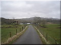
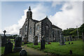
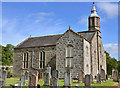
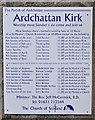
Nearby Images from Geograph Britain and Ireland:
©2007(licence)
©2023(licence)
©2011(licence)
©2011(licence)
©2012(licence)
The above images may not be of the site on this page, they are loaded from Geograph.
Please Submit an Image of this site or go out and take one for us!
Click here to see more info for this site
Nearby sites
Key: Red: member's photo, Blue: 3rd party photo, Yellow: other image, Green: no photo - please go there and take one, Grey: site destroyed
Download sites to:
KML (Google Earth)
GPX (GPS waypoints)
CSV (Garmin/Navman)
CSV (Excel)
To unlock full downloads you need to sign up as a Contributory Member. Otherwise downloads are limited to 50 sites.
Turn off the page maps and other distractions
Nearby sites listing. In the following links * = Image available
143m SSW 202° Achnaba B* Cairn (NM94533626)
269m SSW 208° Achnaba A* Cairn (NM94453616)
319m WSW 253° Achnaba D* Cairn (NM94283631)
506m WSW 257° Achnaba C* Cairn (NM94093630)
1.6km W 267° Achnacreebeag* Chambered Cairn (NM92963639)
2.4km W 265° Achnacree Cairn* Round Cairn (NM922363)
2.5km W 264° Dalvule* Cairn (NM92043626)
2.9km ESE 118° Ardchattan Priory* Sculptured Stone (NM971349)
3.2km SE 135° Dun Chathach (Connel) Hillfort (NM96743401)
3.7km SW 229° Connel Station (Oban) Standing Stone (Menhir) (NM91693408)
4.0km WSW 243° North Connel Barrow* Round Barrow(s) (NM90923471)
4.4km N 355° Achacha standing stone* Standing Stone (Menhir) (NM94444075)
4.4km N 354° Achacha Cairn* Cairn (NM94364076)
4.5km WNW 296° Benderloch Stone Circle* Stone Circle (NM90613853)
4.6km WNW 288° Benderloch Standing Stone* Standing Stone (Menhir) (NM903380)
4.6km NW 312° Culcharron cairn* Cairn (NM913396)
4.6km WNW 290° Dun Mac Sniachan* Vitrified Fort (NM90323822)
5.2km NW 315° Castle Farm standing stone* Standing Stone (Menhir) (NM911402)
5.3km NW 315° Castle Farm cairns* Cairn (NM91014029)
5.8km WNW 302° Kintaline Mill Farm Kist* Cist (NM89793971)
6.0km SSW 208° Kilvaree standing stone* Standing Stone (Menhir) (NM91553124)
6.0km NNE 14° Barcaldine* Standing Stones (NM96374213)
6.2km NW 312° Achnamoine Cairn* Cairn (NM90184082)
6.5km NW 312° Achnamoine 2* Cairn (NM89974104)
7.1km NW 313° Balure Cairns* Cairn (NM89604145)
View more nearby sites and additional images


 We would like to know more about this location. Please feel free to add a brief description and any relevant information in your own language.
 Wir möchten mehr über diese Stätte erfahren. Bitte zögern Sie nicht, eine kurze Beschreibung und relevante Informationen in Deutsch hinzuzufügen.
 Nous aimerions en savoir encore un peu sur les lieux. S'il vous plaît n'hesitez pas à ajouter une courte description et tous les renseignements pertinents dans votre propre langue.
 Quisieramos informarnos un poco más de las lugares. No dude en añadir una breve descripción y otros datos relevantes en su propio idioma.