<< Text Pages >> Hilbre Island (Wirral Peninsula) - Ancient Cross in England in Merseyside
Submitted by Anne T on Monday, 14 January 2019 Page Views: 1144
Early Medieval (Dark Age)Site Name: Hilbre Island (Wirral Peninsula) Alternative Name: Hilbre CrossCountry: England
NOTE: This site is 3.085 km away from the location you searched for.
County: Merseyside Type: Ancient Cross
Nearest Town: Hoylake / West Kirby
Map Ref: SJ185879
Latitude: 53.381636N Longitude: 3.226703W
Condition:
| 5 | Perfect |
| 4 | Almost Perfect |
| 3 | Reasonable but with some damage |
| 2 | Ruined but still recognisable as an ancient site |
| 1 | Pretty much destroyed, possibly visible as crop marks |
| 0 | No data. |
| -1 | Completely destroyed |
| 5 | Superb |
| 4 | Good |
| 3 | Ordinary |
| 2 | Not Good |
| 1 | Awful |
| 0 | No data. |
| 5 | Can be driven to, probably with disabled access |
| 4 | Short walk on a footpath |
| 3 | Requiring a bit more of a walk |
| 2 | A long walk |
| 1 | In the middle of nowhere, a nightmare to find |
| 0 | No data. |
| 5 | co-ordinates taken by GPS or official recorded co-ordinates |
| 4 | co-ordinates scaled from a detailed map |
| 3 | co-ordinates scaled from a bad map |
| 2 | co-ordinates of the nearest village |
| 1 | co-ordinates of the nearest town |
| 0 | no data |
Be the first person to rate this site - see the 'Contribute!' box in the right hand menu.
Internal Links:
External Links:
Ancient Cross fragments found in Merseyside
The Journal of Antiquities features a page for this site, one of three islands off the north-western tip of the Wirral Peninsula in the Dee Estuary - see their entry for Hilbre Island, Dee Estuary, Wirral Peninsula, which gives background information about St Hildeburgh who may have founded a monastic church on this island in the 7th century AD. The Journal adds that "At the dissolution of the monasteries two monks were allowed to remain on the island, the last monk leaving in 1550. Apparently the monks kept a beacon lit during the nightime to aide sea-going vessels in the Dee estuary from colliding with dangerous rocks".
As well as the Hilbre Cross found on this island in the 19th century and dated to around 1000AD, the Journal tells us that artefacts from the Neolithic, Bronze Age and Roman periods have also been found here.
Pastscape has two entries for this island, the first being Pastscape Monument 1535353, which tells us that three fragments of an 11th century cross head were found in an alleged cemetery on the island; two of these fragments are now lost, the other is was in the Charles Dawson Brown Museum, West Kirby - see the West Kirby Museum website and our own site page for St Bridget (Early Christian Sculptured Stone/hogback) in West Kirby. The second Pastscape entry is Monument No. 1525350, which says the lower part of a circle-head with unpierced spandrels with a small fragment of the top of the shaft was discovered in 1852/53 and is now in the Grosvenor Museum in Chester.
Please note these islands are cut off by the tides. Please refer to the Wirral Peninsula website for details and tide times.
Note: Have you seen these cross fragments? Have you visited the island? Do you have any photographs or information to add?
You may be viewing yesterday's version of this page. To see the most up to date information please register for a free account.
Do not use the above information on other web sites or publications without permission of the contributor.
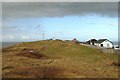
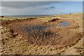
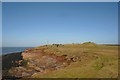
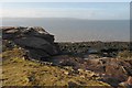
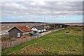
Nearby Images from Geograph Britain and Ireland:
©2011(licence)
©2011(licence)
©2011(licence)
©2011(licence)
©2012(licence)
The above images may not be of the site on this page, they are loaded from Geograph.
Please Submit an Image of this site or go out and take one for us!
Click here to see more info for this site
Nearby sites
Key: Red: member's photo, Blue: 3rd party photo, Yellow: other image, Green: no photo - please go there and take one, Grey: site destroyed
Download sites to:
KML (Google Earth)
GPX (GPS waypoints)
CSV (Garmin/Navman)
CSV (Excel)
To unlock full downloads you need to sign up as a Contributory Member. Otherwise downloads are limited to 50 sites.
Turn off the page maps and other distractions
Nearby sites listing. In the following links * = Image available
1.9km ENE 73° Red Rocks Ancient Mine, Quarry or other Industry (SJ20328843)
3.6km ESE 113° St Bridget (West Kirby)* Early Christian Sculptured Stone (SJ21828641)
3.8km ESE 106° West Kirby Cremation Burial Cist (SJ22158678)
3.9km ESE 108° The Column* Chambered Tomb (SJ222866)
5.2km ESE 118° Face Stone (Stapledon Wood)* Rock Outcrop (SJ23088536)
5.3km ENE 59° Great Meols* Ancient Village or Settlement (SJ231906)
6.7km ESE 115° Thor's Stone* Natural Stone / Erratic / Other Natural Feature (SJ2447484933)
7.4km E 99° Greasby Copse Ancient Village or Settlement (SJ25788664)
7.9km E 82° Overchurch* Stone Circle (SJ264888)
8.7km ESE 102° Arrowe Park standing stones Standing Stones (SJ27058596)
10.4km S 188° Ffynnon Oswald Holy Well or Sacred Spring (SJ1688577622)
10.4km SSW 201° Whitford Church Inscribed Stone Early Christian Sculptured Stone (SJ146782)
10.5km ENE 77° Bidston Hill Rock Carvings* Carving (SJ288900)
10.5km SSW 201° Whitford Inscribed Stone* Early Christian Sculptured Stone (SJ146781)
10.7km SSW 211° Maen Achwyfan* Ancient Cross (SJ129788)
11.1km SW 226° Axton Barrows Round Barrow(s) (SJ104803)
11.6km S 179° St Winefrides Well* Holy Well or Sacred Spring (SJ18517627)
11.7km SW 229° Bryn-Y-Odyn* Round Barrow(s) (SJ0952380376)
11.8km SSW 195° Gorsedd Church* Standing Stones (SJ152766)
11.8km E 83° The Bonks Barrow Cemetery (SJ303891)
11.9km SSW 197° Y Gorseddau* Round Barrow(s) (SJ149766)
12.3km SW 230° Gop Wood Mound* Cairn (SJ08928012)
12.5km SW 231° Gop-y-Goleuni* Cairn (SJ08668015)
12.6km SW 231° Gop Caves* Cave or Rock Shelter (SJ08648009)
12.7km SW 236° Ty-Uchaf* Round Barrow(s) (SJ07868095)
View more nearby sites and additional images


 We would like to know more about this location. Please feel free to add a brief description and any relevant information in your own language.
 Wir möchten mehr über diese Stätte erfahren. Bitte zögern Sie nicht, eine kurze Beschreibung und relevante Informationen in Deutsch hinzuzufügen.
 Nous aimerions en savoir encore un peu sur les lieux. S'il vous plaît n'hesitez pas à ajouter une courte description et tous les renseignements pertinents dans votre propre langue.
 Quisieramos informarnos un poco más de las lugares. No dude en añadir una breve descripción y otros datos relevantes en su propio idioma.