<< Text Pages >> West Kirby Cremation Burial - Cist in England in Merseyside
Submitted by thedrumdoctor on Thursday, 10 March 2011 Page Views: 5402
Neolithic and Bronze AgeSite Name: West Kirby Cremation BurialCountry: England County: Merseyside Type: Cist
Nearest Town: West Kirby Nearest Village: Caldy
Map Ref: SJ22158678
Latitude: 53.372122N Longitude: 3.171567W
Condition:
| 5 | Perfect |
| 4 | Almost Perfect |
| 3 | Reasonable but with some damage |
| 2 | Ruined but still recognisable as an ancient site |
| 1 | Pretty much destroyed, possibly visible as crop marks |
| 0 | No data. |
| -1 | Completely destroyed |
| 5 | Superb |
| 4 | Good |
| 3 | Ordinary |
| 2 | Not Good |
| 1 | Awful |
| 0 | No data. |
| 5 | Can be driven to, probably with disabled access |
| 4 | Short walk on a footpath |
| 3 | Requiring a bit more of a walk |
| 2 | A long walk |
| 1 | In the middle of nowhere, a nightmare to find |
| 0 | No data. |
| 5 | co-ordinates taken by GPS or official recorded co-ordinates |
| 4 | co-ordinates scaled from a detailed map |
| 3 | co-ordinates scaled from a bad map |
| 2 | co-ordinates of the nearest village |
| 1 | co-ordinates of the nearest town |
| 0 | no data |
Internal Links:
External Links:
Cist in Merseyside
Bronze Age Cremation (Not a Cist but the closest on the site list)
[SJ 22238662] Several urns of double-cordon type (2) found in 1840 in the garden of John Robins, Grove Hill, West Kirby, near the Dock Board Mark, and close to the surface. Inverted, they contained cremations with charcoal and ashes and
in one, at least, an edged flint (1). (1,2)
Mr. Robbins house was at SJ 22158678, but the extent of the garden at
that time could not be determined. (3)
SOURCE TEXT
( 1) General reference
Prehistoric Man in Cheshire 1911, 51, fig. 18 (Wm.Shone)
( 2) General reference
Prehistoric Cheshire 1940, Sched. IV. (Varley & Jackson)
( 3) Field Investigators Comments
F1 TPW 26-AUG-64
( 3a) General reference
Miss J Bozoli, Corr. Ches. Community Council, Victoria Road, West Kirby
Archaeology Data Service web page
The use of Google Maps suggests that the find location is now within the back garden of a private residence.
However, the importance of this find proves that the Wirral Peninsula was inhabited by early Man, rather than being written off as an area of forest with no human settlement.
You may be viewing yesterday's version of this page. To see the most up to date information please register for a free account.
Do not use the above information on other web sites or publications without permission of the contributor.
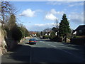
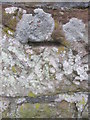
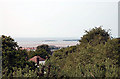
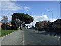
Nearby Images from Geograph Britain and Ireland:
©2014(licence)
©2016(licence)
©2010(licence)
©2014(licence)
©2017(licence)
The above images may not be of the site on this page, they are loaded from Geograph.
Please Submit an Image of this site or go out and take one for us!
Click here to see more info for this site
Nearby sites
Key: Red: member's photo, Blue: 3rd party photo, Yellow: other image, Green: no photo - please go there and take one, Grey: site destroyed
Download sites to:
KML (Google Earth)
GPX (GPS waypoints)
CSV (Garmin/Navman)
CSV (Excel)
To unlock full downloads you need to sign up as a Contributory Member. Otherwise downloads are limited to 50 sites.
Turn off the page maps and other distractions
Nearby sites listing. In the following links * = Image available
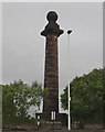
187m SSE 164° The Column* Chambered Tomb (SJ222866)
495m SW 221° St Bridget (West Kirby)* Early Christian Sculptured Stone (SJ21828641)
1.7km SE 146° Face Stone (Stapledon Wood)* Rock Outcrop (SJ23088536)
2.5km NW 311° Red Rocks Ancient Mine, Quarry or other Industry (SJ20328843)
3.0km SE 128° Thor's Stone* Natural Stone / Erratic / Other Natural Feature (SJ2447484933)
3.6km E 91° Greasby Copse Ancient Village or Settlement (SJ25788664)
3.8km WNW 286° Hilbre Island (Wirral Peninsula) Ancient Cross (SJ185879)
3.9km NNE 13° Great Meols* Ancient Village or Settlement (SJ231906)
4.7km ENE 64° Overchurch* Stone Circle (SJ264888)
5.0km E 99° Arrowe Park standing stones Standing Stones (SJ27058596)
7.4km ENE 63° Bidston Hill Rock Carvings* Carving (SJ288900)
8.5km ENE 73° The Bonks Barrow Cemetery (SJ303891)
10.6km SSW 209° Ffynnon Oswald Holy Well or Sacred Spring (SJ1688577622)
11.1km SSW 198° St Winefrides Well* Holy Well or Sacred Spring (SJ18517627)
11.4km SW 220° Whitford Church Inscribed Stone Early Christian Sculptured Stone (SJ146782)
11.5km SW 220° Whitford Inscribed Stone* Early Christian Sculptured Stone (SJ146781)
11.6km SE 142° St Mary and St Helen (Neston)* Ancient Cross (SJ29157749)
12.2km SW 228° Maen Achwyfan* Ancient Cross (SJ129788)
12.3km SSW 213° Gorsedd Church* Standing Stones (SJ152766)
12.5km SW 214° Y Gorseddau* Round Barrow(s) (SJ149766)
12.7km SSW 204° Naid-Y-March* Standing Stones (SJ1676775288)
12.7km SSW 204° Naid-y-March* Standing Stones (SJ16767528)
12.9km SE 127° Raby Mound Round Barrow(s) (SJ32377891)
12.9km ESE 106° St Patrick's Well (Bromborough)* Holy Well or Sacred Spring (SJ34538295)
13.1km SSW 200° Brynford* Barrow Cemetery (SJ174746)
View more nearby sites and additional images


 We would like to know more about this location. Please feel free to add a brief description and any relevant information in your own language.
 Wir möchten mehr über diese Stätte erfahren. Bitte zögern Sie nicht, eine kurze Beschreibung und relevante Informationen in Deutsch hinzuzufügen.
 Nous aimerions en savoir encore un peu sur les lieux. S'il vous plaît n'hesitez pas à ajouter une courte description et tous les renseignements pertinents dans votre propre langue.
 Quisieramos informarnos un poco más de las lugares. No dude en añadir una breve descripción y otros datos relevantes en su propio idioma.