<< Text Pages >> Golgotha Lodge (Williamson Park) - Cairn in England in Lancashire
Submitted by Anne T on Friday, 04 January 2019 Page Views: 2091
Neolithic and Bronze AgeSite Name: Golgotha Lodge (Williamson Park) Alternative Name: Williamson Park (Lancaster); Lancaster MoorCountry: England County: Lancashire Type: Cairn
Nearest Town: Lancaster
Map Ref: SD48666121
Latitude: 54.044290N Longitude: 2.785533W
Condition:
| 5 | Perfect |
| 4 | Almost Perfect |
| 3 | Reasonable but with some damage |
| 2 | Ruined but still recognisable as an ancient site |
| 1 | Pretty much destroyed, possibly visible as crop marks |
| 0 | No data. |
| -1 | Completely destroyed |
| 5 | Superb |
| 4 | Good |
| 3 | Ordinary |
| 2 | Not Good |
| 1 | Awful |
| 0 | No data. |
| 5 | Can be driven to, probably with disabled access |
| 4 | Short walk on a footpath |
| 3 | Requiring a bit more of a walk |
| 2 | A long walk |
| 1 | In the middle of nowhere, a nightmare to find |
| 0 | No data. |
| 5 | co-ordinates taken by GPS or official recorded co-ordinates |
| 4 | co-ordinates scaled from a detailed map |
| 3 | co-ordinates scaled from a bad map |
| 2 | co-ordinates of the nearest village |
| 1 | co-ordinates of the nearest town |
| 0 | no data |
Internal Links:
External Links:
Bronze Age barrows (now destroyed) in Lancashire
The Journal of Antiquities features a page for this site, where 'in olden times', one or more Bronze Age burial mounds or barrows used to exist. Today, they have been destroyed with the Park later built over them in 1881. For more information see The Journal's entry for Golgotha Lodge, Williamson Park, Lancaster, Lancashire, which tells us: "The barrow(s) (tumuli) were excavated back in 1865 at which time six or more funery urns were found along with some other, smaller finds (grave goods). Mr. J. Harker (1865, 1872 & 1877) has left us with some good information on the site which was near Golgotha Lodge, Lancaster; the destroyed barrow(s) also sometimes going under the name of ‘Lancaster Moor’. The site had lay close to what is today Wyresdale Road (on a ridge of land ) at the edge of the now Williamson Park; and to the northeast of what were Bowerham Barracks (now St Martin’s College and part of the University of Cumbria). In the vicinity of the barracks there was, apparently, another prehistoric mound or barrow but, once again this suffered destruction, and not much is known about it and its location is now difficult to pin down."
The Journal also includes drawings of some of the artefacts found near Golgotha Lodge, together with reference material and a list of related websites which should provide further information.
There is no scheduling information on Historic England, and the nearest site referred to on Pastscape is Pastscape Monument No. 41198, which tells us this was the site of gallows, their location shown on the 1786 Yates map of Lancashire. No trace of the gallows remains; the site is in Williamson Park, "an area much disturbed by quarrying".
Note: Do you have any historical information, drawings or illustrations to add?
You may be viewing yesterday's version of this page. To see the most up to date information please register for a free account.
Do not use the above information on other web sites or publications without permission of the contributor.
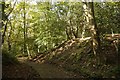
Nearby Images from Geograph Britain and Ireland:
©2021(licence)
©2019(licence)
©2019(licence)
©2019(licence)
©2019(licence)
The above images may not be of the site on this page, they are loaded from Geograph.
Please Submit an Image of this site or go out and take one for us!
Click here to see more info for this site
Nearby sites
Key: Red: member's photo, Blue: 3rd party photo, Yellow: other image, Green: no photo - please go there and take one, Grey: site destroyed
Download sites to:
KML (Google Earth)
GPX (GPS waypoints)
CSV (Garmin/Navman)
CSV (Excel)
To unlock full downloads you need to sign up as a Contributory Member. Otherwise downloads are limited to 50 sites.
Turn off the page maps and other distractions
Nearby sites listing. In the following links * = Image available
1.2km WNW 296° Lancaster City Museum* Museum (SD4761161729)
1.4km WNW 298° Lancaster Priory Cross* Ancient Cross (SD474619)
3.7km NNE 19° Halton St Wilfrid's Churchyard* Ancient Cross (SD49916469)
4.1km NW 318° Torrisholme* Round Barrow(s) (SD45966425)
4.1km NNE 25° The Lancaster Cross* Ancient Cross (SD504649)
4.2km ENE 73° Askew Heights* Ancient Village or Settlement (SD52726239)
6.1km NW 307° Fartle Barrow* Cairn (SD4380364966)
6.4km N 3° Bolton-le-Sands Barrow* Ring Cairn (SD4901467624)
6.4km N 356° Bolton Le Sands Early Christian Sculptured Stone (SD48336765)
6.6km N 356° St Michael's Well (Lancashire) Holy Well or Sacred Spring (SD4828567831)
7.0km W 267° Church Well (Heysham) Holy Well or Sacred Spring (SD416609)
7.6km W 272° St Patrick's Well (Heysham)* Holy Well or Sacred Spring (SD4108961591)
7.6km W 272° Heysham St Peter's Churchyard* Ancient Cross (SD41066161)
7.7km W 273° Heysham Rock-Cut tombs* Rock Cut Tomb (SD4098461655)
7.9km W 272° Heysham Labyrinth* Carving (SD407616)
9.4km N 2° Hunting Hill* Round Barrow(s) (SD49037065)
10.7km N 357° Cote Stones Cairn (SD482719)
11.5km N 2° Warton Crag* Hillfort (SD492727)
11.6km N 357° Badger Hole (Lancashire)* Cave or Rock Shelter (SD48187285)
11.8km N 356° Ings Point Natural Stone / Erratic / Other Natural Feature (SD479730)
11.8km N 358° Dog Holes* Cave or Rock Shelter (SD48337303)
11.9km N 5° Warton Crag giant wall Misc. Earthwork (SD499731)
12.0km ENE 71° Roeburndale stone circle* Modern Stone Circle etc (SD60086496)
12.2km NE 44° St John the Evangelist (Gressingham)* Ancient Cross (SD5725069915)
12.2km NNE 17° Manor Farm* Round Barrow(s) (SD52387285)
View more nearby sites and additional images


 We would like to know more about this location. Please feel free to add a brief description and any relevant information in your own language.
 Wir möchten mehr über diese Stätte erfahren. Bitte zögern Sie nicht, eine kurze Beschreibung und relevante Informationen in Deutsch hinzuzufügen.
 Nous aimerions en savoir encore un peu sur les lieux. S'il vous plaît n'hesitez pas à ajouter une courte description et tous les renseignements pertinents dans votre propre langue.
 Quisieramos informarnos un poco más de las lugares. No dude en añadir una breve descripción y otros datos relevantes en su propio idioma.