


<< Our Photo Pages >> Warton Crag - Hillfort in England in Lancashire
Submitted by anonymous on Thursday, 27 November 2003 Page Views: 15284
Iron Age and Later PrehistorySite Name: Warton CragCountry: England County: Lancashire Type: Hillfort
Map Ref: SD492727 Landranger Map Number: 97
Latitude: 54.147600N Longitude: 2.779221W
Condition:
| 5 | Perfect |
| 4 | Almost Perfect |
| 3 | Reasonable but with some damage |
| 2 | Ruined but still recognisable as an ancient site |
| 1 | Pretty much destroyed, possibly visible as crop marks |
| 0 | No data. |
| -1 | Completely destroyed |
| 5 | Superb |
| 4 | Good |
| 3 | Ordinary |
| 2 | Not Good |
| 1 | Awful |
| 0 | No data. |
| 5 | Can be driven to, probably with disabled access |
| 4 | Short walk on a footpath |
| 3 | Requiring a bit more of a walk |
| 2 | A long walk |
| 1 | In the middle of nowhere, a nightmare to find |
| 0 | No data. |
| 5 | co-ordinates taken by GPS or official recorded co-ordinates |
| 4 | co-ordinates scaled from a detailed map |
| 3 | co-ordinates scaled from a bad map |
| 2 | co-ordinates of the nearest village |
| 1 | co-ordinates of the nearest town |
| 0 | no data |
Internal Links:
External Links:
")
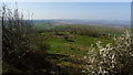
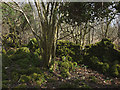
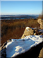
The hillfort is difficult to find due to vegitation! It might be easier in the winter. Access is easy, a nice walk with spectacular views over Morecambe Bay.
You may be viewing yesterday's version of this page. To see the most up to date information please register for a free account.
")
")
")
Do not use the above information on other web sites or publications without permission of the contributor.
Nearby Images from Geograph Britain and Ireland:
©2019(licence)
©2017(licence)

©2010(licence)
©2015(licence)
©2010(licence)
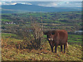
The above images may not be of the site on this page, they are loaded from Geograph.
Please Submit an Image of this site or go out and take one for us!
Click here to see more info for this site
Nearby sites
Key: Red: member's photo, Blue: 3rd party photo, Yellow: other image, Green: no photo - please go there and take one, Grey: site destroyed
Download sites to:
KML (Google Earth)
GPX (GPS waypoints)
CSV (Garmin/Navman)
CSV (Excel)
To unlock full downloads you need to sign up as a Contributory Member. Otherwise downloads are limited to 50 sites.
Turn off the page maps and other distractions
Nearby sites listing. In the following links * = Image available
804m ENE 60° Warton Crag giant wall Misc. Earthwork (SD499731)
854m NNE 20° The Three brothers* Natural Stone / Erratic / Other Natural Feature (SD495735)
928m WNW 290° Dog Holes* Cave or Rock Shelter (SD48337303)
1.0km W 278° Badger Hole (Lancashire)* Cave or Rock Shelter (SD48187285)
1.3km SW 231° Cote Stones Cairn (SD482719)
1.3km WNW 282° Ings Point Natural Stone / Erratic / Other Natural Feature (SD479730)
1.8km NNE 30° Summerhouse Hill Cairn* Cairn (SD50147428)
1.9km NNE 26° Summerhouse Hill* Modern Stone Circle etc (SD50037437)
2.1km S 184° Hunting Hill* Round Barrow(s) (SD49037065)
2.9km NE 48° Yealand ancient stone walls or rows 1 Misc. Earthwork (SD514746)
3.2km E 87° Manor Farm* Round Barrow(s) (SD52387285)
3.3km NE 38° Yealand ancient stone walls or rows 2 Misc. Earthwork (SD513753)
3.4km WNW 292° Woodwell* Holy Well or Sacred Spring (SD4674)
4.3km NNW 336° Bowk Stone Natural Stone / Erratic / Other Natural Feature (SD475767)
4.4km NNW 342° Haweswater Cairns and Propped Stone Cairn (SD479769)
4.5km NNW 341° Haweswater Stones* Misc. Earthwork (SD478770)
5.0km S 190° St Michael's Well (Lancashire) Holy Well or Sacred Spring (SD4828567831)
5.1km S 181° Bolton-le-Sands Barrow* Ring Cairn (SD4901467624)
5.1km S 189° Bolton Le Sands Early Christian Sculptured Stone (SD48336765)
5.7km NE 42° St James's Church (Burton-in-Kendal) Ancient Cross (SD5305076921)
5.9km NNW 341° Hazelslack Stone* Standing Stone (Menhir) (SD473783)
6.3km N 356° The Fairy Steps* Natural Stone / Erratic / Other Natural Feature (SD488790)
6.5km N 5° The Rent Stone* Natural Stone / Erratic / Other Natural Feature (SD498792)
7.0km NW 318° Grubbins Wood Stone Natural Stone / Erratic / Other Natural Feature (SD446780)
7.4km N 2° Bela Stone Row* Stone Row / Alignment (SD495801)
View more nearby sites and additional images


 We would like to know more about this location. Please feel free to add a brief description and any relevant information in your own language.
 Wir möchten mehr über diese Stätte erfahren. Bitte zögern Sie nicht, eine kurze Beschreibung und relevante Informationen in Deutsch hinzuzufügen.
 Nous aimerions en savoir encore un peu sur les lieux. S'il vous plaît n'hesitez pas à ajouter une courte description et tous les renseignements pertinents dans votre propre langue.
 Quisieramos informarnos un poco más de las lugares. No dude en añadir una breve descripción y otros datos relevantes en su propio idioma.