<< Our Photo Pages >> Broadfield Park Glacial Boulder - Natural Stone / Erratic / Other Natural Feature in England in Greater Manchester
Submitted by Sunny100 on Sunday, 23 May 2010 Page Views: 11624
Natural PlacesSite Name: Broadfield Park Glacial Boulder Alternative Name: The Broadfield Park StoneCountry: England
NOTE: This site is 0.474 km away from the location you searched for.
County: Greater Manchester Type: Natural Stone / Erratic / Other Natural Feature
Nearest Town: Rochdale Nearest Village: Mitchell Hey
Map Ref: SD896130
Latitude: 53.613444N Longitude: 2.158675W
Condition:
| 5 | Perfect |
| 4 | Almost Perfect |
| 3 | Reasonable but with some damage |
| 2 | Ruined but still recognisable as an ancient site |
| 1 | Pretty much destroyed, possibly visible as crop marks |
| 0 | No data. |
| -1 | Completely destroyed |
| 5 | Superb |
| 4 | Good |
| 3 | Ordinary |
| 2 | Not Good |
| 1 | Awful |
| 0 | No data. |
| 5 | Can be driven to, probably with disabled access |
| 4 | Short walk on a footpath |
| 3 | Requiring a bit more of a walk |
| 2 | A long walk |
| 1 | In the middle of nowhere, a nightmare to find |
| 0 | No data. |
| 5 | co-ordinates taken by GPS or official recorded co-ordinates |
| 4 | co-ordinates scaled from a detailed map |
| 3 | co-ordinates scaled from a bad map |
| 2 | co-ordinates of the nearest village |
| 1 | co-ordinates of the nearest town |
| 0 | no data |
Internal Links:
External Links:
I have visited· I would like to visit
Sunny100 visited on 1st Jan 2009 - their rating: Cond: 4 Amb: 4 Access: 4 Fairly easy to reach once you are in the park.
")
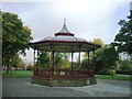
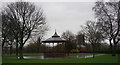
A Glacial Erratic Boulder at SD.896130. This estimated five ton glacial boulder, made of Andecite, stands at the side of a footpath at the eastern end of Broadfield Park, Rochdale, close to the St Alban's road entrance and not far from the bandstand. It had originally stood in a field at Cowm Top farm near Castleton, but was generously given as a gift to Broadfield Park.
Apparently, it came from the Borrowdale area of the Lake District, having been dragged along by the retreating glacial flow - which moved south through NW England and the N.Midlands many thousands of years ago (11,OOO years ago) being the most recent Ice Age - there were others before that.
You may be viewing yesterday's version of this page. To see the most up to date information please register for a free account.
")
")
Do not use the above information on other web sites or publications without permission of the contributor.
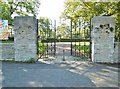
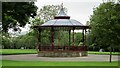
Nearby Images from Geograph Britain and Ireland:
©2019(licence)
©2022(licence)
©2015(licence)
©2019(licence)
©2015(licence)
The above images may not be of the site on this page, they are loaded from Geograph.
Please Submit an Image of this site or go out and take one for us!
Click here to see more info for this site
Nearby sites
Key: Red: member's photo, Blue: 3rd party photo, Yellow: other image, Green: no photo - please go there and take one, Grey: site destroyed
Download sites to:
KML (Google Earth)
GPX (GPS waypoints)
CSV (Garmin/Navman)
CSV (Excel)
To unlock full downloads you need to sign up as a Contributory Member. Otherwise downloads are limited to 50 sites.
Turn off the page maps and other distractions
Nearby sites listing. In the following links * = Image available
3.5km NNW 329° Lower Dunishbooth Promontory Fort / Cliff Castle (SD8779616025)
3.6km NW 325° Lowe Dunishbooth Promontory Fort / Cliff Castle (SD8756115960)
4.3km E 94° Tunshill Tolmen* Holed Stone (SD939127)
4.3km NW 312° Hunger Hill Cairn* Cairn (SD864159)
6.3km NNW 329° Hamer Hill* Stone Circle (SD863184)
6.6km WNW 287° Wind Hill Cheesden* Round Barrow(s) (SD8326214945)
6.9km W 266° Castle Hill, Heywood Hillfort (SD827125)
7.1km SSW 200° St Leonard (Rochdale)* Ancient Cross (SD872063)
7.3km N 9° Hades Hill Cairn (SD908202)
7.6km NE 45° Snoddle Hill Cairn (SD950183)
7.6km W 271° Walmersley Golf Club stone* Modern Stone Circle etc (SD82011319)
7.9km ENE 59° Jacob's Well (Lydgate)* Holy Well or Sacred Spring (SD9638117068)
8.3km ENE 66° Robin Hood's Bed (Blackstone Edge) Natural Stone / Erratic / Other Natural Feature (SD9720416356)
8.4km ENE 69° Blackstone Edge* Rock Art (SD9741416007)
8.5km ENE 68° Blackstone Edge* Standing Stones (SD97521611)
8.5km NE 54° Cow Head End Rock Art (SD9656017991)
8.7km ENE 61° Causeway Edge (Littleborough) Marker Stone (SD9723917133)
8.7km ENE 62° Aiggin Stone* Marker Stone (SD9732917069)
8.8km NE 52° Cow Head (Blackstone Edge)* Rock Art (SD9651918405)
8.8km ENE 64° Rishworth Moor* Standing Stone (Menhir) (SD97531689)
9.2km NE 44° Light Hazzles Edge Rock Art (SD9605619575)
9.2km NE 53° Byron Edge* Rock Art (SD970185)
9.2km NE 48° Cow Head-Light Hazzles Rock Art (SD9651619164)
9.4km NW 314° Waugh's Well (Edenfield) Holy Well or Sacred Spring (SD82871957)
9.6km ENE 78° Rocking Stone (Rishworth Moor) Natural Stone / Erratic / Other Natural Feature (SD990150)
View more nearby sites and additional images


 We would like to know more about this location. Please feel free to add a brief description and any relevant information in your own language.
 Wir möchten mehr über diese Stätte erfahren. Bitte zögern Sie nicht, eine kurze Beschreibung und relevante Informationen in Deutsch hinzuzufügen.
 Nous aimerions en savoir encore un peu sur les lieux. S'il vous plaît n'hesitez pas à ajouter une courte description et tous les renseignements pertinents dans votre propre langue.
 Quisieramos informarnos un poco más de las lugares. No dude en añadir una breve descripción y otros datos relevantes en su propio idioma.