


<< Our Photo Pages >> Hamer Hill - Stone Circle in England in Greater Manchester
Submitted by Andy B on Thursday, 17 April 2008 Page Views: 31816
Neolithic and Bronze AgeSite Name: Hamer Hill Alternative Name: Rochdale's StonehengeCountry: England County: Greater Manchester Type: Stone Circle
Nearest Town: Rochdale
Map Ref: SD863184
Latitude: 53.661904N Longitude: 2.208795W
Condition:
| 5 | Perfect |
| 4 | Almost Perfect |
| 3 | Reasonable but with some damage |
| 2 | Ruined but still recognisable as an ancient site |
| 1 | Pretty much destroyed, possibly visible as crop marks |
| 0 | No data. |
| -1 | Completely destroyed |
| 5 | Superb |
| 4 | Good |
| 3 | Ordinary |
| 2 | Not Good |
| 1 | Awful |
| 0 | No data. |
| 5 | Can be driven to, probably with disabled access |
| 4 | Short walk on a footpath |
| 3 | Requiring a bit more of a walk |
| 2 | A long walk |
| 1 | In the middle of nowhere, a nightmare to find |
| 0 | No data. |
| 5 | co-ordinates taken by GPS or official recorded co-ordinates |
| 4 | co-ordinates scaled from a detailed map |
| 3 | co-ordinates scaled from a bad map |
| 2 | co-ordinates of the nearest village |
| 1 | co-ordinates of the nearest town |
| 0 | no data |
Internal Links:
External Links:
I have visited· I would like to visit
Andy B has visited here
")
"I suppose you could describe it as Rochdale's version of Stonehenge," [Groan - MegP Ed] said Mr Mendelson, 52, who is based in Sweden but originally from Middleton. "It would have been a sacred site and what we've found so far I feel will be the tip of the iceberg.
"It was very unexpected and I didn't believe it at first. I just can't believe that it's been missed by everyone.
"The stones are not arranged randomly and it's quite clear to see.
"For our area and beyond, it's very significant. We've found two burial mounds. The stones may represent particular lunar events in the calendar. I think it would have been a focal point for the whole community."
The two sites have been visited by Peter Iles, a leading archaeological expert from Lancashire County Council. They have also been inspected by English Heritage and entered on the official Greater Manchester archaeology database.
English Heritage described both as "fairly well preserved" and claim both are "possible of Bronze age date" - meaning they could date back to 3,000 BC.
Unlike the famous monument at Stonehenge, however, they are believed to be made of local materials.
The first site, made up of fallen stones, is 10.2m in overall diameter.. The second, which includes the circle, is on the western slope and - according to an English Heritage report - "seems to have been sited to be visible from some distance to the west, rather than the valley floor".
The report adds that both finds "probably represent Bronze Age burial monuments."
Around 20 stones have been uncovered it total - the largest being 1.5m tall - and the entire site covers an acre.
"It's great news for Rochdale," said Mr Mendelsohn. "Prehistoric flints have been found in Littleborough, but as far as I'm aware, this is the first significant discovery in the town.
"I don't know why that site was chosen originally but it has fantastic views of Rochdale and was fairly close to where people lived.
"It's a great site and we really need to get it protected and preserved."
Norman Redhead, the Greater Manchester county archaeologist, said he planned to visit the site in the next few weeks.
Source: Manchester Evening News and see also the Rochdale Observer for images.
IMPORTANT NOTE: Location is not currently known by us so the grid ref given is an educated guess. Please let us know the location of this site so we can update our map.
Note: Exclusive photo of one of the stones, thanks to Stuart Mendelsohn
You may be viewing yesterday's version of this page. To see the most up to date information please register for a free account.
")
Do not use the above information on other web sites or publications without permission of the contributor.
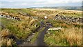
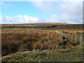
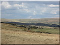
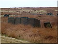
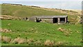
Nearby Images from Geograph Britain and Ireland:
©2022(licence)
©2006(licence)
©2015(licence)
©2013(licence)
©2022(licence)
The above images may not be of the site on this page, they are loaded from Geograph.
Please Submit an Image of this site or go out and take one for us!
Click here to see more info for this site
Nearby sites
Key: Red: member's photo, Blue: 3rd party photo, Yellow: other image, Green: no photo - please go there and take one, Grey: site destroyed
Download sites to:
KML (Google Earth)
GPX (GPS waypoints)
CSV (Garmin/Navman)
CSV (Excel)
To unlock full downloads you need to sign up as a Contributory Member. Otherwise downloads are limited to 50 sites.
Turn off the page maps and other distractions
Nearby sites listing. In the following links * = Image available
2.5km S 178° Hunger Hill Cairn* Cairn (SD864159)
2.7km SSE 153° Lowe Dunishbooth Promontory Fort / Cliff Castle (SD8756115960)
2.8km SSE 148° Lower Dunishbooth Promontory Fort / Cliff Castle (SD8779616025)
3.6km WNW 289° Waugh's Well (Edenfield) Holy Well or Sacred Spring (SD82871957)
4.6km SW 221° Wind Hill Cheesden* Round Barrow(s) (SD8326214945)
4.7km N 7° Bacup Natural History Society Museum* Museum (SD869231)
4.8km ENE 68° Hades Hill Cairn (SD908202)
5.3km NNE 14° Wyrd of Stake Moss* Modern Stone Circle etc (SD876235)
5.9km NNE 25° Tooter Hill (Bacup)* Ancient Village or Settlement (SD888237)
5.9km N 1° Broadclough Dykes, Bacup, Lancashire* Misc. Earthwork (SD864243)
6.2km WSW 250° Whitelow* Cairn (SD80501626)
6.3km SSE 148° Broadfield Park Glacial Boulder* Natural Stone / Erratic / Other Natural Feature (SD896130)
6.7km SW 219° Walmersley Golf Club stone* Modern Stone Circle etc (SD82011319)
6.9km SSW 211° Castle Hill, Heywood Hillfort (SD827125)
8.1km NE 50° Stones monoliths, Todmorden* Standing Stones (SD92522359)
8.5km W 278° Robin Hood's Well, Haslingden* Holy Well or Sacred Spring (SD77861954)
8.6km SW 230° Castlesteads (Walmersley)* Hillfort (SD797129)
8.7km E 90° Snoddle Hill Cairn (SD950183)
9.1km ENE 67° Basin Stone* Rock Art (SD9472921990)
9.3km NE 49° Holy Well (Todmorden)* Holy Well or Sacred Spring (SD9339324411)
9.3km N 6° Thieveley (Holme Chapel) Cairn (SD873277)
9.5km SE 127° Tunshill Tolmen* Holed Stone (SD939127)
9.6km ENE 67° Gaddings Dam Rock Art (SD9514022123)
9.8km E 83° Light Hazzles Edge Rock Art (SD9605619575)
10.0km WSW 249° Whippalow Hill* Barrow Cemetery (SD76921477)
View more nearby sites and additional images


 We would like to know more about this location. Please feel free to add a brief description and any relevant information in your own language.
 Wir möchten mehr über diese Stätte erfahren. Bitte zögern Sie nicht, eine kurze Beschreibung und relevante Informationen in Deutsch hinzuzufügen.
 Nous aimerions en savoir encore un peu sur les lieux. S'il vous plaît n'hesitez pas à ajouter une courte description et tous les renseignements pertinents dans votre propre langue.
 Quisieramos informarnos un poco más de las lugares. No dude en añadir una breve descripción y otros datos relevantes en su propio idioma.