


<< Text Pages >> Hades Hill - Cairn in England in Greater Manchester
Submitted by vicky on Thursday, 03 June 2004 Page Views: 13227
Neolithic and Bronze AgeSite Name: Hades HillCountry: England County: Greater Manchester Type: Cairn
Nearest Town: Bacup Nearest Village: Whitworth
Map Ref: SD908202 Landranger Map Number: 103
Latitude: 53.678182N Longitude: 2.140752W
Condition:
| 5 | Perfect |
| 4 | Almost Perfect |
| 3 | Reasonable but with some damage |
| 2 | Ruined but still recognisable as an ancient site |
| 1 | Pretty much destroyed, possibly visible as crop marks |
| 0 | No data. |
| -1 | Completely destroyed |
| 5 | Superb |
| 4 | Good |
| 3 | Ordinary |
| 2 | Not Good |
| 1 | Awful |
| 0 | No data. |
| 5 | Can be driven to, probably with disabled access |
| 4 | Short walk on a footpath |
| 3 | Requiring a bit more of a walk |
| 2 | A long walk |
| 1 | In the middle of nowhere, a nightmare to find |
| 0 | No data. |
| 5 | co-ordinates taken by GPS or official recorded co-ordinates |
| 4 | co-ordinates scaled from a detailed map |
| 3 | co-ordinates scaled from a bad map |
| 2 | co-ordinates of the nearest village |
| 1 | co-ordinates of the nearest town |
| 0 | no data |
Internal Links:
External Links:
Kerb Cairn in Greater Manchester (Rochdale)
This barrow/cairn is recorded as Pastscape Monument No. 46134, an extract of which reads: "A barrow measuring circa 15 metres north to south, circa 13 metres esat to west, and 0.9 metres high was excavated in 1898. It lay on the Hades Hill side of the depression between Hades Hill and Rough Hill near Facit. The urn, which lay near the centre of the barrow, was ornamented by rope imprints placed chevronwise, and was of the Celtic two tier variety. It contained burnt bones (probably female) flint flakes, a scraper and a fine pointed borer. Also found in the barrow were animal bones, charcoal, flint implements and a barbed arrow head. There were no metal objects. The urn and contents were deposited in the March Collection at the Rochdale Free Library."
The Northern Antiquarian (TNA) also feature a page for this cairn - see their entry for Hades Hill, Whitworth, Lancashire, which gives directions for finding this site, together with a brief archaeology.
TNA advise: "Its exact location is close to a footpath halfway between Hades hill and Rough hill, though it is not mentioned on modern OS maps. It is quite difficult to get to so be ready for a long hard walk." (Please note, TNA give a slightly different grid reference to that given by Pastscape. TNA say it is SD 909 202, rather than SD 908 202.)
You may be viewing yesterday's version of this page. To see the most up to date information please register for a free account.
Do not use the above information on other web sites or publications without permission of the contributor.
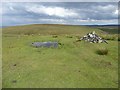
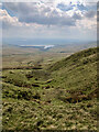
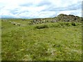
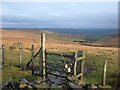
Nearby Images from Geograph Britain and Ireland:
©2011(licence)
©2023(licence)
©2011(licence)
©2005(licence)
©2011(licence)
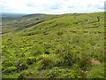
The above images may not be of the site on this page, they are loaded from Geograph.
Please Submit an Image of this site or go out and take one for us!
Click here to see more info for this site
Nearby sites
Key: Red: member's photo, Blue: 3rd party photo, Yellow: other image, Green: no photo - please go there and take one, Grey: site destroyed
Download sites to:
KML (Google Earth)
GPX (GPS waypoints)
CSV (Garmin/Navman)
CSV (Excel)
To unlock full downloads you need to sign up as a Contributory Member. Otherwise downloads are limited to 50 sites.
Turn off the page maps and other distractions
Nearby sites listing. In the following links * = Image available
3.8km NNE 27° Stones monoliths, Todmorden* Standing Stones (SD92522359)
4.0km NNW 330° Tooter Hill (Bacup)* Ancient Village or Settlement (SD888237)
4.3km ENE 65° Basin Stone* Rock Art (SD9472921990)
4.6km NW 316° Wyrd of Stake Moss* Modern Stone Circle etc (SD876235)
4.6km ESE 114° Snoddle Hill Cairn (SD950183)
4.7km ENE 66° Gaddings Dam Rock Art (SD9514022123)
4.8km WSW 248° Hamer Hill* Stone Circle (SD863184)
4.9km NW 307° Bacup Natural History Society Museum* Museum (SD869231)
4.9km NNE 31° Holy Well (Todmorden)* Holy Well or Sacred Spring (SD9339324411)
5.1km SW 216° Lower Dunishbooth Promontory Fort / Cliff Castle (SD8779616025)
5.3km E 97° Light Hazzles Edge Rock Art (SD9605619575)
5.3km SW 217° Lowe Dunishbooth Promontory Fort / Cliff Castle (SD8756115960)
5.8km E 100° Cow Head-Light Hazzles Rock Art (SD9651619164)
6.0km ESE 107° Cow Head (Blackstone Edge)* Rock Art (SD9651918405)
6.0km NW 313° Broadclough Dykes, Bacup, Lancashire* Misc. Earthwork (SD864243)
6.1km ENE 67° Bald Scout Hill* Rock Art (SD9642222612)
6.1km SW 225° Hunger Hill Cairn* Cairn (SD864159)
6.2km ESE 111° Cow Head End Rock Art (SD9656017991)
6.3km NNE 25° Whirlaw Stones* Rock Art (SD9348125886)
6.3km NE 34° The Frying Pan 1* Cairn (SD9433425426)
6.4km ESE 119° Jacob's Well (Lydgate)* Holy Well or Sacred Spring (SD9638117068)
6.4km ESE 105° Byron Edge* Rock Art (SD970185)
6.4km NE 34° The Frying Pan 2* Cairn (SD9445425507)
6.5km E 85° Woolpack Stone Rock Art (SD9727720789)
6.6km NNE 20° Harley Wood Edge Rock Art (SD9312526386)
View more nearby sites and additional images


 We would like to know more about this location. Please feel free to add a brief description and any relevant information in your own language.
 Wir möchten mehr über diese Stätte erfahren. Bitte zögern Sie nicht, eine kurze Beschreibung und relevante Informationen in Deutsch hinzuzufügen.
 Nous aimerions en savoir encore un peu sur les lieux. S'il vous plaît n'hesitez pas à ajouter une courte description et tous les renseignements pertinents dans votre propre langue.
 Quisieramos informarnos un poco más de las lugares. No dude en añadir una breve descripción y otros datos relevantes en su propio idioma.