<< Our Photo Pages >> Cross (near Swithland) - Ancient Cross in England in Leicestershire and Rutland
Submitted by flannel on Monday, 04 January 2021 Page Views: 740
Early Medieval (Dark Age)Site Name: Cross (near Swithland)Country: England
NOTE: This site is 1.032 km away from the location you searched for.
County: Leicestershire and Rutland Type: Ancient Cross
Nearest Town: Loughborough Nearest Village: Swithland
Map Ref: SK557126
Latitude: 52.708208N Longitude: 1.177026W
Condition:
| 5 | Perfect |
| 4 | Almost Perfect |
| 3 | Reasonable but with some damage |
| 2 | Ruined but still recognisable as an ancient site |
| 1 | Pretty much destroyed, possibly visible as crop marks |
| 0 | No data. |
| -1 | Completely destroyed |
| 5 | Superb |
| 4 | Good |
| 3 | Ordinary |
| 2 | Not Good |
| 1 | Awful |
| 0 | No data. |
| 5 | Can be driven to, probably with disabled access |
| 4 | Short walk on a footpath |
| 3 | Requiring a bit more of a walk |
| 2 | A long walk |
| 1 | In the middle of nowhere, a nightmare to find |
| 0 | No data. |
| 5 | co-ordinates taken by GPS or official recorded co-ordinates |
| 4 | co-ordinates scaled from a detailed map |
| 3 | co-ordinates scaled from a bad map |
| 2 | co-ordinates of the nearest village |
| 1 | co-ordinates of the nearest town |
| 0 | no data |
Internal Links:
External Links:
 (PID:221308)")
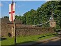
Cross is marked on the 1:25,000 and 1:50,000 OS maps but is on private land. It can be seen from the road and the church grounds. I recommend binoculars.
Location on Bing OS maps
You may be viewing yesterday's version of this page. To see the most up to date information please register for a free account.
 (PID:221309)")
Do not use the above information on other web sites or publications without permission of the contributor.
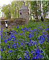
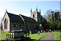
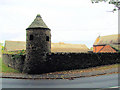
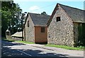
Nearby Images from Geograph Britain and Ireland:
©2017(licence)
©2005(licence)
©2008(licence)
©2007(licence)
©2020(licence)
The above images may not be of the site on this page, they are loaded from Geograph.
Please Submit an Image of this site or go out and take one for us!
Click here to see more info for this site
Nearby sites
Key: Red: member's photo, Blue: 3rd party photo, Yellow: other image, Green: no photo - please go there and take one, Grey: site destroyed
Download sites to:
KML (Google Earth)
GPX (GPS waypoints)
CSV (Garmin/Navman)
CSV (Excel)
To unlock full downloads you need to sign up as a Contributory Member. Otherwise downloads are limited to 50 sites.
Turn off the page maps and other distractions
Nearby sites listing. In the following links * = Image available
2.2km SSE 159° Thurcaston A* Standing Stone (Menhir) (SK56501060)
2.4km SSE 162° Thurcaston B Standing Stone (Menhir) (SK56481030)
2.5km SSE 164° Thurcaston C and D Standing Stones (SK56431020)
2.9km E 90° Rothley Cross* Ancient Cross (SK5861312637)
3.4km WSW 254° Bradgate Hunt's Hill Stone* Standing Stone (Menhir) (SK5247111651)
3.6km SSE 166° Beaumont Leys* Standing Stones (SK566091)
4.4km S 186° Anstey Stone* Standing Stone (Menhir) (SK55260820)
4.8km E 87° Cossington Bronze Age Barrows* Barrow Cemetery (SK605129)
4.9km WNW 295° Beacon Hill (Leicestershire)* Hillfort (SK512146)
5.4km SE 134° St James (Birstall) Early Christian Sculptured Stone (SK59630884)
6.0km WNW 284° Bawdon Monolith Standing Stone (Menhir) (SK49851400)
7.3km NNW 342° Charnwood Museum* Museum (SK534195)
7.3km NW 318° Holywell Haw* Holy Well or Sacred Spring (SK50731800)
7.9km SSE 161° St. Margaret's Church* Holy Well or Sacred Spring (SK584052)
8.3km S 182° Western Park (Leicester)* Misc. Earthwork (SK555043)
8.5km SSE 164° Jewry Wall Museum Museum (SK582045)
8.5km W 274° Kellam's Farm moated site* Ancient Village or Settlement (SK47211310)
8.7km SE 130° The Humber Stone* Standing Stone (Menhir) (SK6241607095)
8.7km E 80° Rearsby Timber Circle Timber Circle (SK643142)
8.7km WNW 298° Grey Hangman Stone* Standing Stone (Menhir) (SK47951665)
8.7km WNW 289° Cat Hill Wood Stone* Modern Stone Circle etc (SK474154)
9.1km SW 221° Bury Camp (Leicestershire) Hillfort (SK498057)
9.3km E 101° Mowde Bush Stone* Standing Stone (Menhir) (SK649110)
9.3km WNW 287° Stone nr Oaks in Charnwood* Natural Stone / Erratic / Other Natural Feature (SK46721523)
9.4km E 79° Blue Stone (Rearsby)* Natural Stone / Erratic / Other Natural Feature (SK6497414518)
View more nearby sites and additional images


 We would like to know more about this location. Please feel free to add a brief description and any relevant information in your own language.
 Wir möchten mehr über diese Stätte erfahren. Bitte zögern Sie nicht, eine kurze Beschreibung und relevante Informationen in Deutsch hinzuzufügen.
 Nous aimerions en savoir encore un peu sur les lieux. S'il vous plaît n'hesitez pas à ajouter une courte description et tous les renseignements pertinents dans votre propre langue.
 Quisieramos informarnos un poco más de las lugares. No dude en añadir una breve descripción y otros datos relevantes en su propio idioma.