

, Aubrey Burl")
<< Our Photo Pages >> Cat Hill Wood Stone - Modern Stone Circle etc in England in Leicestershire and Rutland
Submitted by enkidu41 on Monday, 16 August 2004 Page Views: 6701
Modern SitesSite Name: Cat Hill Wood StoneCountry: England County: Leicestershire and Rutland Type: Modern Stone Circle etc
Nearest Town: Loughborough Nearest Village: Coalville
Map Ref: SK474154
Latitude: 52.734166N Longitude: 1.299459W
Condition:
| 5 | Perfect |
| 4 | Almost Perfect |
| 3 | Reasonable but with some damage |
| 2 | Ruined but still recognisable as an ancient site |
| 1 | Pretty much destroyed, possibly visible as crop marks |
| 0 | No data. |
| -1 | Completely destroyed |
| 5 | Superb |
| 4 | Good |
| 3 | Ordinary |
| 2 | Not Good |
| 1 | Awful |
| 0 | No data. |
| 5 | Can be driven to, probably with disabled access |
| 4 | Short walk on a footpath |
| 3 | Requiring a bit more of a walk |
| 2 | A long walk |
| 1 | In the middle of nowhere, a nightmare to find |
| 0 | No data. |
| 5 | co-ordinates taken by GPS or official recorded co-ordinates |
| 4 | co-ordinates scaled from a detailed map |
| 3 | co-ordinates scaled from a bad map |
| 2 | co-ordinates of the nearest village |
| 1 | co-ordinates of the nearest town |
| 0 | no data |
Internal Links:
External Links:
")
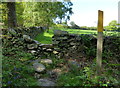
This stone in Cat Hill Wood is nearly 8' high and is the tallest standing stone in the county.
This does not appear to be ancient and may have been erected in the early part of the twentieth century by Boy Scouts from the nearby camp.
Based on the description by, and used by kind permission of, Bob Trubshaw, from his Interactive
Little-known Leicestershire and Rutland CD-ROM.
You may be viewing yesterday's version of this page. To see the most up to date information please register for a free account.
Do not use the above information on other web sites or publications without permission of the contributor.
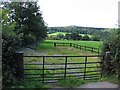
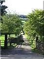
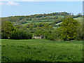
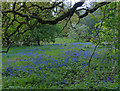
Nearby Images from Geograph Britain and Ireland:
©2006(licence)
©2006(licence)
©2013(licence)
©2013(licence)
©2013(licence)
The above images may not be of the site on this page, they are loaded from Geograph.
Please Submit an Image of this site or go out and take one for us!
Click here to see more info for this site
Nearby sites
Key: Red: member's photo, Blue: 3rd party photo, Yellow: other image, Green: no photo - please go there and take one, Grey: site destroyed
Download sites to:
KML (Google Earth)
GPX (GPS waypoints)
CSV (Garmin/Navman)
CSV (Excel)
To unlock full downloads you need to sign up as a Contributory Member. Otherwise downloads are limited to 50 sites.
Turn off the page maps and other distractions
Nearby sites listing. In the following links * = Image available
699m WSW 256° Stone nr Oaks in Charnwood* Natural Stone / Erratic / Other Natural Feature (SK46721523)
920m NW 311° Hanging Stone (Leicestershire) Natural Stone / Erratic / Other Natural Feature (SK467160)
1.4km NNE 24° Grey Hangman Stone* Standing Stone (Menhir) (SK47951665)
2.3km S 185° Kellam's Farm moated site* Ancient Village or Settlement (SK47211310)
2.5km NW 304° Altar Stone, Whitwick* Modern Stone Circle etc (SK453168)
2.8km ESE 120° Bawdon Monolith Standing Stone (Menhir) (SK49851400)
3.4km WNW 302° Swanimote Hill* Natural Stone / Erratic / Other Natural Feature (SK445172)
3.9km ESE 102° Beacon Hill (Leicestershire)* Hillfort (SK512146)
4.0km WNW 284° Whitwick Spring* Holy Well or Sacred Spring (SK435163)
4.2km NE 53° Holywell Haw* Holy Well or Sacred Spring (SK50731800)
5.0km NW 306° Grace Dieu Priory Stone* Standing Stone (Menhir) (SK433183)
5.1km NNW 335° Belton Banjo enclosure* Causewayed Enclosure (SK45161997)
6.3km SE 127° Bradgate Hunt's Hill Stone* Standing Stone (Menhir) (SK5247111651)
6.9km WNW 293° Griffy's Well* Holy Well or Sacred Spring (SK4118)
7.3km NE 56° Charnwood Museum* Museum (SK534195)
8.7km ESE 109° Cross (near Swithland)* Ancient Cross (SK557126)
10.0km SSE 167° Bury Camp (Leicestershire) Hillfort (SK498057)
10.3km ESE 118° Thurcaston A* Standing Stone (Menhir) (SK56501060)
10.4km ESE 120° Thurcaston B Standing Stone (Menhir) (SK56481030)
10.4km ESE 121° Thurcaston C and D Standing Stones (SK56431020)
10.4km NW 320° The Bulwarks (Breedon on the Hill)* Hillfort (SK406233)
10.5km NW 320° St Mary and St Hardulf (Breedon on the Hill)* Ancient Cross (SK4055723335)
10.6km SE 133° Anstey Stone* Standing Stone (Menhir) (SK55260820)
10.6km NW 309° Moated Mound at Breedon-on-the-Hill* Artificial Mound (SK3902822009)
10.7km WNW 301° Staunton Harold's ancient village* Ancient Village or Settlement (SK3822120860)
View more nearby sites and additional images


 We would like to know more about this location. Please feel free to add a brief description and any relevant information in your own language.
 Wir möchten mehr über diese Stätte erfahren. Bitte zögern Sie nicht, eine kurze Beschreibung und relevante Informationen in Deutsch hinzuzufügen.
 Nous aimerions en savoir encore un peu sur les lieux. S'il vous plaît n'hesitez pas à ajouter une courte description et tous les renseignements pertinents dans votre propre langue.
 Quisieramos informarnos un poco más de las lugares. No dude en añadir una breve descripción y otros datos relevantes en su propio idioma.