<< Our Photo Pages >> Holy Well (Ravenstone) - Holy Well or Sacred Spring in England in Buckinghamshire
Submitted by DavidCWoods on Sunday, 19 December 2004 Page Views: 5719
Springs and Holy WellsSite Name: Holy Well (Ravenstone)Country: England
NOTE: This site is 1.683 km away from the location you searched for.
County: Buckinghamshire Type: Holy Well or Sacred Spring
Nearest Town: Bedford Nearest Village: Ravenstone
Map Ref: SP849510
Latitude: 52.150768N Longitude: 0.760558W
Condition:
| 5 | Perfect |
| 4 | Almost Perfect |
| 3 | Reasonable but with some damage |
| 2 | Ruined but still recognisable as an ancient site |
| 1 | Pretty much destroyed, possibly visible as crop marks |
| 0 | No data. |
| -1 | Completely destroyed |
| 5 | Superb |
| 4 | Good |
| 3 | Ordinary |
| 2 | Not Good |
| 1 | Awful |
| 0 | No data. |
| 5 | Can be driven to, probably with disabled access |
| 4 | Short walk on a footpath |
| 3 | Requiring a bit more of a walk |
| 2 | A long walk |
| 1 | In the middle of nowhere, a nightmare to find |
| 0 | No data. |
| 5 | co-ordinates taken by GPS or official recorded co-ordinates |
| 4 | co-ordinates scaled from a detailed map |
| 3 | co-ordinates scaled from a bad map |
| 2 | co-ordinates of the nearest village |
| 1 | co-ordinates of the nearest town |
| 0 | no data |
Internal Links:
External Links:
 (PID:11048)")
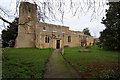
The landowner was happy for me to visit, and in December I did so. She directed me through the gate and down the hill to the north of the church. The field shows many signs of its development as the site of the Priory, with humps and hollows and, near the eastern corner of the field, a few small half-buried pieces of masonry.
There is a large area surrounded by what appeared to be a dry moat, and within the area was a small fenced square – this, I was told, was the well. Sure enough, on prodding the undergrowth a stone cover could be seen. I scraped a little of the moss away but could see not inscription. This may or may not be the original stone.
The 1885 OS map shows a Chalybeate Spring north north west of All Saints’ Church. Following further directions I crossed a gate in the northern corner of the field, then turned left along the bank of a stream which ran along the bottom edge of the field containing the Priory site. Almost in the southern corner of this second field was a very old ash tree, split almost in half. In the roots of the tree was the spring – covered in brambles and very boggy, with a small amount of water emerging and then vanishing back into the ground. This, I am sure, is the Chalybeate Spring.
You may be viewing yesterday's version of this page. To see the most up to date information please register for a free account.
 (PID:11047)")
Do not use the above information on other web sites or publications without permission of the contributor.
Nearby Images from Geograph Britain and Ireland:
©2006(licence)
©2006(licence)
©2012(licence)
©2012(licence)
©2013(licence)
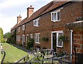
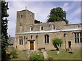
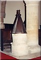
The above images may not be of the site on this page, they are loaded from Geograph.
Please Submit an Image of this site or go out and take one for us!
Click here to see more info for this site
Nearby sites
Key: Red: member's photo, Blue: 3rd party photo, Yellow: other image, Green: no photo - please go there and take one, Grey: site destroyed
Download sites to:
KML (Google Earth)
GPX (GPS waypoints)
CSV (Garmin/Navman)
CSV (Excel)
To unlock full downloads you need to sign up as a Contributory Member. Otherwise downloads are limited to 50 sites.
Turn off the page maps and other distractions
Nearby sites listing. In the following links * = Image available
2.9km NNE 32° Holy Well (Olney)* Holy Well or Sacred Spring (SP864535)
6.2km S 175° Gayhurst Barrow cemetery Barrow Cemetery (SP855448)
9.3km E 83° Nell's Well* Holy Well or Sacred Spring (SP941523)
10.7km SW 214° St. Vincent's Well Holy Well or Sacred Spring (SP7942)
10.8km SSE 167° Millennium Medicine Wheel* Stone Circle (SP8758740483)
11.0km NNE 13° Grendon Cursus Cursus (SP87256174)
11.9km ENE 61° Harrold Barrows* Barrow Cemetery (SP95245702)
12.7km NW 317° Becket's Well* Holy Well or Sacred Spring (SP761602)
13.2km SSW 208° Gorrick’s Well Holy Well or Sacred Spring (SP78803930)
13.2km NW 316° Northampton Museum and Art Gallery* Museum (SP7559260400)
13.3km NW 305° Hunsbury* Hillfort (SP738584)
14.1km SE 129° Holywell (Cranfield)* Holy Well or Sacred Spring (SP961424)
14.3km N 357° Mears Ashby Tumulus* Misc. Earthwork (SP839653)
14.4km E 80° Holywell (Bedfordshire)* Holy Well or Sacred Spring (SP9907753646)
14.9km NW 304° Upton Bowl Barrow Barrow Cemetery (SP72355909)
15.9km SSE 165° Caldecotte Cursus Cursus (SP892357)
16.8km NNW 331° Shepherd's Race (Boughton) Turf Maze (SP764655)
16.8km NNW 331° St John's Well (Boughton)* Holy Well or Sacred Spring (SP765656)
17.3km ENE 64° Felmersham Cursus Cursus (TL004588)
17.5km E 94° Biddenham Bridge Holy Well* Holy Well or Sacred Spring (TL024502)
17.8km SSE 157° Danesborough Hillfort Hillfort (SP922348)
17.8km SSW 196° Whaddon Barrow* Round Barrow(s)
18.0km NNW 327° Boughton bowl barrow* Round Barrow(s) (SP74706589)
18.1km SE 125° The Devil's stone (Bedfordshire)* Standing Stone (Menhir) (SP9989840865)
18.2km E 98° Kempston Cursus Cursus (TL030489)
View more nearby sites and additional images


 We would like to know more about this location. Please feel free to add a brief description and any relevant information in your own language.
 Wir möchten mehr über diese Stätte erfahren. Bitte zögern Sie nicht, eine kurze Beschreibung und relevante Informationen in Deutsch hinzuzufügen.
 Nous aimerions en savoir encore un peu sur les lieux. S'il vous plaît n'hesitez pas à ajouter une courte description et tous les renseignements pertinents dans votre propre langue.
 Quisieramos informarnos un poco más de las lugares. No dude en añadir una breve descripción y otros datos relevantes en su propio idioma.