<< Our Photo Pages >> Rugtvedt Settlement - Ancient Village or Settlement in Norway in Telemark
Submitted by kenntha88 on Thursday, 27 September 2012 Page Views: 1410
Multi-periodSite Name: Rugtvedt SettlementCountry: Norway
NOTE: This site is 2.088 km away from the location you searched for.
Fylke: Telemark Type: Ancient Village or Settlement
Nearest Town: Stathelle
Latitude: 59.033742N Longitude: 9.677625E
Condition:
| 5 | Perfect |
| 4 | Almost Perfect |
| 3 | Reasonable but with some damage |
| 2 | Ruined but still recognisable as an ancient site |
| 1 | Pretty much destroyed, possibly visible as crop marks |
| 0 | No data. |
| -1 | Completely destroyed |
| 5 | Superb |
| 4 | Good |
| 3 | Ordinary |
| 2 | Not Good |
| 1 | Awful |
| 0 | No data. |
| 5 | Can be driven to, probably with disabled access |
| 4 | Short walk on a footpath |
| 3 | Requiring a bit more of a walk |
| 2 | A long walk |
| 1 | In the middle of nowhere, a nightmare to find |
| 0 | No data. |
| 5 | co-ordinates taken by GPS or official recorded co-ordinates |
| 4 | co-ordinates scaled from a detailed map |
| 3 | co-ordinates scaled from a bad map |
| 2 | co-ordinates of the nearest village |
| 1 | co-ordinates of the nearest town |
| 0 | no data |
Internal Links:
External Links:
")
When this site was excavated because of the constructon of the main highway, it was found a stone age settlement from the old stone age.
It was found two fireplaces with a lot of charcoal inside and a number of animal bones close to them.
3200 artifacts were found, among them a lot of pieces of flintstone. Most of the artifacts were found to the east of the fireplaces. In the south end of the site was also found a lot of artifacts, it shows the settlement was large.
Dating of the charcoal dates the findings to around 5500-6000 years ago, it puts it in the period of older stone age. The settlement is around 30 metres above sea level. When the settlement was in use in the stone age, the sea was probably reaching almost up to the settlement.
You may be viewing yesterday's version of this page. To see the most up to date information please register for a free account.
")
")
Do not use the above information on other web sites or publications without permission of the contributor.
Nearby Images from Flickr


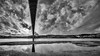
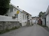

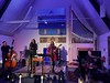
The above images may not be of the site on this page, but were taken nearby. They are loaded from Flickr so please click on them for image credits.
Click here to see more info for this site
Nearby sites
Click here to view sites on an interactive map of the areaKey: Red: member's photo, Blue: 3rd party photo, Yellow: other image, Green: no photo - please go there and take one, Grey: site destroyed
Download sites to:
KML (Google Earth)
GPX (GPS waypoints)
CSV (Garmin/Navman)
CSV (Excel)
To unlock full downloads you need to sign up as a Contributory Member. Otherwise downloads are limited to 50 sites.
Turn off the page maps and other distractions
Nearby sites listing. In the following links * = Image available
2.7km SSW 192° Bamble Offerlund* Timber Circle
3.0km SSW 196° Bamble standing stone* Standing Stone (Menhir)
3.5km SSW 202° Steinsjordene sacrificial marsh* Natural Stone / Erratic / Other Natural Feature
5.6km NNE 27° Lerstang* Stone Circle
5.7km NNE 27° Rødvik-Slottet* Hillfort
9.4km NE 50° Landgangen* Rock Art
9.5km N 8° Eidanger Prestegård* Barrow Cemetery
10.7km SE 128° Mølen* Cairn
12.9km NNE 15° Bjørkedalen-Flogstad* Barrow Cemetery
13.2km NNW 346° Østre Klyve* Barrow Cemetery
14.2km E 101° Sannisteinen* Standing Stone (Menhir)
14.6km N 353° Borgestad* Stone Circle
14.8km E 96° Kongerødhaugen Barrow* Round Barrow(s)
15.1km NNW 346° Lyngbakken* Barrow Cemetery
15.5km NE 45° Omsland* Barrow Cemetery
15.7km NNW 336° Findal Nordre* Barrow Cemetery
15.7km ESE 114° Hummerbakken-Høgvik* Ancient Village or Settlement
16.0km E 96° Hvatum Standing Stone* Standing Stone (Menhir)
16.1km E 96° Bratthaugåsen* Barrow Cemetery
16.4km NNW 332° Holtan* Barrow Cemetery
16.7km E 93° Presteåsen* Standing Stone (Menhir)
17.5km NNW 341° Gimsø Kloster* Barrow Cemetery
18.6km N 356° Løberghaugen* Rock Art
18.7km NNW 345° Galgeholmen* Round Barrow(s)
19.4km NNW 344° Kjempa Hillfort* Hillfort
View more nearby sites and additional images


 We would like to know more about this location. Please feel free to add a brief description and any relevant information in your own language.
 Wir möchten mehr über diese Stätte erfahren. Bitte zögern Sie nicht, eine kurze Beschreibung und relevante Informationen in Deutsch hinzuzufügen.
 Nous aimerions en savoir encore un peu sur les lieux. S'il vous plaît n'hesitez pas à ajouter une courte description et tous les renseignements pertinents dans votre propre langue.
 Quisieramos informarnos un poco más de las lugares. No dude en añadir una breve descripción y otros datos relevantes en su propio idioma.