


<< Text Pages >> Shepherd's Race (Boughton) - Maze or Labyrinth in England in Northamptonshire
Submitted by HOLYWELL on Friday, 04 February 2011 Page Views: 7058
Multi-periodSite Name: Shepherd's Race (Boughton) Alternative Name: Shepherd's RingCountry: England
NOTE: This site is 1.72 km away from the location you searched for.
County: Northamptonshire Type: Maze or Labyrinth
Nearest Town: Northampton Nearest Village: Boughton
Map Ref: SP764655
Latitude: 52.282343N Longitude: 0.881494W
Condition:
| 5 | Perfect |
| 4 | Almost Perfect |
| 3 | Reasonable but with some damage |
| 2 | Ruined but still recognisable as an ancient site |
| 1 | Pretty much destroyed, possibly visible as crop marks |
| 0 | No data. |
| -1 | Completely destroyed |
| 5 | Superb |
| 4 | Good |
| 3 | Ordinary |
| 2 | Not Good |
| 1 | Awful |
| 0 | No data. |
| 5 | Can be driven to, probably with disabled access |
| 4 | Short walk on a footpath |
| 3 | Requiring a bit more of a walk |
| 2 | A long walk |
| 1 | In the middle of nowhere, a nightmare to find |
| 0 | No data. |
| 5 | co-ordinates taken by GPS or official recorded co-ordinates |
| 4 | co-ordinates scaled from a detailed map |
| 3 | co-ordinates scaled from a bad map |
| 2 | co-ordinates of the nearest village |
| 1 | co-ordinates of the nearest town |
| 0 | no data |
Internal Links:
External Links:
Turf Maze in Northamptonshire
One of the most famed of ancient turf mazes. This was a Chartre designed maze but with a spiral in the centre. I existed until the first world war when trenches were cut through it by practising soldiers. It was already overgrown by the mid 1800s however. The village had notable fair and holy well which may have been linked to the maze.
You may be viewing yesterday's version of this page. To see the most up to date information please register for a free account.
Do not use the above information on other web sites or publications without permission of the contributor.
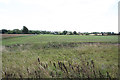
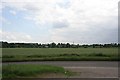
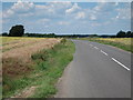
Nearby Images from Geograph Britain and Ireland:
©2011(licence)
©2010(licence)
©2011(licence)

©2011(licence)

©2025(licence)
The above images may not be of the site on this page, they are loaded from Geograph.
Please Submit an Image of this site or go out and take one for us!
Click here to see more info for this site
Nearby sites
Key: Red: member's photo, Blue: 3rd party photo, Yellow: other image, Green: no photo - please go there and take one, Grey: site destroyed
Download sites to:
KML (Google Earth)
GPX (GPS waypoints)
CSV (Garmin/Navman)
CSV (Excel)
To unlock full downloads you need to sign up as a Contributory Member. Otherwise downloads are limited to 50 sites.
Turn off the page maps and other distractions
Nearby sites listing. In the following links * = Image available
141m NE 46° St John's Well (Boughton)* Holy Well or Sacred Spring (SP765656)
1.7km WNW 284° Boughton bowl barrow* Round Barrow(s) (SP74706589)
2.6km NNW 330° Longmans Hill Long Barrow* Long Barrow (SP751677)
5.2km S 190° Northampton Museum and Art Gallery* Museum (SP7559260400)
5.3km S 184° Becket's Well* Holy Well or Sacred Spring (SP761602)
5.9km NNW 345° Brixworth Anglo Saxon Church* Ancient Temple (SP7475071217)
7.5km E 92° Mears Ashby Tumulus* Misc. Earthwork (SP839653)
7.6km SSW 201° Hunsbury* Hillfort (SP738584)
7.6km SSW 213° Upton Bowl Barrow Barrow Cemetery (SP72355909)
9.7km W 269° Great Brington Medieval Cross Ancient Cross (SP6667765176)
11.5km ESE 110° Grendon Cursus Cursus (SP87256174)
13.6km WNW 297° Oster Hill (West Haddon) Cairn (SP64157145)
15.6km SE 141° Holy Well (Olney)* Holy Well or Sacred Spring (SP864535)
15.7km WSW 237° The Larches Ancient Village or Settlement (SP633567)
16.5km ENE 68° Finedon Stone* Marker Stone (SP9161871928)
16.8km SSE 151° Holy Well (Ravenstone)* Holy Well or Sacred Spring (SP849510)
17.8km W 262° Borough Hill (Daventry)* Hillfort (SP588626)
20.6km ESE 115° Harrold Barrows* Barrow Cemetery (SP95245702)
20.8km ENE 76° Redlands Farm Long Barrow Long Barrow (SP965710)
20.9km NW 325° Husbands Bosworth Causewayed Enclosure* Causewayed Enclosure (SP64018235)
21.0km ENE 71° Irthlingborough and Stanwick Barrows* Barrow Cemetery (SP963725)
21.1km ENE 74° Stanwick Lakes* Museum (SP96707150)
21.1km NNW 347° Judith's Stone.* Marker Stone (SP7120786000)
21.6km ENE 75° Raunds Ring Ditch Misc. Earthwork (SP972716)
22.0km N 353° Harborough Museum* Museum (SP7342087285)
View more nearby sites and additional images


 We would like to know more about this location. Please feel free to add a brief description and any relevant information in your own language.
 Wir möchten mehr über diese Stätte erfahren. Bitte zögern Sie nicht, eine kurze Beschreibung und relevante Informationen in Deutsch hinzuzufügen.
 Nous aimerions en savoir encore un peu sur les lieux. S'il vous plaît n'hesitez pas à ajouter une courte description et tous les renseignements pertinents dans votre propre langue.
 Quisieramos informarnos un poco más de las lugares. No dude en añadir una breve descripción y otros datos relevantes en su propio idioma.