Contributory members are able to log private notes and comments about each site
Sites theCaptain has logged. View this log as a table or view the most recent logs from everyone
High Willhays North
Date Added: 19th Aug 2024
Site Type: Ring Cairn
Country: England (Devon)
Visited: Yes on 2nd Aug 2024. My rating: Condition 3 Ambience 4 Access 2
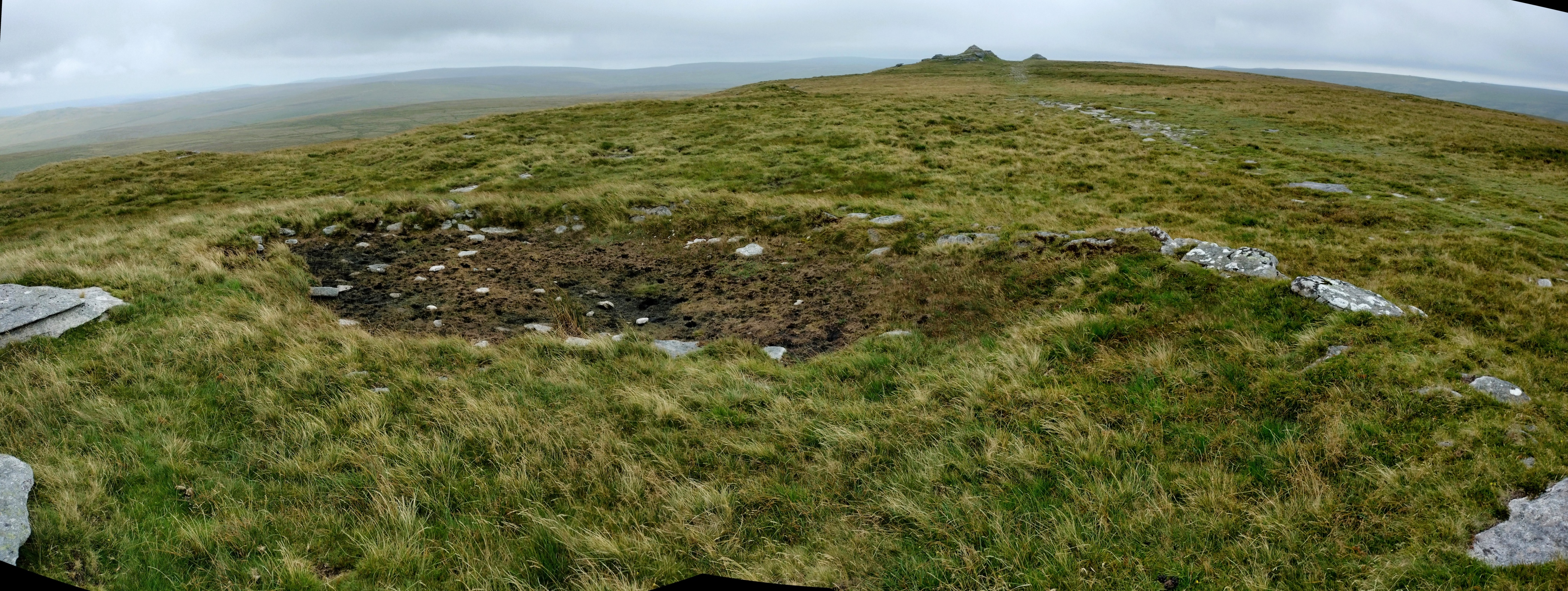
High Willhays North submitted by TheCaptain on 19th Aug 2024. A stitched together panorama of the semi circular tor top cairn on the northern summit of High Willhays. It looks a bit like a semi circular retaining bank for a pool these days. The southern, actual, top of High Willhays (and southern England) beyond.
(View photo, vote or add a comment)
Log Text: Now heading north across the indistinct top of High Willhays towards Yes Tor, I keep an eye open for what we have marked as a ring cairn, which I find positioned adjacent to one of the rock outcrops at the northern top of High Willhays. It seems to be a sort of ring cairn combined with a tor top cairn like that on Showery Tor on Bodmin Moor. It looks a bit like a semi circular retaining bank for a pool.
Fordsland Ledge Chambered cairn
Date Added: 19th Aug 2024
Site Type: Chambered Cairn
Country: England (Devon)
Visited: Yes on 2nd Aug 2024. My rating: Condition 3 Ambience 4 Access 2
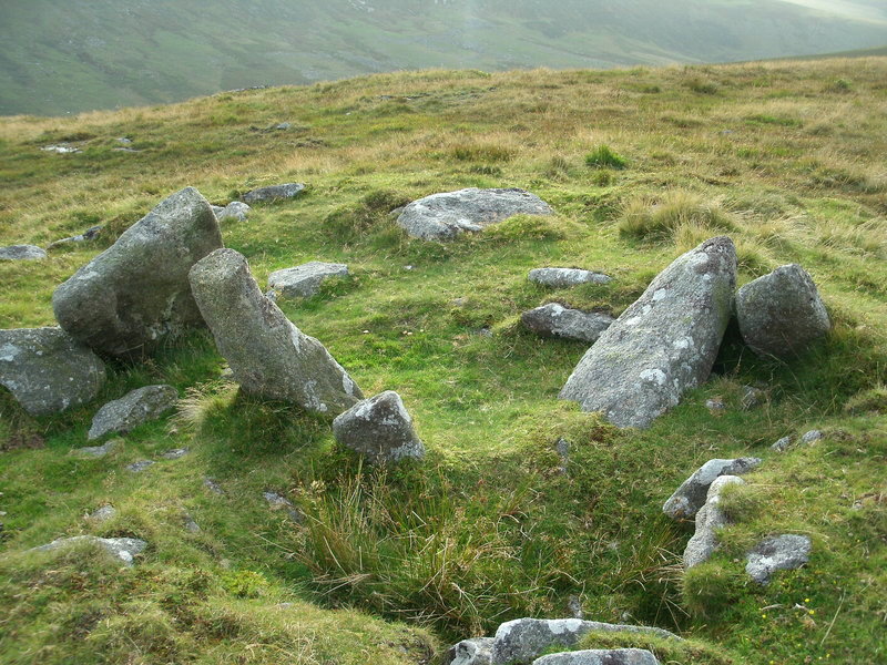
Fordsland Ledge Chambered cairn submitted by Bladup on 5th Oct 2014. Fordsland Ledge Chambered cairn.
(View photo, vote or add a comment)
Log Text: A walk up to the top of southern England, I park at Meldon reservoir and head over the dam then around the lake and up the West Okement river to an area of woodland and waterfalls, at which point I head up towards the top of the ridge north of Black Tor. I almost instantly regret this decision, as it is very hard going in very steep rough and wet ground, and I have a couple of falls, in the meantime seeing several other people descending much further upstream below the tor outcrop. Once up to Black Tor, and extremely weary, I have a serious talk to myself about heading directly back to the car along the track via Longstone Hill, as the weather is worsening and I am really starting to ache. However, after eating a sticky bun I feel the worst is over and decide to carry on up to Fordsland Ledge with its army huts and nice cairn with large stones protruding, seeing heavy rainshowers passing around, but none on me.
High Willhays kerb cairn
Date Added: 19th Aug 2024
Site Type: Ring Cairn
Country: England (Devon)
Visited: Yes on 2nd Aug 2024. My rating: Condition 2 Ambience 4 Access 2
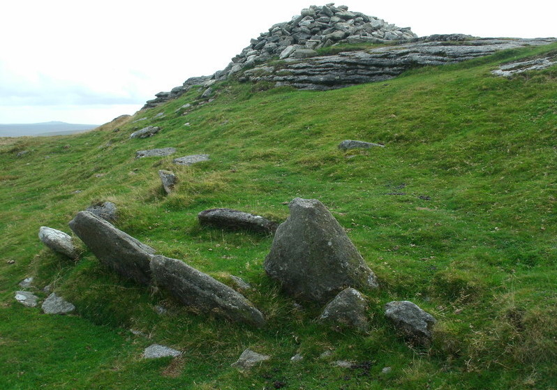
High Willhays kerb cairn submitted by Bladup on 5th Oct 2014. High Willhays prehistoric kerb cairn with the modern cairn behind on top of the Tor.
(View photo, vote or add a comment)
Log Text: From Fordsland Ledge its relatively easy going up to High Willhays, but in a bit of a mist at times which makes me slightly concerned about navigation further on when there will be no obvious trackway. Hard to figure out what exactly this is. There are several side set slabs standing proud just to the east of the top outcrop with its marker cairn on top. It is hard to tell whether these are the remains of a large kerb, or perhaps an internal structure, as in some views it looks to be two parallel rows of slabs.
Longstone Hill stone
Date Added: 21st Aug 2024
Site Type: Standing Stone (Menhir)
Country: England (Devon)
Visited: Yes on 2nd Aug 2024. My rating: Condition 2 Ambience 4 Access 3
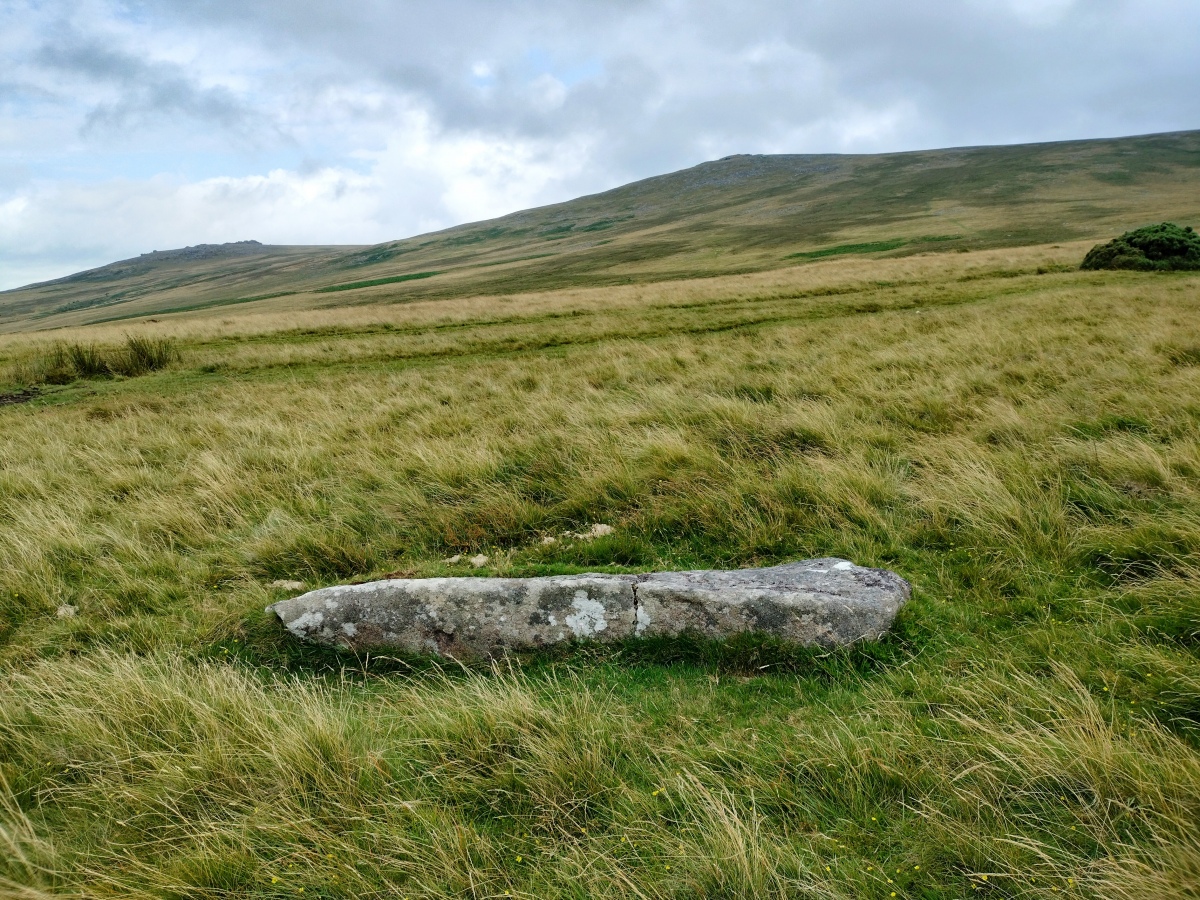
Longstone Hill stone submitted by TheCaptain on 21st Aug 2024. It certainly looks like a shaped menhir to me, and not just a piece of granite!
(View photo, vote or add a comment)
Log Text: After passing the large ring cairn, heading down from Yes Tor to Longstone Hill, there is no semblance of a pathway, but luckily the visibility is now good, and I can clearly see where I am heading towards, and the trackways across it. Its not too bad going down, and once on Longstone Hill, I find the fallen longstone fairly easily. It certainly looks like a shaped menhir to me, and not just a piece of granite!
Holme II
Date Added: 21st Aug 2024
Site Type: Timber Circle
Country: England (Norfolk)
Visited: Yes on 13th Jun 2024. My rating: Condition 2 Ambience 4 Access 2
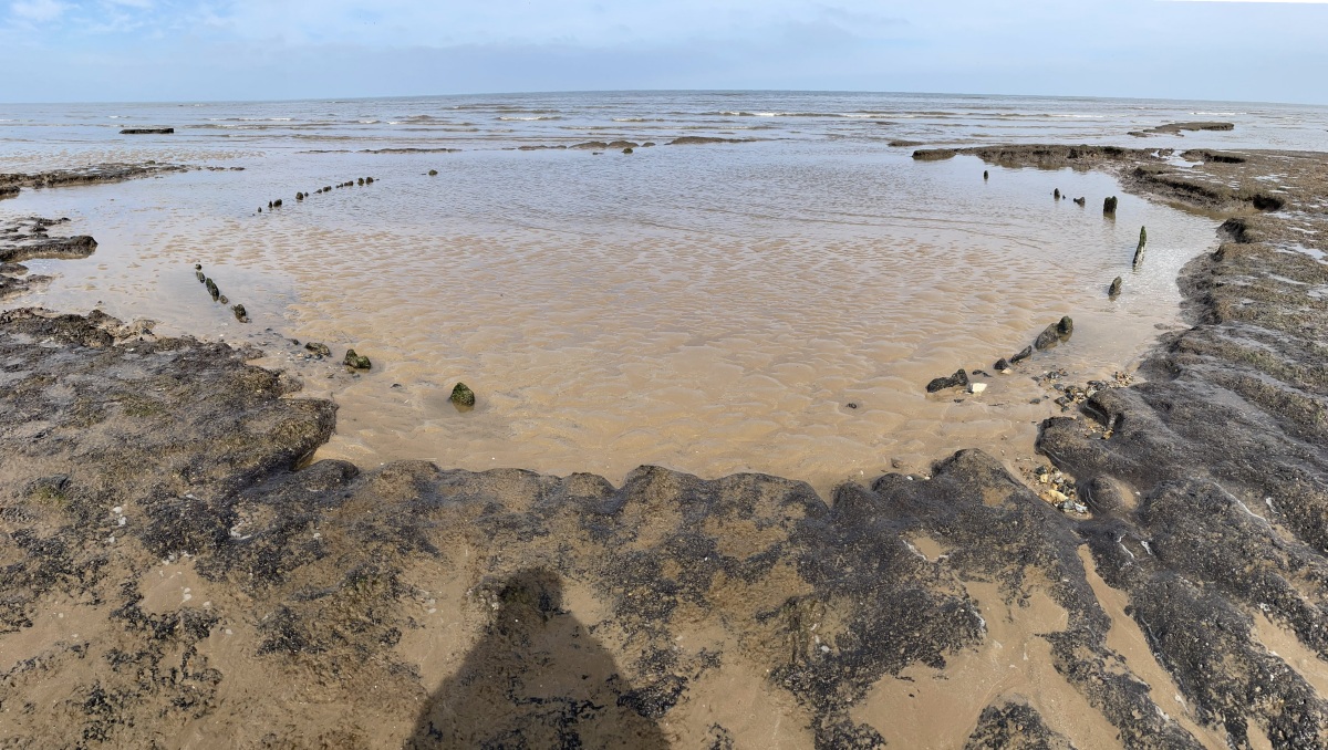
Holme II submitted by dodomad on 16th Apr 2023. This is what remains of Holme II in 2023:
Tom writes: After reading Seahenge by Francis Pryor I finally got to Holme Beach on a low tide. Stunning.
Photo by Tom Charlton @TomCharlton25 on Twitter, reposted with permission - glad I did as the original is now gone
(View photo, vote or add a comment)
Log Text: Went for a walk around the marshes from Thornham, and ended up walking out along the coast path to the north and west. I noticed that there were signposts to "the site of Seahenge". Anyways, I just kept going, past all sorts of interesting wildlife including spoonbills, and up to the Norfolk Wildlife Trust's Holme Dunes visitor centre, which was closing. Found myself drawn down onto the beach, and saw that it was quite close to the position of Seahenge, and was drawn to wander towards it. As I got there, I was looking for the post which I think marks the site of Seahenge, all still under water. But the tide was going out, and slowly things came into view. Now knowing where it all is, I headed back to Seahenge 2, and noted a couple of timbers poking through the waves, so I waited. Slowly more was revealed, but much less than a few days ago, the sand now right up over the inland side, leaving just the tops of a few of the major sector I had previously seen. I stayed for ages as the site was slowly uncovered. When you know where it is, its remarkably easy to find, and also so much easier to walk to from the east at Thornham rather than the west from Holme. In fact, along the coast path on top of the seawall, it would be possible to push a wheelchair, and only half an hour from the public parking. This said, it is possible to park at the Wildlife centre. I took a three little words position from the centre of the circle; garlic clockwork mole. TF 71234 45246
Kings Lynn Museum
Date Added: 21st Jun 2024
Site Type: Museum
Country: England (Norfolk)
Visited: Yes on 11th Jun 2024
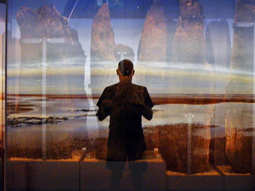
Reflection submitted by Tragic on 11th Jul 2009. Reflected Tragic aka Paul Brooker at the Sea Henge display in Kings Lynn, Norfolk
(View photo, vote or add a comment)
Log Text: A visit to the Lynn museum in Kings Lynn, hopefully to see the remains of Seahenge, removed from Holme beach and displayed here. I had seen online that the gallery in the museum was closed for building work, stating that it would reopen in "early June". It is now the 11th June, so not expecting to be able to see it, I was hoping! Upon getting to the museum, the people at the reception told me that the building work was over running, it was not open, but they were now hopeful for some time in July 2024. No good to me.
Warham Camp
Date Added: 22nd Jun 2024
Site Type: Hillfort
Country: England (Norfolk)
Visited: Yes on 10th Jun 2024. My rating: Condition 5 Ambience 4 Access 4

Warham Camp submitted by h_fenton on 14th Mar 2014. Warham Camp viewed from the north west.
Kite Aerial Photograph
9 March 2014
(View photo, vote or add a comment)
Log Text: A recommended visit from the bar lady at the Binham pub, to occupy a loose hour. Its really impressive in its scale and completeness. Lots of orchids are flowering on the banks in the sunshine.
Seahenge
Date Added: 21st Jun 2024
Site Type: Timber Circle
Country: England (Norfolk)
Visited: Yes on 10th Jun 2024. My rating: Condition -1 Ambience 4 Access 2
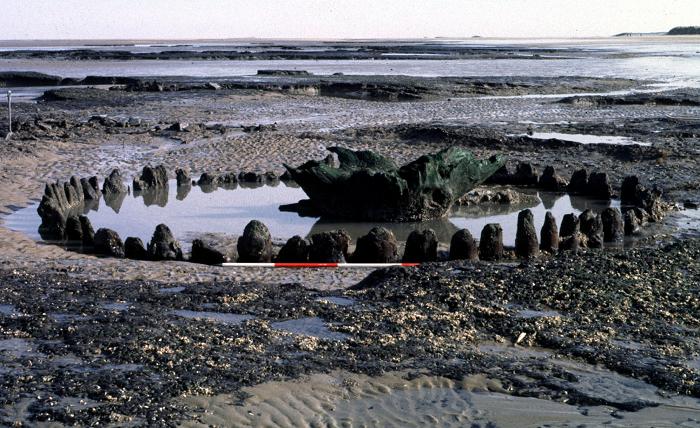
Seahenge submitted by Andy B on 14th May 2002. The original 'Seahenge', now removed to safety, but much remains on Holme beach. Photo copyright English Heritage, used with permission
(View photo, vote or add a comment)
Log Text: After many years, and a fair bit of planning, I got to visit the site of Seahange. I started from the pay car park at Holme, near the golf course, and followed the well marked and made coast path to the north then east, through the marshes and sand dunes. Whern I got to near where I thought the site was, I started looking for the signboard, but it had been knocked over so was not easy to find. I then tried to get down onto the beach, which was not easy with cliffs in the dunes and fences, so I retraced my steps back for a fair old way until I could get down onto the beach, before heading back east to the area of the site. After a fair bit of searching around, near to where it is marked on our map, I first saw a pole and stump sticking up, but nothing else. I wondered whether this was a marker for the site of the original Seahenge now removed.
Holme II
Date Added: 21st Jun 2024
Site Type: Timber Circle
Country: England (Norfolk)
Visited: Yes on 10th Jun 2024. My rating: Condition 2 Ambience 4 Access 2

Holme II submitted by dodomad on 16th Apr 2023. This is what remains of Holme II in 2023:
Tom writes: After reading Seahenge by Francis Pryor I finally got to Holme Beach on a low tide. Stunning.
Photo by Tom Charlton @TomCharlton25 on Twitter, reposted with permission - glad I did as the original is now gone
(View photo, vote or add a comment)
Log Text: After many years, and a fair bit of planning, I got to visit the site of Seahange. It needed a significantly low tide, and a long walk with no features to aim for. It was also a complete unknown as to whether any of the timbers would still be there, and not covered by the sands and mud. I started from the pay car park at Holme, near the golf course, and followed the well marked and made coast path to the north then east, through the marshes and sand dunes. Whern I got to near where I thought the site was, I started looking for the signboard, but it had been knocked over so was not easy to find. I then tried to get down onto the beach, which was not easy with cliffs in the dunes and fences, so I retraced my steps back for a fair old way until I could get down onto the beach, before heading back east to the area of the site. After a fair bit of searching around, near to where it is marked on our map, I first saw a pole and stump sticking up, but nothing else. I wondered whether this was a marker for the site of the original Seahenge now removed. Walking in the wet mud and sand further to the east, I some dark shapes. Is this it? I walked over, and indeed it was a sector of timber stumps poking above the water. Further looking, and there were some more sectors, generally under pools, with a few other stumps showing above the sands, which would have made a circle about 15 metres diameter. Fantastic, and well worth the effort. I noticed that there were a few large timbers on their sides nearby, and many other odd stumps. Nearby were a couple of places with arrangements of stumps showing above the sands, are these remnants of other structures. There are a couple of much more modern linear timber structures heading directly towards the sea from the shore, arranged in pairs, and when speaking to a local, he told me that these were constructed by the army and used as devices to move targets up and down the beach, for training the gunners and tanks that were there at the time. These can be used to give a good indication of where the site is.
Grime's Graves Flint Mines
Date Added: 18th Oct 2024
Site Type: Ancient Mine, Quarry or other Industry
Country: England (Norfolk)
Visited: Yes on 8th Jun 2024. My rating: Condition 4 Ambience 4 Access 4
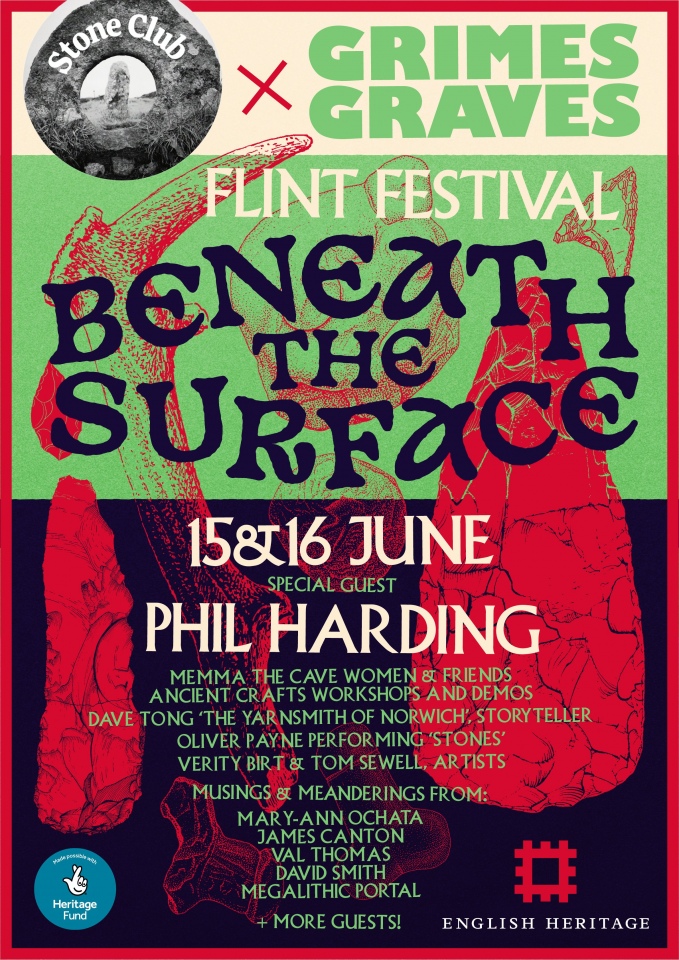
Grime's Graves Flint Mines submitted by Andy B on 19th May 2024. Join us at the Grime's Graves Festival - Saturday 15th & Sunday 16th June 2024
Free to attend.
Andy B from the Megalithic Portal will be there on both days amongst lots else - come and join us!
The talks and hands-on activities are free to attend thanks to generous support from the National Lottery Heritage Fund. If you’d like to visit the exhibition space, or venture down into the pits, you’ll need a booking for Grime’s Graves.
Come and explore the wondrous lunar landscape of...
(View photo, vote or add a comment)
Log Text: At last got here on my way up to North Norfolk. Not quite sure what I was expecting, but I can't say I was completely impressed to start with, and I couldn't help thinking of West Wycombe caves. Strange, as for something that old, I'd have thought I would be really impressed. This feeling gradually changed into one of awe at what I was seeing. Nice to be able to get down one of the shafts to see the workings as a brand new entrance building enables visits down into one of the mineshafts. Once down in the shaft, a very interesting and impressive audio visual showing the history of this place is projected onto the shaft walls, from the ancient seas depositing to form the chalk and flint, up to the prehistoric mining of the flint. All very well done I thought. Down the bottom of the shaft there are various galleries which can be crawled into. Some of the tools used for excavation and flint nodules are left to be seen. I would not recommend doing this with bare knees or on a very wet day! Some of the items found by Armstrong during the 1939 excavations are on display in the museum. But the big question is this. Are they real or fake?
Tinkinswood
Date Added: 26th Apr 2024
Site Type: Chambered Cairn
Country: Wales (South Glamorgan)
Visited: Yes on 25th Apr 2024. My rating: Condition 4 Ambience 3 Access 4
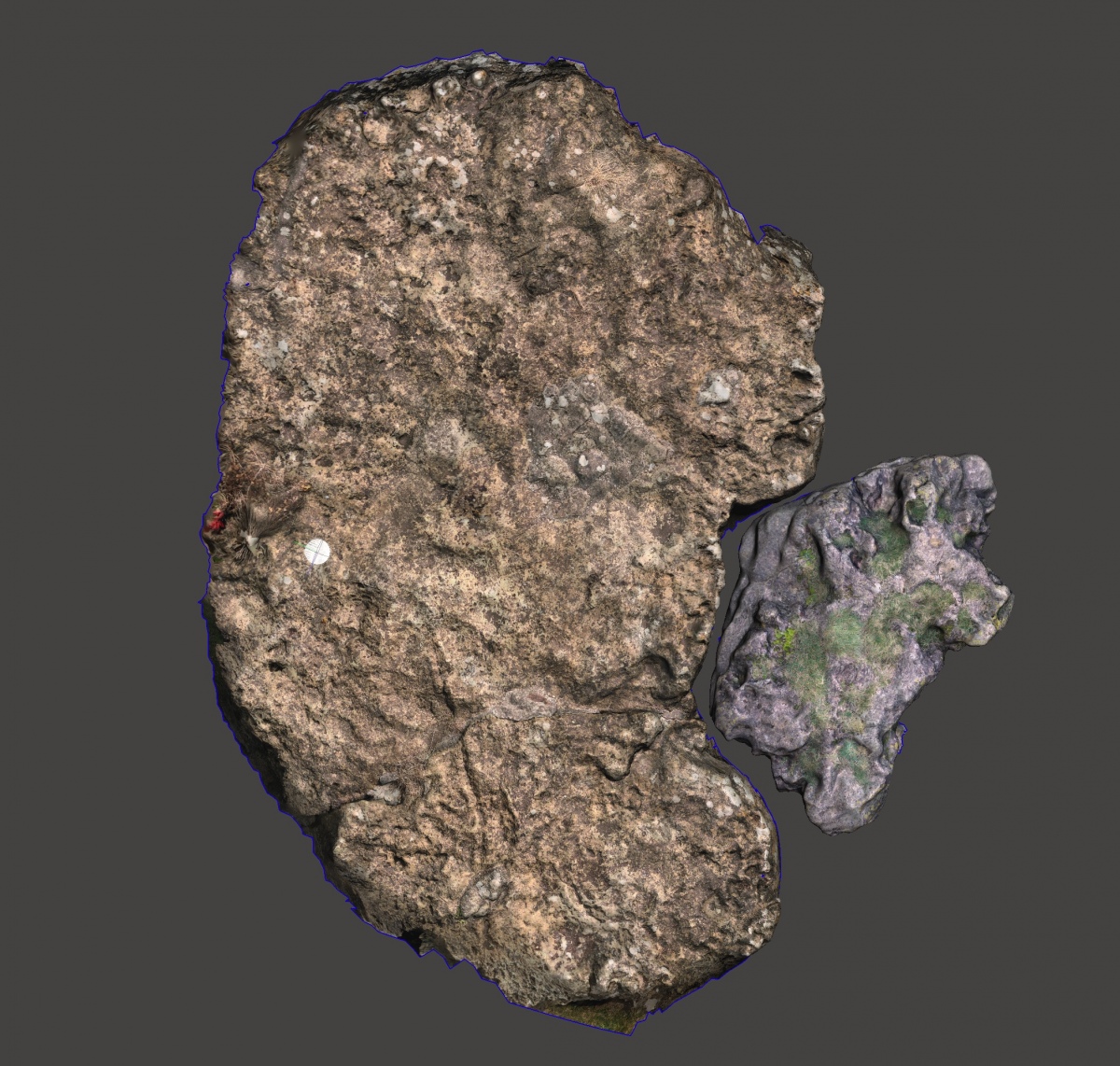
Tinkinswood submitted by Mark_in_Wales on 31st Jul 2022. Tinkinswood and Coed-y-Cwm Capstones Photogrammetry. Chambers are 1km away from each other, yet seem to have a connection.
(View photo, vote or add a comment)
Log Text: Time for another visit to Tinkinswood burial chamber, where I sit and eat my lunch with lots of birdsong. Since my last time here, there has been a lot of fencing off of the eastern and southern fields, making it impossible to see the other chamber or quarry area. What I remember as a possible avenue to the south seems to have all been ripped up and dumped in a heap. To the north, and taking up most of the parking area, there is a lot of road building going on, presumably to a farm on the north side. So overall, very much not improved.
St Lythans
Date Added: 26th Apr 2024
Site Type: Chambered Tomb
Country: Wales (South Glamorgan)
Visited: Yes on 25th Apr 2024. My rating: Condition 3 Ambience 3 Access 4
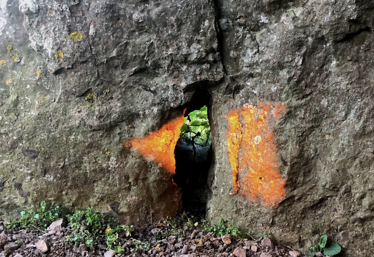
St Lythans submitted by Mark_in_Wales on 22nd Jun 2022. Photo Competition 2022 WINNING ENTRY. This light beam was photographed at 21:14 BST on the 20th of June 2022. St Lythans Burial Chamber is a highly accurate tool for determining the Winter Calendar and making this stunning Arrowhead light-beam at Midsummer. The arrowhead shape (known as an oblique arrowhead in academic circles) is extremely precise, with a straight back, curved cutting surface and hooked single tang. The light-beam is formed by only three stones and the angle of the wall it is b...
(View photo, vote or add a comment)
Log Text: Time for another visit to St Lythams and Tinkinswood. Very nice in the lush springtime
Graig Lwyd Cairns
Date Added: 7th Nov 2023
Site Type: Cairn
Country: Wales (Conwy)
Visited: Yes on 13th Sep 2023. My rating: Condition 3 Ambience 3 Access 2
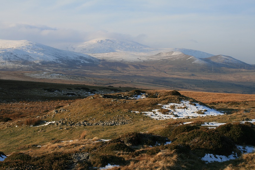
Graig Lwyd Cairns submitted by postman on 15th Apr 2013. Some magic views from here
(View photo, vote or add a comment)
Log Text: Last on my itinerary for today are the Graig Lwyd Cairns. There is the one large cairn within the open access land which looks like a cartoon volcano, conical, steep sides and a crater in the top. Viewed with Moelfre and the other mountains behind it, it reminds me very much of the chains of volcanoes in the Auvergne. The other cairns are in the walled and fenced off fields to the north, and I have no way through to have a close look. However from a low point in the wall, I can make out a couple of places where there are stones standing proud of the ground, possibly a bit like Circle 275. Time to get back down to Penmaenmawr, I have been up here much longer than I initially intended, but then again it has been glorious up here and I am in no real rush other than to get a pint before the pubs shut. The path down is a killer on the knees, so steep and long, I can hardly walk by the time I get back to the car. In need of a pint, time to check what might be open using the useful WhatPub link on the Portal's sitepages. Disappointingly, if its correct, the Fairy Glen will be closed, but the Gladstone in nearby Dwygyfylchi is open, where I have a nice sit outside in the sunshine with a pleasant pint of Facer's, a new brewery to me.
Cors Y Carneddau
Date Added: 6th Nov 2023
Site Type: Stone Circle
Country: Wales (Conwy)
Visited: Yes on 13th Sep 2023. My rating: Condition 3 Ambience 4 Access 2
Cors Y Carneddau submitted by TimPrevett on 14th Sep 2004. A much clearer picture of the location of the Cors Y Carneddau circle.
See main entry for full details.
(View photo, vote or add a comment)
Log Text: I head down to the west and back to the lower track in order to find the Cors Y Carneddau circle. At first I found lots of stones all seemingly scattered around at random, with nothing obvious representing a circle. Some stones are standing proud of the ground over by the wall. But nothing that shouts circle to me. Having a more detailed search of the area, I was at one point heading back to the east, and then an arc of stones came into view. Was this it? Looking closer and several more stones were found under the surface, and for sure this is the remains of a circle, perhaps 10 stones remaining in the circumference, with a diameter of 15 metres or so. The giveaway to being in the right place is a steel bar sticking out of the ground, probably once a fence post, nearby to the two most obvious stones.
Cefn Coch (Penmaenmawr)
Date Added: 6th Nov 2023
Site Type: Ring Cairn
Country: Wales (Conwy)
Visited: Yes on 13th Sep 2023. My rating: Condition 3 Ambience 4 Access 2

Cefn Coch (Penmaenmawr) submitted by LivingRocks on 26th Apr 2005. Cefn Coch as seen when coming over the ridge from Monument 280.
(View photo, vote or add a comment)
Log Text: Having done my research beforehand, I now know to head up and over the nearby ridge to the south and there is the lovely ring cairn, about 10 to 12 metres diameter. It doesn't stand very proud of the ground, and has quite wide "walls".
Monument 280
Date Added: 5th Nov 2023
Site Type: Ring Cairn
Country: Wales (Conwy)
Visited: Yes on 13th Sep 2023. My rating: Condition 3 Ambience 4 Access 2
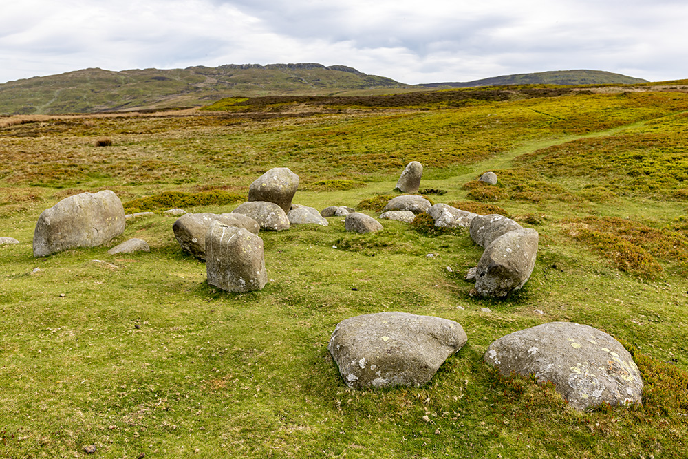
Monument 280 submitted by nigeynoo on 21st May 2018. Monument 280 taken May 20 on a very peaceful afternoon
(View photo, vote or add a comment)
Log Text: Over a couple of mounds, and there is another catchily named site, Monument 280, of which I have no idea what type of site this is. There are many stones stood and arranged, but with no obvious pattern. There is a circle in the middle of them, and several in a straight line through the middle. Is that a burial cist beside one of the large stones? I see online something which states that in 1845 this was described as three circles. Time for lunch, and I notice a pair of glasses within what looks to me like a burial cist, with a leather strap hanging over the large stone beside it.
Druids Circle (Penmaenmawr)
Date Added: 4th Nov 2023
Site Type: Stone Circle
Country: Wales (Conwy)
Visited: Yes on 13th Sep 2023. My rating: Condition 5 Ambience 4 Access 2
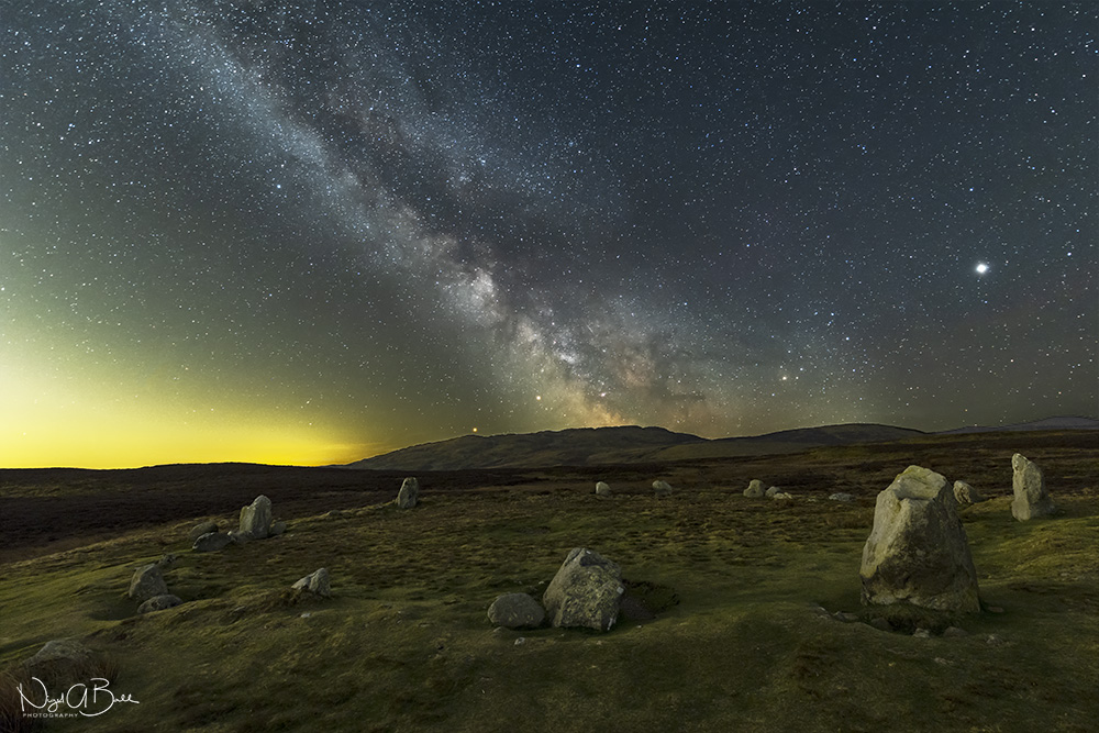
Druids Circle (Penmaenmawr) submitted by nigeynoo on 24th Apr 2018. The magical Druids Circle taken at night with the Milky Way, Mars, Saturn and Jupiter
(View photo, vote or add a comment)
Log Text: From circle 275 the stones of the Druids Circle can be seen up on the hill against the skyline. I make straight for it, but this is probably not the best way as it takes me through a little valley with lots of boggy area to get through. The site is positioned on a flattened platform area, with an embanked circle of stones about 35 metres diameter. Several of the stones are large and standing upright, many much smaller and some are flat to the ground. The position up here is gorgeous with the views out and over the sea with the Great Orme to the east, and Anglesey to the west. There are a couple here taking it all in, with the lady sat sketching the circle. I was intending having my lunch here, but I move on to the next site for that, so we do not disturb each other.
Circle 275
Date Added: 30th Oct 2023
Site Type: Stone Circle
Country: Wales (Conwy)
Visited: Yes on 13th Sep 2023. My rating: Condition 3 Ambience 4 Access 2
Circle 275 submitted by Baz on 26th Jul 2002. Circle 275 Stone Circle, Penmaenmawr.(SH725747)
Five stones in a very small circle with a diameter of 13ft.
The Druids` Circle is on the horizon on the left.
(View photo, vote or add a comment)
Log Text: Next up is the snappily named Circle 275, which is to the south of the trackway in the long grass and heather. This is a lovely little circle of five stones with diameter about 3 metres, and in a most gorgeous setting with views out over the sea and up to the hills with the druids circle visible on the skyline. Is that a spiral carving I see on one of the stones?
Fridd Wanc
Date Added: 30th Oct 2023
Site Type: Round Barrow(s)
Country: Wales (Conwy)
Visited: Yes on 13th Sep 2023. My rating: Condition 3 Ambience 3 Access 2
Fridd Wanc submitted by TimPrevett on 13th Sep 2004. Remains of a round barrow not far from Circle 275; see main entry for details.
(View photo, vote or add a comment)
Log Text: Moving on and the next site just to the north of the trackway is the Fridd Wanc mound, with a telegraph pole standing from its centre. Just to the southeast are several boulders, three obvious large stones, with a couple more not so obvious. Is it the remains of an ancient burial chamber? Or on later thinking, another little circle?
Maen Crwn
Date Added: 30th Oct 2023
Site Type: Standing Stone (Menhir)
Country: Wales (Conwy)
Visited: Yes on 13th Sep 2023. My rating: Condition 3 Ambience 3 Access 2
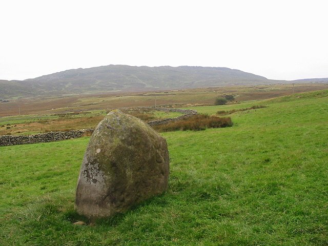
Maen Crwn submitted by stu on 16th Oct 2002. Nice standing stone in field outside Red Farm.
(View photo, vote or add a comment)
Log Text: A bit further southwest, and now into an open paddock like area below the farm, and this large stone is stood in the open grass below an avenue of trees. It has a scratches T + J on its southern face, along with other graffitti.
