Contributory members are able to log private notes and comments about each site
Sites sumdoood has logged. View this log as a table or view the most recent logs from everyone
Weston Camp
Date Added: 21st Mar 2017
Site Type: Hillfort
Country: Wales (Powys)
Visited: Yes on 17th Mar 2017. My rating: Condition 3 Ambience 3 Access 3
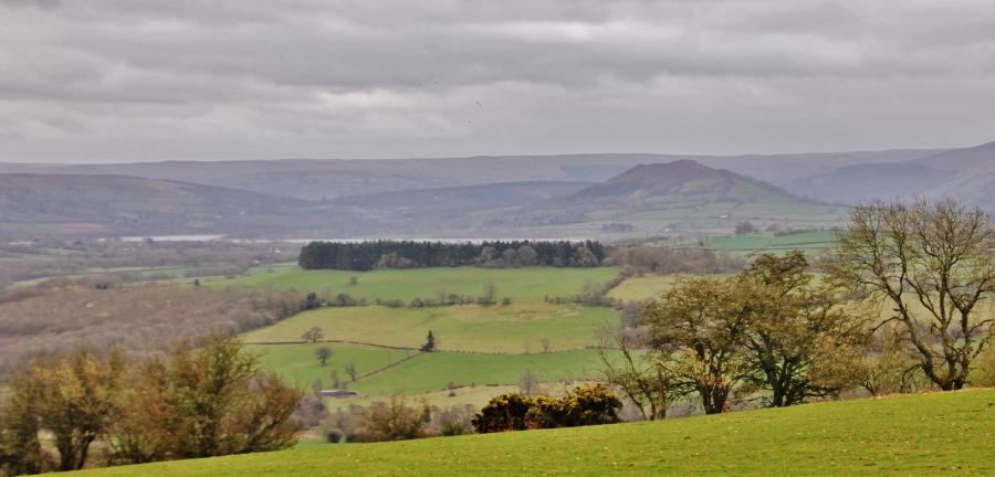
Weston Camp submitted by SumDoood on 21st Mar 2017. Taken from the southern edge of the enclosure. Notice 2/d in from the left is Allt yr Esgair, the location of another hillfort.
The lake is Llyn Safaddan / Llyn Langors / Llangorse Lake.
(View photo, vote or add a comment)
Log Text: This location (where did that name Weston Camp come from?), is I think a settlement, not a hillfort. My 1:25000 map showed it as a Settlement. Both of these (hill)forts were perhaps "defended enclosures", but this is significantly smaller than the adjacent Llanfilo Camp.
Superb location for views of the Brecon Beacons which surely were of significance to the builders, and of other hillforts in the area.
Dane's Dyke
Date Added: 3rd Mar 2017
Site Type: Ancient Village or Settlement
Country: England (Yorkshire (East))
Visited: Yes on 2nd Mar 2017. My rating: Condition 3 Ambience 4 Access 5
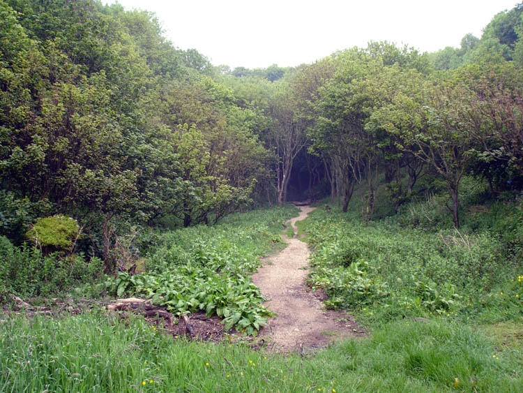
Dane's Dyke submitted by DavidRaven on 20th Aug 2006. The southern end of Dane's Dyke, where the densely-wooded ravine leads to the sea.
(View photo, vote or add a comment)
Log Text: Well worth a look. The structure is 4.5kms long and very complete.
Manor Farm
Date Added: 3rd Feb 2017
Site Type: Round Barrow(s)
Country: England (Lancashire)
Visited: Yes on 2nd Feb 2017. My rating: Condition 1 Ambience 2 Access 4
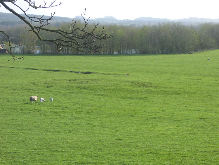
Manor Farm submitted by LivingRocks on 12th Apr 2005. Manor Farm Barrow seen from the roadside. The straight ridge across the field is of modern origin.
(View photo, vote or add a comment)
Log Text: I just laughed. Built by farmers and, I think we can safely assume, destroyed by custodians of the countryside.
Newton Cairn
Date Added: 22nd Dec 2016
Site Type: Chambered Cairn
Country: Scotland (Dumfries and Galloway)
Visited: Yes on 21st Dec 2016. My rating: Condition 3 Ambience 3 Access 3
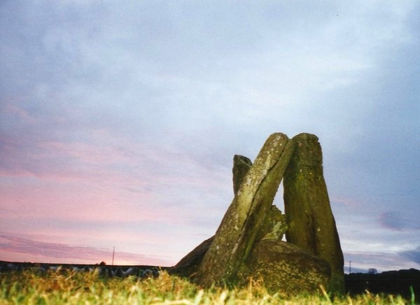
Newton Cairn submitted by Bladup on 13th May 2013. Newton Burial chamber.
(View photo, vote or add a comment)
Log Text: Worth a look, but modern agriculture has done the site no favours.
Pierre Levée (St Léger-de-Montbrun)
Date Added: 17th Oct 2016
Site Type: Burial Chamber or Dolmen
Country: France (Poitou:Deux-Sèvres (79))
Visited: Yes on 17th Oct 2016. My rating: Condition 2 Ambience 3 Access 5
Pierre Levée (St Léger-de-Montbrun) submitted by ocdolmen on 5th Sep 2009. "Pierre Levée" dolmen near Saint-léger-de-Montbrun
(View photo, vote or add a comment)
Log Text: A few photos to follow.
Pen-y-Crug Hillfort
Date Added: 28th Aug 2016
Site Type: Hillfort
Country: Wales (Powys)
Visited: Yes on 28th Aug 2016. My rating: Condition 3 Ambience 3 Access 3
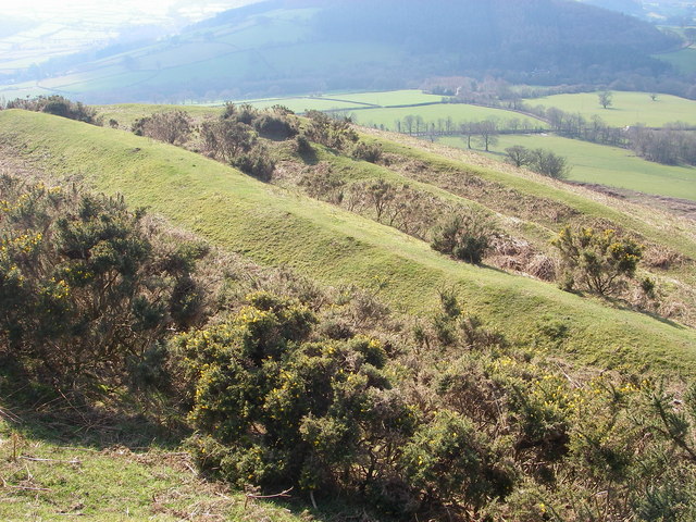
Pen-y-Crug Hillfort submitted by Creative Commons on 27th Feb 2011. The impressive Iron Age hillfort at Pen-y-crug just west of Brecon provides commanding views over the surrounding countryside. It was defended by multiple banks and ditches as seen here.
Copyright Alan Bowring and licensed for reuse under the Creative Commons Licence.
(View photo, vote or add a comment)
Log Text: Low cloud and long bracken - I'll have to go back.
Crois Chnoca Breaca
Date Added: 15th Nov 2016
Site Type: Standing Stone (Menhir)
Country: Scotland (South Uist)
Visited: Yes on 20th Aug 2016. My rating: Condition 3 Ambience 4 Access 3
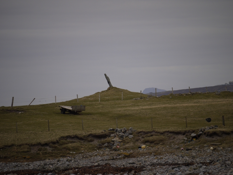
Crois Chnoca Breaca submitted by SHUGS on 2nd Oct 2012. Site in South Uist Scotland
(View photo, vote or add a comment)
Log Text: I feel there's more to be found in this location, so be sure to take a walk along the fast eroding coastline.
An Carra
Date Added: 15th Nov 2016
Site Type: Standing Stone (Menhir)
Country: Scotland (South Uist)
Visited: Yes on 20th Aug 2016. My rating: Condition 3 Ambience 3 Access 4

An Carra submitted by SandyG on 20th May 2016. View from south (28 August 2015).
(View photo, vote or add a comment)
Log Text: Access easy by road followed by an inconvenient scramble over a fence, and a short walk. The stone is visible throughout. Ambience pretty good if you keep the works behind you.
Clach An Tursa
Date Added: 27th Sep 2016
Site Type: Stone Row / Alignment
Country: Scotland (Isle of Lewis)
Visited: Yes on 16th Aug 2016. My rating: Condition 3 Ambience 3 Access 3
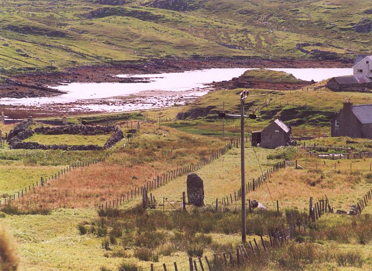
Clach An Tursa submitted by Andy B on 10th Dec 2004. A telephoto view from the road
(View photo, vote or add a comment)
Log Text: I walked from the road and down the drive of a house that seemed not to be occupied, then on down a field of long grass. This is a curious place where the sloping land seems to have been levelled around and downslope from the stones.
Cnoc a Phrionnsa
Date Added: 27th Sep 2016
Site Type: Chambered Cairn
Country: Scotland (Isle of Lewis)
Visited: Yes on 16th Aug 2016. My rating: Condition 2 Ambience 4 Access 3
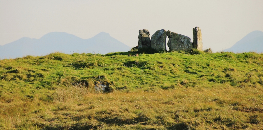
Cnoc a Phrionnsa submitted by SumDoood on 26th Aug 2016. Approaching from the north.
(View photo, vote or add a comment)
Log Text: Location, location, location!
Beamsley Beacon
Date Added: 6th Aug 2016
Site Type: Cairn
Country: England (Yorkshire (North))
Visited: Yes on 5th Aug 2016. My rating: Condition 2 Ambience 3 Access 3

Beamsley Beacon submitted by SumDoood on 5th Aug 2016. Pendle Hill to the WSW (and to the right is, I think, Longridge Fell).
(View photo, vote or add a comment)
Log Text: Middleton Moor's rock art is 1-2kms away, but this is a pleasant out and back walk from the highest point on the nearest road, with powerful views from a location itself visible from a wide radius. The cairn is simply a BIG pile of stones, but the location gives it considerable validity.
Lundskullen
Date Added: 23rd Jun 2016
Site Type: Standing Stones
Country: Sweden (Västergötland)
Visited: Yes on 23rd Jun 2016. My rating: Condition 3 Ambience 4 Access 4
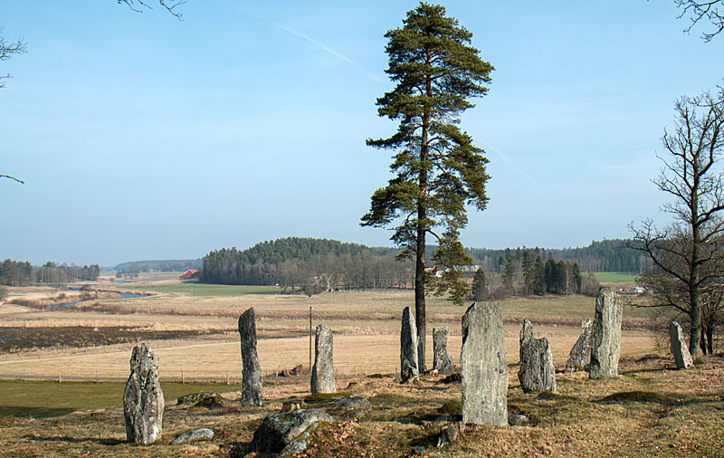
Lundskullen submitted by rolle on 31st Aug 2014. View towards north with the central standing stones and the river Nossan.
(View photo, vote or add a comment)
Log Text: Having waited "only" eight years to visit (after glimpsing it from the E20 in 2008), I am pleased to say it's well worth a visit. Much quarried around, there is still a lot remaining and thoroughly perplexing it looks too.
Credenhill Camp
Date Added: 26th May 2016
Site Type: Hillfort
Country: England (Herefordshire)
Visited: Yes on 26th May 2016. My rating: Condition 3 Ambience 3 Access 3
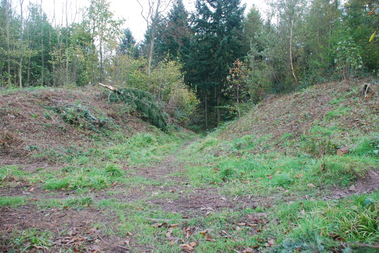
Credenhill Camp submitted by jfarrar on 29th Oct 2008. Southern entrance
(View photo, vote or add a comment)
Log Text: What an ENORMOUS hillfort.
50+ acres, double walls and the internal ones measured from outside are 60m (that's 200ft!) high. Much as I like trees, i.e. enormously, less than half of the middle of the enclosed area has been de-treed. Two dog walkers and I both think that The Woodland Trust should get on with the job of clearing the entire area as far as the outer edge of the walls, as it surely would have been in the Iron Age.
Achnabreck Forest Rock Art
Date Added: 26th May 2016
Site Type: Rock Art
Country: Scotland (Argyll)
Visited: Yes on 17th May 2016. My rating: Condition 3 Ambience 3 Access 5
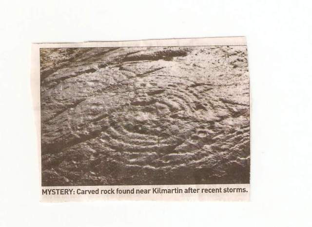
Achnabreck Forest Rock Art submitted by Andy B on 21st Feb 2008. The photo in the Herald of the newly discovered rock art.
(View photo, vote or add a comment)
Log Text: None
Colmac Bridge
Date Added: 21st May 2016
Site Type: Standing Stone (Menhir)
Country: Scotland (Isle of Bute)
Visited: Yes on 15th May 2016. My rating: Condition 3 Ambience 3 Access 4
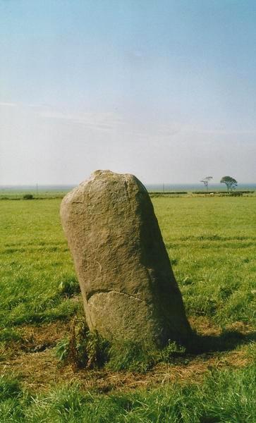
Colmac Bridge submitted by Bladup on 15th Feb 2013. Colmac Bridge Standing stone.
(View photo, vote or add a comment)
Log Text: Not the most exciting stone, unless I missed something!
St Michael's Grave
Date Added: 22nd May 2016
Site Type: Chambered Cairn
Country: Scotland (Isle of Bute)
Visited: Yes on 15th May 2016. My rating: Condition 2 Ambience 4 Access 3
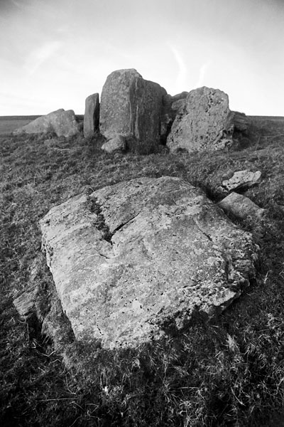
St Michael's Grave submitted by butephoto on 18th Mar 2006. St. Michael's Grave, chambered cairn.
www.butephotography.com for more.
(View photo, vote or add a comment)
Log Text: This is a 4km return walk, if you park at the "P" on the OS map. To drive onward is do-able in a 2WD family car, but though the route is flattish, it is *very* bumpy. There is no tarmac.
Stravanan Bay
Date Added: 18th May 2016
Site Type: Stone Row / Alignment
Country: Scotland (Isle of Bute)
Visited: Yes on 14th May 2016. My rating: Condition 3 Ambience 3 Access 3
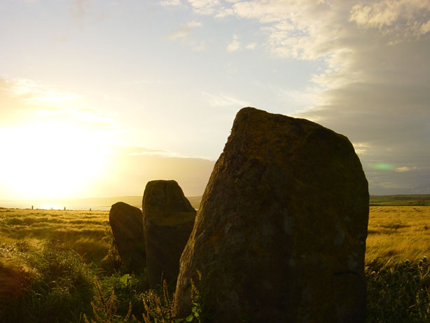
Stravanan Bay submitted by RMG on 11th Jul 2003. Stravanan Bay, Isle of Bute
(View photo, vote or add a comment)
Log Text: Named as Largizean Standing Stones and signposted from the farm at the roadside. Two fields length of walking required. (I took the van, but prob shouldn't've).
Dunagoil hillfort
Date Added: 18th May 2016
Site Type: Vitrified Fort
Country: Scotland (Isle of Bute)
Visited: Yes on 14th May 2016. My rating: Condition 3 Ambience 4 Access 3
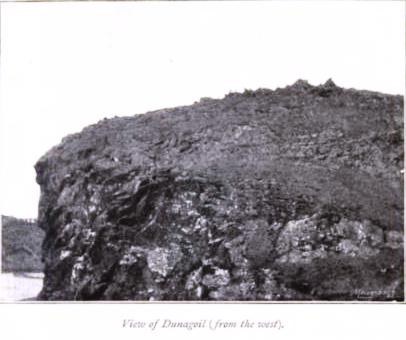
Dunagoil hillfort submitted by durhamnature on 17th Sep 2012. 1843 photo from "The Isle of Bute in Olden Times" by J K Hewison, via archive.org
Site in Isle of Bute Scotland
(View photo, vote or add a comment)
Log Text: Much of its ambience comes from the Arran backdrop, but it's an intriguing site, including the near surroundings, and about all of which I'm sure there is much more to be learnt.
Roulston Scar Camp
Date Added: 12th Mar 2016
Site Type: Hillfort
Country: England (Yorkshire (North))
Visited: Yes on 12th Mar 2016. My rating: Condition 2 Ambience 3 Access 4
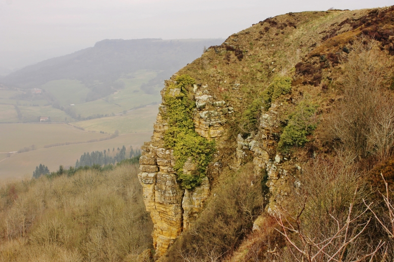
Roulston Scar Camp submitted by SumDoood on 17th Mar 2016. I approached from the N and parked in the car park in the SE corner near the top of the steep descent of Low Town Bank Road, then walked anticlockwise around the western half of the site. I had no map with me so neither looked for, nor noticed any specific ancient features, assuming, perhaps wrongly, that low banks and short ditches were relatively recent. This view is of the steepest and highest of the crumbly-looking cliffs on the west side looking towards the extraordinarily steep main road k...
(View photo, vote or add a comment)
Log Text: Perhaps I missed something. The scenery is impressive as it's just a little way south of the mighty Sutton Bank. Some aerials views would help and there's a gliding club pretty much on top of the site.
Stanwick Hillfort
Date Added: 16th Mar 2016
Site Type: Hillfort
Country: England (Yorkshire (North))
Visited: Yes on 12th Mar 2016. My rating: Condition 3 Ambience 4 Access 5
Stanwick Hillfort submitted by rich32 on 2nd Oct 2006. Stanwick is one huge site, if you could walk round the ramparts you’d cover about 4miles & internally you’ve got 750 acres to get lost in.
The earliest evidence dates the fortifications from the mid to late Iron Age, with occupation waning towards the end of the 1st century AD. It’s likely to have been an important stronghold for the Brigantes & may have been the home of queen Cartimandua, who ruled at the time those chaps from Rome visited.
Theres bundles of evidence from other per...
(View photo, vote or add a comment)
Log Text: HUGE site. To reach the middle of the site I still had more than a mile to drive when I stopped to ask a young couple what a line of ancient-looking earthworks might be. I was very surprised to be told it was all part of the same huge site. I drove around, then I walked around, and I came to an excavated section of wall so wide, so high, and so well built that, oh, the shame of it, I assumed I'd made a mistake and it was Roman. But it isn't - it's proper Iron Age British!
