Contributory members are able to log private notes and comments about each site
Sites markj99 has logged. View this log as a table or view the most recent logs from everyone
Cuween Hill
Date Added: 27th Jul 2025
Site Type: Chambered Cairn
Country: Scotland (Orkney)
Visited: Yes on 9th Aug 2012. My rating: Condition 4 Ambience 5 Access 4
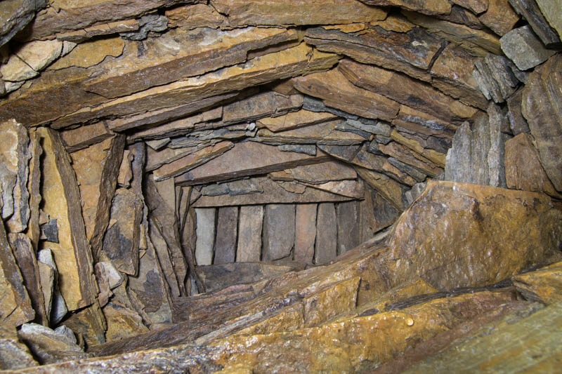
Cuween Hill submitted by coin on 9th Jul 2018. Corbelled ceiling in one of the side chambers.
(View photo, vote or add a comment)
Log Text: Cuween Hill Chambered Cairn is easy to access from a dedicated car park at HY 36684 12850. Cuween Hill Tomb is signed off the Old Finstown Road at HY 36889 12907. It is a good idea to have a powerful torch or headlamp in your rucksack when visiting Cuween Hill Chambered Cairn to improve your photographs.
Grey Man of the Merrick
Date Added: 27th Jul 2025
Site Type: Natural Stone / Erratic / Other Natural Feature
Country: Scotland (Dumfries and Galloway)
Visited: Yes on 16th May 2015. My rating: Condition 5 Ambience 5 Access 1
Grey Man of the Merrick submitted by markj99 on 27th Oct 2020. Grey Man of the Merrick Close-Up
(View photo, vote or add a comment)
Log Text: The Grey Man of the Merrick is an unusual rock site in a valley c. 1 mile SE of the summit of Merrick, the tallest hill in the Galloway Forest. There are multiple routes available but I have walked my route twice: the path is relatively obvious for most of the route and there are good landmarks confirming accurate navigation. The Grey Man of the Merrick is located on a rockface at the top of a valley. The illusion of the bearded man requires an eastern view across the rock face looking towards Benyellary. Directions to the Grey Man are available in the main page.
Dalarran Holm
Date Added: 29th Jul 2025
Site Type: Standing Stone (Menhir)
Country: Scotland (Dumfries and Galloway)
Visited: Yes on 28th Sep 2022. My rating: Condition 4 Ambience 4 Access 4
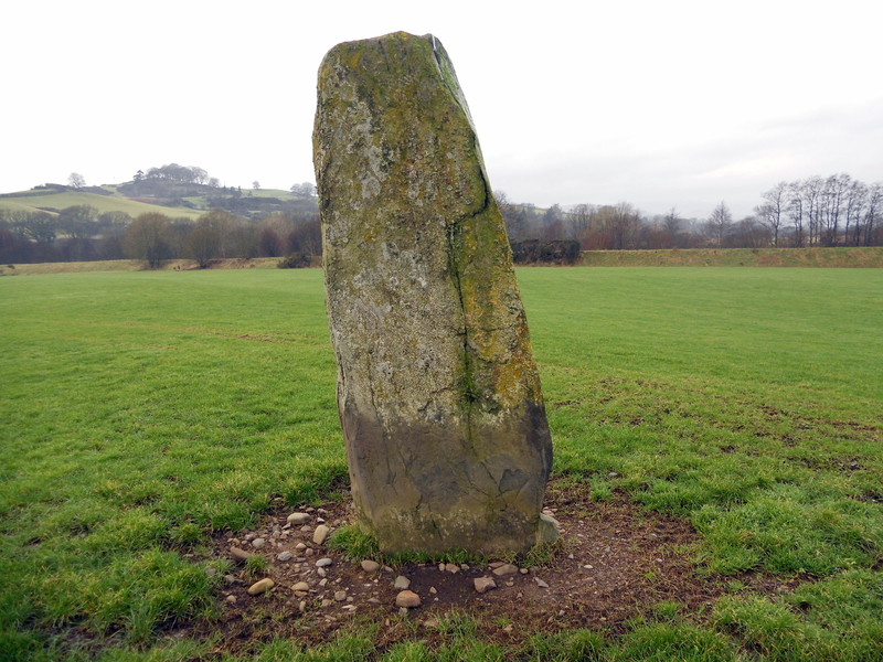
Dalarran Holm submitted by markj99 on 29th Mar 2019. Dalarran Holm close-up.
(View photo, vote or add a comment)
Log Text: There is a large lay-by at NX 64015 78916 on the A713. Dalarran Holm Standing Stone is c. 250 yards N of the lay-by, safely accessible by the edge of the field rather than walking along a busy road.
Dalcross Mains
Date Added: 29th Jul 2025
Site Type: Stone Circle
Country: Scotland (Highlands)
Visited: Yes on 21st Mar 2012
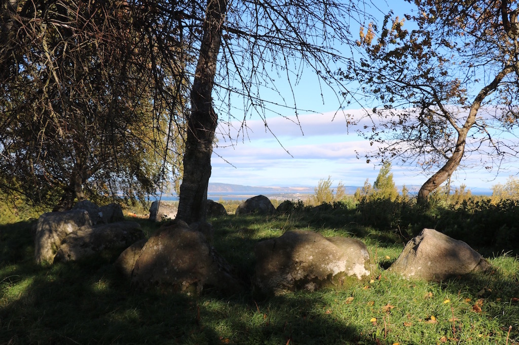
Dalcross Mains submitted by madmark23 on 23rd Oct 2015. A Professor comes and speaks to this cairn once a year.
(View photo, vote or add a comment)
Log Text: If you are visiting the Clava Cairns at Balnuaran it is a short detour to Dalcross Mains Clava Cairn. This unrestored site is an interesting contrast to the restored cairns. It has been subjected to extensive stone removal leaving a semi-circle of kerb stones on a grassy knoll with trees round the perimeter.
Dalginross
Date Added: 29th Jul 2025
Site Type: Stone Circle
Country: Scotland (Perth and Kinross)
Visited: Yes on 29th Oct 2018
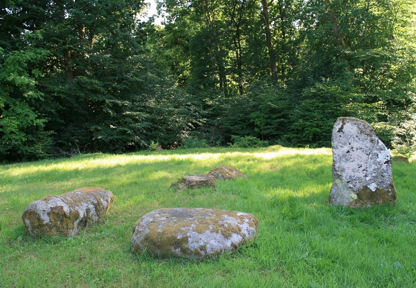
Dalginross submitted by postman on 13th Aug 2013. Peace and quiet, some cars may have gone past, but I didn't notice them.
(View photo, vote or add a comment)
Log Text: It is ironic that this four-poster is located next to the cemetery on the SE of Dalginross: according to trove.scot/place/24857 an urn filled with ashes was found in the site in the 1800's. It is listed as dunmoid, Dalginross in trove.scot.
Dargill
Date Added: 30th Jul 2025
Site Type: Standing Stone (Menhir)
Country: Scotland (Perth and Kinross)
Visited: Yes on 30th Nov 2018. My rating: Condition 4 Ambience 4 Access 4
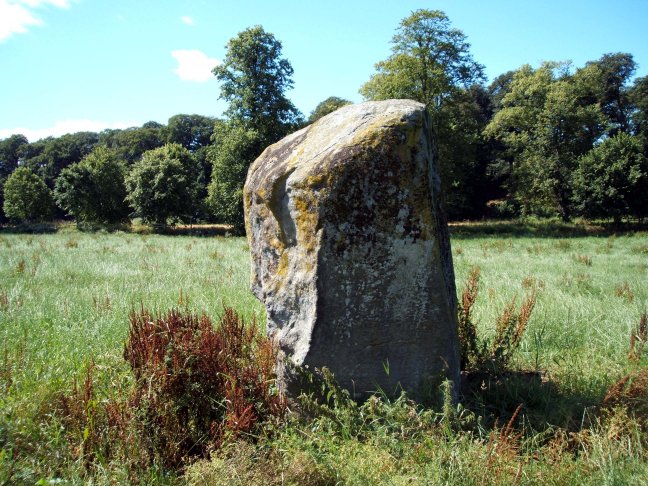
Dargill submitted by Nick on 30th Mar 2013. Looking west
(View photo, vote or add a comment)
Log Text: It is often difficult to park up in the vicinity of monuments close to busy roads. Luckily , in this instance there are 2 lay-by's at the junction of a minor road signed for Balloch with the A822 heading S out of Crieff at NN 8580 2012. Walk across the A822 to a gate into a field. Dargill Standing Stone is located c. 110 yards SE of the gate.
Deepdale Stones
Date Added: 3rd Aug 2025
Site Type: Standing Stone (Menhir)
Country: Scotland (Orkney)
Visited: Yes on 7th Aug 2012
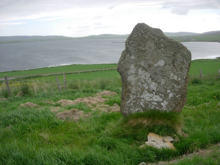
Deepdale Stones submitted by TimPrevett on 22nd Jun 2006. The surviving Deepdale stone, looking over Stenness Loch, in the direction of Brodgar, Stenness, and Maeshowe. Unstan tomb is just behind the stone on the first spur of land. This stone is about 6 feet high, but narrower than my hand.
(View photo, vote or add a comment)
Log Text: Deepdale Standing Stone is located c. 70 yards NE of the A965 with a distant view of the Ring of Brodgar, Stones of Stenness and Maeshowe. The erect slab is not spectacular but worth a short walk for the sea view. A second stone is marked on OS Mapping but it has been removed.
Daviot Ring Cairn
Date Added: 3rd Aug 2025
Site Type: Stone Circle
Country: Scotland (Highlands)
Visited: Yes on 21st Mar 2012
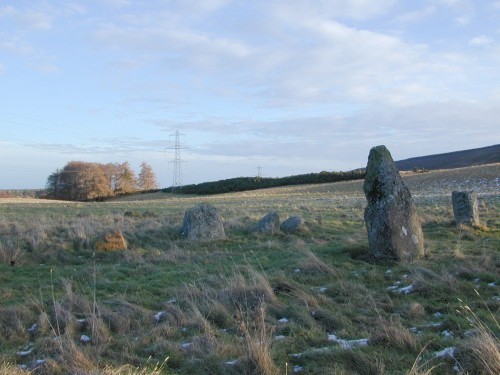
Daviot Ring Cairn submitted by steveco on 24th Feb 2002. Daviot Cairn & Circle NH727411. Surviving part of Clava type cairn and outer circle.
(View photo, vote or add a comment)
Log Text: Daviot Ring Cairn has 2 standing stone 20 feet S of the S Arc, sole remnants of a stone circle enclosing the ring cairn. It is defined by a round grassy platform with intermittent kerb stones up to c. 2 feet high in the centre.
Delford Bridge
Date Added: 9th Aug 2025
Site Type: Standing Stone (Menhir)
Country: England (Cornwall)
Visited: Yes on 18th Mar 2014. My rating: Condition 2 Ambience 4 Access 3
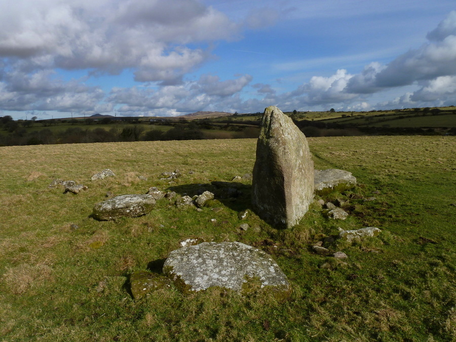
Delford Bridge submitted by Bladup on 14th Apr 2017. Delford Bridge, With Rough Tor and Brown Willy in the background.
(View photo, vote or add a comment)
Log Text: I agree with The Captain that the site could be a ruined dolmen: there are multiple large recumbent stones in the vicinity of the standing stone.
Delfour
Date Added: 9th Aug 2025
Site Type: Cairn
Country: Scotland (Highlands)
Visited: Yes on 23rd Mar 2012. My rating: Condition 3 Ambience 4 Access 4
Delfour submitted by cosmic on 27th Sep 2006. Delfour from North
(View photo, vote or add a comment)
Log Text: It is surprising that there are substantial remains of Delfour Ring Cairn given its proximity to Mid & Easter Delfour Farms: most cairns located in arable land have been robbed out for construction of buildings and walls over the ages. There is a standing stone on the SW perimeter of Delfour Ring Cairn, sole survivor of an outer stone circle. The ring cairn has fared better with discernible inner and outer rings enclosed by large kerb stones.
Devil's Bowling Green
Date Added: 12th Aug 2025
Site Type: Natural Stone / Erratic / Other Natural Feature
Country: Scotland (Dumfries and Galloway)
Visited: Yes on 24th Oct 2010. My rating: Condition 5 Ambience 5 Access 2
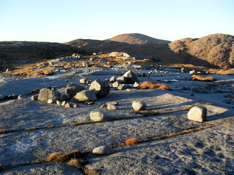
Devil's Bowling Green submitted by markj99 on 3rd Apr 2019. Devil's Bowling Green on Craignaw
(View photo, vote or add a comment)
Log Text: I accessed the Devil's Bowling Green from the public road to Loch Trool. The walk is 9 miles there and back over boggy and rough ground so should be properly planned. Walking directions are available on the main page.
Devils Den
Date Added: 13th Aug 2025
Site Type: Burial Chamber or Dolmen
Country: England (Wiltshire)
Visited: Yes on 9th Feb 2011. My rating: Condition 3 Ambience 4 Access 3

Devils Den submitted by Horatio on 23rd Apr 2022. The entrance to a long mound, described in the 19020s asbeing about 70mtrs. Shame that this is all that remains but still, pretty impressive
(View photo, vote or add a comment)
Log Text: Devil's Den is a naked dolmen close to Fyfield Down, an area with multiple ancient sites. The dolmen was originally a chamber in a now removed long cairn.
Devil's Jump (St Breward)
Date Added: 15th Aug 2025
Site Type: Natural Stone / Erratic / Other Natural Feature
Country: England (Cornwall)
Visited: Yes on 31st May 2019. My rating: Condition 5 Ambience 4 Access 4
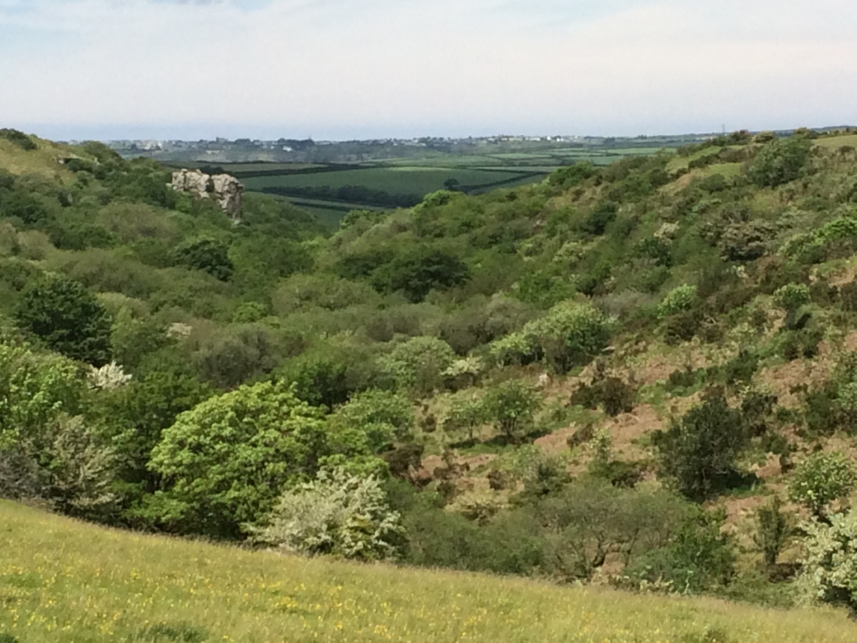
Devil's Jump (St Breward) submitted by markj99 on 14th Aug 2025. Devil's Jump (St Breward) viewed from SE.
(View photo, vote or add a comment)
Log Text: I was curious to investigate the Devil's Jump marked on the OS Map close to Carweather Medieval Village. The natural rock feature consists of two granite crags in a wooded valley. I couldn't find out much information on the net. The biggest surprise was a slab of rock resembling a bearded devil on the S crag.
The Devil's Quoit
Date Added: 15th Aug 2025
Site Type: Burial Chamber or Dolmen
Country: Wales (Pembrokeshire)
Visited: Yes on 28th Aug 2014. My rating: Condition 2 Ambience 4 Access 4
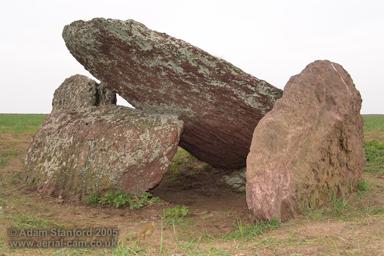
The Devil's Quoit submitted by Adam Stanford on 16th Nov 2006. Devils Quoit (PEM 25) also known as Broomhill Barrows near Freshwater West. I would suggest this is a collapsed burial chamber rather than earthfast (as stated by Nash 2006, Daniel 1950 and others). I say this because of what looks like a large collapsed orthostat that is now visible and that the capstone rests on. The monument consists of five visible stones. 1 capstone, 2 orthosatats, 1 collapsed or horizontal stone and another vertical stone resting on the eastern side of the capstone. I woul...
(View photo, vote or add a comment)
Log Text: Fortunately the field was in grass when I visited so I was able to get close to The Devil's Quoit. It appears to be a collapsed chamber, the sole remnant of a chambered cairn. The chamber is orientated on a NE-SW axis.
Devil's Quoit (St Columb Major)
Date Added: 15th Aug 2025
Site Type: Burial Chamber or Dolmen
Country: England (Cornwall)
Visited: Yes on 16th Oct 2013. My rating: Condition 2 Ambience 3 Access 5
Devil's Quoit (St Columb Major) submitted by hamish on 14th Sep 2005. Right by the side of the road at Quoit Farm near St Columb Major.
(View photo, vote or add a comment)
Log Text: It would be easy to drive past this capstone located beside Little Quoit farm c. 0.80 miles E of St Columb Major on the road to Roche. There is no sign for the stone on the roadside and parking is difficult.
Devil's Quoit (St Twynnells)
Date Added: 16th Aug 2025
Site Type: Standing Stone (Menhir)
Country: Wales (Pembrokeshire)
Visited: Yes on 28th Aug 2014. My rating: Condition 4 Ambience 4 Access 4
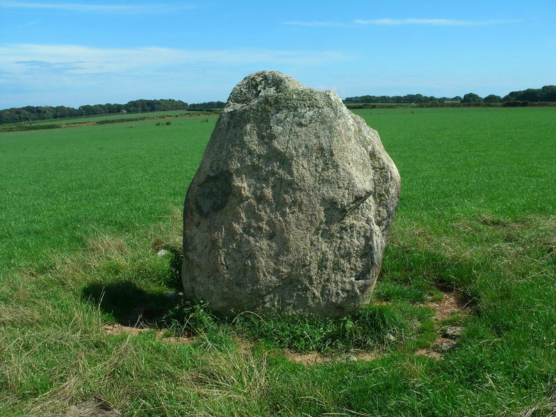
Devil's Quoit (St Twynnells) submitted by Bladup on 13th Sep 2013. Devil's Quoit (St Twynnells).
(View photo, vote or add a comment)
Log Text: Devil's Quoit (St Twynnells) is located in a field S of the B4319 c. 500 yards W of Sampson Farm. The standing stone is an impressive slab c. 6 feet high aligned NE-SW on its long axis.
Harold Stone (Bosherton)
Date Added: 16th Aug 2025
Site Type: Standing Stone (Menhir)
Country: Wales (Pembrokeshire)
Visited: Yes on 28th Aug 2014. My rating: Condition 3 Ambience 4 Access 3
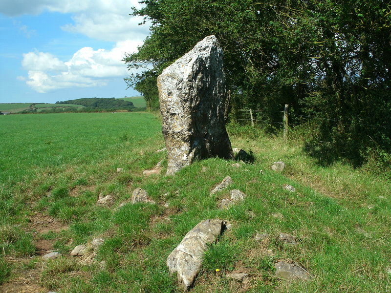
Harold Stone (Bosherton) submitted by Bladup on 13th Sep 2013. Harold Stone (Bosherton) - it looked to my eyes to have maybe once been a side slab of a ruined chamber [quoit], and the stones around it - field clearance or part of a chambered cairn?
(View photo, vote or add a comment)
Log Text: I agree with Bladup: the standing stone could be a remnant of a chamber. It is erected in a grassy mound studded with exposed stones possibly indicating a ruined cairn.
Devil's Quoit (Stackpole)
Date Added: 17th Aug 2025
Site Type: Standing Stone (Menhir)
Country: Wales (Pembrokeshire)
Visited: Yes on 28th Aug 2014. My rating: Condition 4 Ambience 4 Access 4
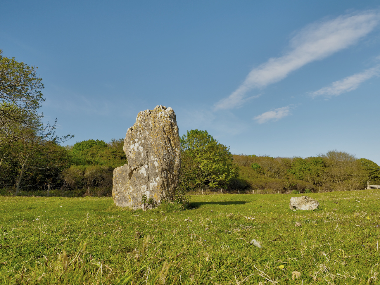
Devil's Quoit (Stackpole) submitted by Horatio on 19th May 2019. Access is easy to find if approaching from Stackpole warren, after entering the double gate enclosure from the woods, before leaving through the second gate in front of you. look right and you'll see a side gate that leads to the stone.
(View photo, vote or add a comment)
Log Text: The Devil's Quoit (Stackpole) is easy to visit from Stackpole Quay Car Park. Head W out of the car park. After c. 400 yards head straight through a crossroad. Continue W for c. 500 yards to reach a path heading S. Take the path S heading for a forest. After you exit the forest turn W into a field for c. 120 yards to reach Devil's Quoit (Stackpole Warren). My walking route is viewable on Devil's Quoit (Stackpole Warren).
Pots and Pans Stone (Greenfield)
Date Added: 18th Aug 2025
Site Type: Natural Stone / Erratic / Other Natural Feature
Country: England (Lancashire)
Visited: Yes on 3rd Jun 2015
Pots and Pans Stone (Greenfield) submitted by markj99 on 19th Jan 2021. Pots and Pans Stone viewed from SE.
(View photo, vote or add a comment)
Log Text: There is a mini roundabout on the A635 at the Clarence Hotel in Greenfield. Take the Chew Valley Road signed for Oldham A699. Follow the A669 for c. 0.3 mile. Take the Kinders Lane right turn opposite the King William IV Hotel. Follow Kinders Lane for 0.4 mile then bear left onto Haw Clough Lane. Stay on Haw Clough Lane for 0.3 mile to reach Knowl Top Farm. There is room to park opposite the start of Pots and Pans Path. It is c. 500 yards up a hill to the Pots & Pans Stone.
Din Lligwy
Date Added: 19th Aug 2025
Site Type: Ancient Village or Settlement
Country: Wales (Anglesey)
Visited: Yes on 24th Aug 2014
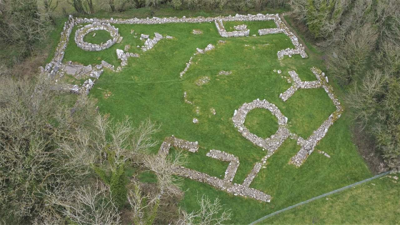
Din Lligwy submitted by TAlanJones on 21st Dec 2023. Aerial view of Din Lligwy.
(View photo, vote or add a comment)
Log Text: There is a small car park at SH 50018 86252 on the narrow lane providing access to the Lligwy monuments. A path starting at the car park heads W for c. 400 yards to Din Lligwy village.
