Contributory members are able to log private notes and comments about each site
Sites markj99 has logged. View this log as a table or view the most recent logs from everyone
Tennad-er-Menguen Dolmen
Date Added: 24th Aug 2025
Site Type: Burial Chamber or Dolmen
Country: France (Bretagne:Morbihan (56))
Visited: Yes on 19th Sep 2023. My rating: Condition 3 Ambience 4 Access 3

Tennad-er-Menguen dolmen submitted by Ogneslav on 30th Aug 2008. The view from West
(View photo, vote or add a comment)
Log Text: The best way to find Dolmen de Kergazec is to visit Dolmen de Kernevé then walk c. 140m SW along the C106 to the edge of an open field. Follow a dirt track heading NE round the margin of the field for c. 300m to reach Dolmen de Kergazec.
Kercadoret Dolmen
Date Added: 24th Aug 2025
Site Type: Burial Chamber or Dolmen
Country: France (Bretagne:Morbihan (56))
Visited: Yes on 17th Sep 2023. My rating: Condition 3 Ambience 5 Access 3

Kercadoret dolmen submitted by binardino on 19th Jun 2006. Site in Bretagne: Morbihan (56)
Kercadoret Dolmen
(View photo, vote or add a comment)
Log Text: Dolmen de Kercadoret is a neglected site in a shrubby wood N of the D781 on the NE edge of Kercadoret. There is a path off the D781 into a field on the NE edge of Kercadoret. Follow round the edge of the wood for c. 80m then follow the wood N for c. 20m to reach a vague path into the wood. Head NW for c. 20 yards through shrubbery to find the hidden dolmen. It is located at 47.58981 -2.9781 if you have a GPS app.
Crucuno Dolmen
Date Added: 24th Aug 2025
Site Type: Burial Chamber or Dolmen
Country: France (Bretagne:Morbihan (56))
Visited: Yes on 19th Sep 2023. My rating: Condition 3 Ambience 5 Access 5
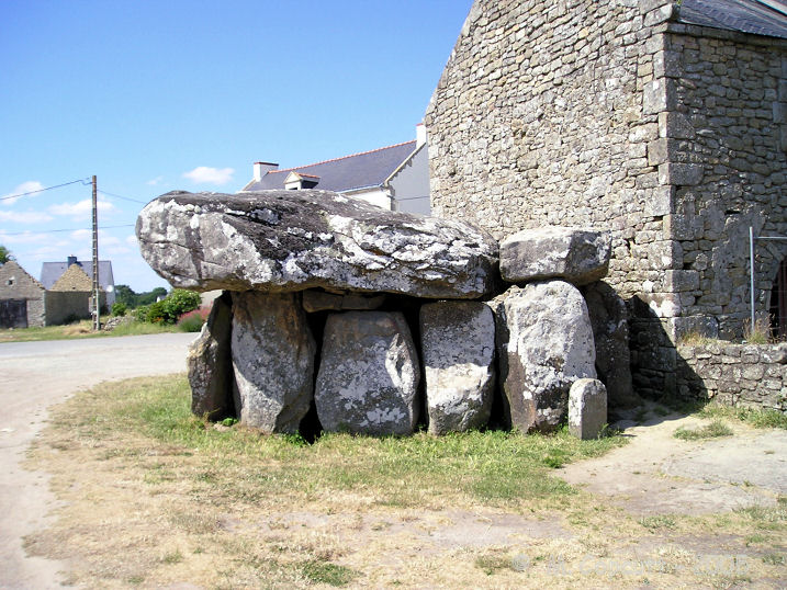
Crucuno dolmen submitted by thecaptain on 22nd Dec 2007. View of the southern side of this massive dolmen, showing clearly its proximity to the farmhouse.
On the right are the last remaining capstone and pair of stones from the long entrance passageway.
(View photo, vote or add a comment)
Log Text: Dolmen de Crucuno is very easy to visit. It is situated adjacent to a house in the centre of Crucuno, a hamlet between Plouharnel and Erdeven. These facts don't make Dolmen de Crucuno any less impressive when you are standing beside it. A giant capstone measuring c. 7.5m long and weighing an estimated 40 tons is supported by 9 large orthostats.
Take the Crucuno turn off the D781 at the Toul Siac'h roundabout. After c. 0.8km turn right into a car park in the centre of the village opposite the dolmen.
Carnac Plage menhir
Date Added: 22nd Aug 2025
Site Type: Standing Stone (Menhir)
Country: France (Bretagne:Morbihan (56))
Visited: Yes on 18th Sep 2023. My rating: Condition 4 Ambience 3
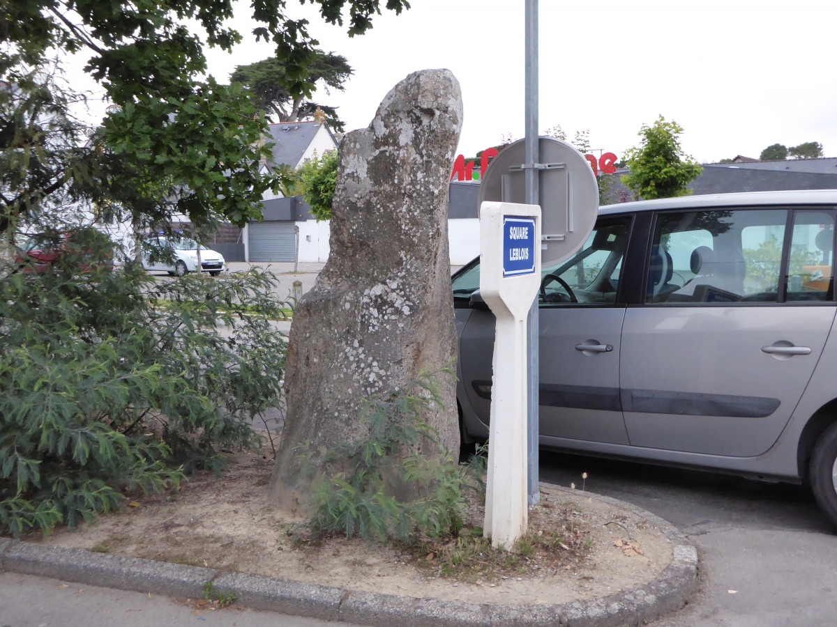
Carnac Plage menhir submitted by TheCaptain on 23rd Mar 2025. In square Leblois in the seaside resort of Carnac plage can be found a dolmen and a menhir.
(View photo, vote or add a comment)
Log Text: It was only a short detour to satisfy my curiosity about this ancient monument transplanted into an urban location. It was somewhat confusing, viewing this ancient monument surrounded by street furniture and cars.
Carfury E Standing Stone
Date Added: 22nd Aug 2025
Site Type: Standing Stone (Menhir)
Country: England (Cornwall)
Visited: Yes on 2nd May 2017. My rating: Condition 4 Ambience 4 Access 4
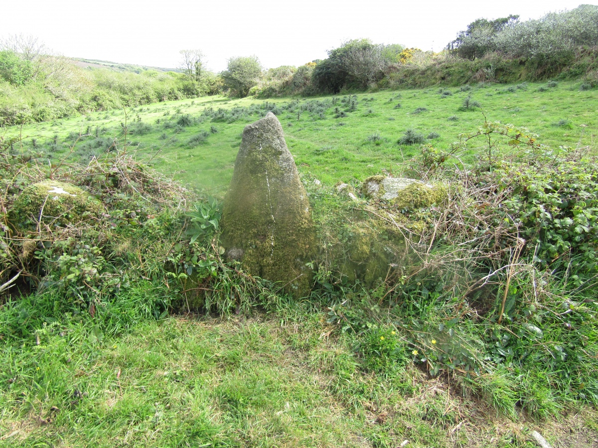
Carfury E Standing Stone submitted by markj99 on 19th Aug 2025. Carfury E Standing Stone viewed from NW.
(View photo, vote or add a comment)
Log Text: I stumbled across this standing stone by accident when I was trying to access Carfury Standing Stone. It has been incorporated into a short ruined dyke running NE-SW. See main page for directions and walking route.
Stannon cairn
Date Added: 20th Aug 2025
Site Type: Cairn
Country: England (Cornwall)
Visited: Yes on 19th Mar 2014. My rating: Condition 3 Ambience 4 Access 4
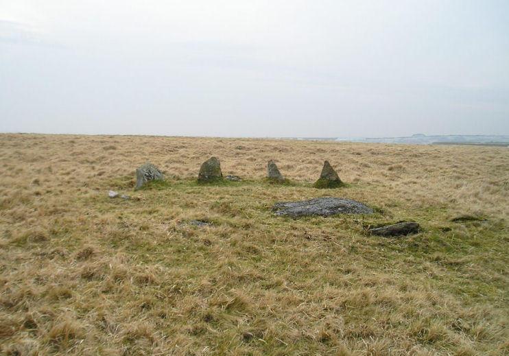
Stannon cairn submitted by TheCaptain on 27th Mar 2005. Cairn circle just east of Stannon Circle on Bodmin Moor.
View looking south westwards at this cairn circle which I found while walking back to my car from Fernacre. A fine set of teeth it has.
(View photo, vote or add a comment)
Log Text: If you are visiting Stannon Stone Circle why not walk c. 400 yards ESE to locate Stannon Kerbed Cairn, a small cairn with 4 prominent kerb stones and a possible undisturbed cist in the centre?
Bosiliack B menhir
Date Added: 19th Aug 2025
Site Type: Modern Stone Circle etc
Country: England (Cornwall)
Visited: Yes on 2nd May 2017. My rating: Condition 4 Ambience 3 Access 3

Bosiliack B menhir submitted by DrNickLeB on 17th Jul 2016. Bosiliack B menhir
(View photo, vote or add a comment)
Log Text: This shaped pillar looks like a boundary marker stone but there are no letters carved on it.
Carfury
Date Added: 19th Aug 2025
Site Type: Standing Stones
Country: England (Cornwall)
Visited: Yes on 2nd May 2017. My rating: Condition 4 Ambience 4 Access 3
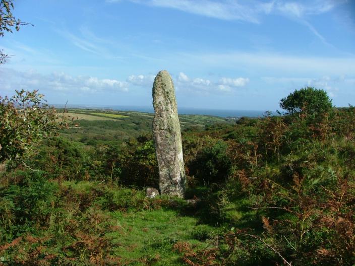
Carfury submitted by enkidu41 on 24th Aug 2004. Not easy to find but well worth the effort.
(View photo, vote or add a comment)
Log Text: I found this standing stone by trial & error: approaching from the W I saw the stone further up the slope. I followed a meandering path from Carfury E Standing Stone keeping the standing stone in sight through gorse and briars.
Din Lligwy
Date Added: 19th Aug 2025
Site Type: Ancient Village or Settlement
Country: Wales (Anglesey)
Visited: Yes on 24th Aug 2014
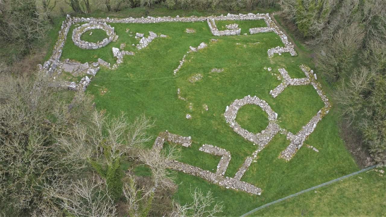
Din Lligwy submitted by TAlanJones on 21st Dec 2023. Aerial view of Din Lligwy.
(View photo, vote or add a comment)
Log Text: There is a small car park at SH 50018 86252 on the narrow lane providing access to the Lligwy monuments. A path starting at the car park heads W for c. 400 yards to Din Lligwy village.
Pots and Pans Stone (Greenfield)
Date Added: 18th Aug 2025
Site Type: Natural Stone / Erratic / Other Natural Feature
Country: England (Lancashire)
Visited: Yes on 3rd Jun 2015
Pots and Pans Stone (Greenfield) submitted by markj99 on 19th Jan 2021. Pots and Pans Stone viewed from SE.
(View photo, vote or add a comment)
Log Text: There is a mini roundabout on the A635 at the Clarence Hotel in Greenfield. Take the Chew Valley Road signed for Oldham A699. Follow the A669 for c. 0.3 mile. Take the Kinders Lane right turn opposite the King William IV Hotel. Follow Kinders Lane for 0.4 mile then bear left onto Haw Clough Lane. Stay on Haw Clough Lane for 0.3 mile to reach Knowl Top Farm. There is room to park opposite the start of Pots and Pans Path. It is c. 500 yards up a hill to the Pots & Pans Stone.
Devil's Quoit (Stackpole)
Date Added: 17th Aug 2025
Site Type: Standing Stone (Menhir)
Country: Wales (Pembrokeshire)
Visited: Yes on 28th Aug 2014. My rating: Condition 4 Ambience 4 Access 4
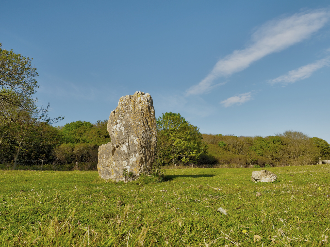
Devil's Quoit (Stackpole) submitted by Horatio on 19th May 2019. Access is easy to find if approaching from Stackpole warren, after entering the double gate enclosure from the woods, before leaving through the second gate in front of you. look right and you'll see a side gate that leads to the stone.
(View photo, vote or add a comment)
Log Text: The Devil's Quoit (Stackpole) is easy to visit from Stackpole Quay Car Park. Head W out of the car park. After c. 400 yards head straight through a crossroad. Continue W for c. 500 yards to reach a path heading S. Take the path S heading for a forest. After you exit the forest turn W into a field for c. 120 yards to reach Devil's Quoit (Stackpole Warren). My walking route is viewable on Devil's Quoit (Stackpole Warren).
Harold Stone (Bosherton)
Date Added: 16th Aug 2025
Site Type: Standing Stone (Menhir)
Country: Wales (Pembrokeshire)
Visited: Yes on 28th Aug 2014. My rating: Condition 3 Ambience 4 Access 3
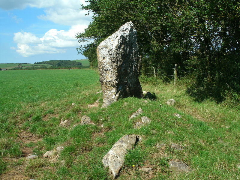
Harold Stone (Bosherton) submitted by Bladup on 13th Sep 2013. Harold Stone (Bosherton) - it looked to my eyes to have maybe once been a side slab of a ruined chamber [quoit], and the stones around it - field clearance or part of a chambered cairn?
(View photo, vote or add a comment)
Log Text: I agree with Bladup: the standing stone could be a remnant of a chamber. It is erected in a grassy mound studded with exposed stones possibly indicating a ruined cairn.
Devil's Quoit (St Twynnells)
Date Added: 16th Aug 2025
Site Type: Standing Stone (Menhir)
Country: Wales (Pembrokeshire)
Visited: Yes on 28th Aug 2014. My rating: Condition 4 Ambience 4 Access 4
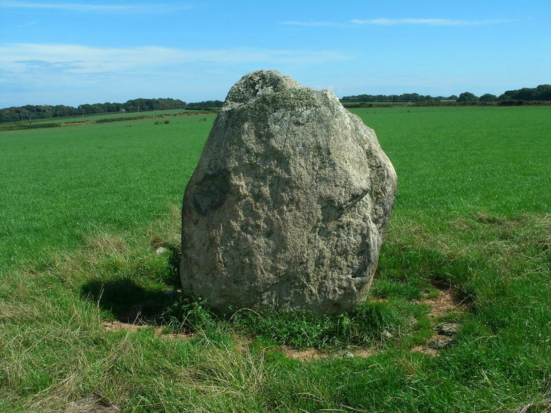
Devil's Quoit (St Twynnells) submitted by Bladup on 13th Sep 2013. Devil's Quoit (St Twynnells).
(View photo, vote or add a comment)
Log Text: Devil's Quoit (St Twynnells) is located in a field S of the B4319 c. 500 yards W of Sampson Farm. The standing stone is an impressive slab c. 6 feet high aligned NE-SW on its long axis.
Devil's Quoit (St Columb Major)
Date Added: 15th Aug 2025
Site Type: Burial Chamber or Dolmen
Country: England (Cornwall)
Visited: Yes on 16th Oct 2013. My rating: Condition 2 Ambience 3 Access 5
Devil's Quoit (St Columb Major) submitted by hamish on 14th Sep 2005. Right by the side of the road at Quoit Farm near St Columb Major.
(View photo, vote or add a comment)
Log Text: It would be easy to drive past this capstone located beside Little Quoit farm c. 0.80 miles E of St Columb Major on the road to Roche. There is no sign for the stone on the roadside and parking is difficult.
The Devil's Quoit
Date Added: 15th Aug 2025
Site Type: Burial Chamber or Dolmen
Country: Wales (Pembrokeshire)
Visited: Yes on 28th Aug 2014. My rating: Condition 2 Ambience 4 Access 4
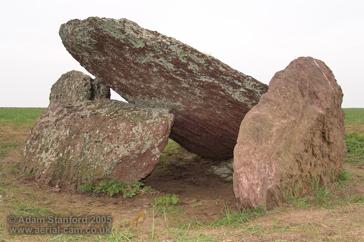
The Devil's Quoit submitted by Adam Stanford on 16th Nov 2006. Devils Quoit (PEM 25) also known as Broomhill Barrows near Freshwater West. I would suggest this is a collapsed burial chamber rather than earthfast (as stated by Nash 2006, Daniel 1950 and others). I say this because of what looks like a large collapsed orthostat that is now visible and that the capstone rests on. The monument consists of five visible stones. 1 capstone, 2 orthosatats, 1 collapsed or horizontal stone and another vertical stone resting on the eastern side of the capstone. I woul...
(View photo, vote or add a comment)
Log Text: Fortunately the field was in grass when I visited so I was able to get close to The Devil's Quoit. It appears to be a collapsed chamber, the sole remnant of a chambered cairn. The chamber is orientated on a NE-SW axis.
Devil's Jump (St Breward)
Date Added: 15th Aug 2025
Site Type: Natural Stone / Erratic / Other Natural Feature
Country: England (Cornwall)
Visited: Yes on 31st May 2019. My rating: Condition 5 Ambience 4 Access 4
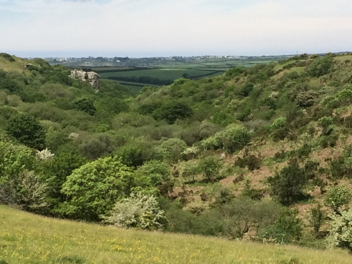
Devil's Jump (St Breward) submitted by markj99 on 14th Aug 2025. Devil's Jump (St Breward) viewed from SE.
(View photo, vote or add a comment)
Log Text: I was curious to investigate the Devil's Jump marked on the OS Map close to Carweather Medieval Village. The natural rock feature consists of two granite crags in a wooded valley. I couldn't find out much information on the net. The biggest surprise was a slab of rock resembling a bearded devil on the S crag.
Devils Den
Date Added: 13th Aug 2025
Site Type: Burial Chamber or Dolmen
Country: England (Wiltshire)
Visited: Yes on 9th Feb 2011. My rating: Condition 3 Ambience 4 Access 3

Devils Den submitted by Horatio on 23rd Apr 2022. The entrance to a long mound, described in the 19020s asbeing about 70mtrs. Shame that this is all that remains but still, pretty impressive
(View photo, vote or add a comment)
Log Text: Devil's Den is a naked dolmen close to Fyfield Down, an area with multiple ancient sites. The dolmen was originally a chamber in a now removed long cairn.
Devil's Bowling Green
Date Added: 12th Aug 2025
Site Type: Natural Stone / Erratic / Other Natural Feature
Country: Scotland (Dumfries and Galloway)
Visited: Yes on 24th Oct 2010. My rating: Condition 5 Ambience 5 Access 2
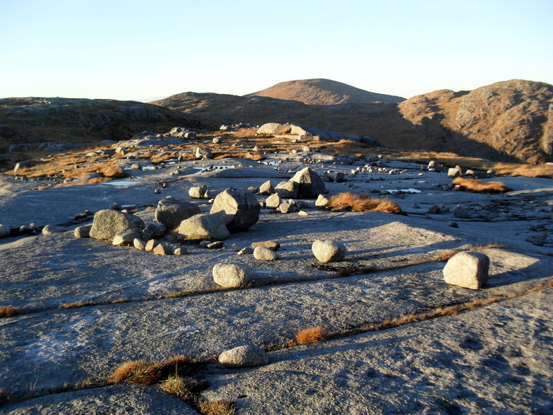
Devil's Bowling Green submitted by markj99 on 3rd Apr 2019. Devil's Bowling Green on Craignaw
(View photo, vote or add a comment)
Log Text: I accessed the Devil's Bowling Green from the public road to Loch Trool. The walk is 9 miles there and back over boggy and rough ground so should be properly planned. Walking directions are available on the main page.
Delfour
Date Added: 9th Aug 2025
Site Type: Cairn
Country: Scotland (Highlands)
Visited: Yes on 23rd Mar 2012. My rating: Condition 3 Ambience 4 Access 4
Delfour submitted by cosmic on 27th Sep 2006. Delfour from North
(View photo, vote or add a comment)
Log Text: It is surprising that there are substantial remains of Delfour Ring Cairn given its proximity to Mid & Easter Delfour Farms: most cairns located in arable land have been robbed out for construction of buildings and walls over the ages. There is a standing stone on the SW perimeter of Delfour Ring Cairn, sole survivor of an outer stone circle. The ring cairn has fared better with discernible inner and outer rings enclosed by large kerb stones.
Delford Bridge
Date Added: 9th Aug 2025
Site Type: Standing Stone (Menhir)
Country: England (Cornwall)
Visited: Yes on 18th Mar 2014. My rating: Condition 2 Ambience 4 Access 3
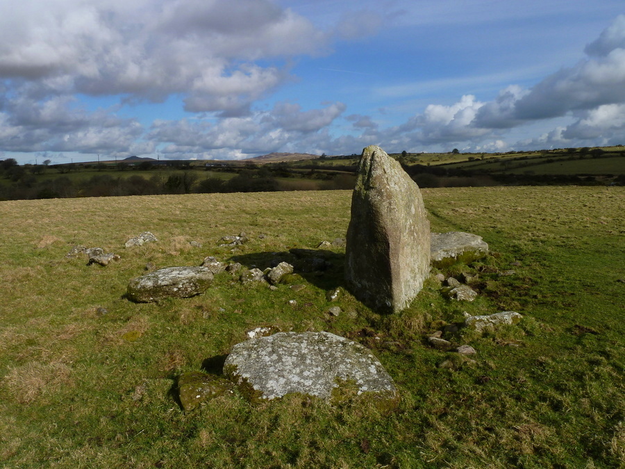
Delford Bridge submitted by Bladup on 14th Apr 2017. Delford Bridge, With Rough Tor and Brown Willy in the background.
(View photo, vote or add a comment)
Log Text: I agree with The Captain that the site could be a ruined dolmen: there are multiple large recumbent stones in the vicinity of the standing stone.
