


Contributory members are able to log private notes and comments about each site
Sites TheCaptain has logged on trip number: 209 (View all trips)
View this log as a table or view the most recent logs from everyone
Col des Ves
Trip No.209 Entry No.1 Date Added: 17th Aug 2026
Site Type: Standing Stone (Menhir)
Country: France (Rhone-Alpes:Savoie (73))
Visited: Yes on 5th Feb 2009. My rating: Condition 3 Ambience 4 Access 2

Col des Ves submitted by thecaptain on 10th Feb 2009. Is this an ancient menhir which has been re-erected, or a more modern marker stone ? I don't know. I can find nothing out about it. But here it stands, up in the high mountains above Tignes near to the Col des Ves.
(View photo, vote or add a comment)
Log Text: Is this an ancient menhir which has been re-erected, or a more modern marker stone ? I don't know. I can find nothing out about it. But here it stands, up in the high mountains above Tignes near to the Col des Ves. It is quite easy to visit in winter, in fact it could be considered a bit of a hazard as it stands in the middle of one of the high mountain ski routes, and is marked by poles, which is how I found it. There I was, skiing down the mountain, and there it was ! Outside the winter ski season, I imagine it is a major effort to visit this stone. I would estimate it to be about 3 metres tall, a metre wide by half a metre thick, but its difficult to tell, as the snow around it is several metres deep. The stone could not be standing naturally here like it is, and there are marks on the stone suggesting fairly recent mechanical contact, but I don't know why, I am making a wild guess at re-erection.
Table des Fées (Rocheville)
Trip No.209 Entry No.6 Date Added: 17th Aug 2026
Site Type: Passage Grave
Country: France (Normandie:Manche (50))
Visited: Yes on 26th Mar 2009. My rating: Condition 3 Ambience 4 Access 5

Table des Fées (Rocheville) submitted by thecaptain on 5th Apr 2009. La Table des Fées.
My Dad can be seen in the lane, with the gap through to the stone seen.
(View photo, vote or add a comment)
Log Text: The stone, thought to be the remains of a dolmen or allée couverte, is about 3m by 2 m, and lays in a field several hundred metres down a lane to the southwest of La Grosse Roche, and possibly has a spring rising to the surface nearby. Although not marked on any of the current maps, was marked on an older map in the nearby village, which allowed me to find it - on a second visit on the same morning !
Four-És-Feins
Trip No.209 Entry No.10 Date Added: 13th Jun 2020
Site Type: Passage Grave
Country: France (Bretagne:Ille-et-Vilaine (35))
Visited: Yes on 12th Jun 2009. My rating: Condition 2 Ambience 4 Access 3
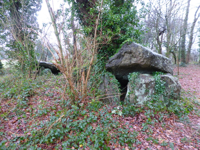
Four-És-Feins submitted by karolus on 12th Jan 2018. Site in Bretagne:Ille-et-Vilaine (35) France
(View photo, vote or add a comment)
Log Text: I went and had another look for this while in the area last weekend, now knowing to look nearby to the Beillac farm. I could see nothing obvious when driving slowly down the lane past the farm, but there was an old couple out tending their wonderful vegetable garden, so I stopped and asked them if they could tell me where the dolmen was. They were interested to know what an Englishman was doing looking for the remnants of the dolmen, but were happy to help.
Unfortunately, I struggled to understand fully all they were saying, a combination of strong accent and using some words I just could not figure out. But I thought I had got enough of a lead to find it easily. Park out of the way of the farm track by the corner of the farm. Cross the field to the south on the newly cut hay at the edge of the field for 200 metres until reaching the other side. Go straight on about another 100 metres (unknown words) until I get to the big trees, and it is on the left, (some more unknown words). Put boots on if you have them. Sounds simple.
Well, it was all very simple simple, until I tried to decide which of all the woodlands were the correct big trees. However, after a few false starts, I found a place in a woodland to the left of the track, with a mound in it, and what looked to be some lumps sticking up, but it was very overgrown. It has to be this, surely. Closer inspection amongst the ivy and brambles, and there were clearly a few side set slabs sticking up through the ground, and I was pretty sure I could determine two rows of slabs about 1.5 metres apart from each other, but with no stone more than 0.5 metres tall, and most substantially lower. I reckoned that what I had found on top of the mound was about 10 metres in length, and had to be the remains of a very ruined allée couverte.
However, walking back to the car, I thought that these poor remains were not really enough to be known by the name Four-es-Feins; the Fairies Oven. Surely something with a name like that must be a grander structure. I also thought it to be too ruined to be what the old couple were explaining to me, although they did say it was just the remains of an allée couverte. I would have thought they would have told me not to bother rather than gladly give me directions.....
Upon returning to the car, I remembered I had book with description in a box in the boot. "Rectangular chamber measuring 10m by 1.5m with 6 orthostats on the south side and 5 on the north. Their length is between 1 and 1.8 metres, height about half a metre and thickness 0.3 metres. Brilliant, this all fits to what I saw. But then, the description goes on. Three cover slabs about half a metre thick, and the backstone are still in place. Around the monument, a dozen or so other stones lie scattered.
Well, I can believe the stones are now more covered by undergrowth and soil than that description, and hence seem smaller. The size, orientation and almost everything seems right, with one major exception; the three cover stones. There was nothing at all which could have been them. Read the description again and realise it has been based upon a plan and writings from 1886 and 1928. Maybe it has become much more wrecked since then, but what of the old couples talk ?
So, was this Four-es-Feins or not? If it wasn't, what had I found ? I am not sure, but like to think I did find it. Certainly until anyone proves otherwise and can show me something better I'll count it.
Beleven allée couverte
Trip No.209 Entry No.11 Date Added: 13th Jun 2020
Site Type: Passage Grave
Country: France (Bretagne:Côtes-D'Armor (22))
Visited: Yes on 12th Jun 2009. My rating: Condition 3 Ambience 2 Access 4

Beleven allée couverte submitted by thecaptain on 24th Jun 2009. There is even a sign here, but unfortunately while holding my camera above my head to get the picture, I have chopped off the bottom and left side a bit.
Still, it shows a plan and good artistic reconstruction of the place.
(View photo, vote or add a comment)
Log Text: Remains of a fairly disturbed but mostly complete allée couverte can be found in dark woodland to the northwest of the village of Plouer-sur-Rance, to the north of the magnificent ancient city of Dinan. Although the quartz block stones of this 14 metre long allée couverte are fairly well disturbed, it is in fact mostly complete, with a well defined terminal cella, and even with traces of its mound still to be seen. It is possible that it once had a lateral entrance.
Remarkably, it is stated that this monument was only discovered in 1972, which I find hard to believe, and it was classified as a monument historique as recently as 1981.
The poor thing is very close to a busy express highway, the N176, which runs along this northern edge of Brittany, but although the noise from the traffic is constant, the dense woodlands do a good job of hiding it all.
Despite looking on maps as if it would be very difficult to access, its on a wooded hillside right next to the dual carriageway road , there is in fact an emergency phone and layby nearby on the northbound carriageway, where it is possible to park and visit the monument. From the layby, hop over a little fence and follow a well worn path to the left for about 100 metres, and there it is ! Brilliant, its like the layby is deliberately put there for us stonehunters !
Outre Tombes
Trip No.209 Entry No.12 Date Added: 13th Jun 2020
Site Type: Stone Circle
Country: France (Bretagne:Ille-et-Vilaine (35))
Visited: Yes on 12th Jun 2009. My rating: Condition 3 Ambience 3 Access 5
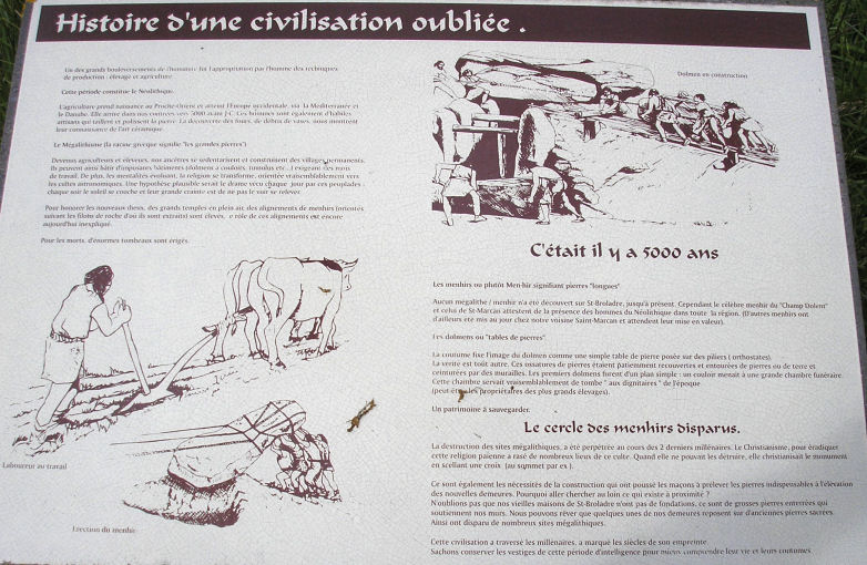
Outre Tombes submitted by thecaptain on 5th Jul 2009. There are several information plaques at the site.
(View photo, vote or add a comment)
Log Text: This horseshoe of megalithic stones has alternatively been considered as a megalithic enclosure (cromlech) or perhaps the stones once surrounding a dolmenic burial chamber. Seven stones are shaped in a sort of semi circle, of diameter about 7 metres.
This monument was classified as a historical monument in 1966, but by 1977 had disappeared, being the victim of an expansion of the local quarry at Vaujour. When this was discovered, the police were called in, but it was all thought to be too late. However, in 1989 it was found that most of the stones hadn't simply been destroyed, but had been moved and dumped into a nearby field, although one had gone through the stonecrusher. With the help of a plan and photograph of the site taken in 1962, the local people (with the help of the quarrying company) had the site recreated in 1998, just a few hundred metres from its original position.
There is also a small menhir erected at the site, the origins of which I do not know, but the stone does not look modern. Today, the site sits in a little meadow near to the top of the quarry, and can be found beside the little road which runs along the top of the hills to the northeast of the massive Vaujour quarries. There are several information plaques at the site, telling of its history and with diagrams and pictures.
La Roche Longue (St-Marcan)
Trip No.209 Entry No.13 Date Added: 13th Jun 2020
Site Type: Standing Stone (Menhir)
Country: France (Bretagne:Ille-et-Vilaine (35))
Visited: Yes on 12th Jun 2009. My rating: Condition 4 Ambience 3 Access 4
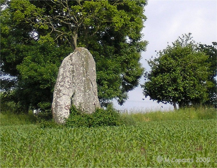
La Roche Longue (St-Marcan) submitted by thecaptain on 30th Jun 2009. View of La Roche Longue seen from the west.
(View photo, vote or add a comment)
Log Text: This well shaped menhir is just under 3 metres tall in a field to the east of the St Marcan cemetary. As with my previous visit, the field is planted with maize, and is today sodden wet, which prevents me from being abole to walk right up to the stone. However, this time I can walk up the western edge of the field by the cemetary, and photograph its other side in the afternoon sunshine.
Menhir du Perron (St-Marcan)
Trip No.209 Entry No.14 Date Added: 13th Jun 2020
Site Type: Standing Stone (Menhir)
Country: France (Bretagne:Ille-et-Vilaine (35))
Visited: Yes on 12th Jun 2009. My rating: Condition -1
Log Text: A 2 metre tall menhir similar to the Roche Longue of St Marcan, once stood in the fields of Perron, about 800 metres south of La Roche Longue. It somehow disappeared in the 1930's.
Allée Couverte de Roche-Plate
Trip No.209 Entry No.20 Date Added: 17th Aug 2026
Site Type: Passage Grave
Country: France (Bretagne:Ille-et-Vilaine (35))
Visited: Yes on 8th Oct 2009. My rating: Condition 3 Ambience 2 Access 5
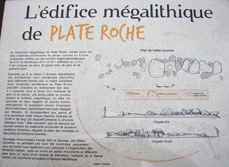
allée couverte de Roche-Plate submitted by thecaptain on 29th Nov 2009. Part of the noticeboard at the site.
(View photo, vote or add a comment)
Log Text: The allée couverte de Roche-Plate was discovered in 1975 near to the Moulin de Roche-Plate on the outskirts of St Lunaire during some ground levelling before building work. The book says eight covering slabs rest on 19 orthostats, around 10 metres in length and oriented NNW to SSE. The allée couverte is today to be found beside the town football stadium, in an empty plot presumably left from building on after the monument was discovered at the time of the development. The allée is 17 metres in length, with the northern half much better preserved than the southern half. It is made from 4 different kinds of rock; grey sandstone, pink and grey granite and some white quartz blocks. Despite being signposted from several places, this is not the easiest monument to find!
dolmen de la Garde Guerin
Trip No.209 Entry No.21 Date Added: 17th Aug 2026
Site Type: Burial Chamber or Dolmen
Country: France (Bretagne:Ille-et-Vilaine (35))
Visited: Couldn't find on 8th Oct 2009. My rating: Access 4

dolmen de la Garde Guerin submitted by thecaptain on 26th Oct 2009. Looking inland along the eastern side of the Pointe de la Garde Guérin.
Th remains of the dolmen are somewhere in here.
(View photo, vote or add a comment)
Log Text: "Ruined dolmen on the southeast side of the Garde Guerin mound. The probable capstone leans against two orthostats, with some other blocks laying around. Dense vegetation make this very difficult to find". I can now personally vouch for this dolmen to be difficult to find. Often I think that difficult to find just requires a bit of perseverance, but here requires more than that ! The headland is a nature reserve, and many footpaths thread their way around and over it. But its not just bracken etc its overgrown with, but gorse, blackthorn and anything else you can think of, varying in height from just below head height to more than 3 metres ! And its so dense, you can hardly see a foot into the jungle ! Lovely place to walk around, as many people were doing, but to find the ruined dolmen without even knowing where it is - no chance !
menhir Garde Guerin
Trip No.209 Entry No.22 Date Added: 17th Aug 2026
Site Type: Standing Stone (Menhir)
Country: France (Bretagne:Ille-et-Vilaine (35))
Visited: Couldn't find on 8th Oct 2009. My rating: Access 4
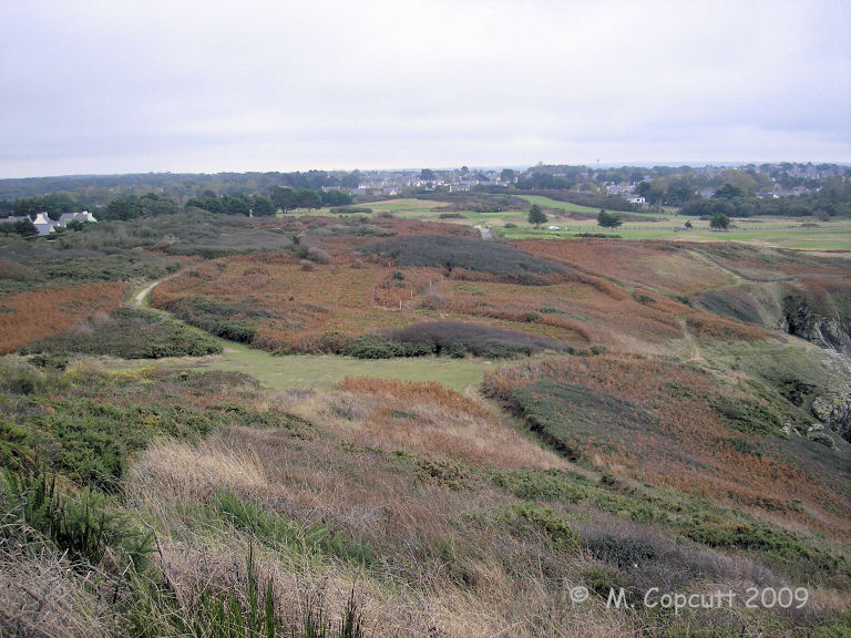
menhir Garde Guerin submitted by thecaptain on 25th Oct 2009. Looking inland along the western side of the Pointe de la Garde Guérin, over where the menhir supposedly is.
(View photo, vote or add a comment)
Log Text: Pyramid shaped menhir one metre in height, which was to be found a few hundred metres south west of the Garde Guerin, but may now have disappeared. As with the nearby dolmen remains, it proved impossible to even start to have a proper look for this stone amongst the extremely dense and tall overgrowth on this nature reserve headland.
Les Roches-Hues
Trip No.209 Entry No.23 Date Added: 17th Aug 2026
Site Type: Stone Row / Alignment
Country: France (Bretagne:Ille-et-Vilaine (35))
Visited: Yes on 8th Oct 2009. My rating: Condition 4 Ambience 2 Access 4

Les Roches-Hues submitted by thecaptain on 10th Nov 2009. When I eventually found my way to this, the top of a large stone could be seen in the distance over some impenetrable overgrowth.
Looking for a way through proved futile.
(View photo, vote or add a comment)
Log Text: Described in 1878 as an alignment of menhirs one kilometre in length, orientated north to south, nowadays all that is to be found is a few stones over a length of about 100m. Well, thats the description in the book, but on the IGN map a menhir is marked. When I eventually found my way to this, having been delayed by private roads and no through ways near to the Roches Douvres residence, the top of a large stone could be seen in the distance over some impenetrable overgrowth. Looking for a way through proved futile. So walking all the way around along the new private road and a view of a splendid menhir can be obtained, looking like it is in somebodies back garden, although it is perhaps common ground. The stone must be at least 4 metres tall, and looks very much like it is alone. It is possible that there are more small stones in amongst the undergrowth nearby and on the golf course, but a menhir seems a better description of this stone.
Pierre de Minoz
Trip No.209 Entry No.24 Date Added: 17th Aug 2026
Site Type: Standing Stone (Menhir)
Country: France (Bretagne:Côtes-D'Armor (22))
Visited: Yes on 8th Oct 2009. My rating: Condition 3 Ambience 3 Access 5
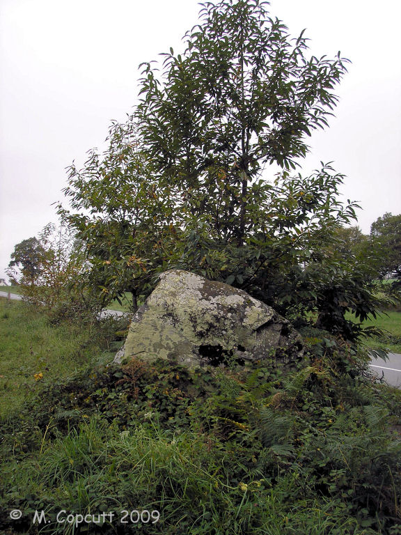
Pierre de Minoz submitted by thecaptain on 11th Nov 2009. Although right beside the D28 on the left bank of the river Fremur, the Pierre de Minoz hides behind a chestnut tree.
(View photo, vote or add a comment)
Log Text: Beside the D28 on the left bank of the river Fremur near to the Chapelle des Vaux can be found the Pierre de Minoz which stands 1.7 metres tall, with its main sides facing east and west. The stone lies on the axis of the nearby alignements of Ville-Crochu, and has some damage from modern farming machinery. Parked at the local picnic site beside the lake and then spent ages looking for this along the trackway beside the river, and then up across the fields towards the old chapel, but found nothing. Having given up, started to drive away, and there it was, right beside the road, about 20 metres west of the bridge, hiding behind a chestnut tree ! So, turn round at the first opportunity, and back to the picnic site to park, from where it is no more than 50 metres to go and have a look and get some pictures! A nice stone, with lots of different coloured lichens etc growing on it.
Menhir de Blainville-sur-Mer
Trip No.209 Entry No.30 Date Added: 17th Aug 2026
Site Type: Standing Stone (Menhir)
Country: France (Normandie:Manche (50))
Visited: Yes on 28th Dec 2009. My rating: Condition 3 Ambience 3 Access 5
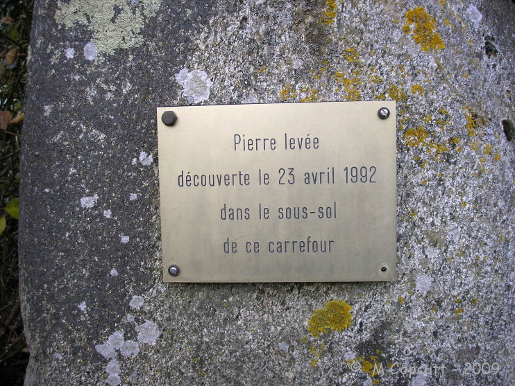
Menhir de Blainville-sur-Mer submitted by theCaptain on 4th Jan 2010. In the little square beside the Mairie and church of Blainville-sur-Mer, stands a little granite menhir, recently rediscovered during roadworks here in 1992.
(View photo, vote or add a comment)
Log Text: In a little garden area beside the little square near to the Mairie and the church of Blainville-sur-Mer, stands a little granite menhir, recently rediscovered. The stone stands about 1.2 metres tall, and was found during roadworks here in 1992.