Contributory members are able to log private notes and comments about each site
Sites TheCaptain has logged. View this log as a table or view the most recent logs from everyone
Gardoms Edge Stone
Date Added: 30th Aug 2025
Site Type: Standing Stone (Menhir)
Country: England (Derbyshire)
Visited: Would like to visit
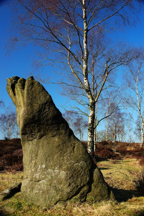
Gardoms Edge Stone submitted by royston7 on 27th Nov 2012. Gardoms edge monolith taken from the east showing the ( not quite ) flat north face. See notes in contribution.
(View photo, vote or add a comment)
Park Gate
Date Added: 30th Aug 2025
Site Type: Stone Circle
Country: England (Derbyshire)
Visited: Would like to visit
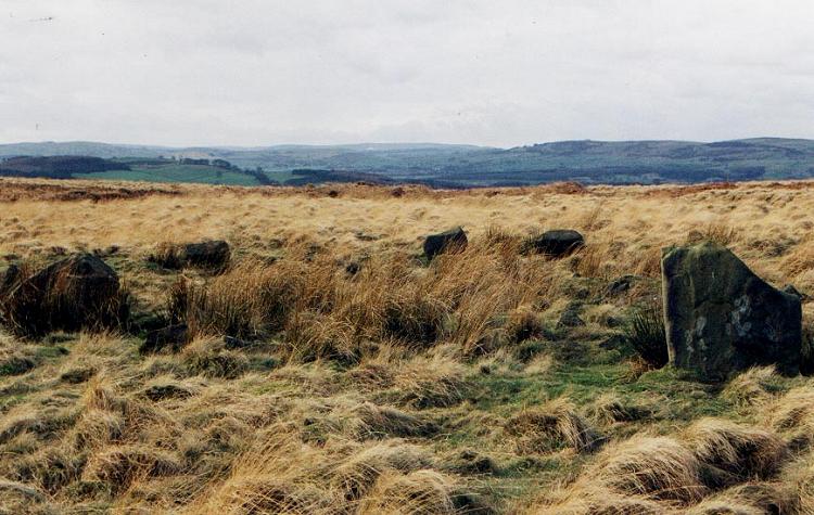
Park Gate submitted by PaulM on 1st Sep 2001. Park Gate Stone Circle, near Beeley, Derbyshire GR: SK281685
Park Gate is a relatively well-preserved embanked stone circle located on a boggy plateau on the moorland above Beeley, at the northern end of a cairnfield. The two ringcairns of Beeley Moor North (GR: SK277687) and Beeley Warren North East (GR: SK279688) are located close by to the north-west.
The circle consists of ten stones in a ring, approximately 12.5m by 12m in diameter with a further stone, completely buried, to the north...
(View photo, vote or add a comment)
Hob Hurst's House
Date Added: 30th Aug 2025
Site Type: Round Barrow(s)
Country: England (Derbyshire)
Visited: Would like to visit
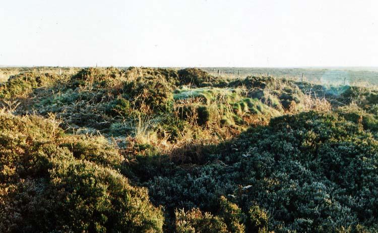
Hob Hurst's House submitted by Vicky on 17th Dec 2001. Hob Hurst's House barrow, Beeley Moor, Derbyshire GR: SK28746923
A general view of Hob Hurst's House. This unusual Bronze Age barrow is located approximately 5km south-east of Baslow on the remote area of open moorland above Harland Edge. It is made up of a central rectangular mound, approximately 8m by 7.5m wide and just under 1m in height. The mound is surrounded by a rectangular bank and ditch, the northern section of which has been damaged by a packhorse track. A small ring of five sto...
(View photo, vote or add a comment)
Arbor Low 1
Date Added: 30th Aug 2025
Site Type: Stone Circle
Country: England (Derbyshire)
Visited: Would like to visit
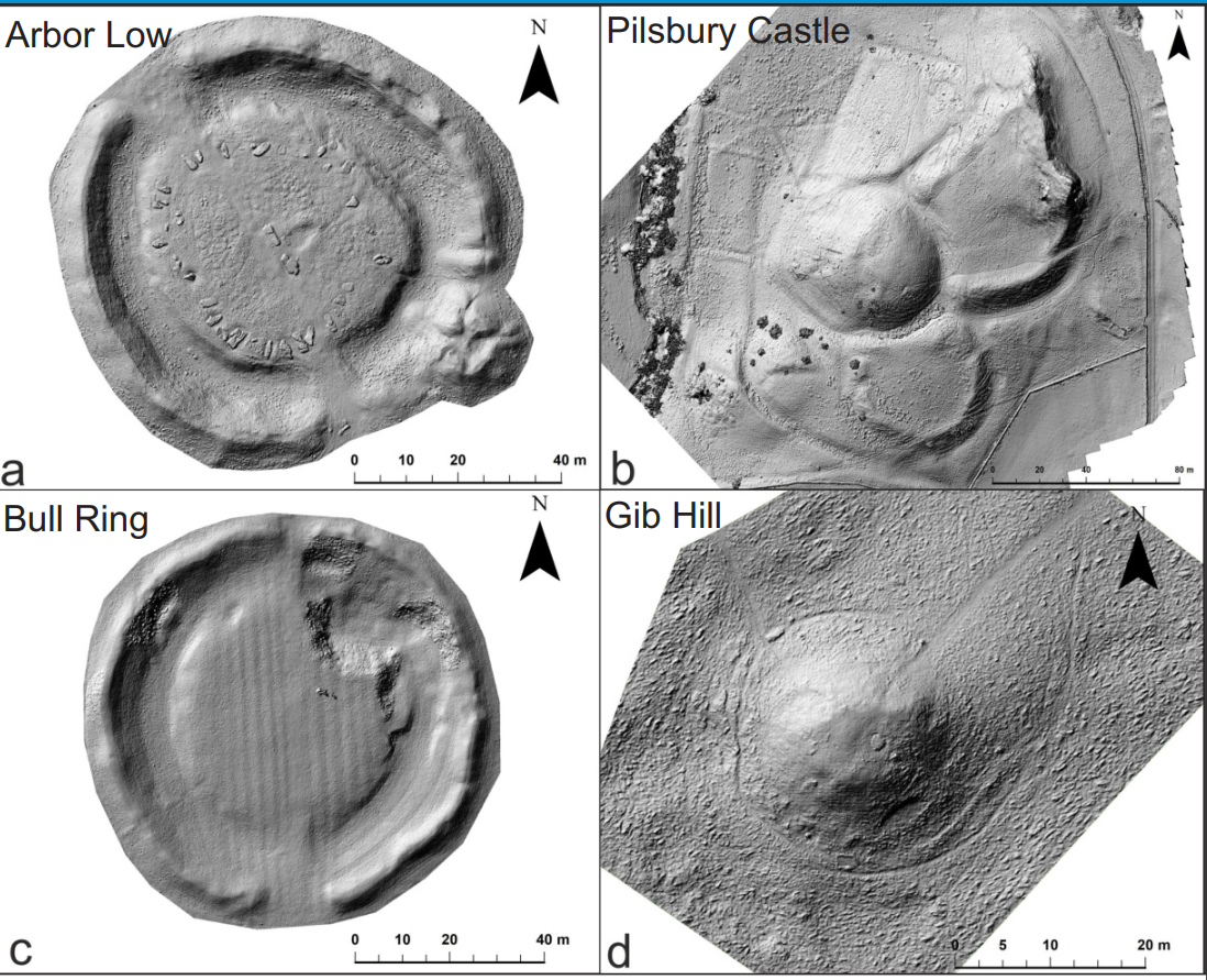
Arbor Low 1 submitted by dodomad on 21st Jan 2023. Hillshade plots of Arbor Low, Pilsbury, Castle, the Bull Ring and Gib Hill produced by Dr Helen Malbon and Dr Alexandre Nobajas from the School of Geography, Geology & the Environment, Keele University. These can in particular be used
to identify areas of damage. With thanks to CottonCasual for letting us know about this work.
(View photo, vote or add a comment)
Nine Ladies
Date Added: 30th Aug 2025
Site Type: Stone Circle
Country: England (Derbyshire)
Visited: Would like to visit
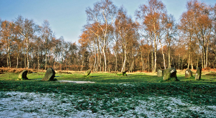
Nine Ladies submitted by Infinite_Fate on 31st Dec 2005. Looking North one November day showing banking (or, the Ladies' skirts).
(View photo, vote or add a comment)
Doll Tor
Date Added: 30th Aug 2025
Site Type: Stone Circle
Country: England (Derbyshire)
Visited: Would like to visit
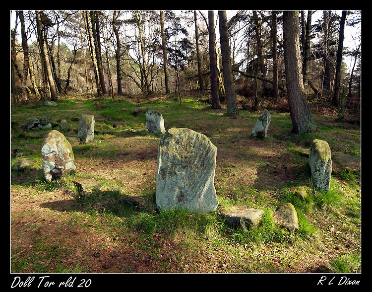
Doll Tor submitted by rldixon on 25th Mar 2011. Doll tor
taken 24-3-2011
(View photo, vote or add a comment)
Nine Stones Close
Date Added: 30th Aug 2025
Site Type: Stone Circle
Country: England (Derbyshire)
Visited: Would like to visit
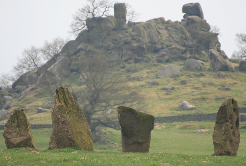
Nine Stones Close submitted by postman on 26th Dec 2012. Zoomed stones and stride
(View photo, vote or add a comment)
The Bridestones (Cheshire)
Date Added: 30th Aug 2025
Site Type: Chambered Tomb
Country: England (Cheshire)
Visited: Would like to visit

The Bridestones (Cheshire) submitted by astronomer on 15th Apr 2011. Lifting the fallen monolith during the 1936-37 excavation.
Photo taken by the then land owner, Mr. G. Ech Roger Jnr. Previously unpublished image made available by the present owner of the glass negatives, Doug Pickford.
(View photo, vote or add a comment)
Five Wells
Date Added: 30th Aug 2025
Site Type: Chambered Tomb
Country: England (Derbyshire)
Visited: Would like to visit
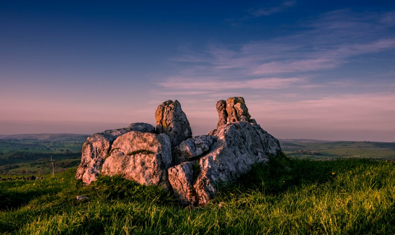
Five Wells submitted by Humbucker on 7th Jun 2018. The pretty eastern chamber of Five Wells looking roughly NE.
(View photo, vote or add a comment)
Lud's Church
Date Added: 30th Aug 2025
Site Type: Natural Stone / Erratic / Other Natural Feature
Country: England (Staffordshire)
Visited: Would like to visit
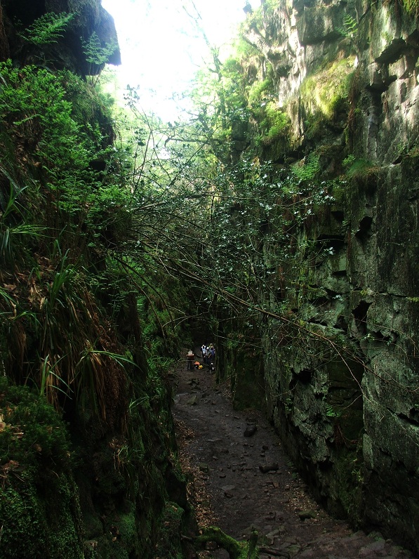
Lud's Church submitted by Postman on 16th Dec 2012. An Artist way back down there is past by a few walkers.
(View photo, vote or add a comment)
Craddock Moor circle
Date Added: 27th Aug 2025
Site Type: Stone Circle
Country: England (Cornwall)
Visited: Yes on 20th Jun 2025. My rating: Condition 3 Ambience 4 Access 3

Craddock Moor circle submitted by mattimpey on 9th Dec 2008. Three of the most prominant prostrate stones look East. The large bush is in the middle of the stone circle.
(View photo, vote or add a comment)
Log Text: Get to Minions eventually, but find that the Cheesewring pub has burned down and is all abandoned. Get a quick pasty at the Minions village shop, before setting off for a walk to the Craddock Moor stone circle, as I havent been there for ages. Its very hot and I am extremely weary, but I get there and manage to have a look amidst a large group of cows. It seems easier to find this time, with the stones more clear, possibly because its less overgrown.
Craddock Moor circle
Date Added: 27th Aug 2025
Site Type: Stone Circle
Country: England (Cornwall)
Visited: Yes on 20th Sep 2009. My rating: Condition 3 Ambience 4 Access 3
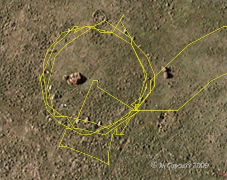
Craddock Moor circle submitted by thecaptain on 22nd Sep 2009. gps track plot of my wanderings round Craddock Moor stone circle on Sunday. Many of the stones can be seen in the picture.
I use an ageing Garmin etrex Venture pocket reciever, and the track is plotted out using GPSVisualizer, with only a few minutes fiddling.
I find it amazing the results that can now be obtained for things like this, using cheap, readily available technology, in a pocketsized device.
(View photo, vote or add a comment)
Log Text: After turning off the track near to the cairn, and heading out over the open moor, I found the circle easily, having headed straight to it from judging things looking at the map, and not using the GPS. I counted about 17 or 18 stones plus gaps on my first time round, but perhaps 19 or 20 next time round including lumps under tufts of grass. The circle is about 42 paces in diameter, with about 5 paces between each stone. When here, in September at the end of the summer, the grass and suchlike was very long, making most of the stones difficult to spot, so I first walked around the outside checking out what I could find. Then I walked around again taking photos, hence some excursions from the circle. I then went to the middle to survey the scene as a whole before looking for somewhere to sit and eat my pasty for lunch, which I would have liked to be the middle of the circle, but there was only long grass there, so a convenient and comfortable looking stone at the southeast did the job. I looked at my gps and was amazed at the nice circle on the screen, so thought I would "draw" another circle on it before I left !
Craddock Moor platform cairn
Date Added: 25th Aug 2025
Site Type: Cairn
Country: England (Cornwall)
Visited: Yes on 20th Jun 2025. My rating: Condition 3 Ambience 4 Access 3
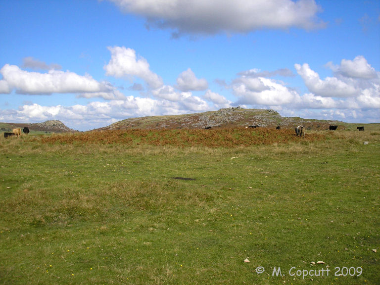
Craddock Moor platform cairn submitted by thecaptain on 1st Oct 2009. View east over Craddock Moor platform cairn and its berm.
Sharptor and Stowe's Hill in the background.
(View photo, vote or add a comment)
Log Text: I get to Minions eventually, but find that the Cheesewring pub has burned down and is all abandoned. Get a quick pasty at the Minions village shop, before setting off for a walk to the Craddock Moor stone circle, as I havent been there for ages. Its very hot and I am extremely weary, but I get there and manage to have a look amidst a large group of cows. Before the circle is the platform cairn which is clear to see all covered in ferns, and is quite a big but low flat circle, probably up to a metre high above the surrounding moor.
Craddock Moor platform cairn
Date Added: 25th Aug 2025
Site Type: Cairn
Country: England (Cornwall)
Visited: Yes on 20th Sep 2009. My rating: Condition 3 Ambience 4 Access 3

Craddock Moor platform cairn submitted by thecaptain on 1st Oct 2009. View northeast over Craddock Moor platform cairn, and right across the middle of Bodmin Moor.
Cornwall's very own mountain Brown Willy is in the distance.
(View photo, vote or add a comment)
Log Text: Following the track out towards Golddiggings quarry, there is a cairn marked at about the top of the local moorland, about where I need to head off southwest to find the stone circle. The cairn is clear to see, and is quite a big but low flat circle, probably up to a metre high above the surrounding moor. Much of it is covered by ferns, and this morning is surrounded by guard cows, some with vicious looking horns, which kept me away on the way out. The views from here are superb, with Brown Willy to be seen off to the northwest, and Sharptor and Stowes Pound very clear to the northeast. It is beautiful out here on the open moor. Turns out this is a circular platform cairn with peripheral berm, 24m in diameter for the cairn and up to 31m in diameter with its berm. English Heritage Scheduled Monument 15056 http://www.magic.gov.uk/rsm/15056.pdf
King Doniert's Stone
Date Added: 25th Aug 2025
Site Type: Ancient Cross
Country: England (Cornwall)
Visited: Yes on 20th Jun 2025. My rating: Condition 3 Ambience 3 Access 5
King Doniert's Stone submitted by cazzyjane on 14th Oct 2010. King Doniert's Stone.
(View photo, vote or add a comment)
Log Text: Now onwards to Minions, first looking at King Doniert's stone. This all took me ages, with some amazing traffic holdups behind sheep, tractors, busses, and best of all Highland Cattle sitting on a bridge. Donierts stone is looking splendid in the sun, but I feel I should head on as the road is chaos, with a school bus and lorry trying to pass each other.
Wenmouth Cross
Date Added: 25th Aug 2025
Site Type: Ancient Cross
Country: England (Cornwall)
Visited: Yes on 20th Jun 2025. My rating: Condition 3 Ambience 3 Access 5
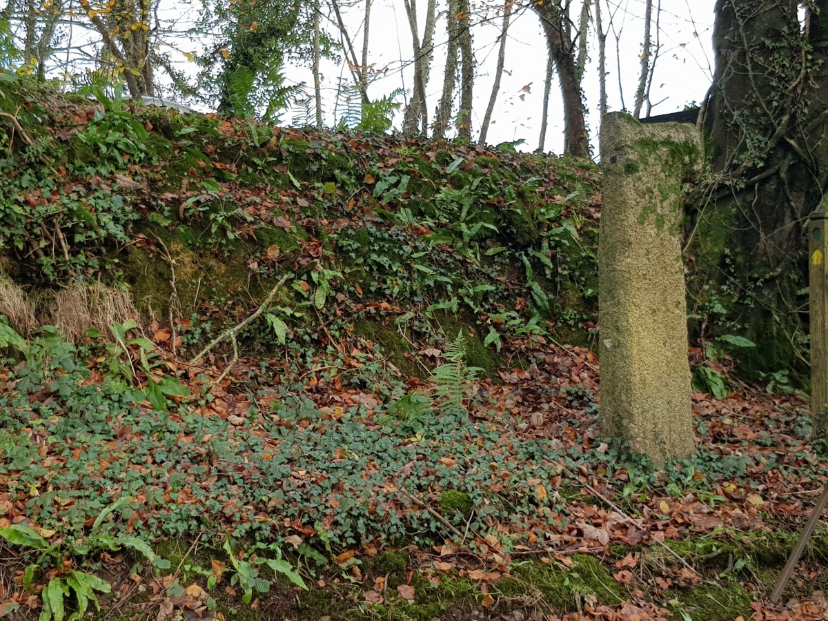
Wenmouth Cross submitted by dooclay on 2nd Dec 2024. A mutilated latin cross set up in 1932 at the Wenmouth cross roads.
(View photo, vote or add a comment)
Log Text: Heading south from Colliford Lake, I stop for a look at Wenmouth Cross. It stands at a shady spot by a road junction, its upper arms broken.
Searle’s Down
Date Added: 23rd Aug 2025
Site Type: Stone Row / Alignment
Country: England (Cornwall)
Visited: Yes on 20th Jun 2025. My rating: Condition 2 Ambience 3 Access 4
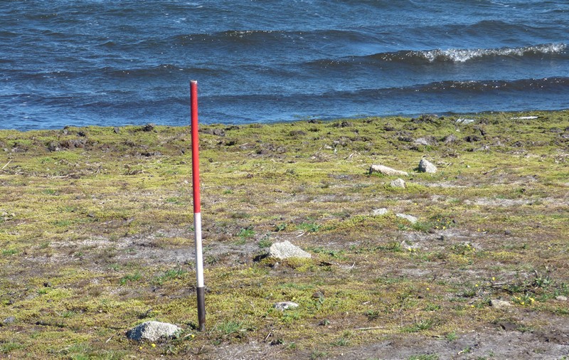
Searle’s Down submitted by SandyG on 19th Jan 2018. The stones nearest the reservoir. View from north west (Scale 1m).
(View photo, vote or add a comment)
Log Text: At Colliford Lake, I park and go for a walk around it's shores, trying to find the Searle’s Down stone row. Can't be sure I actually found anything, perhaps the remnants of an old wall, but I was certainly looking in the right place. Perhaps the main stones are below the water level, although it looks quite low. Now home and looking at Sandy's photographs, clearly what he has of the obvious row is below the level of the water when I was there, but it does look from a couple of the pictures that I did indeed see the top end of the row.
Treslea Cross
Date Added: 19th Aug 2025
Site Type: Ancient Cross
Country: England (Cornwall)
Visited: Yes on 20th Jun 2025. My rating: Condition 4 Ambience 4 Access 5
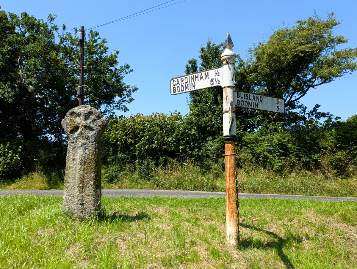
Treslea Cross submitted by TheCaptain on 19th Aug 2025. Treslea Cross, with its choice of ways to go to Bodmin. Personally, I'd choose Blisland as a destination.
(View photo, vote or add a comment)
Log Text: Now on to Treslea Cross, standing in a little green road junction triangle, with its splendid roadsign beside it. A choice of two ways to go to Bodmin, but I am tempted by Blisland.
Cardinham Churchyard
Date Added: 19th Aug 2025
Site Type: Ancient Cross
Country: England (Cornwall)
Visited: Yes on 20th Jun 2025. My rating: Condition 5 Ambience 4 Access 5
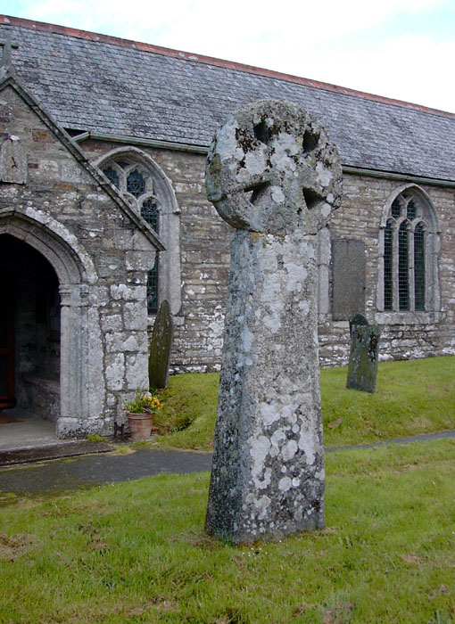
Cardinham Churchyard submitted by Thorgrim on 17th May 2004. This fine 10th century wheel-headed cross is the most southerly example of Scandinavian style ring-chain ornament.
(View photo, vote or add a comment)
Log Text: Leaving Penzance, I head to Bodmin Moor, with the intention of collecting some old sites and southern B101 squares on my way to Minions for a moorland walk. I started off at Cardinham with its two splendid old crosses. One is a carved head mounted on top of a huge pillar, the other round by the side is all complete and with carvings.
Mulfra Quoit
Date Added: 17th Aug 2025
Site Type: Portal Tomb
Country: England (Cornwall)
Visited: Yes on 17th Jun 2025. My rating: Condition 3 Ambience 4 Access 3
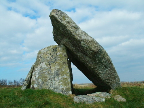
Mulfra Quoit submitted by Bladup on 16th Apr 2013. Mulfra Quoit.
(View photo, vote or add a comment)
Log Text: I still have a pasty in my bag, so after a pint to refresh me, I decide to go up to Mulfra Quoit to eat it. It is a pleasant walk up to Mulfra Quoit in its hilltop position, taking the easy way after parking at the road junction at the top of the Try valley, and walking across the moorland from there. The views southwards from up here are great, with Mounts Bay shimmering in the distance. Three of the original four support stones remain, and the fallen 3 metres square capstone sits at an impressive angle on top of these and the ground. Little of the remains of its circular barrow can be seen.
