Contributory members are able to log private notes and comments about each site
Sites SandyG has logged. View this log as a table or view the most recent logs from everyone
Sancreed Beacon homestead
Date Added: 13th Feb 2020
Site Type: Ancient Village or Settlement
Country: England (Cornwall)
Visited: Yes on 16th Sep 2019. My rating: Condition 2 Ambience 4 Access 3
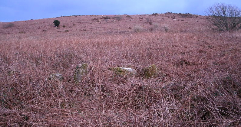
Sancreed Beacon homestead submitted by Bladup on 23rd Nov 2013. Sancreed Beacon homestead - some of the stones of this very overgrown homestead with the beacon in the background. It is very hard to get a photo of the site.
(View photo, vote or add a comment)
Log Text: None
Sandy Road
Date Added: 15th Jan 2015
Site Type: Stone Circle
Country: Scotland (Perth and Kinross)
Visited: Yes on 14th Jan 2015
Sandy Road submitted by SandyG on 14th Jan 2015. Ever wondered what impact a housing development would have on a stone circle? View from north (19th April 2014).
(View photo, vote or add a comment)
Log Text: None
Sannaig
Date Added: 4th Jan 2018
Site Type: Stone Row / Alignment
Country: Scotland (Isle of Jura)
Visited: Yes on 20th Aug 2017. My rating: Condition 2 Ambience 2 Access 2
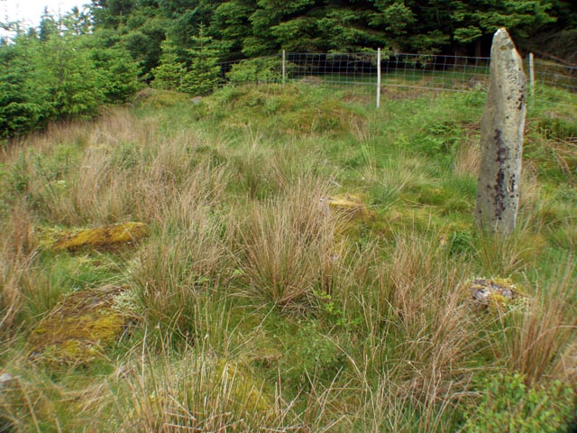
Sannaig NR41 submitted by Tom_Bullock on 9th Jun 2004. A pick of images from the CD-ROM
(View photo, vote or add a comment)
Log Text: Car parking is available at NR 50672 64747. From here follow the forest track to NR 51986 64770. Enter the forest and walk uphill until you reach the small clearing containing the stones. Access from the north is likely to be hampered or prevented by the deer fence. Whilst no ticks were encountered during the visit it would be wise to take particular care when visiting this row.
Scallastle
Date Added: 10th Jan 2019
Site Type: Stone Row / Alignment
Country: Scotland (Isle of Mull)
Visited: Yes on 3rd Jun 2016. My rating: Condition 2 Ambience 4 Access 4
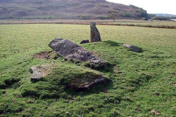
Scallastle submitted by Nick on 2nd Nov 2003. Isle of Mull
NM699383
Ask permission at the farm, parking is easy at the road end as there is plenty of room. Not visible from the road from Craignure, you can only see this heading south from Salen.
Set out on a low mound, with a couple of possible kerb stones still in situ, there is one upright stone (about 1.3m tall) and one recumbent here. The 'kerb stones' may in fact be other recumbents - it's a bit hard to tell. Have a look at the photograph and make your own mind up! The stones ...
(View photo, vote or add a comment)
Log Text: Car parking is available at NM 70110 38516. From here carefully walk along the road to NM 70246 38469 and then follow the track towards the stones.
Scord of Brouster
Date Added: 9th Feb 2020
Site Type: Ancient Village or Settlement
Country: Scotland (Shetland)
Visited: Yes on 8th Jun 2019. My rating: Condition 3 Ambience 4 Access 4
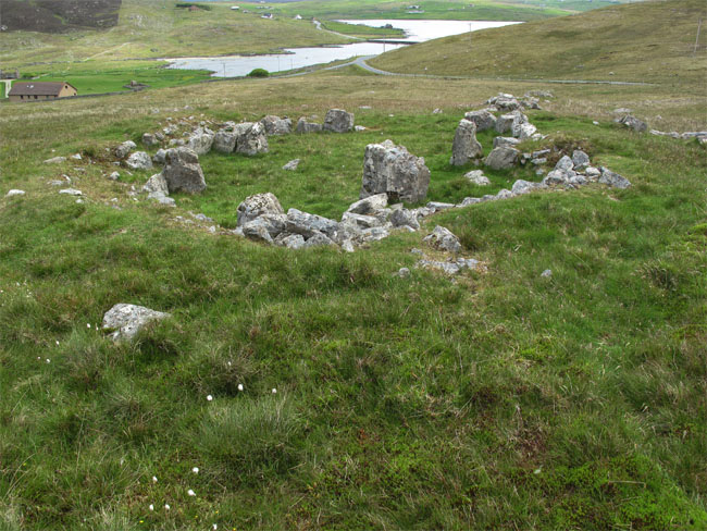
Scord of Brouster submitted by jeffrep on 28th Jul 2010. Ruins of House 2, Largest Dwelling at Scord of Brouster Ancient Settlement, West Mainland, Shetland, Scotland
(View photo, vote or add a comment)
Log Text: Make your way up to the information board at the top of the hill first. From this point you get an overall view of the site.
Scorhill
Date Added: 6th Mar 2015
Site Type: Stone Circle
Country: England (Devon)
Visited: Yes on 27th Feb 2015
Scorhill submitted by SandyG on 27th Feb 2015. View from east (28th April 2013).
(View photo, vote or add a comment)
Log Text: None
Searle’s Down
Date Added: 27th Jan 2019
Site Type: Stone Row / Alignment
Country: England (Cornwall)
Visited: Yes on 25th May 2017. My rating: Condition 2 Ambience 4 Access 4
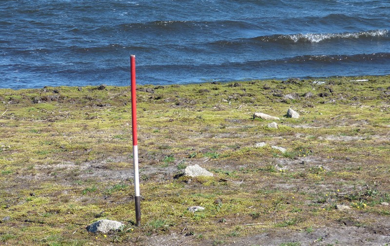
Searle’s Down submitted by SandyG on 19th Jan 2018. The stones nearest the reservoir. View from north west (Scale 1m).
(View photo, vote or add a comment)
Log Text: Most of the row is unavailable for inspection. The only part that is visible when the reservoir is not full is at SX17548 71361. Parking is available at SX 17572 70965. From here walk north along the edge of the reservoir.
Searle’s Down
Date Added: 27th Jan 2019
Site Type: Stone Row / Alignment
Country: England (Cornwall)
Visited: Yes on 15th Oct 2018. My rating: Condition 2 Ambience 4 Access 4

Searle’s Down submitted by SandyG on 19th Jan 2018. The stones nearest the reservoir. View from north west (Scale 1m).
(View photo, vote or add a comment)
Log Text: Following the hot summer the row was revisited following a drop in the reservoir level. Many more stones were visible and the true character of the row revealed.
Setta Barrow
Date Added: 15th Feb 2020
Site Type: Round Barrow(s)
Country: England (Devon)
Visited: Saw from a distance on 26th Apr 2018. My rating: Condition 3 Ambience 5 Access 4
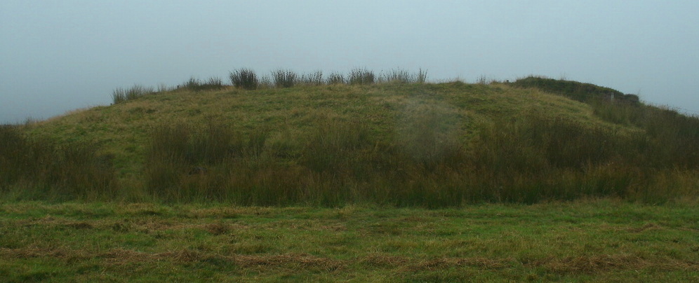
Setta Barrow submitted by Bladup on 19th Sep 2014. The large Setta Barrow.
(View photo, vote or add a comment)
Log Text: None
Shap Avenue
Date Added: 7th Jan 2018
Site Type: Multiple Stone Rows / Avenue
Country: England (Cumbria)
Visited: Yes on 8th Sep 2017. My rating: Condition 1 Ambience 4 Access 4
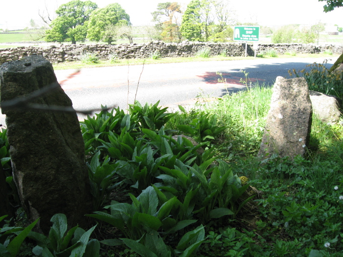
Shap Avenue submitted by AngieLake on 3rd Jun 2011. These were the most noticeable stones fringing the east side of the road, heading back towards the village after visiting Kemp Howe, that might have possibly come from the ancient monuments.
(View photo, vote or add a comment)
Log Text: Parking is available at NY 56358 15076. From here a network of public footpaths provides access to some of the stones. Others can be viewed from the paths and public road.
Sharp Tor North East
Date Added: 11th Feb 2020
Site Type: Stone Row / Alignment
Country: England (Devon)
Visited: Yes on 4th May 2018. My rating: Condition 1 Ambience 5 Access 2
Sharp Tor North East submitted by SandyG on 11th Feb 2020. Stone 4 measures 0.28m long by 0.18m wide, stands 0.23m high and is orientated at 119°. View from south (Scale 1m).
(View photo, vote or add a comment)
Log Text: Car parking is available at SX 64338 59551. From here head east along the path to SX 65778 59971 then head north along the Two Moors Way to the site.
Fieldwork identified a short sinuous line of stones leading from near an irregular cluster of stones which could represent the much truncated remains of a cairn or even a stone circle. This line of stones is unlikely to be natural because there is no surface stone in the vicinity but interpretation as a stone row seems on the basis of the available evidence should be considered uncertain. The row seems rather sinuous for such a short length and there has clearly been much disturbance in the area. Future fieldwork under more sympathetic vegetation conditions may provide an opportunity for a re-interpretation.
Sharpitor cairn circle
Date Added: 30th Jul 2015
Site Type: Cairn
Country: England (Devon)
Visited: Yes on 28th Jul 2015
Sharpitor cairn circle submitted by SandyG on 28th Jul 2015. View from north west. (13th May 2015).
(View photo, vote or add a comment)
Log Text: None
Sharpitor NE
Date Added: 18th Jan 2018
Site Type: Multiple Stone Rows / Avenue
Country: England (Devon)
Visited: Yes on 27th Jul 2015. My rating: Condition 3 Ambience 4 Access 4
Sharpitor NE submitted by SandyG on 27th Jul 2015. On foggy Dartmoor days the archaeology can somehow seem bigger. Cairn below the the stone row has clearly been the target of early explorers. (23rd March 2013).
(View photo, vote or add a comment)
Log Text: Car parking is available at SX 56120 70875. From here the row is a very short walk to the south.
Sharpitor NW double row
Date Added: 18th Jan 2018
Site Type: Multiple Stone Rows / Avenue
Country: England (Devon)
Visited: Yes on 13th May 2015. My rating: Condition 1 Ambience 4 Access 5
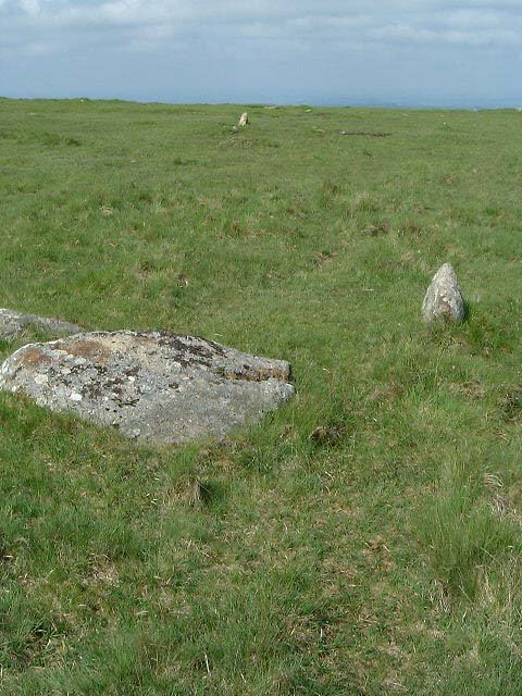
Sharpitor NW double row submitted by Brian Byng on 7th Feb 2002. Sharpitor NW double row looking southwest
(View photo, vote or add a comment)
Log Text: This is a very accessible stone row. Car parking is available adjacent to the row at SX 55678 70644.
Sharpitor NW single row
Date Added: 19th Jan 2018
Site Type: Stone Row / Alignment
Country: England (Devon)
Visited: Yes on 13th May 2015. My rating: Condition 1 Ambience 4 Access 5
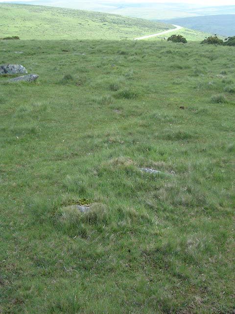
Sharpitor NW single row submitted by Brian Byng on 7th Feb 2002. Sharpitor NW single row, looking northeast
(View photo, vote or add a comment)
Log Text: This is a very accessible stone row. Car parking is available very close to the row at SX 55678 70644.
Sharpitor W
Date Added: 18th Jan 2018
Site Type: Stone Row / Alignment
Country: England (Devon)
Visited: Yes on 23rd Apr 2013. My rating: Condition 4 Ambience 4 Access 3
Sharpitor W submitted by SandyG on 11th Mar 2015. Despite consisting of a number of fairly substantial stones this stone row was not discovered until 1963. This photograph is of the terminal stone at the lower south western end of the row. View from north east (23rd April 2013).
(View photo, vote or add a comment)
Log Text: Car parking is available at SX 55678 70644. From here walk due west for about 700m.
Shaugh Moor row
Date Added: 27th Jan 2019
Site Type: Stone Row / Alignment
Country: England (Devon)
Visited: Yes on 22nd Oct 2014. My rating: Condition 3 Ambience 2 Access 4
Shaugh Moor row submitted by SandyG on 21st Feb 2015. A line of stones winding its way across Shaugh Moor. View from the south east (24th March 2013).
(View photo, vote or add a comment)
Log Text: Road side car parking is available at SX 55337 63758. From here walk south up the hill until you are clear of the china clay dump on your left. Carefully cross the road and head south east across the open moorland for about 260m.
Shaugh Moor Settlement
Date Added: 6th Aug 2015
Site Type: Ancient Village or Settlement
Country: England (Devon)
Visited: Yes on 6th Aug 2015
Shaugh Moor Settlement submitted by SandyG on 6th Aug 2015. Bronze Age round house at SX 55413 63407. The rocks to the left house form part of a contemporary field boundary. View from the south east. (16th May 2015).
(View photo, vote or add a comment)
Log Text: None
Shell Top Chambered Cairn
Date Added: 14th Feb 2020
Site Type: Cairn
Country: England (Devon)
Visited: Yes on 27th Apr 2011. My rating: Condition 3 Ambience 4 Access 3
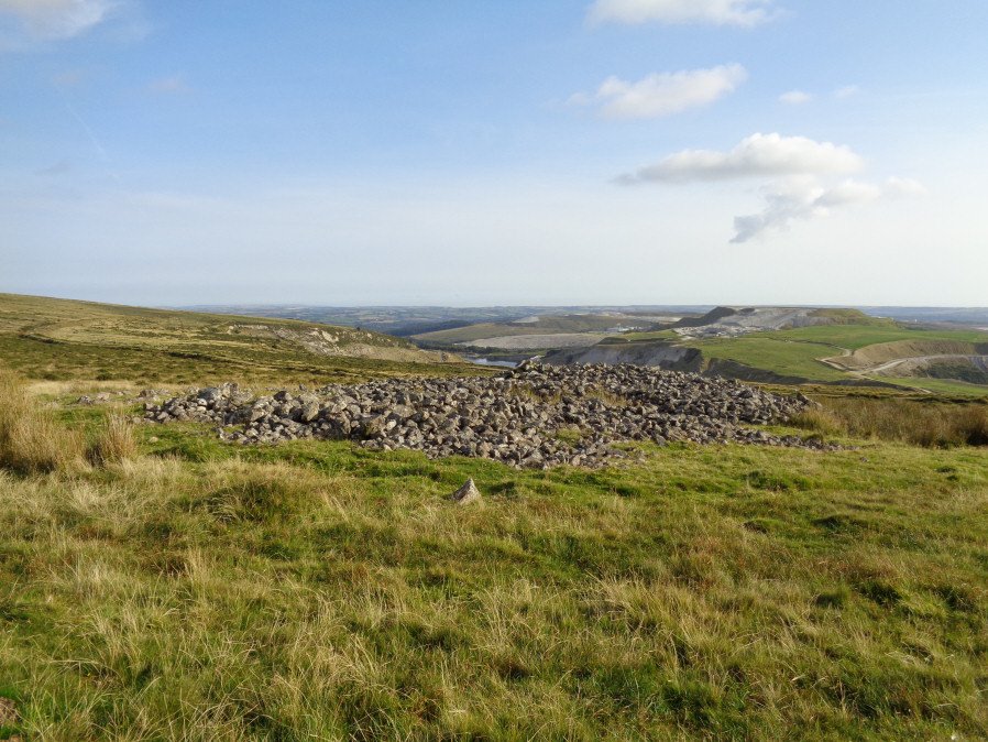
Shell Top Chambered Cairn submitted by davep on 2nd Dec 2019. The Shell Top Chambered Cairn from the Prehistoric Dartmoor Walks (PDW) website. Photograph taken 25th August 2017.
(View photo, vote or add a comment)
Log Text: None
Shell Top South-West stone row
Date Added: 27th Jan 2019
Site Type: Stone Row / Alignment
Country: England (Devon)
Visited: Yes on 2nd May 2013. My rating: Condition 2 Ambience 4 Access 3
Shell Top South-West stone row submitted by SandyG on 13th Mar 2015. A mound at the southern end of the row probably represents a cairn. View from the south (2nd May 2013).
(View photo, vote or add a comment)
Log Text: Car parking is available at SX 57055 63069. From here take the track leading north east which follows the northern edge of the Whitehill Yeo china clay pit. Follow this track to SX 59027 63098 then head due east for about 450m.
