Contributory members are able to log private notes and comments about each site
Sites SandyG has logged. View this log as a table or view the most recent logs from everyone
Searle’s Down
Date Added: 27th Jan 2019
Site Type: Stone Row / Alignment
Country: England (Cornwall)
Visited: Yes on 25th May 2017. My rating: Condition 2 Ambience 4 Access 4
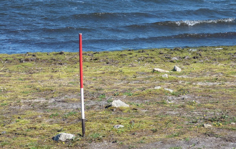
Searle’s Down submitted by SandyG on 19th Jan 2018. The stones nearest the reservoir. View from north west (Scale 1m).
(View photo, vote or add a comment)
Log Text: Most of the row is unavailable for inspection. The only part that is visible when the reservoir is not full is at SX17548 71361. Parking is available at SX 17572 70965. From here walk north along the edge of the reservoir.
Buttern Hill row
Date Added: 15th Jan 2018
Site Type: Stone Row / Alignment
Country: England (Cornwall)
Visited: Yes on 25th May 2017. My rating: Condition 3 Ambience 4 Access 3
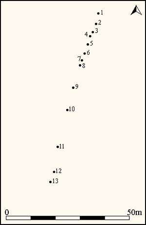
Buttern Hill row submitted by SandyG on 16th Jan 2018. Simplified plan of the Buttern Hill stone alignment (Source: Johnson, N. and Rose, P., 1994, 32 and fieldwork).
(View photo, vote or add a comment)
Log Text: Car parking is available at SX 18347 82645. Take the track leading south and follow to SX 17898 82272. From here walk around the northern slope of Buttern Hill to the row.
Higher White Tor stone row
Date Added: 16th Jan 2018
Site Type: Multiple Stone Rows / Avenue
Country: England (Devon)
Visited: Yes on 26th May 2017. My rating: Condition 3 Ambience 4 Access 3
Higher White Tor stone row submitted by cazzyjane on 9th Jan 2013. Higher White Tor Stone row. Looking down towards Longaford Tor.
(View photo, vote or add a comment)
Log Text: Car parking is available at SX 63757 77614. From here head a short distance along the B3212 towards Postbridge before crossing the road to join the Lychway. Follow the Lychway to SX 61805 77646 and then head towards Higher White Tor.
Conies Down
Date Added: 16th Jan 2018
Site Type: Multiple Stone Rows / Avenue
Country: England (Devon)
Visited: Yes on 29th May 2017. My rating: Condition 2 Ambience 5 Access 1

Conies Down submitted by Brian Byng on 7th Feb 2002. Conies Down Stone Row @ SX58597905 looking north
This row runs almost NS actual azimuth 10 deg. It is 172m long, difficult to find as the stones are small & only about 22 remain standing. The row runs slightly uphill to to a low mound possibly the remains of a burial - no
finds.
(View photo, vote or add a comment)
Log Text: This stone row stands within the Merrivale military live firing range and it is important that you check that there is no firing and that the range is open for visitors before you set off. It can be reached either from the west or south. If approaching from the west, car parking is available at SX 52178 77879. From the car park follow the track leading eastward. This is a bit of slog but has the advantage of passing the stone row at Langstone Moor. Alternatively, access from the south is much easier although there is no path. Car parking is available at SX 59145 76462 and from here you should head due north across Black Dunghill before crossing Conies Down Water.
A series of landmark reveals and other visual links to the surrounding landscape have been identified at Conies Down. These centre around a group of tors to the south west, but North Hessary Tor to the south and Conies Down Tor feature in what are a particularly interesting series of visual treats. The row itself is not remarkable but the way in which it seemingly relates to the surrounding landscape is.
Carneglos row
Date Added: 17th Jan 2018
Site Type: Stone Row / Alignment
Country: England (Cornwall)
Visited: Yes on 22nd Jun 2017. My rating: Condition 2 Ambience 3 Access 3
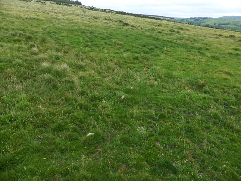
Carneglos row submitted by SandyG on 17th Jan 2018. View from above and north west (Scale 1m).
(View photo, vote or add a comment)
Log Text: Limited car parking is available at SX 19909 78177. From here follow the footpath south to the row. A map showing the footpath will be required.
East Moor stone row
Date Added: 17th Jan 2018
Site Type: Stone Row / Alignment
Country: England (Cornwall)
Visited: Yes on 23rd Jun 2017. My rating: Condition 3 Ambience 4 Access 3

East Moor stone row submitted by TheCaptain on 25th May 2010. When visiting East Moor stone row on Sunday 23 May, I found the row easily without resorting to my new GPS.
While part way walking along the row, which I thought would be recorded as a part of my track, an idea came to me. My new toy could be used to record each stone as I found it by making a waypoint.
Now its just a case of figuring out what to do with all the data. Here is a first attempt to show the results by simply reading the data into Google Earth.
(View photo, vote or add a comment)
Log Text: Limited car parking is available at SX 22112 78933. From here walk east and enter the moorland through a gate. Follow the track to SX 22205 78692 and then head up the hill towards the row. A map is recommended.
The Hurlers
Date Added: 13th Feb 2020
Site Type: Stone Circle
Country: England (Cornwall)
Visited: Yes on 23rd Jun 2017. My rating: Condition 4 Ambience 5 Access 4
The Hurlers submitted by mikeaitch on 21st Jun 2011. Hurlers summer solstice sunrise 2011.
Weather forecast wasn't good but luckily as the sun rose there was a 5 minute gap in the clouds! :)
(View photo, vote or add a comment)
Log Text: None
The Hurlers Pipers
Date Added: 13th Feb 2020
Site Type: Standing Stones
Country: England (Cornwall)
Visited: Yes on 23rd Jun 2017. My rating: Condition 5 Ambience 5 Access 4
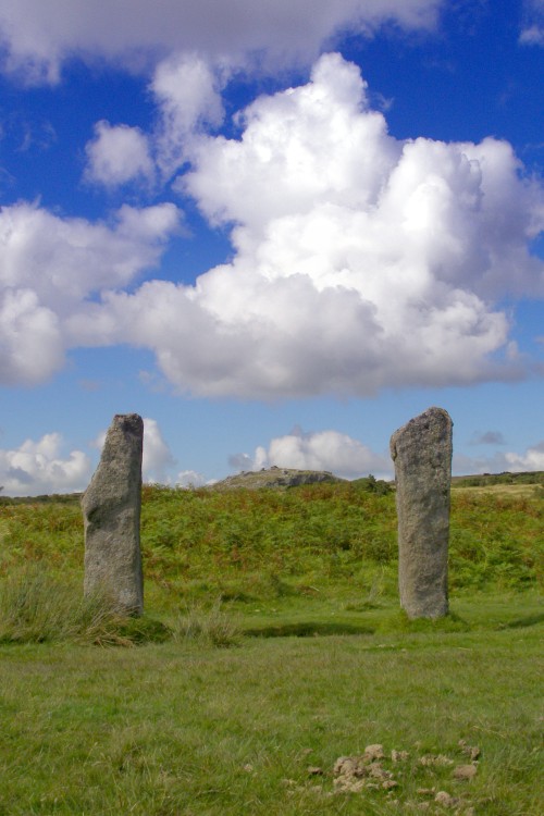
The Hurlers Pipers submitted by JimChampion on 24th Aug 2007. View through the 'goalposts' of the Pipers, neatly framing Stowe's Hill in the distance (home of the Cheesewring natural rock feature and the neolithic enclosure of Stowe's Pound). These two stones stand to the west of the Hurlers stone circles. The dung in the foreground is from the ponies that graze the moor.
(View photo, vote or add a comment)
Log Text: None
Craddock Moor stone row
Date Added: 18th Jan 2018
Site Type: Stone Row / Alignment
Country: England (Cornwall)
Visited: Yes on 24th Jun 2017. My rating: Condition 4 Ambience 4 Access 3
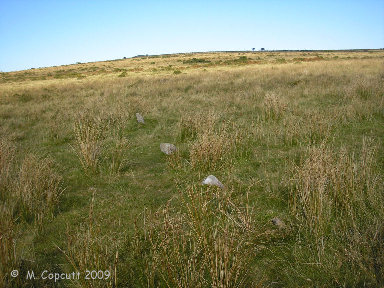
Craddock Moor stone row submitted by thecaptain on 13th Nov 2009. The stones are spaced nice and evenly at just over one metre from each other, and the row is nice and straight.
(View photo, vote or add a comment)
Log Text: Parking is available at SX 25967 71126. Follow the track northward to SX 25015 72002 then head west to the row.
Stripple Stones
Date Added: 13th Feb 2020
Site Type: Stone Circle
Country: England (Cornwall)
Visited: Yes on 25th Jun 2017. My rating: Condition 3 Ambience 4 Access 2
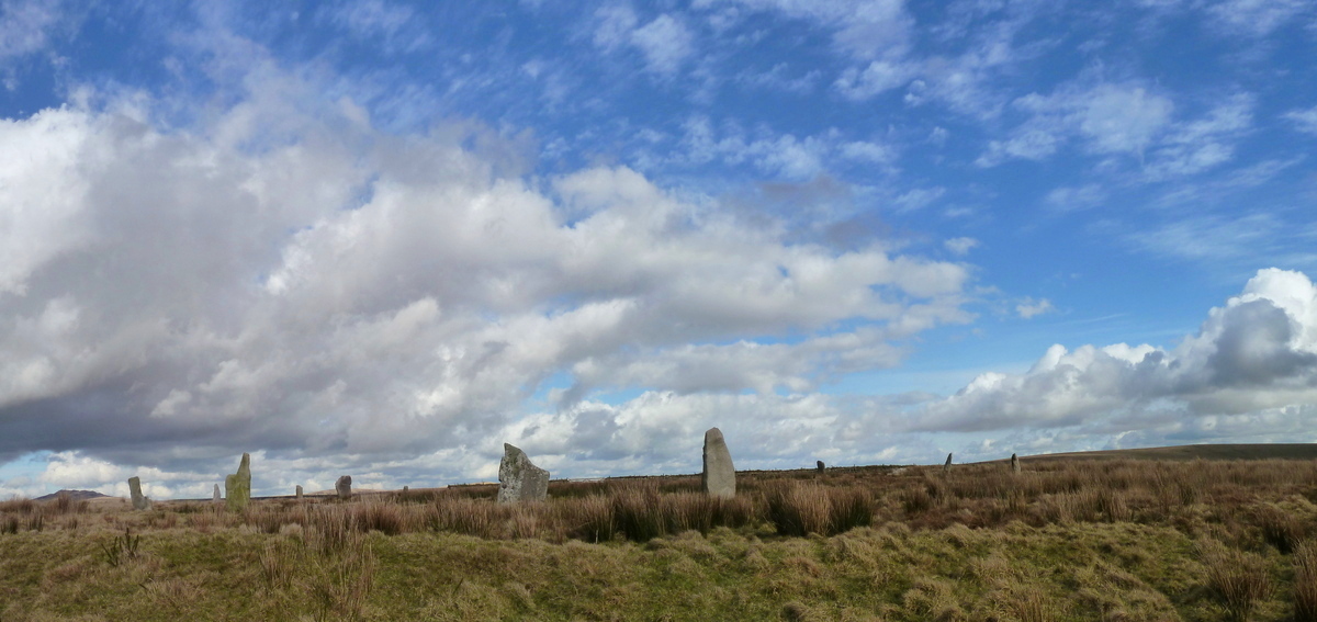
Stripple Stones submitted by Bladup on 14th Apr 2017. Stripple Stones Henge, Lots of stones have been put back up and it looks and feels amazing.
(View photo, vote or add a comment)
Log Text: None
Cardinham Moor row
Date Added: 19th Jan 2018
Site Type: Stone Row / Alignment
Country: England (Cornwall)
Visited: Yes on 26th Jun 2017. My rating: Condition 3 Ambience 4 Access 3

Cardinham Moor row submitted by Bladup on 29th Oct 2013. Cardinham Moor stone row (Colvannick Tor).
(View photo, vote or add a comment)
Log Text: Car parking is available at SX 13235 72552. From here walk south across the moorland to the row.
King Doniert's Stone
Date Added: 12th Feb 2020
Site Type: Ancient Cross
Country: England (Cornwall)
Visited: Yes on 26th Jun 2017. My rating: Condition 4 Ambience 3 Access 5
King Doniert's Stone submitted by cazzyjane on 14th Oct 2010. King Doniert's Stone.
(View photo, vote or add a comment)
Log Text: None
Leskernick Hill Row
Date Added: 16th Jan 2018
Site Type: Stone Row / Alignment
Country: England (Cornwall)
Visited: Yes on 27th Jun 2017. My rating: Condition 2 Ambience 5 Access 3
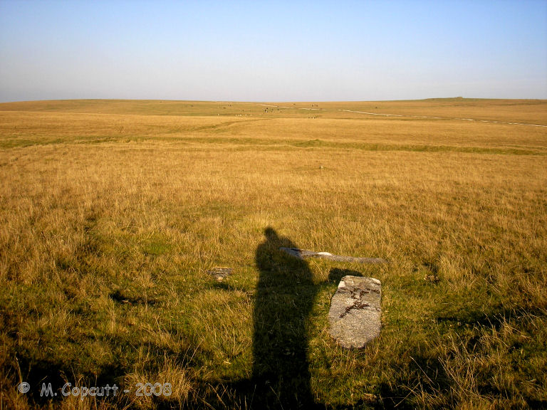
Leskernick Hill Row submitted by thecaptain on 9th Oct 2008. The three fairly large flat slabs at the western end.
View here looking east along the stone row, one of which can clearly be seen.
(View photo, vote or add a comment)
Log Text: I had the great fortune of being shown around the row by Roy Goutté and some members of the TimeSeekers Clearance Group, who were responsible for revealing many of the stones. I would like to thank them for their hospitality and sharing their considerable knowledge of the site. It was a pleasure to meet such interesting people.
This row has recently been partially cleared and recorded by the TimeSeekers Clearance Group led by Roy Goutté who found previously unrecorded stones and a possible cist. This work also revealed a visual treat which is certainly worth mentioning. Along the entire length of the row until the western end is reached at a point they call The Terminal, Brown Gelly complete with cairn on top is completely invisible. However, at the Terminal the cairn at the top of Brown Gelly is suddenly revealed though the hill itself remains hidden from view (Goutté, 2016, 3) Another example of a very precise visual relationship between a row and its landscape. The cumulative evidence for these visual links illustrates that the stone rows were carefully placed within the landscape to acknowledge and celebrate them. Goutté notes a second visual link available from The Terminal. At this point he notes that Brown Willy is perfectly framed in the saddle of rising ground” (Goutté, 2016, 2). This is reminiscent of the view available from the lower end of the Yar Tor stone alignment on Dartmoor.
In common with all the longer rows this alignment is far from straight and Goutté has identified a point close to the tinners’ gully where the orientation of the row shifts. This point may have been of particular significance to the row builders or may indicate an extension to the original row.
Limited parking is available at SX 20389 80372. From here follow the path westward to the row.
Leskernick cairn
Date Added: 16th Jan 2018
Site Type: Cairn
Country: England (Cornwall)
Visited: Yes on 27th Jun 2017. My rating: Condition 3 Ambience 5 Access 3
Leskernick cairn submitted by theCaptain on 27th Oct 2012. Looking westwards towards the cairn from the tin worked stream.
A couple of stones from the stone row can be seen
(View photo, vote or add a comment)
Log Text: None
Devil's Arrows
Date Added: 13th Jan 2019
Site Type: Stone Row / Alignment
Country: England (Yorkshire (North))
Visited: Yes on 1st Aug 2017. My rating: Condition 4 Ambience 3 Access 5

Devil's Arrows submitted by Sunny100 on 30th Apr 2011. Old b/w image of 'The Devil's Arrows stone row, north Yorkshire, showing the almost true alignement.
These Bronze-Age menhirs vary in height from between 16 to 22 feet and are heavily grooved with centuries of erosion.
(View photo, vote or add a comment)
Log Text: There is limited safe parking in the vicinity of the monument.
Broomrigg A
Date Added: 7th Jan 2018
Site Type: Stone Row / Alignment
Country: England (Cumbria)
Visited: Yes on 2nd Aug 2017. My rating: Condition 1 Ambience 2 Access 4
Broomrigg A submitted by rich32 on 22nd Jul 2004. Broomrigg A, Cumbria (NY548467)
The Broomrigg sites are set in a pine plantation and are near to a track This image shows part of Broomrigg ‘A’, it was quite difficult to get more in the shot due to the trees. I also found Broomrigg ‘B’, but gave up on ‘C’ & ‘D’ due to eating too many flies (protein or no protein not nice) and a dodgy GPS signal.
(View photo, vote or add a comment)
Log Text: The stone row is in a working forest and access is therefore sensibly restricted on occasions. Parking is available at NY 54190 46783. From here walk along the forest tracks to the row.
Eyre Stone Rows
Date Added: 6th Jan 2018
Site Type: Stone Row / Alignment
Country: Scotland (Isle of Raasay)
Visited: Yes on 4th Aug 2017. My rating: Condition 2 Ambience 4 Access 1
Eyre Stone Rows submitted by SandyG on 6th Jan 2018. Length of field boundary previously identified as a double stone row. View from south east (Scale 1m).
(View photo, vote or add a comment)
Log Text: The feature described in Canmore forms part of a field boundary that extends further west to NG 57452 34870. The length that was previously described is hidden by bracken making photography difficult in the summer months. The features described are however all discernible. The pairs of stones described are almost touching and represent two sides of an incomplete wall. Walls of this type are present in the vicinity and it was probably intended that the wall would have butted a nearby field boundary at around NG 57541 34821. This is definitely a field boundary and not a stone row.
Eyre Alignment
Date Added: 9th Jan 2019
Site Type: Stone Row / Alignment
Country: Scotland (Isle of Skye)
Visited: Yes on 5th Aug 2017. My rating: Condition 3 Ambience 5 Access 4

Eyre Alignment submitted by Creative Commons on 13th Apr 2010. Sornaichean Coir' Fhinn
A closer view of the stones
It is said that these stones were erected here by Fingal and his fellow hunters to suspend a pot in which whole deer were cooked over a fire to make venison stew.
Copyright John Allan and licensed for reuse under this Creative Commons Licence.
(View photo, vote or add a comment)
Log Text: The stones can be seen from the public highway, however if you wish to get up close, it is safest to park at NG 42052 51884 and follow the road on foot to the gateway at NG 41476 52636. From here cross the field to the stones.
Clach An Tursa
Date Added: 8th Jan 2019
Site Type: Stone Row / Alignment
Country: Scotland (Isle of Lewis)
Visited: Yes on 7th Aug 2017. My rating: Condition 3 Ambience 4 Access 4
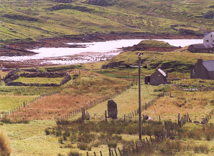
Clach An Tursa submitted by Andy B on 10th Dec 2004. A telephoto view from the road
(View photo, vote or add a comment)
Log Text: Access to the stone row from the public highway is available at NB 20211 42764. From here walk up to the house and seek permission. The stone row is situated in a small narrow field behind the house.
Cnoc Fillibhir Mhor
Date Added: 8th Jan 2019
Site Type: Stone Row / Alignment
Country: Scotland (Isle of Lewis)
Visited: Yes on 7th Aug 2017. My rating: Condition 2 Ambience 4 Access 3
Cnoc Fillibhir Mhor submitted by SandyG on 1st Jan 2018. Looking south along the row (Scale 1m).
(View photo, vote or add a comment)
Log Text: Car parking is available at NB 22492 32928. From here follow the path to Callanish 3 stone circle which is well worth visiting before heading south towards the high ground. Cross the boggy ground towards the gate that provides access to the field in which the row is situated. Visitors need to be aware that special care should be taken to protect against ticks. At the time of the visit large numbers of ticks were encountered at the stone row.
