Contributory members are able to log private notes and comments about each site
Sites SandyG has logged. View this log as a table or view the most recent logs from everyone
Kilpheder Wheelhouse
Date Added: 13th Sep 2016
Site Type: Ancient Village or Settlement
Country: Scotland (South Uist)
Visited: Yes on 20th May 2016
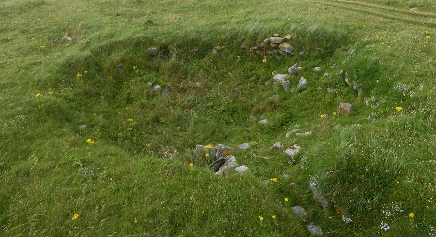
Kilpheder Wheelhouse submitted by SandyG on 20th May 2016. View from the south east (26 August 2015).
(View photo, vote or add a comment)
Log Text: None
Kilmichael Glassary 1
Date Added: 16th Feb 2020
Site Type: Rock Art
Country: Scotland (Argyll)
Visited: Yes on 16th Mar 2017. My rating: Condition 4 Ambience 3 Access 4
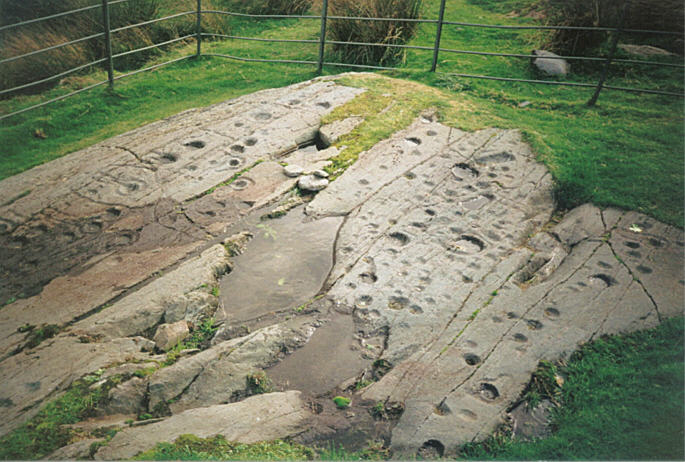
Kilmichael Glassary 1 submitted by hamish on 31st Jul 2005. What a great sight this is on the edge of a housing estate. For all the modernity around it is still enthralling to be here so much to see. Try counting them.
(View photo, vote or add a comment)
Log Text: None
Kildonan SW
Date Added: 8th Jan 2019
Site Type: Multiple Stone Rows / Avenue
Country: Scotland (Highlands)
Visited: Yes on 1st Sep 2016. My rating: Condition -1 Ambience 2 Access 5
Kildonan SW submitted by Tom_Bullock on 12th Dec 2004. Photo used by kind permission of Tom Bullock. More details of this location are to be found on his Stone Circles and Rows CD-ROM
(View photo, vote or add a comment)
Log Text: Sadly, car parking is available on top of the row. The stones visible next to the parking area are probably the result of the road widening work.
Kildonan NE
Date Added: 8th Jan 2019
Site Type: Multiple Stone Rows / Avenue
Country: Scotland (Highlands)
Visited: Yes on 1st Sep 2016. My rating: Condition 4 Ambience 4 Access 4
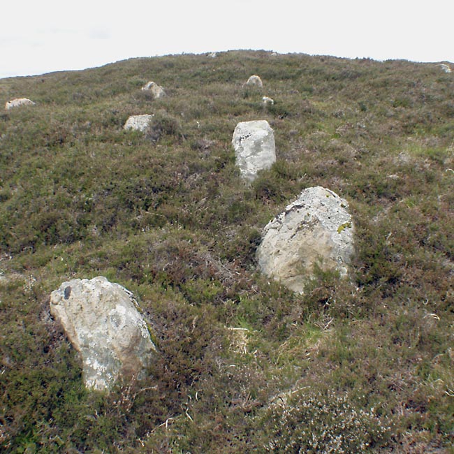
Kildonan NE submitted by Tom_Bullock on 12th Dec 2004. Photo used by kind permission of Tom Bullock. More details of this location are to be found on his Stone Circles and Rows CD-ROM
(View photo, vote or add a comment)
Log Text: Car parking is available at NC 96831 18754. From here walk about 380m to the north west across uneven open moorland.
Kestor Settlement
Date Added: 14th Feb 2020
Site Type: Ancient Village or Settlement
Country: England (Devon)
Visited: Yes on 1st Jan 1999. My rating: Condition 4 Ambience 5 Access 3
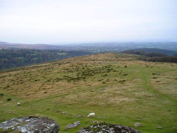
Kestor Settlement submitted by thecaptain on 24th Oct 2004. View northeast from Kestor rocks overlooking Kestor Settlement. The entire hilltop and hillsides here are covered in the ancient remains of ancient huts and field systems.
(View photo, vote or add a comment)
Log Text: Parking is usually available at NGR SX 6680 8655. Allow at least a day to explore this amazing prehistoric landscape.
Kes Tor Cairn
Date Added: 14th Feb 2020
Site Type: Cairn
Country: England (Devon)
Visited: Yes on 16th May 2019. My rating: Condition 2 Ambience 5 Access 4
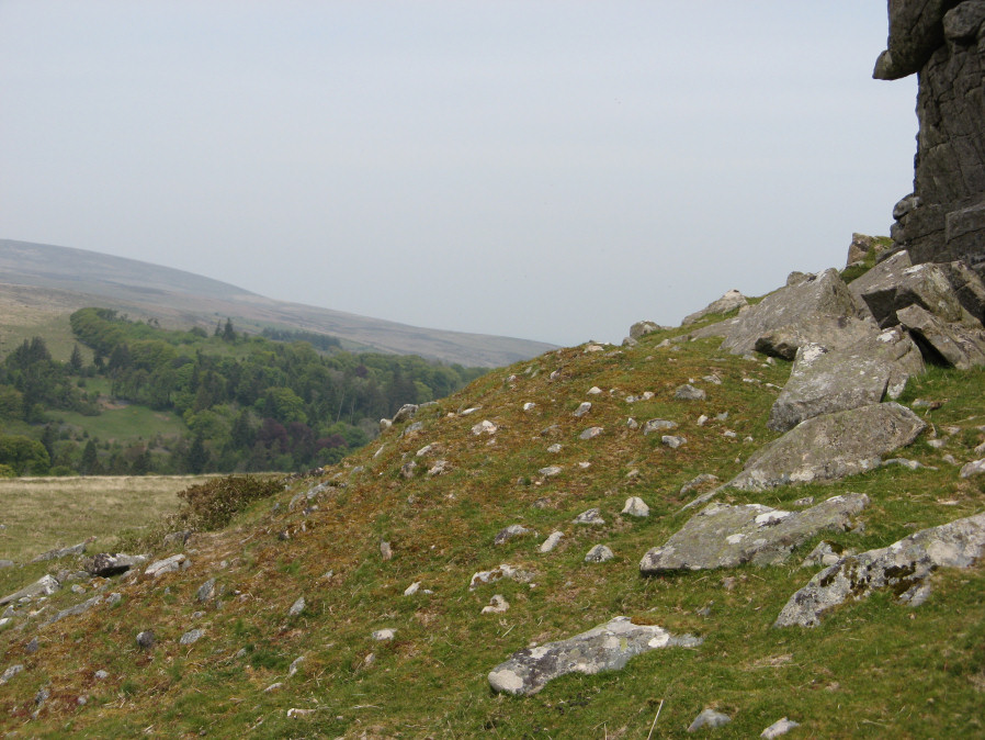
Kes Tor Cairn submitted by davep on 31st Jul 2019. Photograph taken 16th May 2019. Kes Tor Reported Cairn from Prehistoric Dartmoor Walks (site 1923).
(View photo, vote or add a comment)
Log Text: None
Kenidjack Common holed stones
Date Added: 29th Jan 2019
Site Type: Stone Row / Alignment
Country: England (Cornwall)
Visited: Yes on 9th May 2018. My rating: Condition 3 Ambience 4 Access 3
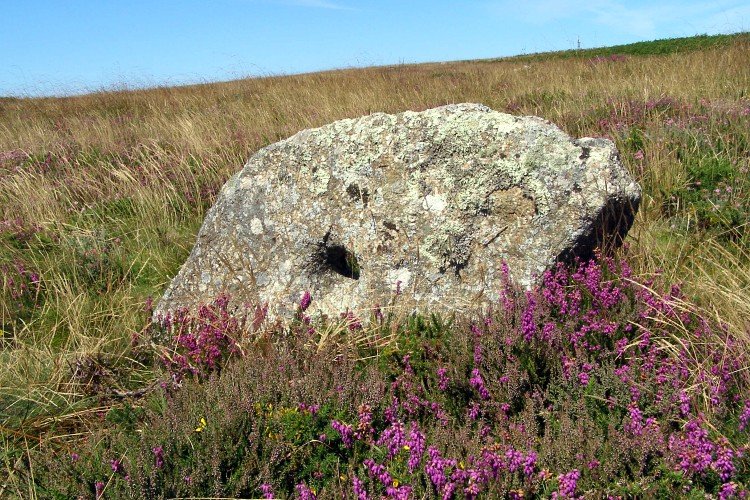
Kenidjack Common holed stones submitted by JimChampion on 24th Oct 2007. August 2007. One of the holed stones on Kenidjack Common, surrounded by flowering bell heather.
(View photo, vote or add a comment)
Log Text: Car parking is available at SW 39343 33369. From here walk west for a short distance along the highway to SW 39191 33324. Head south along the footpath to SW 39081 32899 and enter the common . Follow the track heading south west and then take the path to the south.
Joan Ford Newtake row
Date Added: 5th Feb 2020
Site Type: Multiple Stone Rows / Avenue
Country: England (Devon)
Visited: Yes on 4th Sep 2019. My rating: Condition 3 Ambience 4 Access 3
Joan Ford Newtake row submitted by TheCaptain on 14th Apr 2019. Viewed looking west
(View photo, vote or add a comment)
Log Text: Parking is available SX 65092 72766. From here head across the cattle grid and down the road. At SX 64744 72838 turn left and follow the track to SX 63288 71902. Follow the footpath into Joan Ford’s Newtake towards the stones.
Joan Ford Newtake E
Date Added: 13th Feb 2020
Site Type: Cairn
Country: England (Devon)
Visited: Yes on 4th Sep 2019. My rating: Condition 4 Ambience 5 Access 2
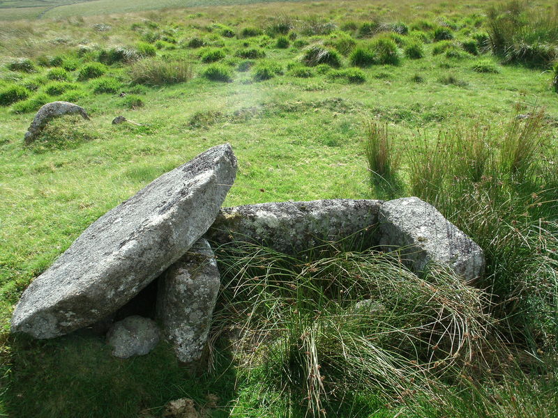
Joan Ford Newtake E submitted by Bladup on 20th Oct 2013. Joan Ford Newtake cairn circle and cist.
(View photo, vote or add a comment)
Log Text: None
Jarlshof
Date Added: 8th Feb 2020
Site Type: Ancient Village or Settlement
Country: Scotland (Shetland)
Visited: Yes on 11th Jun 2019. My rating: Condition 4 Ambience 5 Access 5
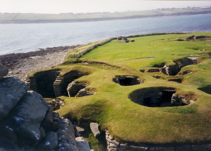
Jarlshof submitted by LizH on 17th Nov 2004. This picture of Jarlshof shows the beautiful setting of the site, and I think the foreground is the bronze age buildings!
(View photo, vote or add a comment)
Log Text: A must visit site. There is so much to see - a veritable palimpsest.
Isle Head
Date Added: 4th Feb 2019
Site Type: Promontory Fort / Cliff Castle
Country: Scotland (Dumfries and Galloway)
Visited: Yes on 6th Sep 2017. My rating: Condition 3 Ambience 5 Access 5
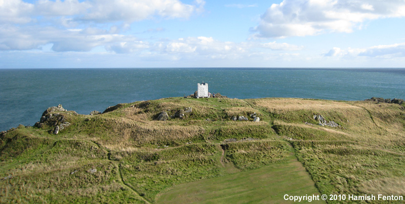
Isle Head submitted by h_fenton on 15th Feb 2011. Isle Head (Isle of Whithorn) Promontory Fort viewed from the north.
Kite Aerial Photograph
16 September 2010 @ 3pm
(View photo, vote or add a comment)
Log Text: None
Isbister: Tomb Of The Eagles
Date Added: 3rd Jan 2015
Site Type: Chambered Cairn
Country: Scotland (Orkney)
Visited: Would like to visit
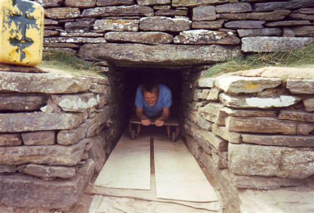
Isbister: Tomb Of The Eagles submitted by cosmic on 20th Feb 2005. Exiting the Tomb
(View photo, vote or add a comment)
Inveryne Stone Row
Date Added: 23rd Jan 2023
Site Type: Stone Row / Alignment
Country: Scotland (Cowal)
Visited: Yes on 24th Aug 2017. My rating: Condition 4 Ambience 3 Access 4
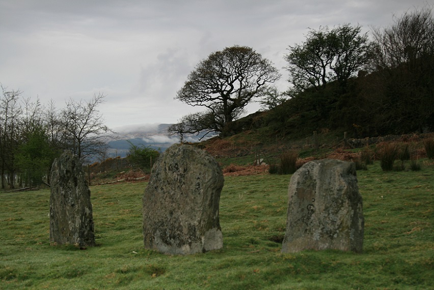
Inveryne Stone Row submitted by postman on 25th May 2013. 28th April, spring takes its time getting up here.
(View photo, vote or add a comment)
Log Text: None
Inverurie 1
Date Added: 30th Jan 2019
Site Type: Class I Pictish Symbol Stone
Country: Scotland (Aberdeenshire)
Visited: Yes on 21st Sep 2014. My rating: Condition 3 Ambience 4 Access 5
Inverurie 1 submitted by SandyG on 29th Dec 2014. Lichen covered Pictish symbol stone (21st September 2014).
(View photo, vote or add a comment)
Log Text: None
Inverewe
Date Added: 16th Feb 2020
Site Type: Class I Pictish Symbol Stone
Country: Scotland (Highlands)
Visited: Yes on 13th Jul 2018. My rating: Condition 2 Ambience 3 Access 5
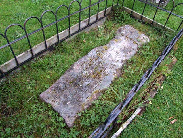
Inverewe submitted by andy_h on 14th Aug 2006. To be found in the ruined churchyard up the turning by the campsite, re-used as a grave slab. The stone is located at the back end of the ruined church and is a little hard to find, as it is very worn and looks much like other grave slabs around it. It depicts a crescent and a 'V'. Another Pictish stone can be seen in Gairloch Heritage Museum, which depicts a fish and the lower part of an eagle.
(View photo, vote or add a comment)
Log Text: Not sure I would have made the journey just to see this but I was staying at the nearby campsite for a few days and visited a few times to see if I could get the light right.
Hurston Ridge
Date Added: 14th Jan 2018
Site Type: Multiple Stone Rows / Avenue
Country: England (Devon)
Visited: Yes on 16th May 2015. My rating: Condition 5 Ambience 5 Access 3
Hurston Ridge submitted by SandyG on 2nd Aug 2015. The tallest stone stands at the upper southern end of the row. (16th May 2015).
(View photo, vote or add a comment)
Log Text: Car parking is available at SX 67576 81091. From here carefully cross the road and head north across open moorland. The row is about 1,300m from the car park. A map or reliable GPS device is highly recomended. Well worth the walk.
Hoscombe SE
Date Added: 3rd Feb 2020
Site Type: Stone Row / Alignment
Country: England (Somerset)
Visited: Yes on 10th Apr 2019. My rating: Condition 2 Ambience 4 Access 2
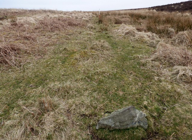
Hoscombe SE submitted by SandyG on 10th Oct 2019. Looking east along the southern part of the Black Barrow, South stone row (Scale 1m). Visited 10th April 2019.
(View photo, vote or add a comment)
Log Text: Limited car parking is available at SS 84543 44569. From here follow the track leading south west to SS 83567 43802. Then head west to the row. This route takes you past Coley Water, South and Porlock Allotment stone rows.
Horn's Cross
Date Added: 27th Dec 2014
Site Type: Ancient Cross
Country: England (Devon)
Visited: Yes on 4th Oct 2014
Horn's Cross submitted by SandyG on 4th Oct 2014. Horn's Cross has been heavily restored. The original socket stone supports a crude modern shaft to which the original head and arms have been attached by an iron band. The shaft bears traces of tare and feather working indicating that it was produced sometime after 1800. View from north east.
(View photo, vote or add a comment)
Log Text: None
Hook Lake Settlement
Date Added: 29th Sep 2014
Site Type: Ancient Village or Settlement
Country: England (Devon)
Visited: Yes on 28th Sep 2014
Hook Lake Settlement submitted by SandyG on 28th Sep 2014. The Hook Lake enclosures. View from south west.
(View photo, vote or add a comment)
Log Text: None
Hook Lake Row
Date Added: 27th Jan 2019
Site Type: Multiple Stone Rows / Avenue
Country: England (Devon)
Visited: Yes on 6th Apr 2013. My rating: Condition 3 Ambience 4 Access 1
Hook Lake Row submitted by SandyG on 4th Oct 2014. Prehistoric stone round house which incorporates a stone row orthostat in its wall. The ranging rod denotes the position of the earlier stone row orthostat. View from north.
(View photo, vote or add a comment)
Log Text: This has never been an easy row to get to. When visited in 2013 car parking was available at SX 62524 61120. Recently (2016) this car parking area has been closed making it much more difficult to access this part of the moor. The alternative car parking location is at SX 64342 59548. From here the easiest way to reach the row is probably to head east to the Two Moors Way at SX 65765 59965. Then follow the track north to SX 64400 64275 where the path to Hook Lake should be taken. Given the effort to get to the area it would be a good idea to have a look at the Upper Erme Row and some the amazing prehistoric settlements at the same time. A full day but hopefully a rewarding one. Best contemplated in the summer.
