Contributory members are able to log private notes and comments about each site
Sites Anne T has logged. View this log as a table or view the most recent logs from everyone
Chatton 2
Trip No.30 Entry No.2 Date Added: 14th Jun 2017
Site Type: Rock Art
Country: England (Northumberland)
Visited: Yes on 11th Jun 2017. My rating: Condition 2 Ambience 4 Access 4
Chatton 2 submitted by SolarMegalith on 18th Mar 2013. Close-up of the "television set" motif (photo taken on March 2013).
(View photo, vote or add a comment)
Log Text: Chatton 2, Rock Art, Northumberland: See visit report for Chatton 1a.
Chatton 1a
Trip No.30 Entry No.2 Date Added: 14th Jun 2017
Site Type: Rock Art
Country: England (Northumberland)
Visited: Yes on 11th Jun 2017. My rating: Condition 2 Ambience 4 Access 4
Chatton 1a submitted by SolarMegalith on 18th Mar 2013. Cup-and-ring mark on Chatton 1a panel shining in the sun after the rain (photo taken on March 2013).
(View photo, vote or add a comment)
Log Text: Chatton 1a, Rock Art, Northumberland: After our trip to the Farne Islands, as we were nearby and had an hour or so to spare, we decided to head off to Chatton to see if we could find the rock art and the rock shelter. Little did I realise that we’d be blown off the top of the hill – I found it almost impossible to stand and take photographs, despite it being a relatively calm, sunny day.
Andrew (husband) related that friends (Martin Green and Dot) who’d visited the trig point here had been unable to find any rock art. They also said that there was now a sign on the gate leading onto the track (at NU 07833 28678) leading up to the rock art site, but we didn't see any. However, the track was clear and easy to follow.
I confess to being really disappointed, as the marks were very worn and faint, and we had difficulty identifying them, even though we knew what we were looking for. We found three examples: Chatton 1a, Chatton 2 and Chatton 3.
Husband set off to the Ketley Crags rock shelter, but didn't take the camera with him, so a separate trip will be required (note: found an alternative route avoiding the stream).
Chapman's Stone
Trip No.124 Entry No.2 Date Added: 5th Apr 2019
Site Type: Standing Stone (Menhir)
Country: Scotland (Dumfries and Galloway)
Visited: Yes on 4th Apr 2019. My rating: Condition 3 Ambience 3 Access 5

Chapman's Stone submitted by Anne T on 5th Apr 2019. Standing just to the west of stone, looking eastwards. The end of the stone nearest us is the tapered end, which would have been the top of the stone when it stood upright.
(View photo, vote or add a comment)
Log Text: Chapman's Stone: Our second stop of the day, and easy to stop alongside the road where it widens slightly, at NY 10746 99049 and walked back the short way to the stone. The stone has a fence built right over the middle of it (it looks like it could be used as a stile). It’s eastern side looks as if it has been knocked and broken by farm equipment. Looking at where the stone is placed in the landscape, it is along an old drover’s road, with the River Annan to its western side; to the NE, there are two flat topped hills in the distance.
Chapman's Stone
Trip No.164 Entry No.2 Date Added: 27th Jun 2021
Site Type: Standing Stone (Menhir)
Country: Scotland (Dumfries and Galloway)
Visited: Yes on 25th Jun 2021. My rating: Condition 2 Ambience 3 Access 5

Chapman's Stone submitted by Anne T on 5th Apr 2019. Standing just to the north east of the stone, looking south west over the road, towards the course of the River Annan. Whilst Canmore classifies this stone as a prehistoric standing stone, they say "the stone traditionally marks the droving stance, and at a later date, the grave of a travelling horse trader" (called Chapman). We believe this is the ancient road to Carlisle from Glasgow, so the route may be really old, and this was one of the marker/way stone along that route.
(View photo, vote or add a comment)
Log Text: Chapman's Stone: Again, our second stop of the day, and I'd remembered wrongly there was a stile which allowed access to the field with this stone in. Rather, the stone acts as a stile, although the height of the fence and the barbed wire at the top stopped us from hopping over; neither could we find a gate on the side of the field nearest the road.
Such a shame this stone hasn't been set upright again. The views in either direction are very pretty.
Chapel Well (Staffield)
Trip No.90 Entry No.3 Date Added: 31st Jul 2018
Site Type: Holy Well or Sacred Spring
Country: England (Cumbria)
Visited: Yes on 30th Jul 2018. My rating: Condition 3 Ambience 5 Access 4
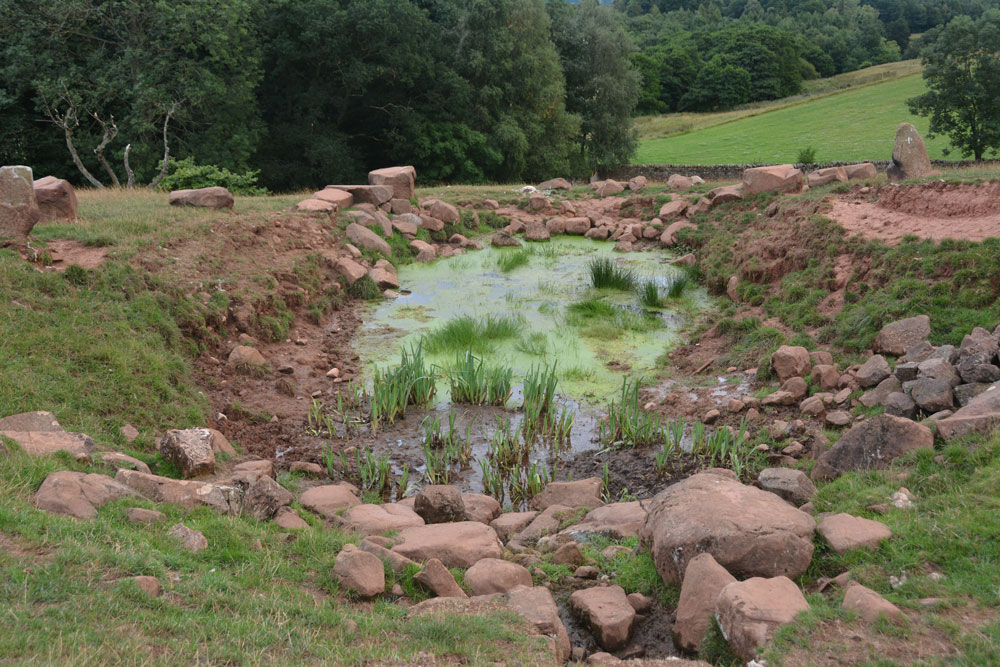
Chapel Well (Staffield) submitted by Anne T on 31st Jul 2018. The well with its pond, taken from the western end. The water bubbled out of the ground just in front of the stone bowl at the time of our visit, and was a fair flow. Between the well pool and the 'pond proper' were some lovely clumps of irises. Certainly peaceful and restful.
(View photo, vote or add a comment)
Log Text: Chapel Well, Near Staffield, Cumbria: Not far from the incised stone at Cross House. We parked near the junction down the hill where there was room to bump up onto the grass verge and walked to the gate at NY 53603 43081, which is signposted towards ‘Dale’. We kept the dry stone wall to our right hand side, and as we approached the gate into the wood, a stone drinking trough and a tree with a ditch leading from it came into view. Slightly up the slope there were some red sandstone boulders on the horizon, with a sheep track leading up to it.
The drinking trough is at NY 53774 43194 and is similar to the ones we saw at Newbeggin. The tree with its accompanying ditch is at NY 53778 43244, and there are signs of another stone structure under the tree, now dry and ruined, but possibly a secondary outlet for the well during wet weather. At the bottom of the slope, a small hole leads through the stone wall into Croglin Water just beyond.
This well is certainly in a lovely spot, hidden in a dip towards the top of the slope. There were two ‘standing stones’, one on either side of the large well pool; the rest of the large boulders had been quarried and placed around the top of the pool. A circular well bowl can be seen at the top, centre of the well, and a good flow of water came from the well (not as much as Powdonnet Well). Half a sheep had been left to rot at the south eastern end of the pool, which spoilt the ambience, and stopped me from exploring the exit pipe, but taking that away, we could have lingered for a long while. Beautiful!
Chapel Well (Cambusbarron)
Trip No.108 Entry No.7 Date Added: 10th Nov 2018
Site Type: Holy Well or Sacred Spring
Country: Scotland (Stirling)
Visited: Yes on 30th Oct 2018. My rating: Condition -1 Ambience 2 Access 4
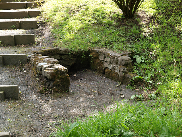
Chapel Well (Cambusbarron) submitted by peigimccann on 12th Sep 2016. Bruce's Well 7-7-09
(View photo, vote or add a comment)
Log Text: Bruce's Well, Cambusbarron: Even with the GPS from the Portal, we had great trouble finding this well, and in the end had to ask two locals. One pointed us to an old water fountain in a nearby park, now repurposed as a planter; the other took us to a footpath by the side of a small stream and pointed us down the path, saying “a lot of people come to look, but there’s not really much to see.”
We found the steps, as photographed on the Portal, but there was a sign declaring this the site of the well only.
In the middle of the village, a police officer was standing in a doorway with a number of people outside making phone calls. As we headed up the steps from the site of the well back to the car, a white clothed forensics officer exited the house. Haven't found out what happened, but this certainly made it a memorable visit to the site of this well.
Chantry Well (Brigham)
Trip No.91 Entry No.6 Date Added: 18th Aug 2018
Site Type: Holy Well or Sacred Spring
Country: England (Cumbria)
Visited: Yes on 14th Aug 2018. My rating: Condition -1 Ambience 2
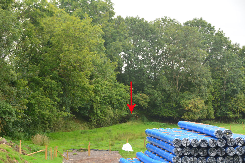
Chantry Well (Brigham) submitted by Anne T on 16th Aug 2018. This is the approximate site of the Chantry Well, as pointed out by the church warden of St. Bridgets, and as recorded by Pastscape Monument 9025 and the Old Cumbria Gazetteer. A new mains water pipeline is being driven through the field, although it was previously recorded the well was destroyed by quarrying. Some marshy ground still remains fenced off in the corner by the red arrow.
(View photo, vote or add a comment)
Log Text: Chantry Well, Brigham (Destroyed) The Reverend Mary told us there was a holy well at Brigham. There are actually 2 listed – Chantry Well and Nun’s Well, next to the A66.
Mr. Furness, the church warden also mentioned the well, but said it was no longer there. In the field opposite the church, a new water pipeline is being constructed. In the field to the south a new housing estate is also being built. There is no access into the field because of the building works, but the grid reference gives a point where the tree line bends.
Challacombe Cross Settlement
Trip No.130 Entry No.3 Date Added: 24th May 2019
Site Type: Ancient Village or Settlement
Country: England (Devon)
Visited: Yes on 11th May 2019. My rating: Condition 3 Ambience 4 Access 4

Challacombe Cross Settlement submitted by TheCaptain on 5th Mar 2017. A photo of what I have called Shapley Common Hut, taken during a walk at Easter 1988.
I dont believe this would be at the location given on the Portal sitepage, but more to the northeast, around SX697830, as our walk first took us south along the ridge to Hookney Tor and Grimspound
(View photo, vote or add a comment)
Log Text: Challacombe Cross/Shapley Common Hut Circles: Having seen quite a few hut circles in Northumberland, I wasn’t expecting much from this site – a few stony-outlined circles in the bracken, but what a lovely surprise this site was – hut circles with very large boulders making up the perimeter. It turned out this was just a taster of the sites we saw around Merrivale, Stanlake and Kestor.
From the Leeper/Leapra Cross, we walked WSW along the B3212 to SX 70049 83251, where an old hollow way/track leads up onto the moor. Armed with the GPS for the first part of the walk,
The hut circles can be clearly seen on UK Grid Reference Finder. The HE entry gives a location just to the west of the line of hut circles – they run from SX 69750 83029 in the south to SX 69779 83133 in the north. Unfortunately the GPS attachment for my camera seems to have stopped working, so I’m waiting for a plan of this site to arrive, so I can assign grid references to each of the hut circles.
Walking to the top hut circle, looking down towards the viewpoint just off the B3212 Princetown Road at SX 69834 83454, it was possible to get a photo of the hut circles all in a line down the hill. Whilst we saw many people head off northwards across the moor, there was no-one else on or near this site at all.
We must have spent a good hour photographing the hut circles and looking at the medieval banks and ditches, some of which cut the hut circles.
Chagford Druid's Well
Trip No.131 Entry No.1 Date Added: 3rd Jun 2019
Site Type: Holy Well or Sacred Spring
Country: England (Devon)
Visited: Yes on 11th May 2019. My rating: Condition 3 Ambience 4 Access 5
Chagford Druid's Well submitted by cazzyjane on 9th May 2012. Druid's Well, Chagford. Looks like a tiny quoit but has lots of clear water running from it.
(View photo, vote or add a comment)
Log Text: Druid's Well, near Chagford: Our first stop of the day, with bright sunshine and deep shadows. As we approached the well, this was our first of several encounters with a very friendly Granny looking after granddaughter on skittish, but beautiful, horse. Granny was following both round in a car, making sure horse and rider were OK on these narrow lanes. We passed them several times, and met Gran again later in the day outside her farm, when we were driving towards the burial chamber, when we needed to get past a large tractor and trailer going down the narrow, and very potholed lanes.
This well is just outside a property called Wellpark. At first it looks like a grass covered mound, but looking closer there is a well chamber, a large capstone and an exit water channel. On looking at the Pastscape entry, they mention another well recorded on the OS maps, only 9m away, built of an iron post and slate structure, now infilled. We didn't see this, although there was plenty of farm machinery and piles of stones and grit at the sides of the road.
Ceoppa's Barrow
Trip No.21 Entry No.2 Date Added: 5th May 2017
Site Type: Round Barrow(s)
Country: England (Tyne and Wear)
Visited: Yes on 4th May 2017. My rating: Condition 3 Ambience 4 Access 4
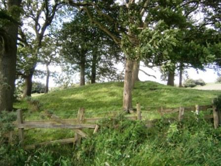
Ceoppa's Barrow submitted by durhamnature on 18th Jul 2012. View from south.
(View photo, vote or add a comment)
Log Text: Ceoppa's Barrow, Tyne & Wear: From Bucks Nook/North View, we headed off eastwards along Bradley Fell Road, taking the second right ((Kyo Lane), then dog-legging right/left along the Lead Road then down Horsegate Bank to Claython Terrace Road. Pulling in in the small layby next to the forestry track just before Heavygate Farm at NZ 12710 59129 we walked down the farmtrack running immediately to the west of Heavygate Farm.
Walking by the farmyard was an education in old farm equipment – old tractors, dumper trucks, old cars, pumps. The official grid reference for this barrow is NZ12605890, although I found it to be NZ12605890. Surprisingly, this barrow doesn’t seem to be scheduled.
The barrow is located not quite at the top of the hill, which seems to be at Broomfield Farm, but has brilliant views down to the Derwent Valley to the south.
The gates to the fields were wired shut, but we managed to get photographs from opposite the main entrance to the farm and the gates into the field at NZ 12775 58928. There was definite evidence of a surrounding ditch.
Cavers Cross
Trip No.93 Entry No.5 Date Added: 31st Aug 2018
Site Type: Ancient Cross
Country: Scotland (Scottish Borders)
Visited: Yes on 29th Aug 2018. My rating: Condition 2 Ambience 4 Access 5
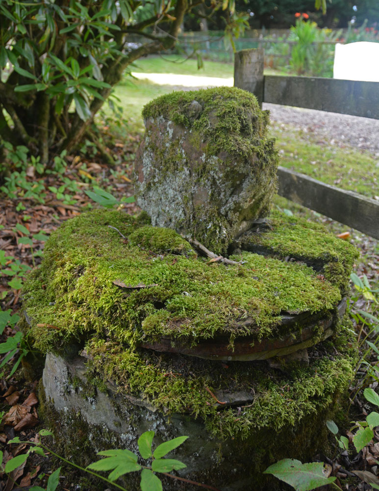
Cavers Cross submitted by Anne T on 31st Aug 2018. A view looking across the cross to the north, towards the small 'cross roads' in the centre of the hamlet of Cavers. The base is round but in pieces which have been stacked on top of each other, held together in places by old metal staples.
(View photo, vote or add a comment)
Log Text: Cavers Cross, near Hawick: From the motte, we drove round to Cavers – a very nicely kept estate, with well kept verges and few places to park along the straight, narrow road by the houses. In the end, we pulled right up to the fence at the largish entrance to a field gate at NT 54235 15805, intending to run back to the car if anyone thought we were in the way.
Walking south west towards the houses (I didn’t even recognise the Auld Kirk, as its been converted into a house with large driveway), we couldn’t see anything resembling a cross. There was a lady who was painting her fence and her large dog, who barked at us and sniffed my hands. I asked her if she knew of the remains of the cross, and she said, “Yes, but it’s only small”. She showed us where it was ‘hiding’ – behind a fence and shrubs in deep shade, then behind its own wooden fence, now much broken. She gave us permission to go into the garden of the holiday cottage as there was no-one there at the time of our visit. Whilst the Canmore record mentions the base of the cross (with the metal bands much visible), nothing is mentioned about the shaft it currently holds. This is of red sandstone and shaped, although much moss-covered.
Moving a small bit of stone near the join of the shaft and the base, there is evidence of a straight cut for part of the socket hole. We didn’t’ see any dowel holes, as the surface was moss and twig covered, but then the report that mentions this is dated 1933!
Caulks Well (Selkirk)
Trip No.158 Entry No.3 Date Added: 5th Mar 2020
Site Type: Holy Well or Sacred Spring
Country: Scotland (Scottish Borders)
Visited: Yes on 27th Feb 2020. My rating: Condition 3 Ambience 4 Access 4
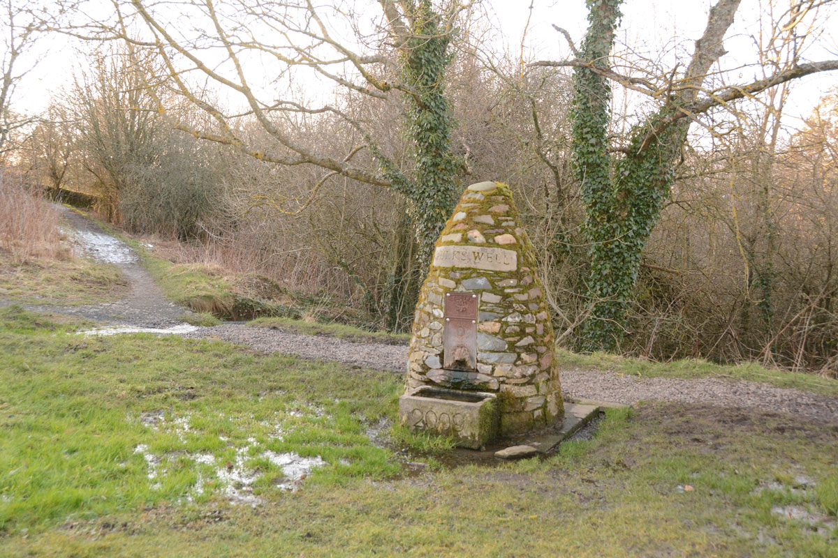
Caulks Well (Selkirk) submitted by Anne T on 5th Mar 2020. Standing just to the east of the well, at the bottom of one of the mounds on the golf course. There was so much water at the time of our visit that the whole area around the well was almost ankle deep in water. It was not obvious from standing by the well how the water arrives at this location, but standing where we parked at NT 47845 27908, just across the A699, there are a series of hills behind from which the water must run down to the well.
(View photo, vote or add a comment)
Log Text: Caulks Well, Selkirk Hill: No mention on Canmore.
We parked in a small layby at NT 47734 27869, which had been largely used for dumping road repair materials, then crossed to the northern side of the A699 and walked up (North East) to the Borders Abbey Way, and followed the track some 150 metres (part of the path were icy) to the well.
Right at the edge of the Golf Course, there is such a plentiful stream of water that there are three sources of the spring in the same small area: (1) at the base of the signpost; (2) at the well house itself, and (3) in a pool which emerges just to the south of the well house. The water tumbles down to the stream below.
Source: https://blackbob.org.uk/pdf/Trail1-SelkirkHill.pdf
Turn left, and follow the track until the Borders Abbeys Way signpost (12), turn left again, to follow the Way back to the A699. You pass the Hill Shelter (13), and a picnic bench (14), then Caulks Well (15), a drinking fountain. The water from here is so good to drink that a former Provost (who shall remain nameless!) used to bring a bottle to take water from it to have with his whisky; and an Italian woman, who met and married a soldier from Selkirk at the end of WW2, coming to live in the town, would drink nothing else."
Cat Stane (Inch)
Trip No.11 Entry No.2 Date Added: 26th Feb 2017
Site Type: Standing Stone (Menhir)
Country: Scotland (Midlothian)
Visited: Yes on 20th Feb 2017. My rating: Condition 2 Ambience 2 Access 5

Cat Stane (Inch) submitted by golux on 9th Feb 2014. View looking NW, without the incongruous background.
(View photo, vote or add a comment)
Log Text: Cat Stane (Inch), Standing Stone, Edinburgh: Also known as the Liberton Road / Gilmerton Road Standing Stone, this stone has obviously been relocated next to what appears to be the rear entrance of Inch View nursing home, off Gilmerton Road, next to Inch Park. Driving into the complex from Gilmerton Road, there is a circular car park in front of you. Immediately to 12 o’clock of this circle is a small access road to (the rear?) of Inch View Care Home for the Elderly. Just before a small wooden hut, the stone is located in a small rectangle of grass, surrounded by a knee high metal railing.
This area appeared to be a garden, so I started to take some quick photos, only to be challenged (quite rightly!) by one of the nurses who shot out to talk to us. She explained for security reasons, they needed to be vigilant for visitors. Having explained what we were doing, she told us some of the history of the surrounding area, particularly relevant to fans of Sir Walter Scott and Mary Queen of Scots.
Not in an impressive location, this stone could easily be mistaken for a large garden ornament, but worth seeing whilst in the area. I spotted some quarry marks in the face facing the building.
Castleton (Newcastleton)
Trip No.31 Entry No.3 Date Added: 30th Jun 2017
Site Type: Ancient Cross
Country: Scotland (Scottish Borders)
Visited: Yes on 24th Jun 2017. My rating: Condition 1 Ambience 4 Access 5
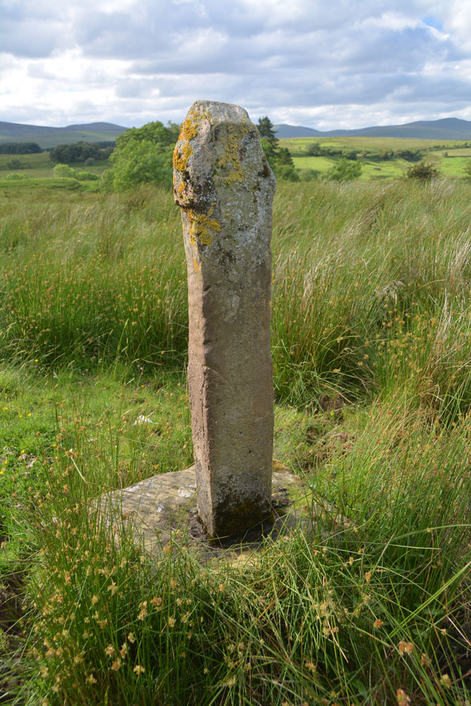
Castleton (Newcastleton) submitted by Anne T on 30th Jun 2017. Standing just behind the cross at its eastern side, looking back over the Liddel Water valleys.
(View photo, vote or add a comment)
Log Text: Castleton Cross, Near Newcastleton: Whilst this cross can be seen from the road, it is best viewed from the field (gate opposite the cemetery, otherwise its a clamber over a barbed wire fence in boggy ground). The shaft is a modern replacement, made of concrete. The field contains many lumps and bumps - the remains of the old village. This spot is virtually opposite Old Castleton earthworks (Liddel Castle) and with the enigmatic cemetery with its strange grave markers and brilliant views, it was well worth the stop. Shame the road was so busy at this time on night; cars whizzed by at 60 mph at regular intervals. Not the safest place to walk.
Castleton (Dollar)
Trip No.84 Entry No.6 Date Added: 26th Jul 2018
Site Type: Standing Stone (Menhir)
Country: Scotland (Clackmannanshire)
Visited: Yes on 14th Jul 2018. My rating: Condition 4 Ambience 4 Access 4

Castleton (Dollar) submitted by Anne T on 26th Jul 2018. Standing stone in Clackmannanshire Scotland. Standing just to the south west of the stone, looking at its location in relation to the surrounding hills and capturing its shadow at this time of the evening.
(View photo, vote or add a comment)
Log Text: Castleton Standing Stone, Pool of Muckhart: To find this stone, we followed the signs to the ‘Japanese’ garden, which had a large car park. The entrance and part of the car park were still in the process of being constructed, but was obviously just about to close for the night, so we parked as close a wall outside the entrance. Scanning the field for a gate, there was one by the farm house, some distance away (and it looked as if there was a small stream we’d have had to cross to reach the stone) or an old, painted red iron gate (very ornate) virtually opposite from where we parked. This had not been used in some time, and our usual gate opening skills didn’t work. We ended up climbing over the gate and walked across the field.
It was by now so hot and sticky, that the sheep had taken shelter under the trees to the east of this stone, in what looked like an old sheep fold, now fallen into ruin. This standing stone had two sides which were eroded, one with what looked like cups, but (having seen similar examples doing the ERA data entry exercise) are probably small holes where pebbles have fallen out, or possible solution holes if the stone had lain on the ground for some considerable time.
A very lovely spot, with gentle rolling hills to the north and north west.
Castlesteads (Yanwath Wood)
Trip No.68 Entry No.7 Date Added: 7th Apr 2018
Site Type: Ancient Village or Settlement
Country: England (Cumbria)
Visited: Yes on 5th Apr 2018. My rating: Condition 2 Ambience 3 Access 3
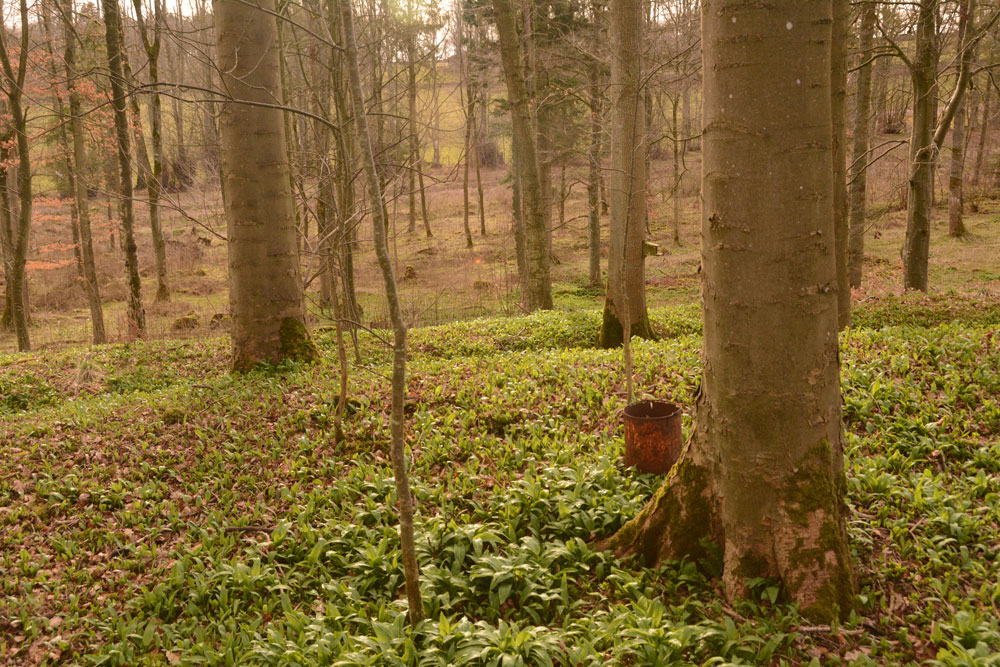
Castlesteads (Yanwath Wood) submitted by Anne T on 7th Apr 2018. Standing just inside the inner bank on the north western side of the enclosure looking across a ditch and two banks.
(View photo, vote or add a comment)
Log Text: Castlesteads (Yanwath Woods), Cumbria: This hillfort/enclosure is a pleasant stroll away from St. Michael’s Church and Lowther Castle, along footpaths and forest tracks, crossing the River Lowther either on the road or the footpath. After crossing the river, we followed the forest track north then to the west when the track split some 100 metres or so after the river crossing. The track following the river was full of dog walkers from the nearby holiday/caravan park, although heading up into the forest, it was peaceful and calm.
This was a very strange site, as there is higher ground to the north/north west of this enclosure. There were some huge boulders within the interior of the enclosure. Some made up what seemed to be wall lines, others just seemed scattered about.
The northern part of the enclosure seems to have been clipped by the construction of the forest track, and this has removed the outer banks and ditches on this side.
Castlesteads (Lowther)
Trip No.68 Entry No.6 Date Added: 10th Apr 2018
Site Type: Misc. Earthwork
Country: England (Cumbria)
Visited: Yes on 5th Apr 2018. My rating: Condition 2 Ambience 4 Access 4
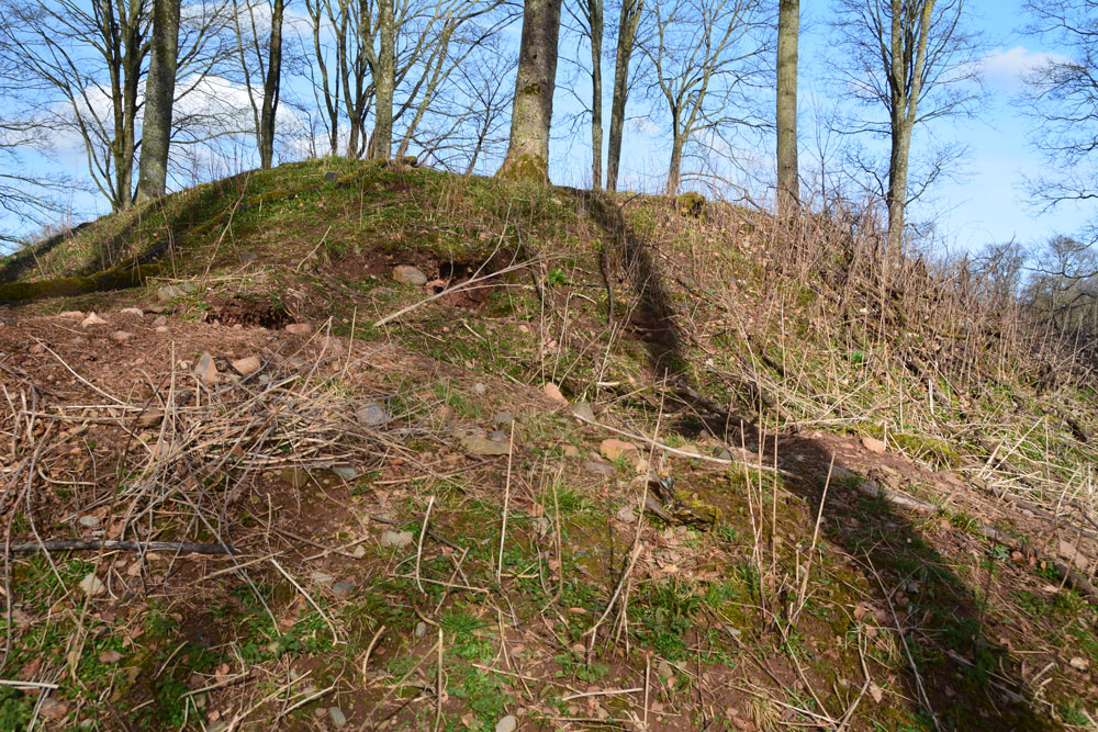
Castlesteads (Lowther) submitted by Anne T on 10th Apr 2018. Approaching the earthworks from its north western side. The bank rises rapidly from the River Lowther below. It's a very strategic spot on a curve of the river.
(View photo, vote or add a comment)
Log Text: Castlesteads Earthworks, Lowther Castle: This Castlesteads (as opposed to the Iron Age settlement we visited next) is just over 220 metres south of the gate into St. Michael’s Churchyard.
Being on a high spot above a bend in the River Lowther, it looks like a very strategic spot to build a defensive structure. In fact, Pastscape says it’s the remains of an old Pele Tower or other medieval building.
Hidden in the woods, but with a footpath leading to it, it is an intriguing ruin, with high banks on all four sides of a rectangle and remnants of the masonry on its western edge.
Castlehowe Scar Stone Circle
Date Added: 8th Sep 2014
Site Type: Stone Circle
Country: England (Cumbria)
Visited: Yes on 7th Sep 2014. My rating: Condition 3 Ambience 4 Access 5
Castlehowe Scar Stone Circle submitted by baz on 3rd May 2003. Castlehowe Scar Stone Circle (NY587155).
Ten stones form this small stone circle which is now huddled up against a drystone wall, in a field with a locked gate. On the other side of the wall, there appears to be a stone row.
(View photo, vote or add a comment)
Log Text: Castlehowe Scar Stone Circle, near Shap, Cumbria: Having previously stopped at the Thunder Stone 200 metres to the west of Castlehowe Scar Farm, we drove almost 1 kilometre up to this little stone circle. All the land from the Thunder Stone up to Castlehouse Scar Wood on the right hand side of the road is labelled as access land on the Ordnance Survey maps. Immediately before the wood there is a single track metalled road, which turns right towards Hardendale Quarry, with room for 2-3 cars to park on the verge next to the field containing the stone circle.
Whilst the land is labelled access land, there was a padlock on the gate to the field, so we explored from the field next door, where there seemed to be a few red granite stones poking up through the grass in the field. ‘A stone row’, my husband pronounced.
Having driven over 60 miles to get here, and having checked that the field really was access land, in frustration we ended up climbing over the gate to walk quickly round this small stone circle (this is in complete contrast to the farmer at the Gamelands Stone Circle, near Orton, who had very kindly put in a kissing gate to allow entry). There was a water container left close to the stones by the farmer, and I was sorely tempted to try and move this out of the way to avoid it spoiling the photographs, but didn’t dare (and I suspect I would have needed a tractor to attempt it).
All the stones were red Shap granite – we wondered after if they had been polished at some stage in the past to make them shine. The red of the granite certainly stood out amongst the white/grey of the natural limestone bedrock nearby. Checking on the geology of the area when we got home, these red granite stones seem to only came from a very small area, so any of these red stones would have needed to have been quarried and moved up to their current locations.
Strangely, to me, the size of the stones seemed large in comparison to the diameter of the circle, as they did what remained of Kemp Howe at the edge of Shap Village.
Whilst we were parked at Castlehowe Stone Circle, there were many cars coming and going – dog walkers, people doing outdoor activities (we thought they might be cavers) and the owner of the wood next door. Curious that so many people were around, but no-one took any notice of the stone circle, apart from us – perhaps they are all too familiar with it.
We next drove on to Iron Hill, further down the minor road running alongside Castlehouse Scar Wood to Hardendale Quarry to continue our Stone Circle and Cairn adventure.
Castle Law
Trip No.85 Entry No.1 Date Added: 26th Jul 2018
Site Type: Hillfort
Country: Scotland (Midlothian)
Visited: Yes on 15th Jul 2018. My rating: Condition 3 Ambience 4 Access 4
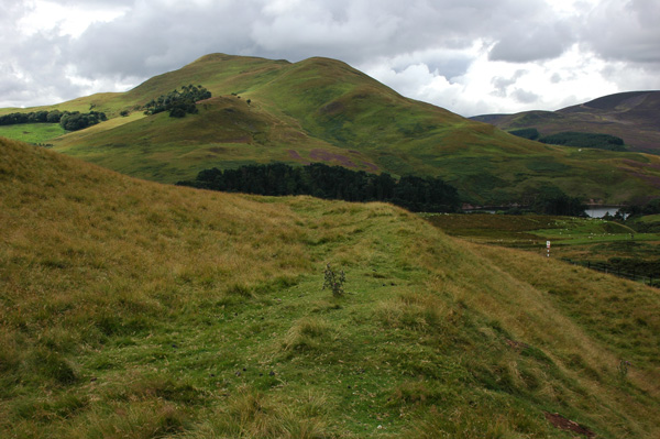
Castle Law submitted by nicoladidsbury on 14th Oct 2007. Castlelaw Hillfort - this photo shows the earth banks and terraces of the hill fort.
(View photo, vote or add a comment)
Log Text: Castle Law Hillfort, Glencorse: First stop of the day, and I was surprised this hill fort was so close to a modern military firing range. Because of its proximity to Edinburgh, there were a few other people parked in the small car park below the fort, but very few walked up onto it; a track carried on up the hill.
The earth house was very unusual, with steps leading down into it, and a narrow, curving passage leading into it. About half way down, a small doorway leads into a circular chamber.
We searched, and found, the cup marked stone towards the eastern wall of the terminus. If other stones had been put on top of this, the cups couldn’t have been seen. It was difficult to capture the cups (and some micro-cups?) in the dim lighting, even using flash and a torch, and had me giggling with our efforts to get a good photograph.
We walked round the inner defences of the fort, admiring the shooting range below, then carried on up the hill to what was left of the palisaded settlement. Walking up the hill to this site gave us an excellent view down on to the hillfort.
Castle Knowe (Glencorse)
Trip No.85 Entry No.2 Date Added: 27th Jul 2018
Site Type: Ancient Village or Settlement
Country: Scotland (Midlothian)
Visited: Yes on 15th Jul 2018. My rating: Condition 2 Ambience 3 Access 4
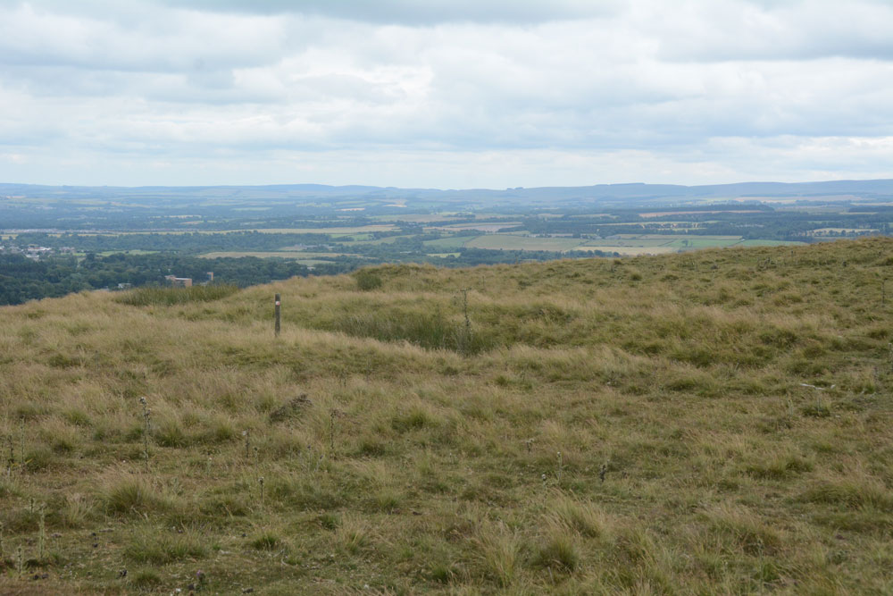
Castle Knowe (Glencorse) submitted by Anne T on 27th Jul 2018. The main line of the low palisade bank/trench to the north eastern side of this palisaded settlement.
(View photo, vote or add a comment)
Log Text: Castle Knowe Palisaded Settlement, Glencorse: From Castle Law hill fort, we continued northwards up the track, turning right up another footpath onto the Castle Knowe Palisaded Settlement. I stopped half way up to get some photos of Castle Law Hill Fort, looking down on it. There were a few other people walking up the track, and whilst they had largely stopped at the fort to look quickly around, no-one paid any attention to this settlement.
There wasn’t a lot to see, apart from some small boundary banks and ditches on the northern and just the north eastern side. There is a modern cairn on top – just a pile of red sandstone rocks, but this was very eye-catching, particularly from the car park and fort below, mostly because of its red colour.
The military earthworks to the north of this settlement look like a much more substantial monument, but are just for military training exercises.
Whilst there were only a couple of the palisade trenches visible on the north and north east side of the settlement, and possibly signs of one of the timber house circles, it was well worth walking further up the hills for the views to the east and north.
