

<< Our Photo Pages >> Castlehowe Scar Stone Circle - Stone Circle in England in Cumbria
Submitted by baz on Tuesday, 06 May 2003 Page Views: 12861
Neolithic and Bronze AgeSite Name: Castlehowe Scar Stone CircleCountry: England County: Cumbria Type: Stone Circle
Nearest Town: Shap Nearest Village: Hardendale
Map Ref: NY5874815472 Landranger Map Number: 91
Latitude: 54.532832N Longitude: 2.638992W
Condition:
| 5 | Perfect |
| 4 | Almost Perfect |
| 3 | Reasonable but with some damage |
| 2 | Ruined but still recognisable as an ancient site |
| 1 | Pretty much destroyed, possibly visible as crop marks |
| 0 | No data. |
| -1 | Completely destroyed |
| 5 | Superb |
| 4 | Good |
| 3 | Ordinary |
| 2 | Not Good |
| 1 | Awful |
| 0 | No data. |
| 5 | Can be driven to, probably with disabled access |
| 4 | Short walk on a footpath |
| 3 | Requiring a bit more of a walk |
| 2 | A long walk |
| 1 | In the middle of nowhere, a nightmare to find |
| 0 | No data. |
| 5 | co-ordinates taken by GPS or official recorded co-ordinates |
| 4 | co-ordinates scaled from a detailed map |
| 3 | co-ordinates scaled from a bad map |
| 2 | co-ordinates of the nearest village |
| 1 | co-ordinates of the nearest town |
| 0 | no data |
Internal Links:
External Links:
I have visited· I would like to visit
markj99 visited on 19th Feb 2023 - their rating: Cond: 2 Amb: 4 Access: 5 Castlehowe Scar Stone Circle is easy to visit, located adjacent to a minor road to Orton near Shap. This small stone circle consists of an assortment of rounded stones. Despite its stature this site is well worth a visit.
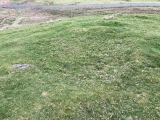
TheCaptain visited on 19th Sep 2022 - their rating: Cond: 3 Amb: 3 Access: 5 Onwards to Castlehowe Scar Stone Circle, my first new circle of the day. Easy parking beside the small lane running south, and its easy to see the circle just in the next field, but no entrance available today. It’s a small scruffy circle of large boulders, close to the field wall and with a cattle feeder placed inside it.
drolaf visited on 6th Aug 2020 - their rating: Amb: 3 Access: 4
SumDoood visited on 22nd Mar 2015 - their rating: Cond: 2 Amb: 3 Access: 5 Dull really, but the stones (rows) leading south across open ground into the shallow valley might cause you some thought.
Anne T visited on 7th Sep 2014 - their rating: Cond: 3 Amb: 4 Access: 5 Castlehowe Scar Stone Circle, near Shap, Cumbria: Having previously stopped at the Thunder Stone 200 metres to the west of Castlehowe Scar Farm, we drove almost 1 kilometre up to this little stone circle. All the land from the Thunder Stone up to Castlehouse Scar Wood on the right hand side of the road is labelled as access land on the Ordnance Survey maps. Immediately before the wood there is a single track metalled road, which turns right towards Hardendale Quarry, with room for 2-3 cars to park on the verge next to the field containing the stone circle.
Whilst the land is labelled access land, there was a padlock on the gate to the field, so we explored from the field next door, where there seemed to be a few red granite stones poking up through the grass in the field. ‘A stone row’, my husband pronounced.
Having driven over 60 miles to get here, and having checked that the field really was access land, in frustration we ended up climbing over the gate to walk quickly round this small stone circle (this is in complete contrast to the farmer at the Gamelands Stone Circle, near Orton, who had very kindly put in a kissing gate to allow entry). There was a water container left close to the stones by the farmer, and I was sorely tempted to try and move this out of the way to avoid it spoiling the photographs, but didn’t dare (and I suspect I would have needed a tractor to attempt it).
All the stones were red Shap granite – we wondered after if they had been polished at some stage in the past to make them shine. The red of the granite certainly stood out amongst the white/grey of the natural limestone bedrock nearby. Checking on the geology of the area when we got home, these red granite stones seem to only came from a very small area, so any of these red stones would have needed to have been quarried and moved up to their current locations.
Strangely, to me, the size of the stones seemed large in comparison to the diameter of the circle, as they did what remained of Kemp Howe at the edge of Shap Village.
Whilst we were parked at Castlehowe Stone Circle, there were many cars coming and going – dog walkers, people doing outdoor activities (we thought they might be cavers) and the owner of the wood next door. Curious that so many people were around, but no-one took any notice of the stone circle, apart from us – perhaps they are all too familiar with it.
We next drove on to Iron Hill, further down the minor road running alongside Castlehouse Scar Wood to Hardendale Quarry to continue our Stone Circle and Cairn adventure.
Richard13 visited on 1st Mar 2007 - their rating: Cond: 3 Amb: 3 Access: 4
BolshieBoris visited on 1st Jan 1995 - their rating: Cond: 3 Amb: 3 Access: 5
MAIGO FrothNinja have visited here
Average ratings for this site from all visit loggers: Condition: 2.67 Ambience: 3.29 Access: 4.71
")
For more information see Pastscape Monument No. 11775 which describes this as a "small stone circle 220m SE of Castlehowe Scar. It consists of a circle 5m in diameter of 11 variably spaced boulders, 10 of which are rounded pink granite and one being hewn blue granite."
The circle is also scheduled as Historic England List ID 1011610(Small stone circle 220m south-east of Castlehowe Scar), which adds: "The monument is not known to have been excavated. The monument does not extend south of the field boundary".
You may be viewing yesterday's version of this page. To see the most up to date information please register for a free account.
")
")
")
")
")
")
")
")
")
")
")
")
")
")
")
")
")
")
")
")
")
")
")
")
")
These are just the first 25 photos of Castlehowe Scar Stone Circle. If you log in with a free user account you will be able to see our entire collection.
Do not use the above information on other web sites or publications without permission of the contributor.
Click here to see more info for this site
Nearby sites
Key: Red: member's photo, Blue: 3rd party photo, Yellow: other image, Green: no photo - please go there and take one, Grey: site destroyed
Download sites to:
KML (Google Earth)
GPX (GPS waypoints)
CSV (Garmin/Navman)
CSV (Excel)
To unlock full downloads you need to sign up as a Contributory Member. Otherwise downloads are limited to 50 sites.
![]()
![]()
Turn off the page maps and other distractions
Nearby sites listing. In the following links * = Image available
61m S 191° Castlehowe Scar Stone Row* Stone Row / Alignment (NY5873615412)
354m WSW 258° Castlehow Stones Stone Row / Alignment (NY584154)
587m WNW 283° Thunder Stone (Castlehowe Scar)* Natural Stone / Erratic / Other Natural Feature (NY5817615610)
1.1km SE 126° Iron Hill North* Stone Circle (NY59631482)
1.1km SE 128° Iron Hill South* Stone Circle (NY59641476)
1.8km S 171° Hardendale Timber Circle (NY590137)
1.8km NW 318° Cross Shaped Stone of Keverigg* Ancient Cross (NY5751916849)
1.9km NW 318° Cross Stone of Keverigg Ancient Cross (NY57511687)
2.2km SSE 165° Kalmott cairn circle* Ring Cairn (NY59301333)
2.3km SSE 168° Oddendale stone alignment* Stone Row / Alignment (NY5919113205)
2.5km WSW 254° The Giant's Foot (Cumbria)* Standing Stone (Menhir) (NY5630014781)
2.6km S 169° Oddendale* Stone Circle (NY59201291)
2.6km SW 230° Shap Avenue* Multiple Stone Rows / Avenue (NY567138)
2.8km S 189° St Anne's Well (Shap)* Holy Well or Sacred Spring (NY5829412700)
2.8km SSE 162° Seal Howe Iron Age/Romano British field system* Misc. Earthwork (NY5961612783)
2.8km W 262° Goggleby Stone* Standing Stone (Menhir) (NY5592215093)
2.9km SSE 160° Seal Howe Cairn 2* Round Cairn (NY5969912781)
2.9km SSE 163° Seal Howe* Cairn (NY59541272)
2.9km W 264° Aspers Field* Standing Stone (Menhir) (NY5584115208)
2.9km SW 221° Kemp Howe* Stone Circle (NY56801330)
3.0km SSE 149° Seal Howe Cairn 3* Round Cairn (NY6025312925)
3.0km NW 319° Gunnerkeld* Stone Circle (NY56821775)
3.0km SE 131° Ewe Close* Ancient Village or Settlement (NY61021348)
3.1km W 269° Skellaw Hill Tumulus* Round Barrow(s) (NY5565015470)
3.2km W 266° Keld Lane Stones* Standing Stone (Menhir) (NY5554615286)
View more nearby sites and additional images


 We would like to know more about this location. Please feel free to add a brief description and any relevant information in your own language.
 Wir möchten mehr über diese Stätte erfahren. Bitte zögern Sie nicht, eine kurze Beschreibung und relevante Informationen in Deutsch hinzuzufügen.
 Nous aimerions en savoir encore un peu sur les lieux. S'il vous plaît n'hesitez pas à ajouter une courte description et tous les renseignements pertinents dans votre propre langue.
 Quisieramos informarnos un poco más de las lugares. No dude en añadir una breve descripción y otros datos relevantes en su propio idioma.