Contributory members are able to log private notes and comments about each site
Sites Anne T has logged. View this log as a table or view the most recent logs from everyone
St John Lee Church (Oakwood Stone)
Date Added: 15th Sep 2014
Site Type: Rock Art
Country: England (Northumberland)
Visited: Yes on 14th Sep 2014. My rating: Condition 3 Ambience 3 Access 5
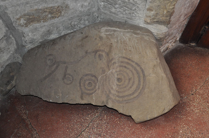
St John Lee Church (Oakwood Stone) submitted by Anne T on 15th Sep 2014. Close up of the Oakwood Stone in the porch of the church of St John of Beverley at St John Lee. Note someone has apparently used watercolour to highlight the motifs, which are striking.
(View photo, vote or add a comment)
Log Text: St John Lee Rock Art, near Hexham. Also known as The Oakwood Stone: We’ve been to St John Lee Church near Acomb a few years ago, as it is only 6 miles from our house, when our interests lay in finding Roman remains reused within local churches. At the time I only had a small camera and wasn’t taking many photographs.
St. John Lee can be reached from the roundabout at the junction with the A69 and the A6079 turnoff to Hexham. Turning north from the roundabout opposite the A6079, drive along a small side road signposted to St John Lee. The road climbs uphill but levels out after about half a mile and just as the houses come into view there is a sharp left hand turn down a small single track road to the church.
The church is on the left hand side of the road, with the graveyard divided between both sides of this small road. There is room to park one car on the verge by the lych gate.
The Church itself is relatively modern: The Church of England web site tells me St John Lee was built in 1884, but it certainly contains some old relics, including this portable rock art stone, according to ADS “found approx. 1,000 metres east of the church, although this was still unlikely to be its original position.”
The stone is located in the porch of the church, which is sited at the west end, furthest away from the lych gate (although the path is smooth and disabled access is possible). We were a little taken aback that someone had very recently chain-sawed down two or three of the yew trees at either side of the path, and the church felt somewhat denuded as a result, although we had a clear view of the east end of the church as a result.
The stone itself is situated immediately to the right hand side of the door as you walk into the porch. The rock art motifs are striking, but someone has outlined the patterns using what looks like brown watercolour, which has sunk into the stone. Using my finger, I traced round the faint lines and found the marks to be accurate to the faint depressions in the rock.
There is no church guide book, which is a shame, but there is a framed description of the stone on the wall above the stone (there is a page of visitor notes in the porch which describes the painted memorial plaques, but nothing else that we could find).
Also within the porch, to the left hand side, is a Roman altar stone, the top of which has been chiselled out to house an old sundial.
On the wall facing you as you enter the porch, there are also some old grave covers and the remains of old carvings displayed. On the window sills there are also small stone fragments, but no explanation as to what they are.
Worth stopping by if you are passing.
St John the Baptist (Hope Bagot)
Trip No.169 Entry No.2 Date Added: 8th Aug 2021
Site Type: Holy Well or Sacred Spring
Country: England (Shropshire)
Visited: Yes on 15th Jul 2021. My rating: Condition 3 Ambience 4 Access 4
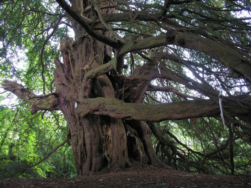
St John the Baptist (Hope Bagot) submitted by TimPrevett on 23rd Sep 2007. The yew certainly adds a heavy ambience to the place. I found it a little creepy myself, but interestingly enough, it has many clouties - the most I've seen on a well outside of Cornwall. (Lots more not visible in this photo).
(View photo, vote or add a comment)
Log Text: St John The Baptist, Hope Bagot: We parked in the village hall car park, about the only place in the village we could leave the car, as the lanes here were so narrow. The church was very difficult to spot from the road, but thankfully, a sign in the village hall car park pointed us up some steps, through a gate and straight into the churchyard.
What an unusual old church, very reminiscent of Escomb Saxon Church. Just as we entered the churchyard, we met the Church Warden's wife, who stopped to talk to us, and told us how to find the well (underneath a yew tree at the northern side of the churchyard (approaching the church from the north, there is a wooden gate into the churchyard; come through this gate and take the small path to your right hand side. This leads the 20m or so to the well).
There is also a Victorian well head at SO 58858 74092. The Church Warden's wife told us there were a number of springs in the village.
St John The Baptist (Rolleston)
Trip No.78 Entry No.4 Date Added: 26th Jun 2018
Site Type: Ancient Cross
Country: England (Leicestershire and Rutland)
Visited: Yes on 24th Jun 2018. My rating: Condition 3 Ambience 3 Access 4

St John The Baptist (Rolleston) submitted by Anne T on 26th Jun 2018. Site in Leicestershire and Rutland England. The floriated cross head looks more modern than the worn capital underneath.
(View photo, vote or add a comment)
Log Text: Churchyard Cross, St John The Baptist, Rolleston: Apart from one sign post on the road by the church in Skeffington, this exclusive hamlet may well not exist. The road is gated (at least 3 gates), the roads are very narrow, and at the junction of the road and the bridlepath down to the church, there are a number of ‘no parking’ signs. This meant our daughter-in-law-to-be had to drop us off and drive some distance away, then collect us afterwards.
There is a small iron gate into the churchyard. This appears to be the only entrance, as the road at the eastern end of the church is labelled ‘private’. Eventually managing to open the gate into the church, we found the cross at the south eastern corner of the church, almost hidden in the shadows of the trees. It looked as if the owner of the modern house had incorporated this part of the churchyard into their private garden, so we very much felt like we were trespassing and expected someone to come out of the house and shout at us to ‘move on’.
Due to the heavy shadows and bright sunlight, it was a little difficult to photograph this cross. There appears to be a difference of opinion between Historic England and Pastscape as to the date of this cross – HE says 14th century; Pastscape 17th. The socket stone was marginally intriguing as it had a small hole in each side, presumably to drain any water away.
Making our way back along the gated road to civilisation, we stopped by the stream to let the dog paddle.
St John the Baptist (Tunstall)
Date Added: 7th Jun 2015
Site Type: Early Christian Sculptured Stone
Country: England (Lancashire)
Visited: Yes on 4th Jun 2015. My rating: Condition 3 Ambience 3 Access 5
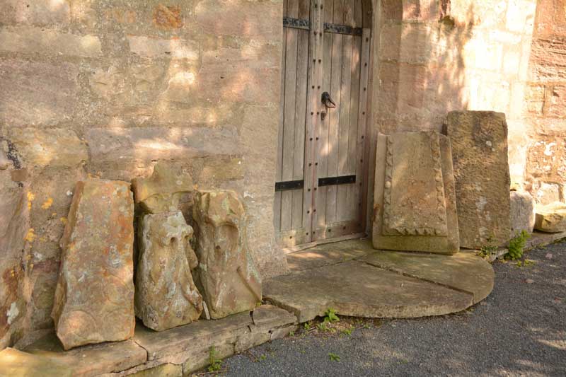
St John the Baptist (Tunstall) submitted by Anne T on 7th Jun 2015. We searched and searched for the Roman altar, but couldn't find it. Outside the west door, there is a display of architectural stones, including medieval grave markers and what looked like a very worn Anglo Saxon Cross Head/Finial.
(View photo, vote or add a comment)
Log Text: Votive Stone, St. John The Baptist, Tunstall: Driving from St. Wilfrid’s, Melling, we continued north along the A683. Just mile or so along the road, the A683 becomes a ‘minor road’ splitting off to the left, whilst the main carriageway continues as the A687. Following the A683 into Tunstall village, Church Lane is the last turn to the right hand side, almost at the end of the village. This road disappears into green fields with a few large houses along the way. After about 600 metres, the church appears to your left hand side, with parking places outside the entry stile. This is a glorious country setting with a beautifully looked after churchyard.
The ADS web site was down at the time of writing, but the British History Online notes are really helpful, telling me that this church, now named St. John The Baptist, used to be dedicated to St. Michael, and is largely of “15th century date .... there are some remains, however, of a 13th century structure, fragments of which have been used in the rebuilding”.
The church guide was £5, so we didn’t buy it, but quickly looked through it to find it mentioned a Roman altar as well as the votive stone, but no clues as to the whereabouts of either - I had to use my phone to find out where the votive stone was; we found no suggestion of the Roman altar, although there was a display of architectural pieces and medieval grave markers by the west door which included what looked like a very worn Anglo Saxon cross head.
To assist future visitors, the votive stone is on the eastern-most of the three windows (nearest to the organ), on the left hand side of the window surround. Curiously, it has been placed on its side.
At the east end of the south aisle there is a small chapel which contains a much broken effigy, said to be of Sir Thomas Tunstall. There is also an ancient chest just outside the south chapel and outside a sundial shaft which stands on three octagonal steps.
St John the Baptist and St Alkmund (Aymestrey)
Trip No.165 Entry No.1 Date Added: 21st Jul 2021
Site Type: Ancient Cross
Country: England (Herefordshire)
Visited: Yes on 9th Jul 2021. My rating: Condition 4 Access 4
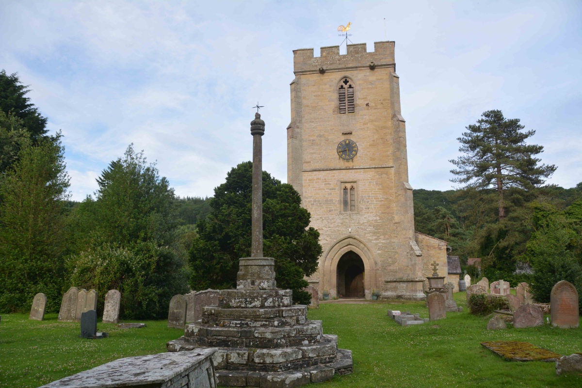
St John the Baptist and St Alkmund (Aymestrey) submitted by Anne T on 21st Jul 2021. Standing just inside the lych gate, looking past the cross to the west door into the church.
(View photo, vote or add a comment)
Log Text: Churchyard Cross (Aymestrey): We were here for my son and DIL's wedding rehearsal, but I was also very keen to get out into the churchyard to photograph this cross before dusk fell. Whilst the cross is medieval, Beaker burials have been found nearby, and I'm doing further research on the church to find out if a wooden building might have pre-dated the 12th century church. A very pretty spot, although difficult to find the church car park (the small lane is just to the north of the northern wall of the churchyard), and we missed this, so parked in the village hall and walked back the 150-200m to the church along the (at that time of night) quiet A4110.
St John The Evangelist (Crosscanonby)
Trip No.91 Entry No.3 Date Added: 17th Aug 2018
Site Type: Ancient Cross
Country: England (Cumbria)
Visited: Yes on 14th Aug 2018. My rating: Condition 3 Ambience 4 Access 5
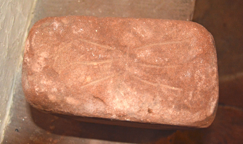
St John The Evangelist (Crosscanonby) submitted by Anne T on 17th Aug 2018. Face D of AS Corpus Cross Canonby 03, also known as The Thunder Bolt Stone. The Corpus tells us this face shows: "the incised ornament consisting of a single horizontal line on which converge three incised lines from above and below." This is the famous 'thunder bolt' symbol.
(View photo, vote or add a comment)
Log Text: St John The Evangelist, Crosscanonby: We had arranged to meet the Reverend Mary at the church at 2pm. Between Gilcrux and here we had an hour to spare, so went into Cockermouth for lunch and a quick walk round the town. Travelling through Dearham and across the A596 to Crosscanonby, as we dropped down a small hill after having crossed the A596, we realised how close this church is to the Solway Firth (according to UK Grid Finder measurements its 900m).
This little church is side on to the road, and is virtually invisible until you reach the gate into the churchyard, although the ‘this church is open’ board gave something away.
I’d not looked at the AS Corpus notes I’d brought, but straight away we spotted the hogback against the south eastern corner of the nave.
Walking inside was a real treat. This is clearly a very old building. Reverend Mary (just ‘Mary’ she said) told us this church used to be the mother church for Maryport and the farm house next door (to the west of the church) used to be part of the monastery; the monks used to process from the monastery to the church; rumour has it there is a tunnel from the farmhouse to the church, but it’s never been found.
The church is pretty special, although I focussed on photographing the stones in the porch whilst Andrew spoke to Mary about the structure of the building, as I was conscious of taking up Mary’s time and we needed her to come across to Dearham to open the vestry for us. I’d love to go back and spend more time here.
St John the Evangelist (Gressingham)
Date Added: 6th Jun 2015
Site Type: Ancient Cross
Country: England (Lancashire)
Visited: Yes on 4th Jun 2015. My rating: Condition 3 Ambience 4 Access 5
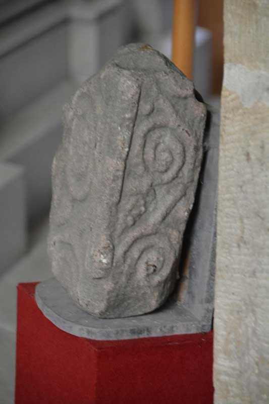
St John the Evangelist (Gressingham) submitted by Anne T on 6th Jun 2015. A photograph showing the side of the cross fragment inside the church. As it was securely fastened to the wall, I was unable to turn it round to photograph the reverse side.
(View photo, vote or add a comment)
Log Text: 9th Century Anglo Saxon Cross Fragments, St John The Evangelist, Gressingham: Having decided upon a day out in Lancashire/Cumbria on an Anglo Saxon Cross hunt, this was our stop of the day. We approached from junction 35 of the M6, taking the B6254 through Over Kellet and taking a right hand turn, named Fall Kirk, down to Gressingham. This is a pretty little village with the church on the junction of Fall Kirk and Back Lane, sited on a hill next to a small stream which joins the River Lune to the south. Not having phoned through before visiting, we were delighted to find the church open, with a lovely Norman arch over the entrance door on the south wall. But whilst it was warm and sunny outside, this Grade 1 listed church was cold inside.
Whilst the Pastscape and Wikipedia notes talk about more than one fragment of 9th cross inside the church, we could only spot one, despite a thorough hunt by both of us. This was strapped into the north-east corner of the nave, just before a large tomb for George Marton, so I was unable to turn it round to photograph the reverse side. The 9th cross shaft built into the external south-west corner of the nave was easy to spot, with the sunlight picking out the decoration nicely [note: having reviewed the Pastscape notes, another fragment might be inside the vestry, which we didn't check].
There was a pulpit of dark wood dated 1714 on the south side of the church, and retained some of the original box pews. There was also a tapestry on hessian against the south wall, opposite the chest tomb and the stone fragment which caught my imagination – someone has put a lot of hard work into this.
St John's Cross (Canongate)
Trip No.153 Entry No.1 Date Added: 9th Oct 2019
Site Type: Ancient Cross
Country: Scotland (Midlothian)
Visited: Yes on 1st Oct 2019. My rating: Condition 2 Ambience 3 Access 4

St John's Cross (Canongate) submitted by Anne T on 9th Oct 2019. The location of the old St John's Cross (now said to be outside Canongate Kirk). Whilst the location is said to be marked by a white St John's Cross, the paint had almost been worn away, and if I hadn't seen similar circles of pavers in other locations, might not have recognised the spot. Having spotted the circle, a closer look around revealed the plaque describing the cross on an adjacent wall in deep shadow on the south side of Canongate.
(View photo, vote or add a comment)
Log Text: St John's Cross, Edinburgh (site of): The site of this cross was one of the clues (no. 6) on the 'Treasure Trail' map for the Old Town Trail. The markings for this cross were very faint indeed. I only recognised the spot by the circle of bricks in the road, as I’d seen similar features before. There is a plaque on the wall nearby.
From the funny, small brass plates in the road and pavement just to the west, at the junction of High Street and Canongate (W-E) and Jeffrey Street-Saint Mary's Street to the east, the cross would have been located just outside the old city walls.
Whilst I've been to Edinburgh on a number of occasions, I have never walked down Canongate before, and it was a great spot for discovering 'old things and old sites'.
St John's Well (Osmotherley)
Date Added: 8th Oct 2014
Site Type: Holy Well or Sacred Spring
Country: England (Yorkshire (North))
Visited: Couldn't find on 5th Oct 2014
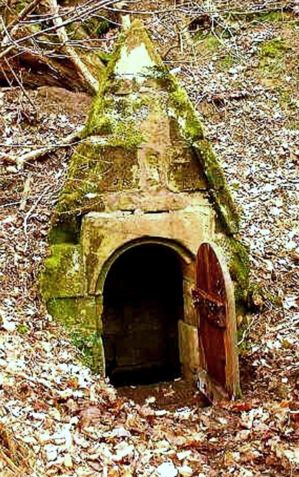
St John's Holy Well submitted by Sunny100 on 14th Jun 2010. St John's Holy Well, near Osmotherley, N.Yorkshire, at SE.447981.
(View photo, vote or add a comment)
Log Text: St John's Well (Osmotherlery): This being a glorious late afternoon, and having not only precise instructions on how to reach St John’s Well from the Mount Grace Priory staff but the GPS co-ordinates and a map I’d printed off with the exact location of the well, we set off to try and reach it. Not as easy as it first appeared! The first path, following what we both thought were the directions given to us, went too far up hill, then path just stopped at the top of the hill. Retracing our steps and turning on the GPS device, we followed the watercourse wending its way south away from the priory, between the edge of the forest and the adjoining meadow and found the track we should have followed. Whilst we could see the path leading up the hill towards the well, I let my husband take the lead, but it became just too difficult – waist high bracken, broken branches and large, boggy holes to fall into – it would have been too easy to twist and ankle or fall over. As it was getting late, we decided to come back in the winter, when the undergrowth has died back. We knew that this well was one of three which supplied the Priory, the first being in the north east corner, just outside the Great Cloister. A second is to the south of this, supplying the Lesser Cloister, and the third (not managed by English Heritage) is St. John’s Well. We did manage to get a photograph of Well House one. Despite there having been a lengthy dry spell, there was still a good flow of water from this spring, and the water was beautifully clear. There is a great similarity between the well house we saw and the image of St John's Well submitted by Sunny100.
St John's Well (Spott)
Trip No.105 Entry No.7 Date Added: 5th Nov 2018
Site Type: Holy Well or Sacred Spring
Country: Scotland (East Lothian)
Visited: Yes on 27th Oct 2018. My rating: Condition 3 Ambience 3 Access 4
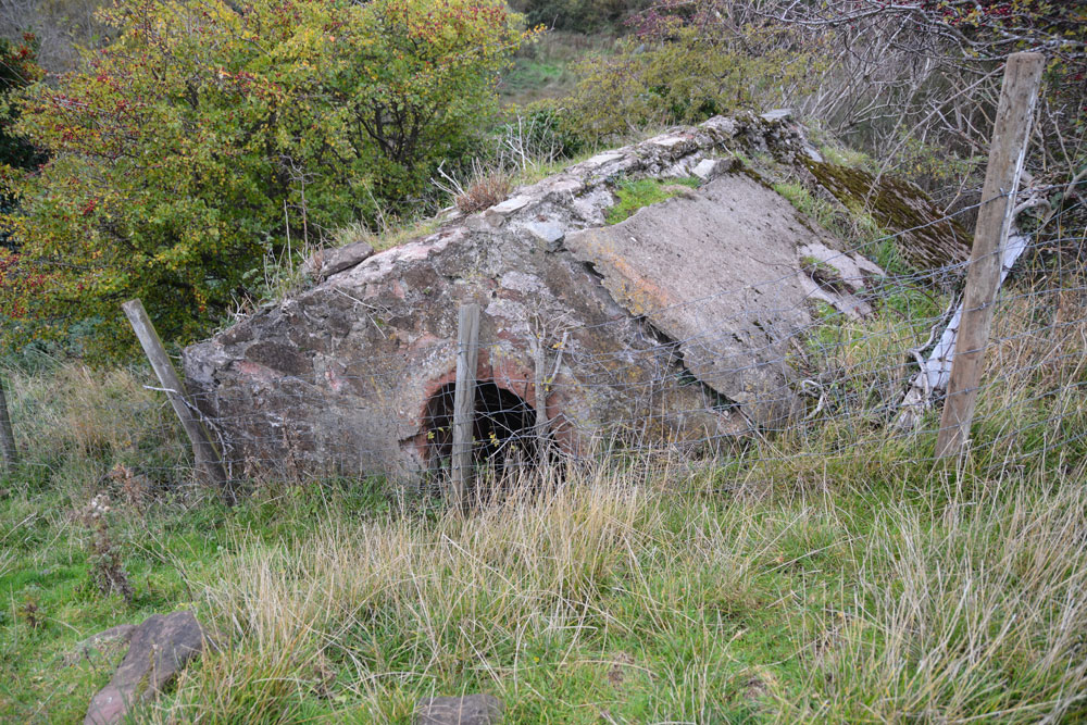
St John's Well (Spott) submitted by Anne T on 5th Nov 2018. This old cistern is some 100m further north, at the eastern side of the gully running from the well. I wondered if it was part of the 18th century works which piped water from this well into Dunbar.
(View photo, vote or add a comment)
Log Text: St John's Well, Spott: With the wind still whistling and starting to get dark, we really wanted to see this well and the nearby Easter Broomhouse standing stone before calling it a day. At the north eastern end of Spott, a gated stile by the small school lets you into the field, which, at the time of our visit, was full of very large, curious sheep.
Following the line of the first two telegraph poles, a gully comes into view. The well house is located at the top of this, at the bottom of the gully, so we needed to slither down the 6ft or so to the bottom to photograph the well.
Whilst the well cavity was dry, there was a pool of water a couple of metres further down the gulley.
Further down the field there was a very old, ruined building with an arched window. I am curious to know what this is – need to look it up on Canmore. Because of its location, my immediate thought was that it was a hermitage. No separate Canmore record, but is recorded on the map as a cistern.
St Julian's Well (Ludlow)
Date Added: 9th Aug 2021
Site Type: Holy Well or Sacred Spring
Country: England (Shropshire)
Visited: Yes on 15th Jul 2021. My rating: Condition 3 Access 5
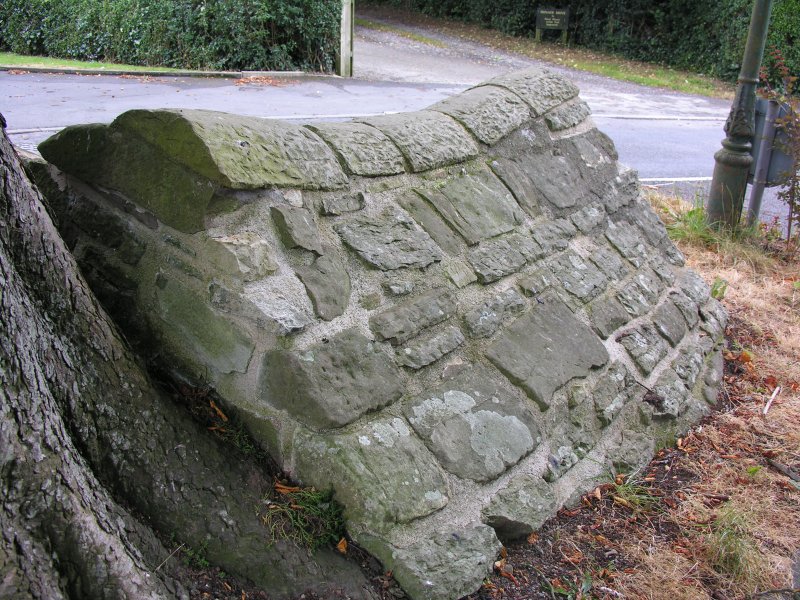
St Julian's Well (Ludlow) submitted by TimPrevett on 23rd Sep 2007. The obvious or not so obvious if you don't know it's there - St Julian's Well in the centre of Livesey and St Julian's Ave, Ludlow. A property called Wellside is to its north. This was the first not famous holy well I went in search of several years ago, and I'm glad to have worked out where it is at last!
(View photo, vote or add a comment)
Log Text: St Julian's Well, Ludlow: Last stop of the day before collecting our car from the garage and driving back to the holiday cottage, then home tomorrow. The well was deep in dappled shade, it being late afternoon on a hot, sunny day. We parked just south west of the well, at the side of Livesey Road. This road was busy with other cars, presumably because of all the roadworks in the area, routing cars along past the well.
A very odd spot for the well, and the tree next to it had grown over part of the well structure. Someone had wedged a drinks cannister into what had been the pipe from inside the well house, which now appeared to be dry. We couldn't see any obvious channels for water to flow down, and we were unable to hear any water flowing anywhere in the vicinity.
Worth stopping off to take a few photographs, and another well site to tick off the list.
St Kentigern (Aspatria)
Date Added: 5th May 2015
Site Type: Ancient Cross
Country: England (Cumbria)
Visited: Yes on 1st May 2015. My rating: Condition 3 Ambience 4 Access 5
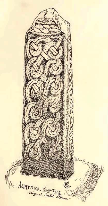
St Kentigern (Aspatria) submitted by durhamnature on 11th Sep 2012. Cross of St Kentigern, Aspatria, from "Early Sculptured Crosses...in the Diocese of Carlisle", 1899, via internet.org
(View photo, vote or add a comment)
Log Text: Anglo Norse Crosses and a Viking Hogback, St Kentigern's Church, Aspatria: Following the A596, signposted to Aspatria, the church is on the right hand side as you drive into the village, set above the road and separated from it from a stone wall.
Parking in a one hour disk parking spot just outside the church, we noticed straight away a tall cross standing at the exterior east end of the church and went straight round to photograph it [according to Wikepedia http://en.wikipedia.org/wiki/Gosforth_Cross “In 1887, the Rev. William Slater Calverley commissioned a replica life-sized copy of this cross and erected it in the churchyard at Aspatria, Cumbria.“ There was also a collection of artefacts with what looked like parts of two Anglo Saxon Cross heads built into the wall.
There was a church festival, with flowers, fairy lights and candles, lots of regular church-goers helping out and many other visitors popping in, so with my camera and flashgun, I felt a bit as if we were intruding.
Enterging the church from the west doorway through the porch, we literally had to walk round another cross at the west end of the church. I asked if it was OK to take photographs using the flash it is was in relative darkness on its western side; the surrounding displays made it a little challenging to take photographs although one of the gentlemen helpers offered to move the flower stand they were using to hold leaflets for visitors, which made it easier.
There was another table with all sorts of reading material displayed on it, including a browning newspaper article saying the cross outside was a copy of the Gosforth Cross [whilst the shape was similar, I questioned whether or not the carving was the same – I’ll need to compare the photographs].
The guide then pointed us in the direction of the unusual and lovely 13th century font and told us there was part of a Viking Hogback displayed. The carvings were intricate. The church guide told me this stone was “found amongst the building material of the Norman church”.
A quick walk around the rest of the flower displays followed, especially as we ended up blocking the aisles with our small granddaughter’s pushchair and no-one could get past! As a result, we missed some of the other crosses within the building, particularly those in the vestry, but we’ll go back again when the festival isn’t on and we can wander around more freely. According to the Pastscape record there is another cross (sans top) 40 yards south of the church.
With directions from one of the guides in the church, we walked to the north side of the church yard to find St. Patrick’s Well.
St Laurence's Church (Bradford on Avon)
Trip No.136 Entry No.4 Date Added: 12th Jun 2019
Site Type: Early Christian Sculptured Stone
Country: England (Wiltshire)
Visited: Yes on 17th May 2019. My rating: Condition 3 Ambience 5 Access 4
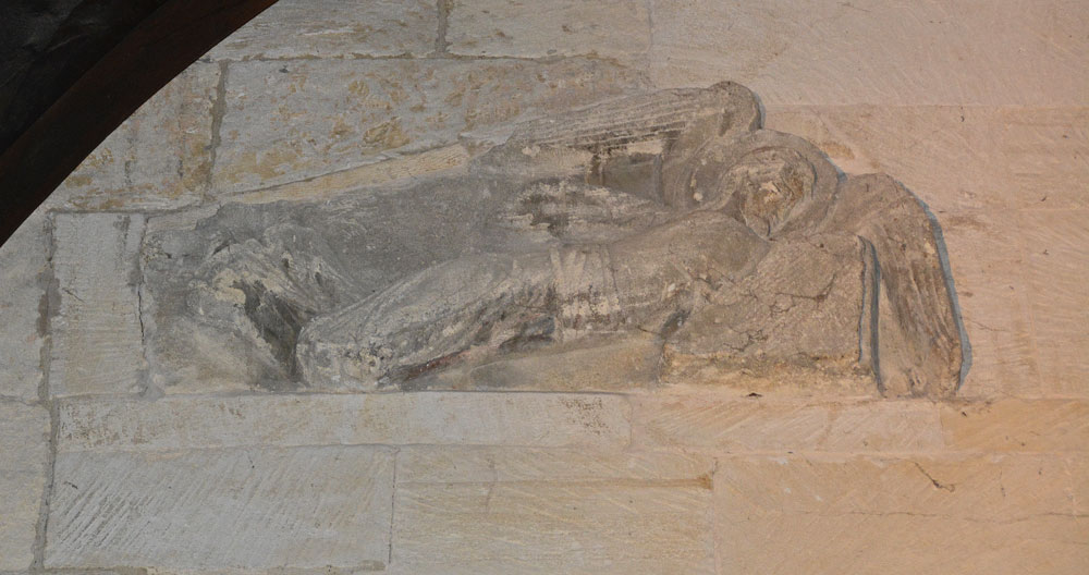
St Laurence's Church (Bradford on Avon) submitted by Anne T on 11th Jun 2019. The right hand facing angel, recorded as AS Corpus Bradford on Avon 5b. They were discovered embedded in a wall above the western side of the chancel arch around 1850, later used in a flue in 1856-1857, then placed over the porch leading to the modern house attached to the south side of the building. Both angels are carved from single blocks of stone, which taper from head to feet, with the angels facing each other. Dated to AD1000.
(View photo, vote or add a comment)
Log Text: St Laurence's Church, Bradford on Avon: From Wells, we had to decide which church was going to be the very last visit of our Dartmoor Expedition, as we were rapidly running out of time – Deerhurst or Bradford-On-Avon. In the end, the decision was down to knowing that St. Laurence’s Church would be open, although only until about 5pm or 5.30pm, so the race was on to battle the traffic to get here in time. Eventually we made it with about 45 minutes to spare, managing to park just round the corner from both St. Laurence’s and Holy Trinity.
What a treasure! I’d read that it was as complete as Escombe Saxon Church, but it felt so different – more doorways and very, very dark. The only spotlights were on the angels over the chancel archway, a small light in the sanctuary, then the rest through the narrow doorways and tiny windows.
The church was a real tourist magnet and I had to wait several times to get a shot without people in the photo. I’m sure I annoyed everyone with my flash, but that was the only way I could photograph the stone fragments.
I’m really pleased I’d printed of the Corpus of Anglo Saxon Stone Sculpture pages before we went, as I understood what I saw at the time. I put my papers down to take a photograph of the altar, coming out of the sanctuary to find someone had picked them up and was reading them. I had to ask nicely for them back and explain these were mine, but there was a leaflet in a box on the south wall of the nave.
I was really sad we couldn’t get this little church to ourselves for ten minutes or so. We ended up having 15 minutes to look into Holy Trinity Church opposite, only to almost get locked in, although we spent 10 minutes or so talking to the very knowledgeable church warden. Then we walked around the town after to avoid the queues of traffic that had built up.
St Lawrence's Church (Kirkland)
Trip No.66 Entry No.2 Date Added: 10th Feb 2018
Site Type: Ancient Cross
Country: England (Cumbria)
Visited: Yes on 9th Feb 2018. My rating: Condition 3 Ambience 4 Access 4
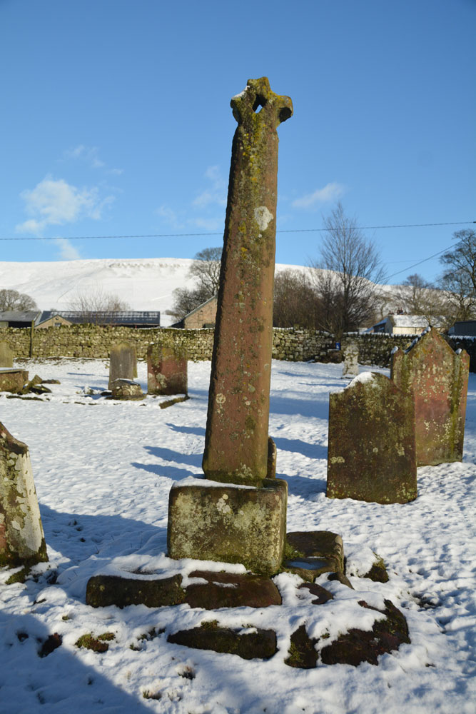
St Lawrence's Church (Kirkland) submitted by Anne T on 10th Feb 2018. Looking due east across one of the broad faces of the cross. I wondered where the small fragments of broken arm were; they weren't in the church, as we searched around for these. Probably long lost.
(View photo, vote or add a comment)
Log Text: Ancient Cross, St Lawrence's Church, Kirkland, Cumbria: The church itself is unremarkable, although a pretty stream runs just outside the southern wall of the churchyard. Parking is available just outside the church, on the grass, although on the day of our visit it was snowy and the ground was boggy, so we parked just over the bridge, just east of the T-junction.
The church was being renovated, so to avoid the scaffolding and a muddy walk right round the churchyard from the gate at the north-western edge of the church, we hopped across the small wire fence, meant for containing the sheep.
The cross is tall and slender, but with broken arms. We observed two channels in the base, where the cross shaft meets the base, from which melting snow water was running. On another cross base near Cairnpapple, Canmore recorded that similar channels were thought to be from the base being used as a drinking trough at some time in its past. Here, the channels seemed to serve as a way of getting rid of water which might run down between the cross shaft and its base.
Certainly a remote spot here, although plenty of farm traffic.
St Leonard's Well (Sheepstor)
Trip No.134 Entry No.16 Date Added: 22nd Jun 2019
Site Type: Holy Well or Sacred Spring
Country: England (Devon)
Visited: Yes on 15th May 2019. My rating: Condition 3 Ambience 3 Access 5
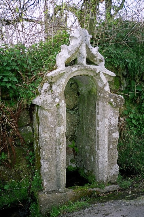
St Leonard's Well (Sheepstor) submitted by KiwiBetsy on 21st Nov 2004. St Leonard's Well is enhanced by a recycled church window.
(View photo, vote or add a comment)
Log Text: St Leonard's Holy Well, Sheepstor: I spotted this well as we were driving down to the car park near Whittenknowles and we stopped to photograph it on the way back.
The sunshine was really, really bright coming over the wall, so the few photos I took worked out best looking at the well from an angle. The well was completely dry, with the well structure full of ferns and weeds.
Our last stop of the day before going for an ice cold drink at Princetown.
St Luke's Church (Townhead)
Trip No.66 Entry No.1 Date Added: 10th Feb 2018
Site Type: Ancient Cross
Country: England (Cumbria)
Visited: Yes on 9th Feb 2018. My rating: Condition 3 Ambience 4 Access 5
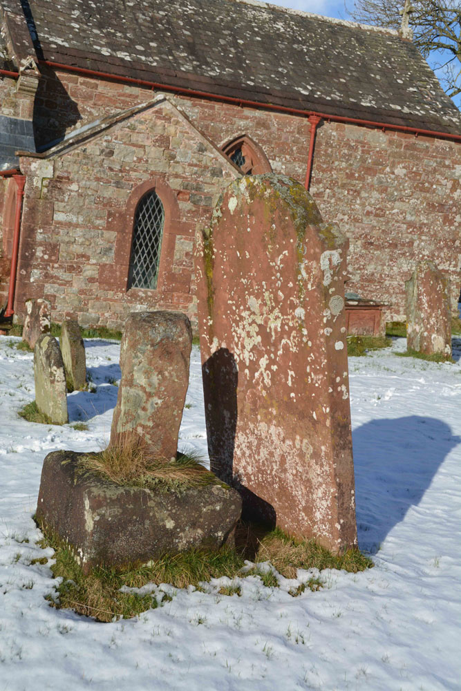
St Luke's Church (Townhead) submitted by Anne T on 10th Feb 2018. Standing just to the south west of the cross base and shaft, looking at the southern wall of the church. No carvings are evident on this side of the base or cross shaft, although there is a large depression towards the top of the cross shaft, which looks like it has been damaged at some point.
(View photo, vote or add a comment)
Log Text: Ancient cross, St. Luke's Church, Townhead, near Ousby. OK, so the weather was supposed to be better the further west we went, so we took the option of travelling to this site via Alston and the high moors. A bit of a mistake, as there was much more snow here than at home, but it was lovely, if a bit of a slow drive. The roads within Ousby village were quite complex for such a small village, and we managed twice to take the wrong turn, but finally ended up at this very small hamlet.
Parking is available just to the west of the church, where the road widens, although walking to the gate of the church was tricky as it was quite a busy road, with farm traffic and lorries (considering the road is a dead end, I wondered where the traffic went).
No-one had been in the churchyard since the snow had fallen, so we picked our way up to the north door. The church is relatively plain inside, until you walk up to the chancel, where there is the most fantastic carved effigy, made out of wood and now encased in a glass/plastic case to preserve it. Half of this has broken off, but I was glad we'd gone inside the church to see this. There was no church guide, or any notes for visitors, and I haven't been able to find out much about this since.
The cross base and remnant of cross shaft are to the south of the nave/chancel, almost on top of a tall, red sandstone grave stone. We could see no markings or carvings on the cross shaft or base, apart from a shallow carved cross on top of the shaft, with small 'cups' as terminals.
The snowy hills in the background made this quite an atmospheric place.
St Maelog's Cross
Trip No.167 Entry No.3 Date Added: 22nd Jul 2021
Site Type: Ancient Cross
Country: Wales (Powys)
Visited: Saw from a distance on 12th Jul 2021
St Maelog's Cross submitted by Sunny100 on 11th May 2010. St Maelog's Cross, Llowes Church, Powys at SO193417
(View photo, vote or add a comment)
Log Text: St Maelog's Cross: Despite being told the church was open, and going armed with masks and hand sanitiser, the door was very firmly locked. We could see the back of the cross through the windows at the north western corner of the church, but it was impossible to photograph through the tiny, dirty panes. So disappointed. I did spot a sundial in the churchyard, built into a memorial stone, so had to be content with photographing that.
St Margaret (Hornby)
Date Added: 6th Jun 2015
Site Type: Ancient Cross
Country: England (Lancashire)
Visited: Yes on 4th Jun 2015. My rating: Condition 3 Ambience 4 Access 5

St Margaret (Hornby) submitted by Anne T on 6th Jun 2015. The smaller fragment contains chevron patterns on its upper part and some form of scroll work on its lower section.
(View photo, vote or add a comment)
Log Text: Anglo Saxon Cross Fragments, St. Margaret's Church, Hornby: From Gressingham, we continued east along the twisty-turny Back Lane, over the narrow bridge over the River Lune, to its junction with the A683. Turning right, we were almost immediately in Hornby. St. Margaret’s sits on the left hand side of the road, before the main road takes a right hand turn. There is ample parking on the right hand side of the road opposite the church which is distinctive with its octagonal tower.
Opening the gate from Main Street, you fall into the porch of the church, which is very dark. Inside, the church appears very modern and (to me) without personality, although there is evidence of much older structures such as the traces of old roof lines in the interior west wall; Pastscape records it as having building having started in 1514, with the nave being rebuilt in 1817 with clerestorey being added in 1889.
There was no church guide, just one board with an A4 sheet of notes. This told us that: “Under the tower are two fragments of 9th century crosses, one showing the five loaves and two fishes; this is unique in England, though there are two in Ireland. They both came from the Priory ...”, although the Pastscape record says they are 8th to 9th century and that both fragments had been reused in a 19th century barn wall at Priory Farm before coming to the St. Margaret’s. The church notes continued: “The churchyard contains a huge cross base, which may be pre-Conquest or Norman. The original cross could have been twelve feet high. Its presence is something of a mystery.”
The Anglo Saxon Cross Fragment with the carving of the five loaves and two fishes was impressive, and definitely worth stopping to see. Alongside it, to the right, was a much smaller fragment with chevrons.
The churchyard is beautifully kept, with well mown grass and shrubs being clipped into amazing shapes and kept low to the ground. The cross base is huge in comparison to others that I’ve seen – I had to climb on top of a stone to photograph the top, which has a slot for a cross to go into on top.
St Margaret's Well (Edinburgh Castle)
Date Added: 30th Dec 2015
Site Type: Holy Well or Sacred Spring
Country: Scotland (Midlothian)
Visited: Yes on 17th Dec 2015. My rating: Condition 3 Ambience 2 Access 4
St Margaret's Well (Edinburgh Castle) submitted by KiwiBetsy on 26th Sep 2006.
The site of the well lies between the railway track and Edinburgh Castle. It can be accessed on foot from the network of tracks that run both from the castle esplanade and from Princes Street Gardens.
(View photo, vote or add a comment)
Log Text: St. Margaret's Well, Edinburgh Castle: I arrived in Edinburgh on an early train but even at 08:45 it was wet and windy and too dark to see much. By 09:30, fortified by a cup of coffee, having met my old University friend, we set off towards the castle. The well sits on far side of the railway track, immediately under the castle and next to the footpath. The area is heavily littered, and without the image from the Portal I wouldn't have known this was a well. We braved the puddles to look inside the domed structure behind the plaque, but this was full of rubble and rubbish. Disappointing, but another well crossed off my 'to visit' list.
St Margaret's Well (Edinburgh)
Trip No.11 Entry No.4 Date Added: 26th Feb 2017
Site Type: Holy Well or Sacred Spring
Country: Scotland (Midlothian)
Visited: Yes on 20th Feb 2017. My rating: Condition 3 Ambience 3 Access 5
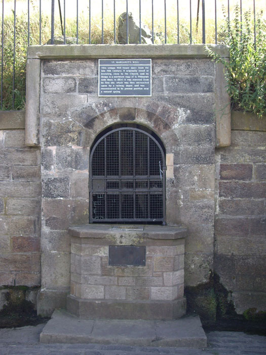
St Margaret's Well (Edinburgh) submitted by feorag on 12th Aug 2006. St. Margaret's Well in Holyrood Park, Edinburgh. Photographed 12th August 2006.
(View photo, vote or add a comment)
Log Text: St Margaret's Well, Holyrood, Edinburgh: Located just off Queen’s Drive in Holyrood, near Dynamic Earth, and 400 metres from St. Anthony’s Well, this well house can be seen from the road.
I had to photo-shop out the pile of rubbish that had gathered at the base of the well (disgusting!). There was a good flow of water out of the pipe inside the well house, although it was impossible to get a photograph of this there was a black heavy metal grill covering it.
I came across a reference on Pixyledpublications telling me “the spring itself is a holy well, called The Well of the Holy Rood or St. David’s Well and dates from 1198, the well head was re-erected from St. Margaret’s Well at Restalrig ….. legend has it that King David after mass decided to go hunting in the area and was thrown from his horse by a giant stag which then carried the king, stopping at the spring. In thanks for his deliverance, he built the Abbey of Holyrood there …. (the well house) has an internal width of six feet by five feet in height with a central pier with a carved head which is provided with a spout.”
The well house bears a plaque which reads: “This unique Well House dates from the late 15th Century. It originally stood at Restalrig, close to the Church, and its design is a miniature copy of St. Triduana’s Aisle there. In 1860 it was removed from its first site, which was then encroached upon by a railway depot, and was reconstructed in its present position near a natural spring.”
