

<< Our Photo Pages >> St Leonard's Well (Sheepstor) - Holy Well or Sacred Spring in England in Devon
Submitted by KiwiBetsy on Sunday, 21 November 2004 Page Views: 7257
Springs and Holy WellsSite Name: St Leonard's Well (Sheepstor)Country: England County: Devon Type: Holy Well or Sacred Spring
Nearest Town: Dousland Nearest Village: Sheepstor
Map Ref: SX5607467630
Latitude: 50.490751N Longitude: 4.030365W
Condition:
| 5 | Perfect |
| 4 | Almost Perfect |
| 3 | Reasonable but with some damage |
| 2 | Ruined but still recognisable as an ancient site |
| 1 | Pretty much destroyed, possibly visible as crop marks |
| 0 | No data. |
| -1 | Completely destroyed |
| 5 | Superb |
| 4 | Good |
| 3 | Ordinary |
| 2 | Not Good |
| 1 | Awful |
| 0 | No data. |
| 5 | Can be driven to, probably with disabled access |
| 4 | Short walk on a footpath |
| 3 | Requiring a bit more of a walk |
| 2 | A long walk |
| 1 | In the middle of nowhere, a nightmare to find |
| 0 | No data. |
| 5 | co-ordinates taken by GPS or official recorded co-ordinates |
| 4 | co-ordinates scaled from a detailed map |
| 3 | co-ordinates scaled from a bad map |
| 2 | co-ordinates of the nearest village |
| 1 | co-ordinates of the nearest town |
| 0 | no data |
Internal Links:
External Links:
I have visited· I would like to visit
Septembre3 would like to visit
lucasn visited on 24th Jun 2019 - their rating: Cond: 3 Amb: 3 Access: 5
Anne T visited on 15th May 2019 - their rating: Cond: 3 Amb: 3 Access: 5 St Leonard's Holy Well, Sheepstor: I spotted this well as we were driving down to the car park near Whittenknowles and we stopped to photograph it on the way back.
The sunshine was really, really bright coming over the wall, so the few photos I took worked out best looking at the well from an angle. The well was completely dry, with the well structure full of ferns and weeds.
Our last stop of the day before going for an ice cold drink at Princetown.
cazzyjane have visited here
Average ratings for this site from all visit loggers: Condition: 3 Ambience: 3 Access: 5
 (PID:10688)")
St Leonard’s Well wells up happily into the basin formed by the base of the window although it may have originally risen on nearby church land before being piped to the roadside for the convenience of the villagers.
Update May 2019: St Leonard's Well is recorded as Pastscape Monument No. 438815 and Historic England List ID 1326392. Pastscape tells us the original site of the well was in a field belonging to a glebeof the church; water was then piped to the roadside, where "a canopy was built with fragments from the old east window of the church" (source: Devonshire Association reports and transactions (S Baring Gould) 30, 1898 Page 90).
The most recent site visit recorded on Pastscape was dated 1980, when the original site of the well could not be found. In May 2019, the well was dry at the time of our visit.
You may be viewing yesterday's version of this page. To see the most up to date information please register for a free account.
 (PID:63387)")
 (PID:242357)")
 (PID:210916)")
 (PID:210752)")
 (PID:198887)")
 (PID:198886)")
 (PID:198885)")
Do not use the above information on other web sites or publications without permission of the contributor.
Click here to see more info for this site
Nearby sites
Key: Red: member's photo, Blue: 3rd party photo, Yellow: other image, Green: no photo - please go there and take one, Grey: site destroyed
Download sites to:
KML (Google Earth)
GPX (GPS waypoints)
CSV (Garmin/Navman)
CSV (Excel)
To unlock full downloads you need to sign up as a Contributory Member. Otherwise downloads are limited to 50 sites.
Turn off the page maps and other distractions
Nearby sites listing. In the following links * = Image available
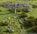
117m W 280° Roman Cross (Sheepstor)* Ancient Cross (SX5595967653)
1.4km E 80° Yellowmead* Stone Circle (SX57486784)
1.4km E 80° Yellowmead row* Multiple Stone Rows / Avenue (SX5748267842)
1.5km E 79° Yellowmead cairn* Cairn (SX5753167863)
1.5km SSE 166° Ringmoor Down Stone Row* Multiple Stone Rows / Avenue (SX56416617)
1.7km WSW 239° Marchant's Cross* Ancient Cross (SX54626681)
1.7km ESE 106° Gutter Tor north* Cairn (SX5767667137)
1.7km S 176° Ringmoor Down Cairn 3* Cairn (SX5615465937)
1.7km E 85° Yellowmead ring cairn* Ring Cairn (SX57776774)
1.7km S 178° Ringmoor Down Cairn 4* Ring Cairn (SX5610265907)
1.7km ESE 116° Gutter Tor South* Cist (SX5760966828)
1.8km E 98° Gutter Tor Roundhouse* Ancient Village or Settlement (SX57846732)
1.8km S 170° Ringmoor Down stone circle* Stone Circle (SX56336581)
1.9km SSE 168° Ringmoor Down* Barrow Cemetery (SX56406580)
1.9km N 6° Leather Tor* Cist (SX5631869522)
1.9km SSE 163° Ringmoor Down Cairn 2* Cairn (SX56596576)
2.0km ENE 70° Outholme Newtake* Cist (SX57996827)
2.2km SSE 168° Brisworthy* Stone Circle (SX5646765489)
2.2km SSE 166° Ringmoor Down Cairn 1* Cairn (SX56566549)
2.5km S 181° Brisworthy Cup Stone* Rock Art (SX55986516)
2.5km SSE 147° Legis Tor Cairns* Cist (SX57396548)
2.5km ESE 102° Whittenknowles Rocks* Ancient Village or Settlement (SX5852867024)
2.5km SE 144° Legis Tor East* Cairn (SX57496554)
2.6km NE 48° Down Tor Cist* Cist (SX58046929)
2.6km SSE 153° Legis Tor Enclosures* Ancient Village or Settlement (SX572653)
View more nearby sites and additional images


 We would like to know more about this location. Please feel free to add a brief description and any relevant information in your own language.
 Wir möchten mehr über diese Stätte erfahren. Bitte zögern Sie nicht, eine kurze Beschreibung und relevante Informationen in Deutsch hinzuzufügen.
 Nous aimerions en savoir encore un peu sur les lieux. S'il vous plaît n'hesitez pas à ajouter une courte description et tous les renseignements pertinents dans votre propre langue.
 Quisieramos informarnos un poco más de las lugares. No dude en añadir una breve descripción y otros datos relevantes en su propio idioma.