Contributory members are able to log private notes and comments about each site
Sites Anne T has logged. View this log as a table or view the most recent logs from everyone
Cairnbaan 2
Trip No.89 Entry No.4 Date Added: 4th Aug 2018
Site Type: Rock Art
Country: Scotland (Argyll)
Visited: Yes on 19th Jul 2018. My rating: Condition 3 Ambience 5 Access 3
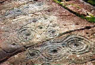
Cairnbaan 2 submitted by rockartuk on 19th Aug 2001. On the crossing of the A83 and B841 (to Crinan), behind The Cairnbaan Hotel, there is a signposted path leading to two panels with great Rock Art. This is site 2 (not fenced!). Beautiful combined carvings. Prehistoric loudspeakers; stock-still........
(View photo, vote or add a comment)
Log Text: Cairnbaan 2 Rock Art Panel: Leaving Cairnbaan 1 by its western corner, there’s a notice saying ‘further panels’. This was a little further than we thought, but very much worth the additional walk.
This second panel was truly magnificent, with its interlinked carvings. As the nice young couple from Huddersfield said: “A lovely one to finish on.”
We waited for the sun to come out to get the best contrast on the motifs. I really, really enjoyed seeing this panel.
As it was very hot, we decided to wander back through the forest slowly and make our way to Lochgilphead for refreshments. With only two more standing stones on the list to see, this almost concluded our Scottish visit.
Nether Largie Mid
Trip No.87 Entry No.15 Date Added: 6th Aug 2018
Site Type: Cairn
Country: Scotland (Argyll)
Visited: Yes on 17th Jul 2018. My rating: Condition 3 Ambience 4 Access 4

Nether Largie Mid submitted by jeffrep on 15th Mar 2008. View from the North of Nether Largie Mid Cairn in Kilmartin Glen.
(View photo, vote or add a comment)
Log Text: Nether Largie Mid-Cairn: This cairn is not quite as impressive as Nether Largie South, but we found it fascinating to look at. Reading Webb's "In The Footsteps of Kings" she says the cairn was originally placed on a slightly raised terrace, but its position has been exaggerated because the ground beyond the fence has been ploughed, and reduced in height over time." The course of the Kilmartin Burn has also been straightened; it once would have meandered around all these cairns in this 'linear cemetery'. By the time we'd reached this cairn, the stream of visitors had slackened off, and we had time to sit and admire this glorious glen.
Despite searching for some time, we didn't find the axehead carving or the cup mark in the southern cist, nor could we seen the cup marked rock 10m to the north west. I did take a number of photos inside the cist, including the inside of the capstone, as sometimes faint carvings show up better on the photos, but nothing was visible. We tried!
The notice boards on site read: “Nether Large Mid lies at the midpoint of Kilmartin Glen’s line of cairns. Its edge is marked by kerbstones. Two important people were buried here 4,000 years ago. In 1929, archaeologist James Hewat Craw found two empty stone graves or ‘cists’ underneath this Bronze Age cairn. The bodies they once contained had dissolved away in the acid soil. An axehead is faintly carved inside the southern grave. Concrete posts show the position of the northern one.”
“The line of cairns stretches for more than 2.5 miles (4km). Look up the glen to Nether Large North and Glebe. Look down to Nether Large South and Ri Cruin, surrounded by trees. A sixth cairn between here and Nether Largie South was destroyed in the 1880s. This was the burial place of the elite. Their power had probably been based on controlling the flow of metal from Ireland up the Great Glen to bronze-working centres in north-east Scotland.”
Nether Largie North
Trip No.87 Entry No.16 Date Added: 6th Aug 2018
Site Type: Cairn
Country: Scotland (Argyll)
Visited: Yes on 17th Jul 2018. My rating: Condition 3 Ambience 4 Access 4
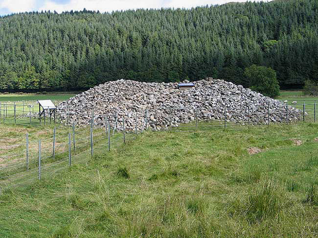
Nether Largie North submitted by jeffrep on 15th Mar 2008. Nether Largie Cairn North, Kilmartin Glen.
(View photo, vote or add a comment)
Log Text: Nether Largie North, Kilmartin: From afar (approaching it from Nether Largie Mid) this cairn had a white square in the middle of its top, which looked like Cairnpapple, which got me thinking you could enter the chamber. This was indeed the case, as the white square was a hatch which could be raised to descend into the chamber.. According to the information board, the capstone has 10 carved axes.
By this time, I think ‘monument overload’ had come over Andrew, who decided to go and get the car, saying he’d meet me at Kilmartin Church, giving me time to visit this cairn and Glebe Cairn before meeting him. I only had one walking pole, and overbalanced whilst trying to climb up the heap so stones so reluctantly gave up. I was disappointed not to be able to see this. We thought we might find time to go back and explore, but there really was so much else to see. One for the next visit.
Glebe Cairn
Trip No.87 Entry No.17 Date Added: 6th Aug 2018
Site Type: Cairn
Country: Scotland (Argyll)
Visited: Yes on 17th Jul 2018. My rating: Condition 3 Ambience 4 Access 3

Glebe Cairn submitted by PaulH on 1st Apr 2003. Kilmartin Valley
Glebe Cairn
NR 833989
Glebe cairn was constructed between 2000 and 1500 BC. It was built on the site of two earlier stone circles, and contained two burial cists
(View photo, vote or add a comment)
Log Text: Glebe Cairn, Kilmartin: By the time I’d walked from Nether Largie Stone Alignment, across to Temple Wood and to Nether Largie, South, Mid, North and Glebe Cairn, I realised it was quite a long way (about 2km the sign post said), but I hadn’t really noticed the distance as the sites were so fascinating to see.
From the lane leading from Nether Largie North Cairn, you need to cross a footbridge over Kilmartin Burn at NR 83147 98870. At this time of evening, the dragon flies were flitting over the water and the sheep were starting to gathered in a line along the fence.
Following the grassy footpath towards this huge heap of stones, I walked all the way around this cairn, which seemed much larger than the others. There were no real distinguishing features, such as cists or cist covers, that were visible. The mound seemed disturbed in places, with stones pushed out in small ‘arms’ here and there along its edges.
Rachel Butter’s Kilmartin book (page 58) says: “The Glebe Cairn: Excavators found two small stone circles beneath the cairn with two finely made pots and a jet necklace placed in two cists. The cairn is smaller than it was a century ago – in 1864 it was at least 4 metres high and 33 metres across.”
Nether Largie Stone Row
Trip No.87 Entry No.11 Date Added: 7th Aug 2018
Site Type: Stone Row / Alignment
Country: Scotland (Argyll)
Visited: Yes on 17th Jul 2018. My rating: Condition 3 Ambience 4 Access 4
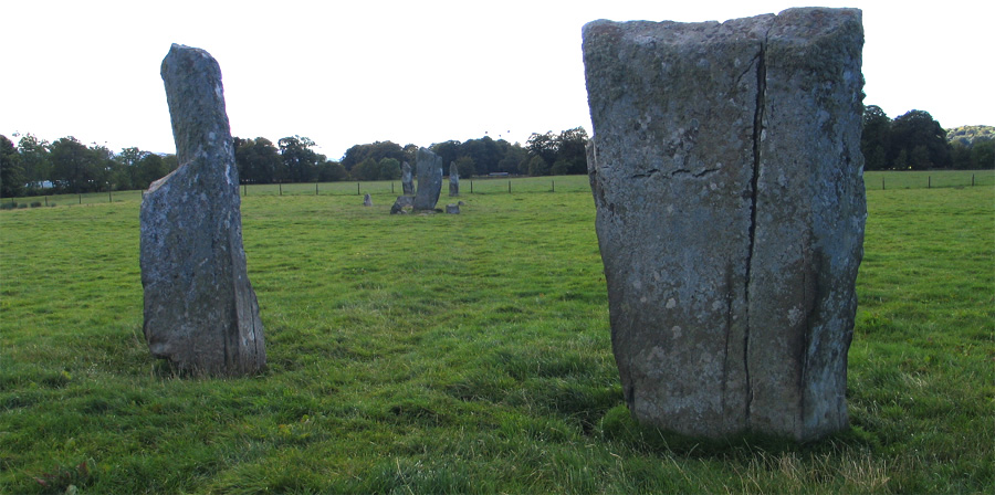
Nether Largie Stone Row submitted by jeffrep on 7th Feb 2013. The Netrher Largie Stones in Kilmartin Glen, Argyll and Bute, Scotland -- five central standing stones, arranged in an "X" shape. The nine foot central stone is accompanied by a number of smaller stones surrounding it. The central stone also has several cup marks.
(View photo, vote or add a comment)
Log Text: Nether Largie Stone Alignment: Ever since I read about this alignment in the early text for the Portal's book "The Old Stones" I've wanted to visit this location. It's in a lovely, lovely, setting, in the Kilmartin Glen. Having got used to Northumberland where you largely only see sheep or cattle around monuments, I was so disappointed by the number of people visiting here. We had two attempts, one being late in the evening, but there were still plenty of folks here. The photographers amongst us 'queued up' to take photographs along the alignment; when it was my turn, a family meandered over and spent half an hour wandering up and down the row, oblivious to me standing there with the camera. I did manage a couple of photographs along the alignment, but had to chose my moments when they were behind one of the stones! Congratulations to the Kilmartin Museum for having a great tourist trail, but I'd like to come back in late January/February, when hopefully there would be less visitors. After this visit, we stuck to sites largely off the main tourist trail.
Kilmartin Churchyard
Trip No.87 Entry No.18 Date Added: 7th Aug 2018
Site Type: Sculptured Stone
Country: Scotland (Argyll)
Visited: Yes on 17th Jul 2018. My rating: Condition 3 Ambience 4 Access 4
Kilmartin Churchyard submitted by Ghriogair on 16th Jul 2009. Kilmartin Churchyard
(View photo, vote or add a comment)
Log Text: Kilmartin Churchyard: Having booked ourselves in for an evening meal at the Kilmartin Arms opposite the church (warning: the portions were huge, but really good), we went across to the churchyard to find the cross slabs in the churchyard that Rachel Butter mentions in her "Kilmartin" book (page 99) and found so much more. This really finished the evening off nicely.
There is also a lapidarium and the Poltalloch Enclosure with some really nice carved grave slabs.
There is a small car park immediately outside the church, and there is disabled access into the church with its crosses inside. The churchyard itself was a little tricky to negotiate, as we had to step over old chest tombs to see some of the carved slabs. Nice views down to the glen below, and a peaceful place to spend time.
Kilmartin House
Trip No.88 Entry No.10 Date Added: 18th Aug 2018
Site Type: Museum
Country: Scotland (Argyll)
Visited: Yes on 18th Jul 2018. My rating: Condition 4 Ambience 4 Access 5
Kilmartin House submitted by DrewParsons on 29th Jun 2010. Located in the middle of the village of Kilmartin, the museum has a good display of local finds and interesting descriptions of the prehistoric sites in the neighbourhood. There is also a well stocked museum shop on the premises.
(View photo, vote or add a comment)
Log Text: Kilmartin Museum: We managed to get a space in the car park. From the number of cars parked outside the museum and along the roads, we thought the place would be heaving with people (including a bus tour which had turned up), but the café was quiet and relaxing and there was only one other lady and a younger man who was with her, in the museum.
The museum was small, and a bit disappointing for the £7 entry fee, but it was nicely laid out and they gave you a map of the sites to visit. The lady on reception told us we were allowed to take photographs, but as long as they were not for publication on the internet.
I bought 4 postcards and “In The Footsteps of Kings” book of walks around the Kilmartin area, which gave a lot of information about the area, together with photographs and what to look for, which helped inform our visits greatly – wonderful photos in it, too!
I photographed Glebe Cairn from the path running outside the conservatory.
I have since been in contact with the Visitor Services Office, at the museum, and received the following reply on 14th August 2018 (see private notes).
Mercat Cross (Clackmannan)
Trip No.84 Entry No.8 Date Added: 26th Jul 2018
Site Type: Ancient Cross
Country: Scotland (Clackmannanshire)
Visited: Yes on 14th Jul 2018. My rating: Condition 3 Ambience 4 Access 5
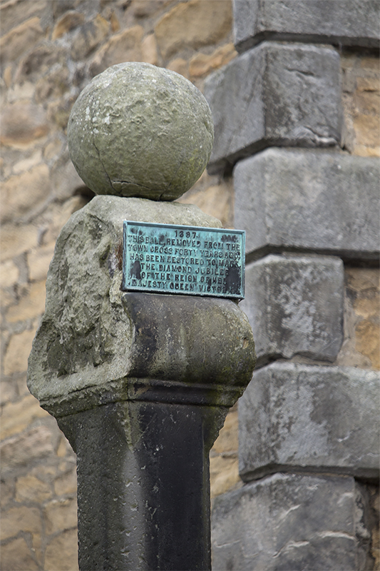
Mercat Cross (Clackmannan) submitted by peigimccann on 27th Aug 2017. Clackmannan market cross
(View photo, vote or add a comment)
Log Text: The Mercat Cross, Clackmannan: The Mercat Cross, the Stone of Mannan and the Tolbooth are all in the same small area. When we arrived, it was about 6.40pm and the sun was low in the sky, giving deep shadows. Much to the amusement of the people drinking outside the pub behind the Tolbooth, I took a number of photographs of these monuments, then retreated to the car to try and get out of the heat. Was worth seeing, but at this time of day I wanted something to eat, drink and cool shade!
Parkmill Cross (Alloa)
Trip No.84 Entry No.7 Date Added: 26th Jul 2018
Site Type: Ancient Cross
Country: Scotland (Clackmannanshire)
Visited: Couldn't find on 14th Jul 2018. My rating: Condition -1
Log Text: Parkmill Cross, Alloa: Could not find this – the grid reference seemed to be somewhere in a breaker’s yard. Parking in the nearby housing estate just to the south west of this location, we followed the footpath sign to the footpath which ran west-east along the bottom of the field this cross base is supposed to be in, the tall fence and padlocked gates prevented entry. Andrew tried to gain access from the car breakers yard to the north-west, but said it looks as if their site has been extended to cover where this cross might have been.
Stone of Mannan
Trip No.84 Entry No.9 Date Added: 26th Jul 2018
Site Type: Standing Stone (Menhir)
Country: Scotland (Clackmannanshire)
Visited: Yes on 14th Jul 2018. My rating: Condition 3 Ambience 4 Access 5

Stone of Mannan submitted by peigimccann on 27th Aug 2017. Stone of Mannan
(View photo, vote or add a comment)
Log Text: Stone of Mannan, Clackmannan: I was surprised to find this only about 20m east of the Mercat Cross (refer to that page for the rest of my visit report). Right next to the market cross and the Tolbooth. See the report above. I was interested to read the plaque on the eastern wall of the Tolbooth: “The Stone or Clack, originally placed at the foot of Lookabootye Brae, was sacred to the pre-Christian deity Mannan and is an unique relic of pagan times. It was raised on the large shaft in 1833”.
Wizard's Stone (Dollar)
Trip No.109 Entry No.4 Date Added: 11th Nov 2018
Site Type: Natural Stone / Erratic / Other Natural Feature
Country: Scotland (Clackmannanshire)
Visited: Yes on 31st Oct 2018. My rating: Condition 3 Ambience 3 Access 4

Wizard's Stone (Dollar) submitted by Anne T on 11th Nov 2018. Site in Clackmannanshire Scotland. Standing just to the east of the stone, looking north west across the footpath.
(View photo, vote or add a comment)
Log Text: Wizard's Stone (Dollar): We stopped off at a café in Dollar for a sandwich and cup of tea, then set off north east out of the town to find the Wizard’s Stone. This was really easy to spot. There is a small area to park on Hillfoot Road, where the road divides, at NS 96634 98999.
Rather than walk up ‘the (marked foot) path’ we walked into the field to photograph the stone. There are a number of pieces lying immediately around the stone, the larger of which appears deeply embedded in the ground; a smaller piece looks as if it had spalled off through, perhaps, frost action.
The Maiden Stone (Tullibody)
Trip No.109 Entry No.7 Date Added: 12th Nov 2018
Site Type: Sculptured Stone
Country: Scotland (Clackmannanshire)
Visited: Yes on 31st Oct 2018. My rating: Condition 3 Ambience 3 Access 4
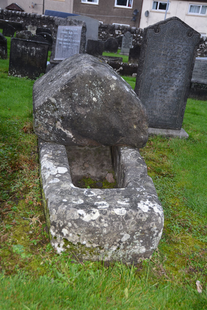
The Maiden Stone (Tullibody) submitted by Anne T on 12th Nov 2018. Site in Clackmannanshire Scotland. The Maiden Stone from the east. Whilst there are no visible carvings on the coped cover, I thought it might resemble how a hogback looked on a Viking tomb.
(View photo, vote or add a comment)
Log Text: The Maiden Stone, Tullibody: This stone coffin is next to the ruins of the old church. We parked in the car park for the new church and walked through the graveyard which runs parallel to the road. Some really unusual tombstones, and quite spooky to walk through the graveyard and look around the outside of the Old Church as dusk was falling on Halloween!
Castleton (Dollar)
Trip No.84 Entry No.6 Date Added: 26th Jul 2018
Site Type: Standing Stone (Menhir)
Country: Scotland (Clackmannanshire)
Visited: Yes on 14th Jul 2018. My rating: Condition 4 Ambience 4 Access 4

Castleton (Dollar) submitted by Anne T on 26th Jul 2018. Standing stone in Clackmannanshire Scotland. Standing just to the south west of the stone, looking at its location in relation to the surrounding hills and capturing its shadow at this time of the evening.
(View photo, vote or add a comment)
Log Text: Castleton Standing Stone, Pool of Muckhart: To find this stone, we followed the signs to the ‘Japanese’ garden, which had a large car park. The entrance and part of the car park were still in the process of being constructed, but was obviously just about to close for the night, so we parked as close a wall outside the entrance. Scanning the field for a gate, there was one by the farm house, some distance away (and it looked as if there was a small stream we’d have had to cross to reach the stone) or an old, painted red iron gate (very ornate) virtually opposite from where we parked. This had not been used in some time, and our usual gate opening skills didn’t work. We ended up climbing over the gate and walked across the field.
It was by now so hot and sticky, that the sheep had taken shelter under the trees to the east of this stone, in what looked like an old sheep fold, now fallen into ruin. This standing stone had two sides which were eroded, one with what looked like cups, but (having seen similar examples doing the ERA data entry exercise) are probably small holes where pebbles have fallen out, or possible solution holes if the stone had lain on the ground for some considerable time.
A very lovely spot, with gentle rolling hills to the north and north west.
Deil's Cradle (Dollar)
Trip No.109 Entry No.5 Date Added: 11th Nov 2018
Site Type: Natural Stone / Erratic / Other Natural Feature
Country: Scotland (Clackmannanshire)
Visited: Saw from a distance on 31st Oct 2018. My rating: Condition 3 Ambience 3 Access 3
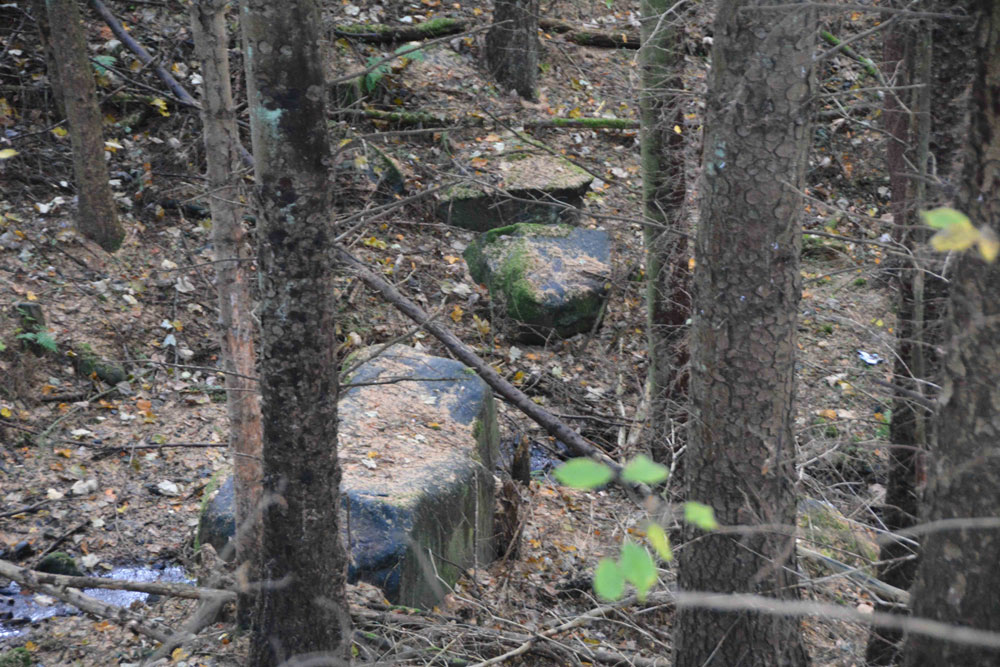
Deil's Cradle (Dollar) submitted by Anne T on 11th Nov 2018. Site in Clackmannanshire Scotland. With this large erratic at the bottom of a small gorge, with daylight failing, we wanted to get to Tullibody to see the Maiden's Stone, so photographed it from a distance only.
(View photo, vote or add a comment)
Log Text: Devil's Cradle, Dollar: With this being Halloween, I was keen to try and see this massive erratic rock. From the Wizard’s Stone eastwards, the road gets narrower, not much wider than a single track road, so we parked in Tarmangie Drive, at NS 96743 99038, and walked up Upper Hillfoot Road (the southern part) at NS 96743 99038. Looking down through the woodland, we saw a large erratic by the side of a small burn.
This stone is in a very deep gorge, and we couldn’t immediately see a way to get to it With a 70 degree slope on one side and a near vertical drop on the other, we decided, with the failing light, to carry on to Tullibody and see sites which we really wanted to get to before dark, so photographed this stone only from a distance.
Haer Stane
Trip No.109 Entry No.8 Date Added: 12th Nov 2018
Site Type: Standing Stone (Menhir)
Country: Scotland (Clackmannanshire)
Visited: Yes on 31st Oct 2018. My rating: Condition 3 Ambience 3 Access 4
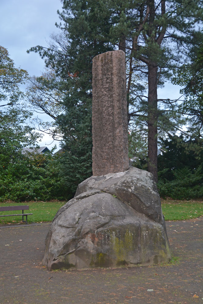
Haer Stane submitted by Anne T on 12th Nov 2018. Site in Clackmannanshire Scotland. Approaching the Haer Stane, which is at the far (north western) end of the park. It was dusk on Halloween, and the light was failing fast!
(View photo, vote or add a comment)
Log Text: Haer Stane, Tullibody: This is one of the strangest erratics I’ve seen, as it’s been repurposed as a war memorial. We parked on School Road, by the school, and walked down to the entrance to this long, thin park; the only gate we could find into this area was through a lych gate at the corner of School Road and Lychgate Road. The erratic is almost at the far (north western) end of the park.
The stone was adjacent to the rear of the school where a large construction project is taking place, so the noise was very intrusive. We were the only people taking note of this erratic; all the other people around must have been locals who were walking their dogs.
The crosses on the eastern face of the cross shaft have been well done, and mimic Anglo Saxon crosses with interlaced designs.
Barmore Fort
Trip No.48 Entry No.5 Date Added: 5th Oct 2017
Site Type: Hillfort
Country: Scotland (Cowal)
Visited: Saw from a distance on 21st Sep 2017. My rating: Condition 3 Ambience 4 Access 4
Barmore Fort submitted by SolarMegalith on 28th Aug 2017. The northern wall of the Barmore fort (photo taken on August 2017).
(View photo, vote or add a comment)
Log Text: Barmore Hillfort, Ormidale, Argyll: We saw this hillfort from a distance only. The map indicated a footbridge across the River Ruel. We drove up and down several times but couldn’t find it. The ground was so wet after heavy rain, we would have needed wellies to navigate the fields, so elected to view this from a distance only. We did drive back along the A886 looking for a parking space on the south eastern side of the fort, but there were only private driveways. A disappointing end to the day.
Balliemore (Craigendive)
Trip No.48 Entry No.1 Date Added: 4th Oct 2017
Site Type: Standing Stones
Country: Scotland (Cowal)
Visited: Yes on 21st Sep 2017. My rating: Condition 3 Ambience 4 Access 4
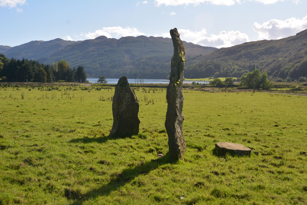
Balliemore (Craigendive) submitted by Anne T on 4th Oct 2017. Standing to the north of these two stones, looking south to the head of Loch Striven. A glorious location.
(View photo, vote or add a comment)
Log Text: Ballimore Standing Stones, West of Dunoon: To escape the rain in Armadale, we decided to take the ferry from Gourock to Dunoon. We stopped off in Dunoon for a cup of tea and a sandwich at The Tudor Coffee Shop above Thornton’s on the main high street, then we set off into the countryside, taking the B836 to Craigendive, past Loch Tarsan.
I spotted these on the map and as they were not very far off the beaten track, decided to stop off and find them. These two stones were in one of the loveliest places, just off the B836 (essentially a single-track road with passing places), to the north of Loch Striven. Surrounded by hills on three sides, on a lush, level grassy plain, with Loch Striven to the south, these standing stones lie immediately south of Balliemore Farm. We parked at NS 05511 84269, next to a pile of road gravel and stones, and walked up the track towards the farm.
There is one tall, narrow stone, and a shorter, triangular one, with a third slab lying at the base of the taller one. Packing stones can be seen in the grass.
The field was very, very wet, and we had to jump over the pools of water at the edge, particularly around the telegraph poles. A pair of wellies would have come in extremely handy!
Glendaruel Churchyard
Trip No.48 Entry No.2 Date Added: 4th Oct 2017
Site Type: Sculptured Stone
Country: Scotland (Cowal)
Visited: Yes on 21st Sep 2017. My rating: Condition 3 Ambience 4 Access 4
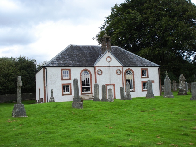
Glendaruel Churchyard submitted by Ghriogair on 21st Jul 2009. Glendaruel Church
(View photo, vote or add a comment)
Log Text: Kilmodan Stones, Glenaruel: Also known as Clacahn of Glendaruel and the Kilmodan Stones
Our second visit of the day, and another lovely spot by the River Ruel. We parked by the now deserted (almost derelict) hotel in Kilmodan village, and walked down towards the church, which is Georgian and very Church of Scotland inside.
The Lapidarium is situated to the south west of the churchyard, nearer to the river. The church guide leaflet says that the Lapidarium was formerly the mausoleum of the Campbells of Auchenbreck, roofed in as a Lapidarium. In 1970, the stones were moved from the graveyard into this building.
“The stones are 14th and 15th century and are of the Loch Awe school of carvers. The stone is schistose and the quality of the stone suggests if would have come from local quarries. In comparison to the other West Highland schools the workmanship is clumsy. In addition, the Loch Awe slabs were never inscribed. So we do not know the names of the patrons commemorated. There are 11 stones in the Lapidarium with number 6 being renowned as the finest example of the Loch Awe School. Stone 11 is the grave slab of Donald McCloy who was minister in Kilmodan from 1609 to 1636.
The bright light streaming into the Lapidarium made at this time of the afternoon made it difficult to photograph the stones properly, despite Andrew trying to block the light out, and me kneeling on the floor to avoid the direct sunlight.
There is a cup and ring marked rock mentioned on the map near to the hotel, although we were unable to find it.
Ardachearanbeg Standing Stone
Trip No.48 Entry No.3 Date Added: 5th Oct 2017
Site Type: Standing Stone (Menhir)
Country: Scotland (Cowal)
Visited: Yes on 21st Sep 2017. My rating: Condition -1 Ambience 4 Access 4
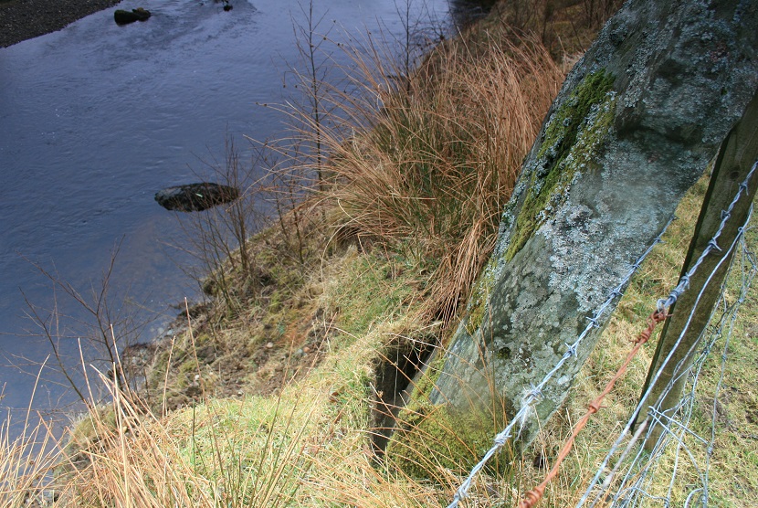
Ardachearanbeg Standing Stone submitted by postman on 7th May 2013. This was three years ago, I wouldn't take the bet its still there.
(View photo, vote or add a comment)
Log Text: Ardachearanbeg Standing Stone, Argyll: Hunted all along the fence line, peering into the river and along the banks for around 100 metres each side of the grid reference and couldn’t find this stone. There was no phone signal, so wasn’t able to call up the Canmore record to double check. Later found out (see below) it has fallen into the river, although we had a pretty good check, looking through the trees and in the river itself, for about 100 metres each way from the grid reference. The river was higher than normal due to all the rain in this part of the world.
Access into the field was from a gate along a small lane just west of the A886 leading to two farms/holiday cottages. There is a small layby at NS 00298 86038 at the junction to these lanes. The field slopes down to the River Ruel. Wellies are advised, as the field was pretty boggy at the time of our visit.
Meckan's Grave (Loch Riddon)
Trip No.48 Entry No.4 Date Added: 5th Oct 2017
Site Type: Cist
Country: Scotland (Cowal)
Visited: Yes on 5th Oct 2017. My rating: Condition 2 Ambience 4 Access 5
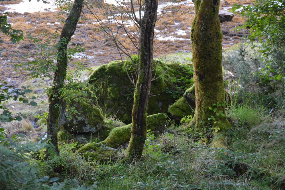
Meckan's Grave (Loch Riddon) submitted by Anne T on 5th Oct 2017. According to Canmore, the burial lies on the mudflat. I was disappointed not to be able to scramble down to take a closer look, but shot some photographs through the tree line. On closer inspection at home, I think this is the cist burial site - caught purely by chance!
(View photo, vote or add a comment)
Log Text: Meckan's Grave, Loch Ridon/Loch Ruel: There is only a signpost by natural crag but grid reference puts it on the mudflats at the head of Loch Riddon/Loch Ruel. There was a phone signal of sorts so I called up some images of Meckan’s Grave on the internet, only to find most people had photographed the crag, which had been blasted through to create the road.
It was virtually impossible for me to scramble down to the mudflats, so we ended up peering through the trees and caught what I thought might be a cist burial, which was more obvious on the computer screen at home. We didn’t spot the plaque.
We drove down to Shellfield Farm and looked back up at the head of the Loch from the fence next to the loch – wonderful in the early evening light.
