Contributory members are able to log private notes and comments about each site
Sites Anne T has logged. View this log as a table or view the most recent logs from everyone
Seal Well (Hexham)
Trip No.147 Entry No.3 Date Added: 6th Sep 2019
Site Type: Holy Well or Sacred Spring
Country: England (Northumberland)
Visited: Yes on 3rd Sep 2019. My rating: Condition 2 Ambience 3 Access 4
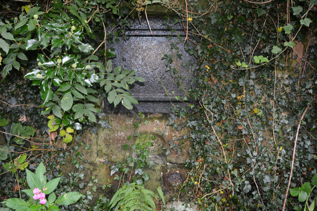
Seal Well (Hexham) submitted by Anne T on 5th Sep 2019. There was a vague path through the weeds to the well (we tried to reach it by a path a few metres to the west of the well, but it was far too overgrown to walk down), so I carefully made my way through the nettles and brambles to take a closer look.
(View photo, vote or add a comment)
Log Text: The Seal/Sele Well, Hexham: Walking into a part of Hexham we’d never been to before, we came across the Cock Shaw Burn which runs SW-NE along the western side of the Sele. We passed a gloriously ornate drinking fountain (now dry) next to the southern side of the school, right next to the footpath. At the western side of the Sele, a footpath turned to our right, downhill. At the bottom, a footbridge crosses the Cock Shaw Burn. We turned left along the footpath running along its southern side, and about 30m along, spotted a stone and cast iron structure behind the nettles.
We managed to trample down the nettles to get a closer look. I unhooked some of the ivy from the ring in the indentation in the middle of the well to get a closer look at the underlying well structure. No-one has seen this well in some time, but it was very nice to find it.
This is a really old part of Hexham, and one we’d never explored before. Nearby, a second burn (presumably the Cowgarth Burn) runs along a cobbled road through Tanner’s Yard.
We went onto find, and photograph, Wine's Well (to the west of Hexham) and the Park Well (to the east). These are recorded as just 'wells' on Pastscape, and have no holy or healing characteristics that I'm aware of.
Sewborrans Stone
Trip No.9 Entry No.2 Date Added: 14th Feb 2017
Site Type: Standing Stone (Menhir)
Country: England (Cumbria)
Visited: Yes on 12th Feb 2017. My rating: Condition 3 Ambience 3 Access 4
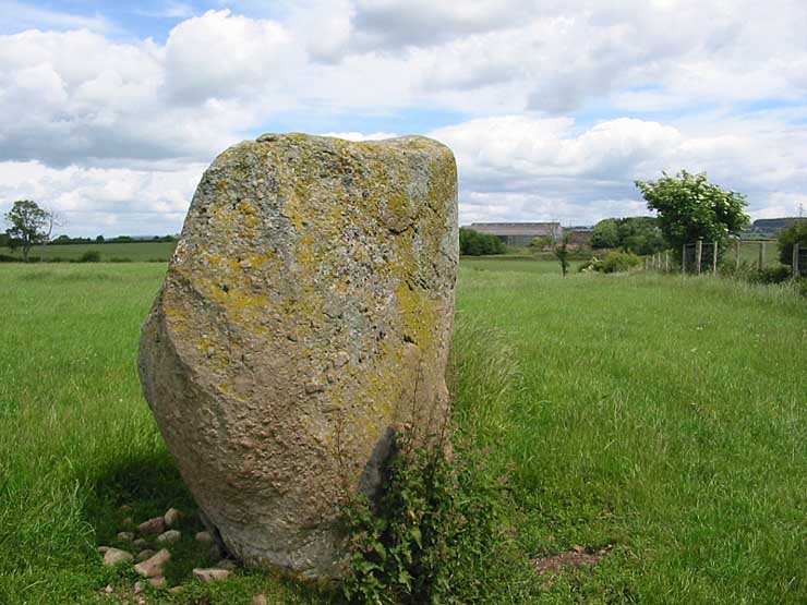
Sewborrans Stone submitted by stu on 16th Jul 2004. NY4884 2999.
1.5m high stone. Visible from the road.
(View photo, vote or add a comment)
Log Text: Sewborwens Standing Stone (and outliers), Penrith, Cumbria: From the Skirsgill Standing Stone, we made our way back on the A66, heading westwards (you can only turn left onto this dual carriageway). Turning round at the next roundabout, heading back to Penrith, we took the first left hand turn down the mnor road leading past the golf driving range and Greystoke Pillar (18th century monument to the 11th Duke of Norfolk). About 1.5 kms down this road from the A66, there is a barn on the right hand side of the road with a small (muddy) layby next to it. There is a gate into the main field to the east of the barn and the standing stone is visible next to the first fence line to the east.
There was nothing in the field, so we kept to its edge to look at the stone. Before reaching the stone, I spotted two more smaller stones in the hedge line, which looked like part of a row or avenue leading to the stone.
Having photographed the stone, I spotted more large stones against the wire fence. This modern fence has been put on top of what looked like an old (medieval?) stone wall line. There were at least three large boulders, two looking like they had been shaped and with flat bottoms, which had been moved against the old wall to clear the field.
An email to Cumbria County Council provided the information: "there are 2 smaller stones which may be related to the larger stone, beside the hedgerow bordering the B5288 and about 120 metres bearing 280 degrees from the major stone. The southernmost stone is c1.08 metres and the northermost stone is c0.75 metres.” They also added that notes from 1973 tell us: “Thompson records the ‘remnants of a stone sepulchural ring at Sewborrans”, but he doesn’t know what the original source was.
Sewingshields Crags
Date Added: 8th May 2015
Site Type: Stone Row / Alignment
Country: England (Northumberland)
Visited: Yes on 8th May 2015. My rating: Condition 3 Ambience 4 Access 3
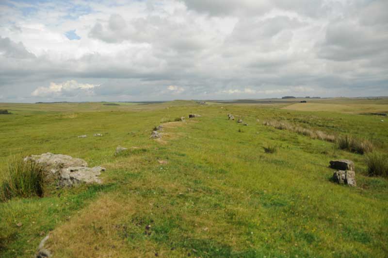
Sewingshields Crags submitted by Anne T on 8th May 2015. The boundary feature as it appears half way along its length, looking east.
(View photo, vote or add a comment)
Log Text: Sewingshields Crags Possible Stone Row, now known to be a boundary feature: I'm putting this on for completeness, as Andy B has added this as a site in it's own right; for my originalvisit report with more details, see Simonburn (Davy's Lee) Stone Circle visit report, 20th July 2014.
Having spotted a group of features on the map that looked interesting: Davy's Lee Settlement, Davy's Lee Stone Circle and various tumuli, we decided to take advantage of the sunshine and walk to this area. The previous weekend, we'd visited Standingstone Rigg, near Great Lonbrough Farm. If we had continued south along the footpath for a couple of kilometres from Standingstone Rigg, we would have reached Davy’s Lee from the north. Instead, we took the opposite approach, from the south, from the old military road (B6318). My husband parked the car by the Old Repeater Station (parking on the Old Military Road being sparse and difficult, with soft verges, lay-by's virtually non-existent and fast-flying cars driving up and down) having dropped me off at the farmhouse 100 yards west from this road junction, on the opposite side of the road, by the footpath up to Sewingshields and Sewingshields Crags. We’ve done this walk before, to see the Roman fishing loughs, but with this walk, we needed to follow the path nortwards past the farmhouses, round the back of Sewingshields Crags to the bottom of the hill, then turn off a track to the left hand side (approx. Grid reference: NY 80653 70820). The track disappears for a while, so we headed left up a bank with what looked like quarried stone at the top, running in a double row running approximately east to west (approx. Grid ref: NY 80393 70793).
Note: at the time of writing, I am going along to this area next week to help survey a group of stack-stands and/or sheilings (12th to 15th) so will have another look at this feature then.
Shap Avenue
Date Added: 7th Jul 2014
Site Type: Multiple Stone Rows / Avenue
Country: England (Cumbria)
Visited: Yes on 5th Jul 2014. My rating: Condition 2 Ambience 4 Access 3
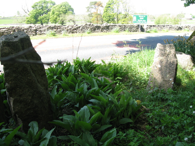
Shap Avenue submitted by AngieLake on 3rd Jun 2011. These were the most noticeable stones fringing the east side of the road, heading back towards the village after visiting Kemp Howe, that might have possibly come from the ancient monuments.
(View photo, vote or add a comment)
Log Text: Armed with information from the Portal and a map of the locations of the stones they've mapped in the stone row so far from Shap Local History Society, we started off at Kemp Howe stone circle, and walked round the village looking for stones. We met a couple of the more senior locals as we went round, and they were keen to help and point out where the stones were, and tell us of others. There are so many stones around and near to the village, most of them clearly on the same alignment that we became quite overwhelmed with the scale and sense of what our ancestors achieved and what it all represented.
We ended up at Skellaw Hill and the Thunder Stone, then had to call it a day, as we wanted to travel over to Swinside Stone Circle before heading off home.
The Shap Stone Row is certainly intriguing, and I came back with around 100 photos of possible stones and locations - I've picked two to submit that aren't already recorded on this page.
Well worth exploring, and whilst visiting, I'd also recommend hopping down to Shap Abbey and Keld Chapel nearby, too. Both are free to get into, and are in picturesque locations, with a lot of history attached.
Shapbeck Plantation
Trip No.15 Entry No.1 Date Added: 3rd Apr 2017
Site Type: Stone Circle
Country: England (Cumbria)
Visited: Yes on 2nd Apr 2017. My rating: Condition 3 Ambience 4 Access 4
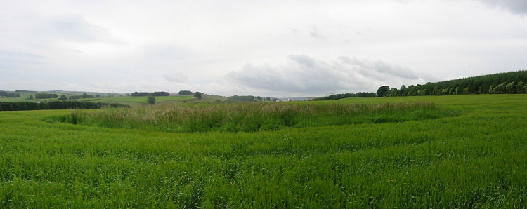
Shapbeck Plantation submitted by stu on 16th Jul 2004. NY552 188.
General view of the overgrown stone circle.
(View photo, vote or add a comment)
Log Text: Shapbeck Plantation Stone Circle: Our first stop of the day, whizzing off the M6 southbound at Eamont Bridge and travelling on the A6 through Clifton & Hackthorpe to Shapbeck Gate. There, a side road leads to a bridge across the River Leith, but there was no parking to be had. We turned back northwards up the A6 and parked in a layby some ¼ mile north of the footpath leading up to Shapbeck Plantation. We took our lives in our hands walking back to the footpath, with cars and motorbikes travelling fast along the road, and the verge was lumpy and bumpy and difficult to walk along.
Finally reaching the footpath, almost opposite the road leading to Southfield and Stonygill Bridge, we turned west over the fields towards Shapbeck Plantation, I was glad I had worn my wellies, as the gates into the fields were deep in muddy water. Careful of the stock in the first field, we crossed through the gate into a second field, where the footpath vanished – it had been ploughed out. Following the dry stone wall line up the hill towards the plantation, it was only when we had almost reached the top of the field that a fenced off area to the northern side of the field came into view.
Walking towards this, it was clear the farmer had been using this area as a dump for old metal items and other stones, although an inner and outer circle were clearly visible. It looked as if the circle had been built on a slight mound, with a ditch around the outside. At this time of year, there wasn't much vegetation, so it was possible to see lots of the stones.
Without the plantation, there would have been views 360 degrees around the site. Even today, this area was busy, busy, busy, with the A6, M6 and West Coast railway all intersecting and intermingling in the valley below. Walking across the fields, many of the smaller stones poking out of the earth had a very distinctly green tinge.
Definitely worth braving the traffic to visit this site.
Sheilknowe Burn Enclosure
Trip No.37 Entry No.3 Date Added: 8th Aug 2017
Site Type: Ancient Village or Settlement
Country: Scotland (Scottish Borders)
Visited: Yes on 6th Aug 2017. My rating: Condition 1 Ambience 3 Access 4
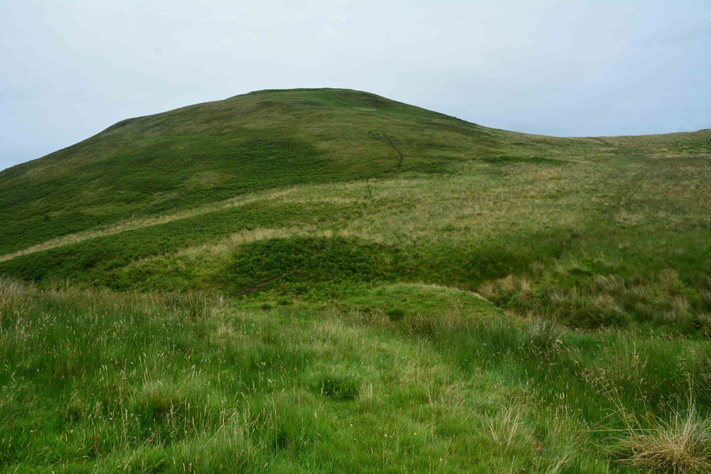
Shielknowe Burn Enclosure submitted by Anne T on 8th Aug 2017. Standing near the fence which cuts across the southern boundary of this horseshoe shaped enclosure, looking towards Shielknowe Burn, part of the land in a small loop of the burn seems to have slipped down. The burn forms the northern most boundary of the settlement. Green Humbleton hillfort is almost in the centre/top of the photograph.
(View photo, vote or add a comment)
Log Text: Shielknowe Enclosure, Yetholm: From the Virtue Well we made our way to Kirk Yetholm, finding the small side road which is actually the Pennine Way, but which can be driven down to a small parking area beside where the Halter Burn and Shielknowe Burn meet. Here a footbridge leads over the Burn, the Pennine Way and St. Cuthbert’s Way meeting at this point.
We tried St. Cuthbert’s Way first of all, running parallel to Shielknowe Burn on it’s eastern side, but after a few hundred yards, came across a rocky outcrop where I would have needed to turn into a mountain goat (OK for my husband, but not for me) so we retreated and walked almost back to the footbridge. There is another mown track which runs on the western side of the stream – boggier but much easier to follow and the sides of the small gorge not quite so precipitous.
It's a good job we had the GPS with us, together with a printed sheet of the Canmore details, otherwise we’d have walked across this settlement without knowing it was there. By finding it’s centre (the south western edge is almost at the corner of the fenced off field containing Shielknowe Burn Scooped Enclosure.
By carefully walking over the area, we could see very slight banks and changes in vegetation, but my goodness, had we not been out with NOWTAG, we would have missed this.
Sheriff Muir Row
Trip No.83 Entry No.2 Date Added: 24th Jul 2018
Site Type: Stone Row / Alignment
Country: Scotland (Stirling)
Visited: Yes on 13th Jul 2018. My rating: Condition 3 Ambience 5 Access 4
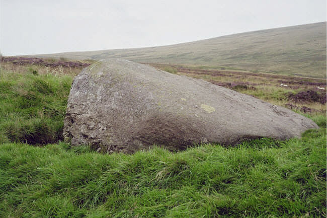
Sheriff Muir Row submitted by hamish on 15th Jul 2005. The recumbant stone it must have been quit impressive when upright.
(View photo, vote or add a comment)
Log Text: Sheriffmuir Stone Row: Please can I claim the Portal prize for 'the most horsefly bites at one ancient site'? At first glance, it looked easy to walk to this stone row. The reality was it was a couple of hundred yards from the road, in deep heather. Having waded through the shrubbery, and having found the Wallace Stone, however, finding the rest of the stones was easy, as they are more or less in a line running north east to south west. I managed to pull up Sandy G’s ”Stone Rows of Great Britain” website, with details of the stones, which helped enormously.
The horse flies were horrendous. I got eaten alive, and was glad to get back to the car to slap some antihistamine on. It was a real shame the Sheriffmuir Inn wasn’t open, as we were desparate for a cold drink (any drink, really) by the time we’d walked to, and photographed, all five stones.
We decided to go onto Dunblane for a cup of tea and something to eat (and lots of antihistamine cream for me!). Despite all the bites, I thoroughly enjoyed exploring this stone row, in the brilliant sunshine and glorious views.
Shielknowe Burn Scooped Settlement
Trip No.37 Entry No.4 Date Added: 8th Aug 2017
Site Type: Ancient Village or Settlement
Country: Scotland (Scottish Borders)
Visited: Yes on 6th Aug 2017. My rating: Condition 2 Ambience 3 Access 4
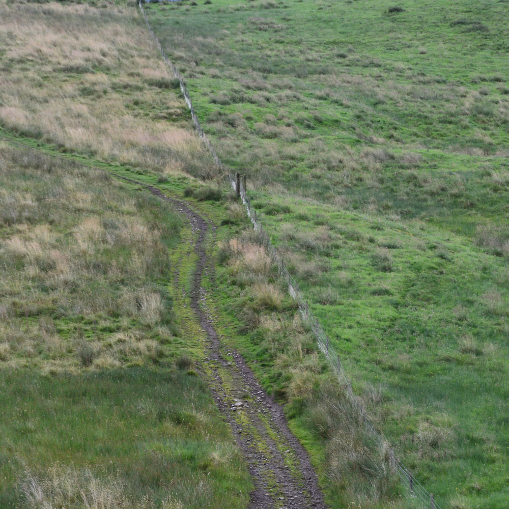
Shielknowe Burn Scooped Settlement submitted by Anne T on 8th Aug 2017. This Scooped Settlement can be seen from Shielknowe Enclosure. Its western most building platform is cut by a modern fence and St. Cuthbert's Way. Photograph taken from the almost ruined Shielknowe Enclosure to the south of Shielknowe Burn.
(View photo, vote or add a comment)
Log Text: Shielknowe Burn Scooped Settlement, Yetholm: This scooped settlement, lying on the northern side of Shielknowe Burn is much easier to see, and is visible from Shielknowe Enclosure, cut by the fence which also cuts the Enclosure. The muddy track from Shielknowe Enclosure runs downhill, crosses the burn, and leads up to join St. Cuthbert’s Way.
Two scooped out areas can be seen, although the farmer had very tightly knotted the twine securing the gate, so whilst Andrew (husband) hopped over the gate, I undid the ‘Gordion Knot’ to get into the settlement. The grass was very tussocky and wet, so walking along the banks of the western most scoop was interesting.
Much more exciting sites to come, so we didn’t spend an awful long time here.
Shitlington
Trip No.27 Entry No.4 Date Added: 27th May 2017
Site Type: Marker Stone
Country: England (Northumberland)
Visited: Yes on 25th May 2017. My rating: Condition 3 Ambience 4 Access 4
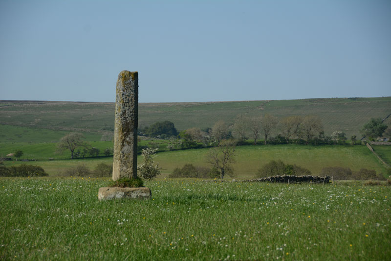
Shitlington submitted by Anne T on 27th May 2017. First view of the Shitlington Cross, walking across the field from the make-shift stile across the stone wall. The views across the surrounding moors are lovely.
(View photo, vote or add a comment)
Log Text: Shitlington Cross, near Bridge House (south of Bellingham): We stopped here because we were passing on the way to the Bridge House/Hetherington Farm homestead and it was marked on the OS map as a ‘cross’. It looks like an old standing stone on a sandstone cross base, similar to the Hurl Stone near Ewe Hill/Lilburn Grange (http://www.megalithic.co.uk/article.php?sid=35235but with a genuinely older base (not just reset in concrete).
Someone had made a stile over the wall into the field. As this was just pasture, we kept to the edge of the field to have a closer look. Very enigmatic, just sitting in the middle of the field with nothing around it.
Checked the top – there was no socket on top, just weathered. It was worth stopping to look because of the wonderful views over Watergate Moor, Wark Common and Broughy’s Hill. Could have sat here all day in the sunshine.
Shorter Cross
Trip No.131 Entry No.2 Date Added: 3rd Jun 2019
Site Type: Ancient Cross
Country: England (Devon)
Visited: Yes on 12th May 2019. My rating: Condition 3 Ambience 3 Access 5
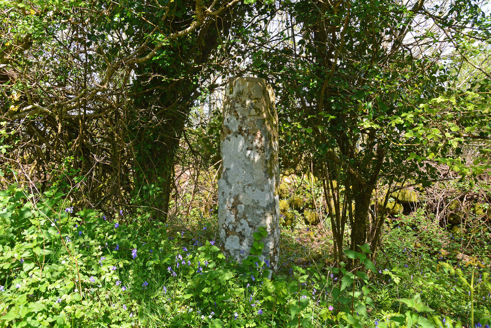
Shorter Cross submitted by Anne T on 3rd Jun 2019. At first glance the standing stone is just another tree-trunk along the side of the minor road - until you look closer. It is remarkably like a standing stone, but very well preserved.
(View photo, vote or add a comment)
Log Text: Shorter Cross, near Druid's Well, Chagford: Not far from Druid’s Well (about 350m as the crow flies), this is a lovely cross, more like a standing stone, with no cross arms.
The cross is well hidden behind/between trees, but we were able to walk into the dip/ditch between the road and the dry stone wall. The crosses on both faces of the stone were clearly visible; on the side nearer the road there was a small, square, equal armed cross inside a larger cross in relief.
Shovel Down Cairn Row 4
Date Added: 1st Aug 2019
Site Type: Cairn
Country: England (Devon)
Visited: Yes on 16th May 2019. My rating: Condition 2 Ambience 4 Access 3
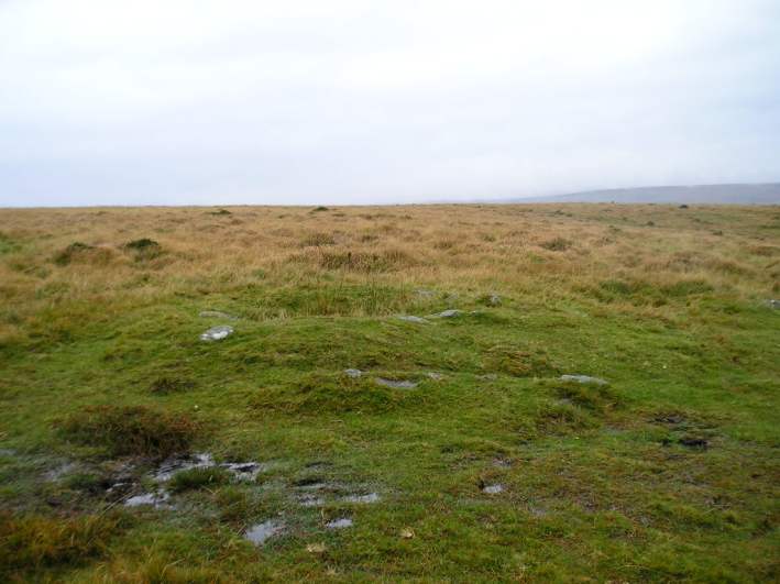
Shovel Down row 4 Cairn submitted by thecaptain on 16th Oct 2004. At the southern end of row 4 is a 7 metre diameter cairn with a central pit. This is the view looking west.
(View photo, vote or add a comment)
Log Text: Shovel Down Row 4 Cairn: Walking from Kes Tor across the moorland trackway, we came across this 'stony lump' at the top of a slope. Looking to my right (north), there was a double stone row running downslope at 90 degrees to the track. Only a small cairn, but interesting, particularly given its context. The group spent some time checking to see if any trace of the cist was visible, but we didn't find it.
Shovel Down Fourfold Circle
Trip No.135 Entry No.8 Date Added: 1st Aug 2019
Site Type: Stone Circle
Country: England (Devon)
Visited: Yes on 16th May 2019. My rating: Condition 3 Ambience 5 Access 3
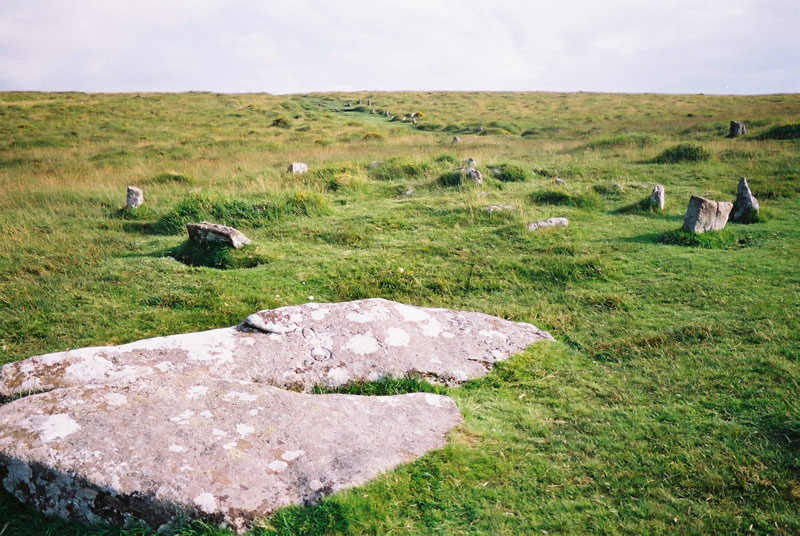
Shovel Down Fourfold circle submitted by simcon on 29th Aug 2003. SX659861 Shovel Down Stone Circle, Dartmoor Devon. I see this Web site lists two circles here, SE and NW. I only saw this circle which matches the description of Shovel Down SE Stone Circle. The view is looking south where the row continues to a large standing stone. Notice the two large standing stones fallen at the bottom of this picture. One has CP carved into it and the large stone over the hill has DC using the same size and style of letters. I do not know what this means. I parked in Fernw...
(View photo, vote or add a comment)
Log Text: Shovel Down Fourfold Stone Circle: Again, so many monuments in such a short walk – but by now, I should have stopped being surprised! At Kes Tor, Sandy G had spotted AngieLake, who had arrived a little later than us at the car park, and who had wandered about looking for us. By this time, it was lunchtime, and we were pleased to re-group and sit and take a welcome break, using the two large stones as the head of row 2 as a convenient picnic spot.
Whilst everyone was sharing out their sandwiches and tea/coffee, I took a few minutes to try and photograph the small-ish stones of the fourfold stone circle, largely hidden by the grassy tussocks, but none-the-less still recognisable as a kerbed cairn, although a little similar (if smaller) than Yellowmead.
With its proximity to row 2 and row 4, and other rows and features I'd not yet seen, this was an amazing spot.
Shovel Down row 1
Trip No.135 Entry No.12 Date Added: 1st Aug 2019
Site Type: Stone Row / Alignment
Country: England (Devon)
Visited: Yes on 16th May 2019. My rating: Condition 1 Ambience 3 Access 3

Shovel Down row 1 submitted by thecaptain on 14th Oct 2004. Shovel Down row 1.
At the northern end of this ruinous single stone row can be seen a few stones larger than the majority of theose remaining. Most of the remaining stones are very small and difficult to spot under the grass
This view is looking southwards along the general direction of the row.
(View photo, vote or add a comment)
Log Text: Shovel Down Row 1: My goodness, this row was difficult to spot! Thank goodness for Sandy’s patience, his wellington boots and his pole in pointing out a few of the stones!
Shovel Down row 2
Trip No.135 Entry No.9 Date Added: 1st Aug 2019
Site Type: Multiple Stone Rows / Avenue
Country: England (Devon)
Visited: Yes on 16th May 2019. My rating: Condition 3 Ambience 5 Access 3
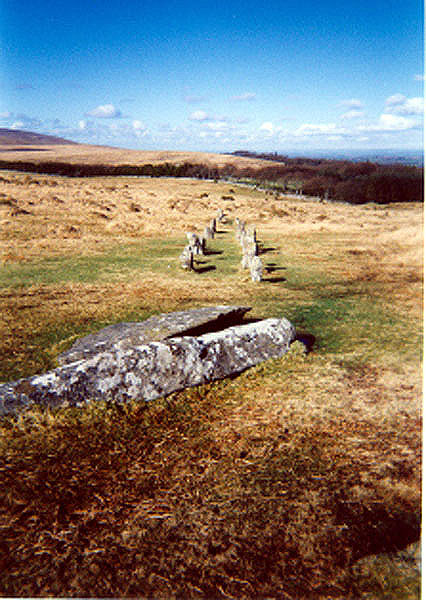
Shovel Down row 2 submitted by AngieLake on 27th Oct 2004. Looking in the opposite direction from Simcon's picture, the fallen portals are in the foreground of this photo and show the avenue leading up to them, and to the concentric circle or cairn.
(Taken on cheap single-use camera, as were the recent Scorhill postings)
(View photo, vote or add a comment)
Log Text: Shovel Down Row 2 with fallen standing stones: We enjoyed a much welcome lunch break at the two pillar stones at the head (southern end) of row 2. Angie got some photographs of Andy B sitting on the larger of the two pillars, and later I wished I’d have stood over her shoulder to get similar shots.
I didn’t walk to the northern most end of this stone circle, as I thought we proposed to visit it on the way back to the car park, but we took a slightly different route, so didn’t see the stones at its other terminus.
By this time of the day, the number of monuments we'd seen already was getting a little overwhelming (so many in such a relatively small piece of moorland), I was really glad I’ been very careful to write down the numbers of the photographs I’d taken for each monument, making it easier to sort the photos out into ‘which monument was which’ that evening.
Shovel Down row 3
Trip No.135 Entry No.10 Date Added: 1st Aug 2019
Site Type: Multiple Stone Rows / Avenue
Country: England (Devon)
Visited: Yes on 16th May 2019. My rating: Condition 2 Ambience 3 Access 3
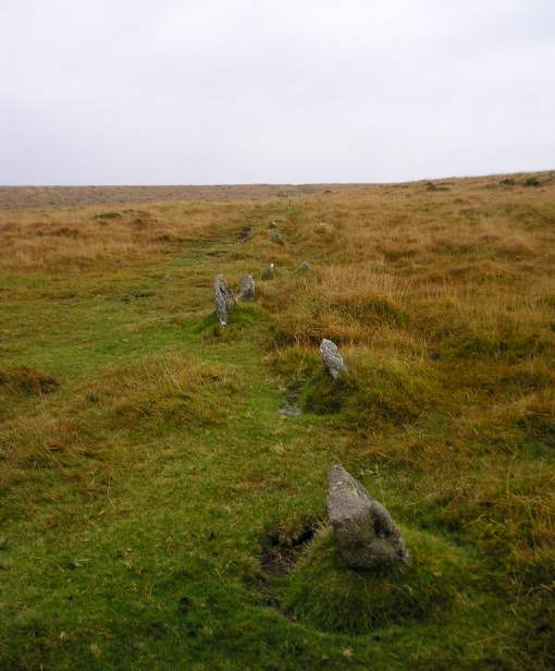
Shovel Down row 3 submitted by thecaptain on 16th Oct 2004. Shovel Down row 3 lseen here looking south from the northern part.
The row continues over the crest in the foreground and down into the dip, where it ends beside the Fourfold Circle.
(View photo, vote or add a comment)
Log Text: Shovel Down Row 3: To the west of stone row 2, and to the north of row 4, there was not much left to see of this row, which I tried to trace (without much success due to the high, tussocky grass on this part of the moor) as we walked down towards the stone circle.
Now writing up my photojournal, I’m pleased to see that Sandy G’s photographs, whilst showing a lot more stones, are a little similar to mine, largely showing the tops of stones peeking out of the grass. Good job for our superb guide, who pointed out the row to me.
Shovel Down row 4
Trip No.136 Entry No.7 Date Added: 1st Aug 2019
Site Type: Multiple Stone Rows / Avenue
Country: England (Devon)
Visited: Yes on 16th May 2019. My rating: Condition 3 Ambience 4 Access 3
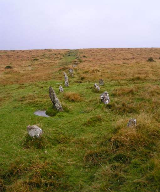
Shovel Down row 4 submitted by thecaptain on 16th Oct 2004. A typical Dartmoor avenue, seen here from the northern end, running off up the hillside to the south.
(View photo, vote or add a comment)
Log Text: Shovel Down Row 4: From Shovel Down Cairn Row 4, this row started just to the north west, the stones ‘marching’ steadily downhill. These stones were similar in size to the Drizzlecombe Stone Rows 1 & 2, but largely hidden in tall grass.
Whilst everyone else walked down to the Fourfold Stone Circle to start a well deserved lunch break, and see the start of Shovel Down Row 2, I paused to take photographs of row 4. The row reminded me more than a little of Standingstone Rigg in Northumberland, with the size of the stones and the steepness of the slope down which the stones ran (not literally!).
Shovel Down row 5
Trip No.135 Entry No.13 Date Added: 1st Aug 2019
Site Type: Multiple Stone Rows / Avenue
Country: England (Devon)
Visited: Yes on 16th May 2019. My rating: Condition 3 Ambience 4 Access 3
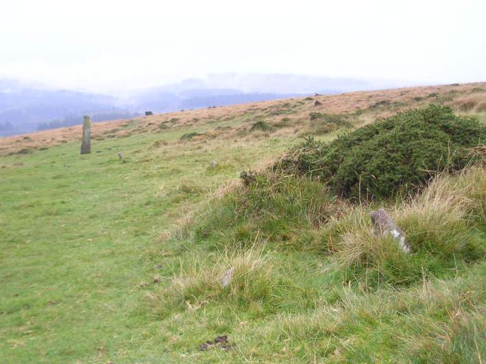
Shovel Down row 5 submitted by thecaptain on 15th Oct 2004. Shovel Down Row 5.
Although most of the stones in this avenue are either small or have been removed, traces of the row can be seen right to the Longstone.
View looking southwest at the lower end of the row, with Fernworthy forest in the distance.
(View photo, vote or add a comment)
Log Text: Shovel Down Row 5: Having been a little mystified by trying to find Rows 3 and 1, and having to rely on Sandy G to point out a few of the ground-level small stones, to find this stone row, running towards the Longstone, was really good. Glorious views over to Kes Tor, although it was still a little misty to get great photos.
Shovel Down row 6
Trip No.135 Entry No.15 Date Added: 1st Aug 2019
Site Type: Multiple Stone Rows / Avenue
Country: England (Devon)
Visited: Yes on 16th May 2019. My rating: Condition 1 Ambience 3 Access 3
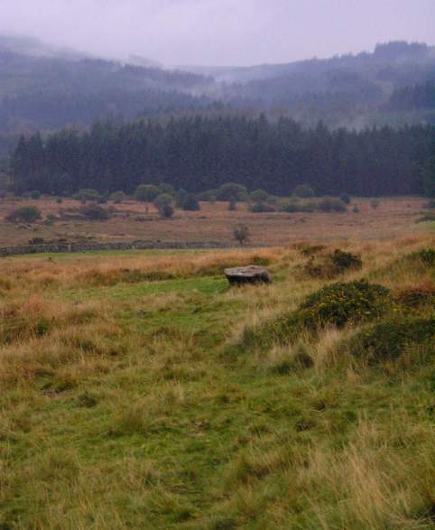
Shovel Down row 6 submitted by thecaptain on 15th Oct 2004. Shovel Down Row 6
View looking south towards the Three Boys Stone. Fernworthy forest in the distance.
(View photo, vote or add a comment)
Log Text: Shovel Down Row 6: Nothing is visible of this row now, although we walked down the line of the row to get to the Three Boys.
Shovel Down stone circle
Trip No.135 Entry No.11 Date Added: 1st Aug 2019
Site Type: Stone Circle
Country: England (Devon)
Visited: Yes on 16th May 2019. My rating: Condition 2 Ambience 3 Access 3
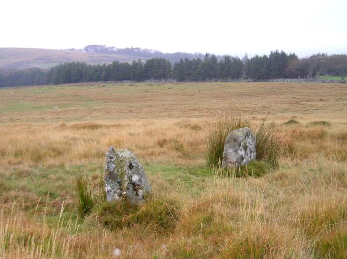
Shovel Down stone circle submitted by thecaptain on 13th Oct 2004. Two of the remaining standing stones viewed looking east.
The northern end of row 3 is just down to the right of this picture somewhere.
(View photo, vote or add a comment)
Log Text: Shovel Down Stone Circle: Before we visited this site, I thought there would be nothing to see, but I was wrong. Whilst there are just three stones remaining, they appear to the eye to sit along the arc of a circle. However, the authenticity of this stone circle is queried by Pastscape.
The stones are sited in deep, tussocky grass, I was very pleased to be able to reach this stone circle, not far off the main footpath, using my walking poles to balance.
Our GPS recorded the three stones at:
SX 65830 86187, SX 65822 86196 and SX 65823 86199
Sidwood Iron Age Settlement
Date Added: 20th Jun 2014
Site Type: Ancient Village or Settlement
Country: England (Northumberland)
Visited: Yes on 11th Jun 2014
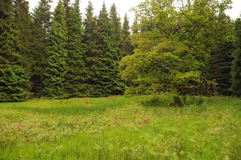
Sidwood Iron Age Settlement submitted by Anne T on 11th Jun 2014. This was our first view of the settlement, on the left hand side of the footpath from Tarset Burn. The site is in a forest clearing, demarked by an old tree which stands on its own.
The foundations of two hut circles are clearly visible through the grass and bracken, and the entrance (to the left hand middle of the photograph) and sunken yard are clearly identifiable.
(View photo, vote or add a comment)
Log Text: None
