Contributory members are able to log private notes and comments about each site
Sites Anne T has logged. View this log as a table or view the most recent logs from everyone
Rochester (Otterburn)
Trip No.31 Entry No.2 Date Added: 19th Jun 2017
Site Type: Modern Stone Circle etc
Country: England (Northumberland)
Visited: Yes

Rochester (Otterburn) submitted by Anne T on 19th Jun 2017. View of this modern stone circle from the gateway into the field from the rear of the Camien Café.
(View photo, vote or add a comment)
Log Text: Rochester (Otterburn) Modern Four Poster: We’ve seen this stone circle and a tumble-down round house whilst driving by on the A68 on a number of occasions but never stopped. However, today, after a hot but pleasant afternoon walking to Dour Hill Cairn, we doubled back to the café for refreshments and got chatting to the owners.
The café owners told us there used to be a round house here, but it was demolished by the University of Newcastle who ran the Brigantium project. There is now a timber faced building on the site and they intend using it for ‘Dark Skies’ and the Redefest music festival which is run on 1st weekend of August in Redesdale (this year it will be Friday 4th August to Saturday, 5th August). See https://redefest.org.uk/about-us.
Robin of Risingham (Woodburn)
Trip No.33 Entry No.1 Date Added: 10th Jul 2017
Site Type: Carving
Country: England (Northumberland)
Visited: Yes on 8th Jul 2017. My rating: Condition 3 Ambience 3 Access 4
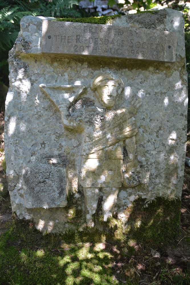
Robin of Risingham (Woodburn) submitted by Anne T on 9th Jul 2017. The carving (a half sized modern replacement put here by Redesdale Society in 1983). Behind this carved stone there is a gap of a few inches then a huge, odd shaped boulder. Despite numerous searches on the internet we've been unable to find where the remains (the legs) of the original carving are currently kept. They didn't appear to be on the boulder - we looked long and hard.
(View photo, vote or add a comment)
Log Text: Robin of Risingham, West Woodburn: Our first stop of the day, just south of West Woodburn on the A68. The sun was shining, it was warm and there was barely a breeze apart when the many motorbikes whizzed past at high speed.
Conveniently, there is a layby next to the start of the footpath leading from the A68 to Parkhead Farm at NY 90466 85463. Letting ourselves in through the gate into the field, the view was picturesque with views across the River Rede Valley to the west and pretty sheep and their large lambs.
We were keen to see this as the Historic England entry says this is the only known Roman statue carved from rock in Northumberland.
Making our way to the southern edge of the farm, there was a track leading through the field just to its east, just above their driveway. Following this to the end of the field, there was no way out – no stile, no sign, nothing. We retraced our steps and tried to find a different way past the farm buildings and ended up in a barn with some wonderful horses. In the end, we let ourselves into the farmyard and walked down the driveway, hoping to come across someone so we could ask where the proper path was.
There are some 3 to 4 houses along your left hand side here. Walking past the last one, Robin can be found about 100 metres further along the driveway. Husband Andrew then headed up the short tree covered slope to the wall separating the farm drive from the quarries above and found the carving hidden amongst the trees.
The dappled sunlight coming through the trees made this tricky to photograph. All the literature we’ve read said only the legs remain. We hunted for ages to see if they were on the rock behind the modern replica, or on the surrounding stone walls.
The intention later was to find the Roman Tombs on Otterburn Ranges which weren’t being used for military training this weekend, but we spent so long on other sites that we left this for another day.
Robin Hood's Well (Chollerton)
Date Added: 4th Sep 2014
Site Type: Holy Well or Sacred Spring
Country: England (Northumberland)
Visited: Yes on 3rd Sep 2014. My rating: Condition 1 Ambience 2 Access 4

Robin Hood's Well (Chollerton) submitted by Anne T on 4th Sep 2014. Walking across the field from the footpath from the B6342 to Well House Farm, this is the first view of Robin Hood's Spring/Holy Well. [I double checked the grid reference to ensure I had the right place].
(View photo, vote or add a comment)
Log Text: Robin Hood's Well, Colwell, Northumberland: I last visited Colwell on 13th June 2014, when we went in search of the old chapel (located in someone’s back garden, so not accessible without permission), the two wells in the centre of the village – Coley’s Well and Pricky’s Well – and Blue Crags Hill Fort (also known as Brecken Hills Fort).
Both Coley’s Well and Pricky’s Well are at the eastern edge of the village at the cross-roads where the northern most side-road from the A68 leads eastwards to meet the B6342. Whilst part of the area’s rich history, neither well is pleasing to the eye (very similar to Meg’s Well in Aydon). They sit alongside a small stream, the Coal Burn.
About 200 yards south of the village is a third well, Robin Hood’s Well. As this is recorded as a holy spring, I was keen to see this, so stopped off whilst I was passing by.
There is parking in a layby by the road junction mentioned above, near to Pricky’s Well. From here, it is a 200 yard walk south down the B6342 to the footpath which leads eastwards towards Well House (grid reference: NY 96641 74198. This is a very busy little road, with no footpaths, so I had to keep stepping up onto the grass verges to avoid the traffic.
Robin Hood’s Well is almost on the field boundary next to the road. To reach it, on opening the gate to the field by the footpath sign, you need to turn right immediately and walk 50 yards or so to the south (towards the woodland). The first view is of a post sticking up from marsh grass, which looks like a fence post. As you get closer, you will see a stone lying next to the post. A closer look shows a pool of water around the post and stone, and boggy ground surrounding it – a shame it is so unremarkable for such a historic well.
There is a further spring which appears 100 yards further south down the field, which has a clearer water course marked by stones on either side, but was dry (although the ground was very boggy) on the day of my visit.
At (or near) Well House Farm (according to the Hexham Courant and Visitor UK web sites) there is also a fourth sulphurous well, The Bore Well, reputed to improve fertility and which is well cared for with a proper housing.
Robin Hood's Well (Burghwallis)
Trip No.64 Entry No.1 Date Added: 16th Jan 2018
Site Type: Holy Well or Sacred Spring
Country: England (Yorkshire (South))
Visited: Yes on 15th Jan 2018. My rating: Condition 2 Ambience 2 Access 5
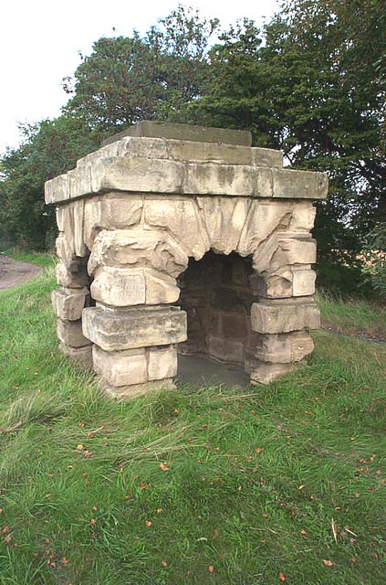
Robin Hood's Well (Burghwallis) submitted by Andy B on 18th Oct 2010. The old well has now been capped with concrete.
(View photo, vote or add a comment)
Log Text: Robin Hood's Well, just off the A1 near Burghwallis: With the rain pounding down on the car and a warning light just appeared on the car dashboard, we were glad to pull off the A1 near Burghwallis. It was easy enough to pull onto the layby (it was a busy place), but difficult to get back onto the A1 and we had to wait quite a long time for a big enough gap in the traffic to appear.
I pulled my coat on and headed off the few metres from the car to the well housing, getting soaked on the way. Having wanted to stop off here for years, but never having succeeded, I confess to being really disappointed. This really is just a recently constructed stone 'well house', with a bit of graffiti inside and a vague hollow for where the well pipe might have been situated. Still, I achieved it and got a few photos, having to wipe the camera down well once I huddled back in the car to warm up.
Robin Hood's Well ( Yorkshire)
Date Added: 8th Sep 2015
Site Type: Holy Well or Sacred Spring
Country: England (Yorkshire (North))
Visited: Yes on 5th Sep 2015. My rating: Condition 4 Ambience 3 Access 3
Robin Hood's Well ( Yorkshire) submitted by HOLYWELL on 16th May 2010. A Victorian fancy or pagan site? More likely the other as Robert James Culverwell in his
"The Enjoyment of Life; or Health, Recreation and Rational use of Time, 1850" notes:
Yet for awhile let gay fancy beguile us with merry visions of the past. On this glade, the Curtal Friar of Fountains encountered Robin Hood, whom at length he threw into the Skell and, afterwards, fought to his heart's content. Then whistled out so many of his good ban dogs; but Little John let his arrows fly among them ...
(View photo, vote or add a comment)
Log Text: Robin Hood's Well at Fountain's Abbey, North Yorkshire: After our visit to Ripon Cathedral to see the Anglo Saxon/Pre-Norman stones, we took our small grand-daughter over to Fountains Abbey to enjoy the sunshine in a beautiful location. Walking past the Abbey to Studley Royal Water Gardens, we retraced our steps on the opposite side of the River Skell to the Abbey ruins. I'd spotted this structure on the walk down and said "that looks like a well". When we went past it on the return leg of our walk, it was indeed a well, although dry. It wasn't until I got back and checked on the Portal that I found out it was "Robin Hood's Well."
The stones on the left hand side, as you face the well, look as if they are being undermined by the wear on the track that leads up past it to the woods, but comparing the photographs submitted in 2010, it hasn't changed much.
Peering inside the well, there is a stone channel on the left hand side at the top/back of the well which routes water (if there is any) into the basin at the bottom.
Ripon Cathedral
Date Added: 7th Sep 2015
Site Type: Ancient Cross
Country: England (Yorkshire (North))
Visited: Yes on 5th Sep 2015. My rating: Condition 3 Access 5
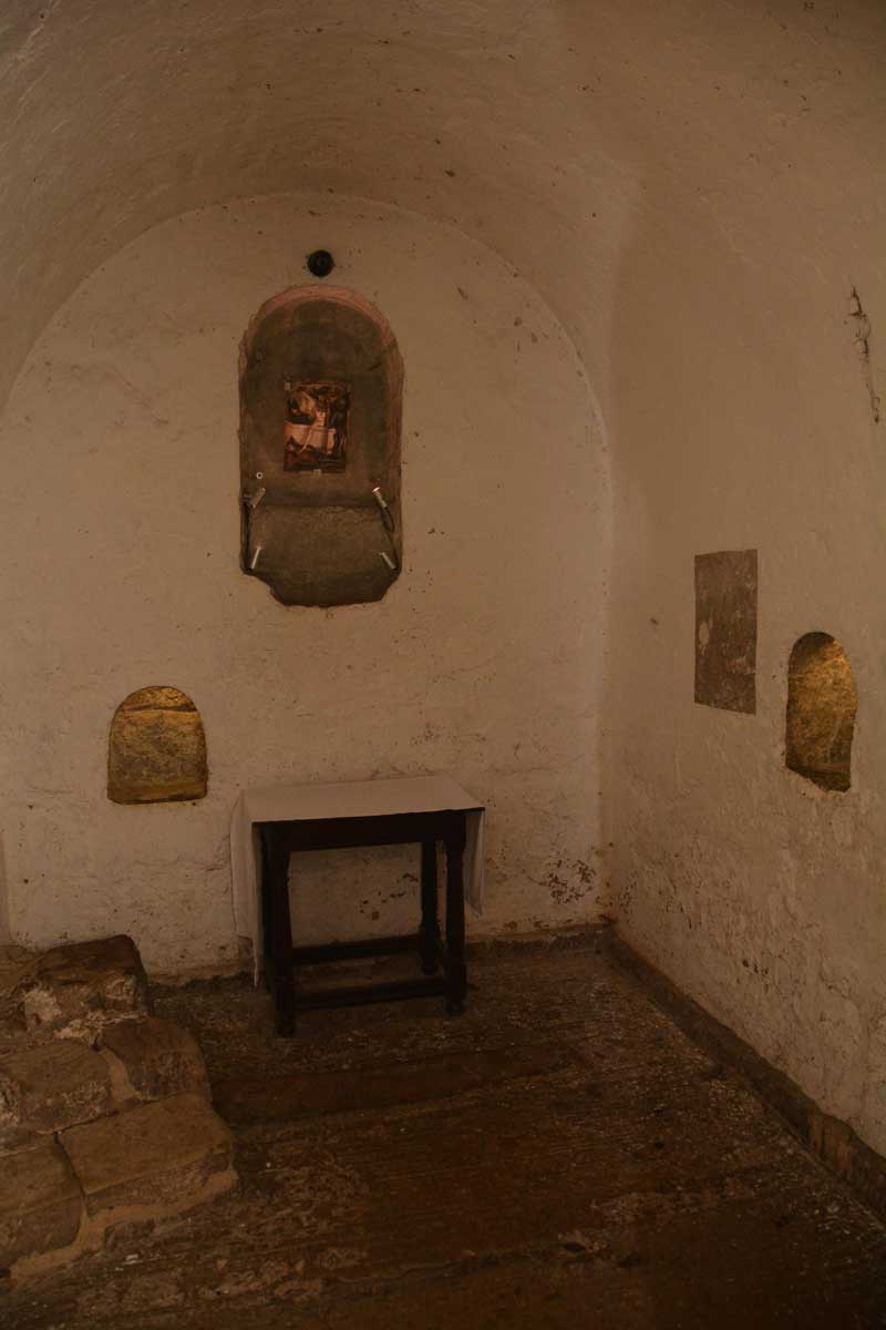
Ripon Cathedral submitted by Anne T on 3rd Aug 2015. This is the Anglo Saxon crypt at Ripon Cathedral, which is said to be part of St. Wilfrid's original 7th century church on this site. It has been white-washed since I visited 3 years ago. No sign of the Anglo Saxon cross fragments we were told might be down here, but very interesting never-the-less.
(View photo, vote or add a comment)
Log Text: Anglo Saxon Stones, Ripon Cathedral: Visit by arrangement with the Head Verger, 5th September 2015.
I'd made enquiries about the Anglo Saxon stones and received the following reply: "There is in fact little at Ripon by way of sculptured remains from the Anglo Saxon period. Clearly the Crypt itself is entirely Anglo Saxon, but there are no carvings here and some at least of the stones are Roman in origin. What remains otherwise are two stones built into the outer wall of the North Transept which are said to have come from Wilfrid’s 7th Century church. They have distinctive Celtic interlaced patterns. Also, in the Chapel of the Resurrection below the Chapter House there is a substantial drumstone which was one of two discovered in the 1990s under the tower. They are thought to be column bases from Wilfrid’s church. They are shaped with three stepped bands, but otherwise not decorated. One remains where it was found, the other now serves as an altar stone in the Chapel. (I wonder if these are the ‘imposts’ you have heard about?) The Chapel is not normally accessible, but it might be possible to arrange with a verger to see it.
The other early piece of stonework is the Sigurd Stone which is part of a stone cross which bears the image of the legend of Sigurd who was a Norse hero who sucked his thumb after a burning encounter with a dragon - though there are various interpretations of the story. The representation of this story on a Christian cross is of course remarkable, but this may not be of so much interest as it probably comes from a slightly later period. The stone fragment itself is currently in store."
In fact the Sigurd stone was largely obscured by staging, which hadn't been removed, so the verger on duty had to bring a torch to illuminate the three fragments, and I had to move fire extinguishers and clamber on top of staging to be able to see it at all. What a shame - this is a fantastic example of Anglo-Scandinavian carving. The verger also took me down to the Resurrection Chapel to see the large drumstone which now forms the altar; then we dived across into the north aisle to another small chapel to see another drumstone, worked into a font in the distant past but now topped with a modern circular mirror. We then went outside to see the stones in the external wall of the north transept (west end), then to the south nave where we'd spotted what looked like the remains of an ancient preaching cross (which I've also enquired about - yet to see a reply).
The cathedral was exceptionally busy, with the Great North Art Show being on, and the Northern Philharmonic Orchestra rehearsing for a concert that evening. Well worth going! Many thanks to the vergers for their time and patience.
First visit, 28th August 2015: Anglo Saxon Stones at Ripon Cathedral: I was intrigued by this page on the Portal, as I've been to several events here and not noticed any Anglo Saxon cross fragments , so when passing through decided to stop and have a look.
We were greeted by a guide and asked him if he knew of the whereabouts of any Anglo Saxon stones or sculptures and were told they were probably down in the Anglo Saxon Crypt. I also had to pay £3 in order to take photographs within the Cathedral.
The crypt has been white-washed since I last saw it (which is probably how it would have been in Anglo Saxon times) and this somewhat spoiled the ambience for me. There was a piece of wall left in its original condition, and you could see the remains of well worn scratches (possible runes and a small dedication cross?). I wasn't convinced this is what I was looking for.
Since coming home, I've researched what this stone(s) might be and found reference to a 'roman-looking' carved pillar and some imposts on the Corpus of Anglo Saxon Stone Sculpture web site. We certainly didn't find these, although we had a good scout round. I have since sent off an email to one of the senior admin team at the Cathedral, and will report back when I get a reply.
Ringhole Copse Cross
Trip No.132 Entry No.2 Date Added: 5th Jun 2019
Site Type: Ancient Cross
Country: England (Devon)
Visited: Yes on 13th May 2019. My rating: Condition 3 Ambience 3 Access 5

Ringhole Copse Cross submitted by Anne T on 5th Jun 2019. Standing on the grass verge to the east of the Ringhole Copse Wayside Cross, looking west. Historic England says this cross "(is) on an upland ridge which is the watershed between the valleys of tributaries to the River Yeo and River Taw". With the busy A30 just metres away to the north (right hand side of the cross), the cross felt lonely and isolated. Just think what foot traffic passed it in Medieval times!
(View photo, vote or add a comment)
Log Text: Ringhole Copse Wayside Cross: Not on our original list, but we spotted this cross on the map, with only a minor detour to our next few stops for this morning.
This wayside cross is adjacent to, and just south of, the A30, about 20m west of the road which connects the minor roads running over the A30 . Strangely, it looks as if it is in its original spot, although the HE scheduling information tells me that it was relocated to its present position in 1988 when they improved the A30.
The incised cross on the eastern side is clearly visible, but only part of the carving on the western face is visible under the covering of lichen.
Ring Hill Cross
Trip No.132 Entry No.3 Date Added: 5th Jun 2019
Site Type: Ancient Cross
Country: England (Devon)
Visited: Yes on 13th May 2019. My rating: Condition 1 Ambience 2 Access 4
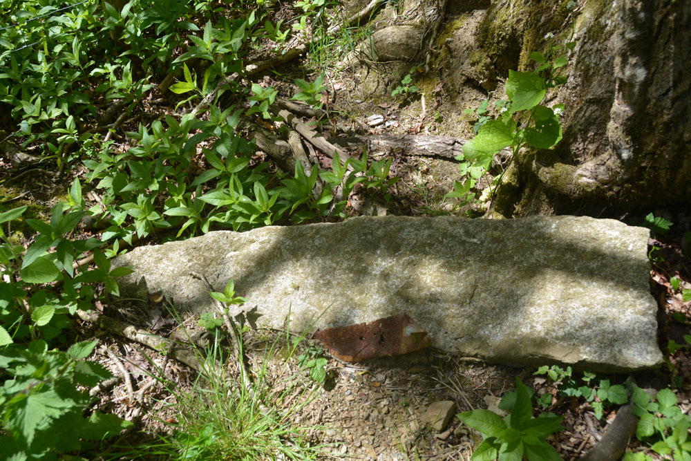
Ring Hill Cross submitted by Anne T on 5th Jun 2019. A closer look at this tapered stone, lying close to the grid reference point. The fact it had been left (carefully?) by the tree, as opposed to having been deposited roughly with other lumps of stone nearby indicated it might have been important and set aside for a reason.
(View photo, vote or add a comment)
Log Text: Possibly the Ring Hill Wayside Cross?: From the Pastscape description, and armed with our GPS, this cross should have been relatively easy to find, but was actually the hardest. We spotted the old footpath coming down the slope and joining the minor road to South Zeal, but the fence posts and gates have been renewed in very recent years. The cross was perhaps 5m to the west of its given grid reference.
There were a few old gateposts lying around near the fence line, so we thought we’d take a very sneaky look. Letting ourselves cautiously in through the gate, we spotted an old granite gate post at the foot of a tree, which matched the description given by Pastscape, so I photographed it. Nearby was the remains of a brick structure, which looked a bit like an old fireplace back, but which is marked as ‘W’ (well) on the HE map.
Ring Chesters
Trip No.41 Entry No.5 Date Added: 27th Aug 2017
Site Type: Hillfort
Country: England (Northumberland)
Visited: Yes on 26th Aug 2017. My rating: Condition 3 Ambience 5 Access 3

Ring Chesters submitted by Creative Commons on 21st Dec 2011. Ring Chesters hillfort. Copyright Andrew Curtis (http://www.geograph.org.uk/profile/32242), re-used under Creative Commons licence.
(View photo, vote or add a comment)
Log Text: Ring Chesters, Elsdonburn Shank: This was a relatively long walk. Having parked at Thompsons Wall Farm (NT 86817 30529), we took the tarmacked footpath up to Elsdonburn Shank farm (discussed farmhouse but the land is still farmed) and neatly kept.
Just before the barn at Elsdonburn Shank, we diverted down the footpath to (an un-named burn) where there is a gate leading to the small stream with stones placed to step across. From here, it is uphill towards the north and south ‘villages’, with large boulders punctuating the path. Having left the villages, there is a reasonably steep climb 160 metres or so up to the start of Ring Chesters Hillfort.
The black clouds had been gathering all afternoon, and as soon as my foot touched the second ring of the hillfort, the wind began to howl and raindrops stung my face. A lot of my photographs have rain splatter across them, despite constantly wiping the lens. Although the wind was strong and it was raining, it was still warm and I was in my sleeveless blouse.
The views around this hillfort are impressive, with 360 degree views. You can see as far as the sea to the north east. I clambered up the norther rings, where a trackway through has been worn by the sheep. From the aerial photographs, the main route is in the north west, with another in the south east - although this was less obvious as it was staggered, and the wind was much stronger in this direction and I felt I was being blown back to the west!
A quad bike track has been worn in the south western section, and this leads onto a level platform which looks as if it might be for either crops or animals.
The top is covered in structures and archaeology, which in the wind and rain was impossible to appreciate fully. Several roundhouses were visible, one in particular which seemed to have a hearth.
As we walked back down the hill towards the ‘villages’ the rain and wind stopped. I confess it was a relief to get out of the wind. This time we followed the marked footpath, which is towards the fence which runs just to the north of the northern-most village enclosure, and followed this until it disappeared. We then picked up the line of stones running towards the burn, up and over it, and back up the hill towards Elsdonburn Shank farm.
From here, we went in search of the elusive shielings that we’d missing on the way up. Passing by the barn near the farmhouse, I somehow managed to disturb all the pigeons roosting, and they came flying out of the barn like bats emerging from the eaves of a house in the evening.
Ridley Common
Date Added: 16th Sep 2014
Site Type: Stone Circle
Country: England (Northumberland)
Visited: Yes on 14th Sep 2014. My rating: Condition 3 Ambience 4 Access 2
Ridley Common submitted by TheWhiteRider on 2nd Jul 2006. Ridley Common Stone Circle. Only visible from the other side of a boundary fence. A number of keep out/private property signs made it abundantly clear that taking the easier route up a road to look at the circle was not allowed. Instead I had to scramble through difficult boggy ground along the field boundary until I spotted the circle.
(View photo, vote or add a comment)
Log Text: Ridley Common Stone Circle and Enclosure, Northumberland: All the web sites we’d looked at quickly before visiting this stone circle said that it was sited on private land, and access was difficult. According to our 2007 Ordnance Survey Map, this land is now marked as Access Land, so we decided to explore. This stone circle is almost 2km along the Pennine Way from the B6318 (Military Road), then turning off down a private road on access land to reach the circle. The footpaths we took passed an old lime kiln, up and over a gap in Hadrian’s Wall (with a splendid view of Cuddy’s Crags immediately north of the Wall) onto the Pennine Way and over Ridley Common towards Cragend.
We parked at grid reference NY 78147 67858, down a small side road which runs south off the B6318 towards West Crindledykes and the ‘back entrance’ to Vindolanda. There is a small layby which will take two cars just before the junction with the main road. The footpath is then 50 yards right across the fast and busy B6318 (the most difficult and dangerous part of the whole ‘expedition’).
It was cloudy but warm. At first there was a lot to see and the crags behind Hadrian’s Wall were brilliant. There were many walkers along both Hadrian’s Wall Path and the Pennine Way to the east and west, but as soon as we crossed to the north of Hadrian’s Wall, we only met two people coming in the opposite direction all day.
I confess that Ridley Common isn’t the most fascinating of walks, being largely scrub and rough heathland, but you can see for miles, along to Sewingshields Crags, Gwenhyfhar’s Chair, Queen’s Crags, King’s Crags and Broomlee Lough to the east.
I would seriously recommend taking wellington boots for a walk after a period of wet weather – the peaty ground was bad enough after a prolonged dry spell up here, even on higher ground. Previous walkers have put stepping stones into particularly bad parts, but even so, detours are necessary around some particularly boggy parts of the path.
Continue along the Pennine Way until it crosses Jenkins Burn then comes to a kissing gate where the Pennine Way continues northwards with a grassy track crossing it from south-west to north-east. At this point, there is a proliferation of old gate posts and an old sheep pen. To the left, there is an old ‘private, no public access’ sign, low in the grass (but nothing like the many notices recorded on other web sites at previous visits recorded by others in 2002 and 2006). Having checked the map again and being sure we were on access land, we continued westwards down the track towards the stone circle.
A couple of hundred yards along, the track appeared to cut through what could have been another stone circle or feature, and I took a photograph to look at later when we got home.
At first, we were unable to make it out any stone circle, then some low lying white stones became clear in the grass to the left of the track, with the fence-line diverting around its left hand side.
We were amazed at its size – husband Andrew paced out the diameter – 16 metres from south to north, with 14 stones around the perimeter (some only just visible through the grass). There were two outliers towards the south-east corner and another in the hillside rising to the north on the other side of the track (further investigation of this hillside led to discovering what seemed to be pairs of stones buried in the grass towards the top of the hill).
The tallest stone, to the west hand side, rises 1.1 metres above the current ground level, and its western side is stained red where all the sheep have rubbed against it.
There appeared to be one cup mark on one of the taller stones to the south-eastern side of the circle.
In walking round the circle, I could feel other stones under the grass inside the outer circle, some with their points just showing above the turf. I got the impression (and would have like to have been able to prove) that there was an inner circle or cairn within the main circle.
On the map there were hut circles and an enclosure marked on the hillside to the north of the circle, so after sitting amongst the stones of the circle to take in the ambience, we explored this.
Thinking about the whole of the context of the site whilst I was there – the position of the enclosure is perfect – being defensible with water and farmland. But I couldn’t understand the placement of the circle, being in a low-lying bowl with no clear lines of sight, unless to Gwenhyfar’s Chair, Queen’s Crags and King’s Crags to the north west (where of course there are other settlements and stone circles).
In trying to find out more about this stone circle and the surrounding monuments, we weren’t able to find out very much, except that there is a number of monuments which have been scheduled together (English Heritage Monument Number 1017961), including this stone circle, a defended Iron Age Settlement, an Iron Age/Romano-British farmstead a Roman camp and 15 shielings of medieval date. Fascinating, and still so much to understand about this part of the world.
Ridlees Cairn
Trip No.28 Entry No.5 Date Added: 29th May 2017
Site Type: Cairn
Country: England (Northumberland)
Visited: Yes on 28th May 2017. My rating: Condition 3 Ambience 4 Access 4
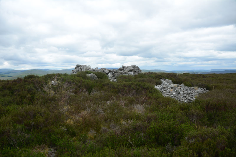
Ridlees Cairn submitted by Anne T on 29th May 2017. Approaching Ridlees Cairn from the east. It is a substantial cairn, made up of small and medium sized stones.
(View photo, vote or add a comment)
Log Text: Ridlees Cairn, Otterburn Ranges: This is one of the times I’ve actually made it up to a Trig Point (usually too steep a climb or too high a drop for my liking), but this was easy. Ridlees Cairn was actually 250 metres to the east north east of Bushman’s Crag, but I’m sure some people may visit the crag thinking it is the cairn. The views here are impressive. No wonder the military have a bunker hidden just up the road, and possibly hollowed out the centre of the cairn for use as a machine gun nest (apologies if this is not the case, this is just husband guessing).
Parking at the cairn (the metalled roads had deteriorated from this point and were very narrow), we walked to the east of the cairn and pushed through the heather to reach it.
It is substantial, with a flattened stone kerb around it, partly hidden by heather, partly by tumbled stones.
Rhymer's Stone (Melrose)
Trip No.50 Entry No.7 Date Added: 7th Oct 2017
Site Type: Marker Stone
Country: Scotland (Scottish Borders)
Visited: Yes on 24th Sep 2017. My rating: Condition 3 Ambience 3 Access 4
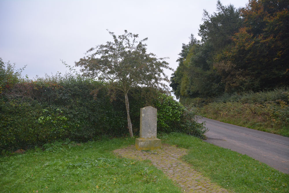
Rhymer's Stone (Melrose) submitted by Anne T on 7th Oct 2017. Contrary to first appearances, not a grave stone, but a modern marker stone! First view of the Rhymer Stone, erected in 1929 by the Melrose Literary Society.
(View photo, vote or add a comment)
Log Text: Eildontree Stone/Rhymer Stone, Melrose: After our failed attempt to find St. Dunstan’s Well in Melrose, we wanted to end the day on a positive note, so asked to come here, particularly because of the Steeleye Span song. The sign from the road said ‘Rhymer’s Stone’ ½ mile. It was more like a good mile, then a walk of about 300 metres from the layby by the gate closing the road. Loved the view up to Eildon Hillfort, but far too late in the day to go exploring.
Redhills Rock Art
Trip No.96 Entry No.6 Date Added: 14th Sep 2018
Site Type: Rock Art
Country: England (Cumbria)
Visited: Yes on 11th Sep 2018. My rating: Condition -1 Ambience 4 Access 4
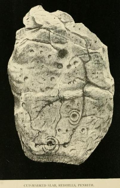
Redhills Rock Art submitted by durhamnature on 29th Oct 2012. Photograph from "Transactions of the Cumberland Archaeological Society" via archive.org
(View photo, vote or add a comment)
Log Text: Sockbridge / Redhills cist, small stone circle and round cairn (now all destroyed): We went to see this site as part of our amateur investigation of the possible Newbeggin Stone Alignment. Whilst the location is glorious, overlooking a steep scarp slope to the River Eamont below, and views to the hills of the North Lakes to the south, nothing can be seen here at all.
Just to the north of the scarp slope, there is a faint, very shallow, sub circular area, with one very broken stone at its edge, now almost buried in nettles. This stone is very unlike any of the others around Newbeggin in shape, almost looking like a mudstone rather than sandstone or limestone. This stone did have veins of quartz running through it, along with a few inclusions.
It was worth coming to this site for the walk and the scenery. We approached using the footpath from Sockbridge village, walking through a field of enormous Friesian cows, then a huge field of recently harvested sileage, then using the footbridge over the River Eamont, and up the hill, veering off to our left after the limestone pavement that ran along the top of the scarp slope.
Red Well, Barnard Castle
Date Added: 7th Jun 2015
Site Type: Holy Well or Sacred Spring
Country: England (County Durham)
Visited: Yes on 2nd Jun 2015. My rating: Condition 4 Ambience 4 Access 4
Red Well, Barnard Castle submitted by durhamnature on 6th Sep 2012. The stone-built shelter and bench seat.
Site in County Durham England
(View photo, vote or add a comment)
Log Text: Red Well, Barnard Castle: Before leaving home late this afternoon, I'd done a quick trawl of what information could be found on the Red Well on the internet, and come across a curious document entitled: “Archaeo-Environment Ltd: South West Durham Heritage Corridor, Volume II Journeys Part 2” in which page 170 (actually page 3 of the document) talked about “Dr. Edwards’ Health Restoring Walk: a route walking from the rail path into the centre of Barnard Castle viewing Dr. Edwards’ natural springs and former railway building”. It then talks about “this circular route leaves the main railway line behind Glaxo and uses existing rights of way (not bridleways) to visit Barnard Castle via the Red Well. Red Well is an attractive 19th century spring located within its own enclosure. It was popularised by Dr. George Edwards who encouraged the residents of Barnard Castle to make use of its health-giving properties ‘Its valuable laxative qualities has, I know, been ascertained. The Red Well was named from the colour of the stain left on the stone over which the mineral spring flowed (Wilkinson 1998, 46). It no longer stains the stone and is not recommended for drinking .... Access to the enclosure today is by an old metal kissing gate which contributes towards local historic character. Inside the enclosure a stone shelter with seat provides views towards Glaxo buildings, but would had originally viewed the railway line. Overgrown with wildflowers rendering the path virtually invisible, the Town Council are only able to mow it once a year. A path was constructed originally in a horseshoe shape around the edge of the enclosure linking the well with the seating area.”
Leaving Barnard Castle along Galgate (the A688 towards Darlington), then peeling off along Harmire Road (the B6278) we drove past the Glaxo buildings. We had difficulty in spotting the footpath signs, as they were either very tiny rectangular shaped or just below the level of the stone walls/shrubs along the sides of the road. In the end we parked along the road into Montalbo Industrial Estate and walked back, crossing (the now busy road, as it was factory closing time), and easily found the footpath which followed the small stream through the grassy meadows on the opposite side of the road.
By this time, the wind was howling and heads down, we started through the field that had a “Bull In Field” notice on the kissing gate (there wasn’t this time, we checked thoroughly before crossing). In the second field we were mugged by the sheep who came baaing and running at us, probably thinking we’d brought them sheep nuts or some other treat. They were disappointed, and when we crossed back, they pointedly ignored us.
A metal kissing gate leads into the enclosure with the Red Well in it. The well/spring certainly has a good output, water streaming from the outlet pipe. The sign inside the stone shelter is curious – there was obviously a ‘battle’ of some kind over the well in the past. Need to find out more, but most of the internet enquiries come up with ‘Red Well Inns/Hotels/Pubs – will find time to look further soon.
Not the best of locations for the well now, with its views over Glaxo Smith Kline buildings and the wind turbines, but on the edge of town and surrounded by meadows and sheep.
We had to really battle the wind going across the meadows back to the car, and were glad of its shelter once we’d arrived. Shame, because whilst it was sunny, the wind meant we didn’t linger at this spot. It was now early evening, so back home, via Staindrop to find the Anglo Saxon Cross fragment.
Rawcliffe Howe
Trip No.7 Entry No.3 Date Added: 2nd Oct 2016
Site Type: Cairn
Country: England (Yorkshire (North))
Visited: Yes on 1st Oct 2016. My rating: Condition 2 Ambience 2 Access 5
Rawcliffe Howe submitted by vagabondnma on 13th Mar 2007. Rawcliffe Howe as seen from the road - which allows you to see its profile. Unfortunately the embankment cuts right through it. So some of it is missing.
(View photo, vote or add a comment)
Log Text: Rawcliffe Howe, south of Stape Village, North Yorkshire: No entry exists for Rawcliffe Howe on the ADS, but does on Historic England. From Old Wives’ Well, driving southwards back down through the Village of Stape, we came to a four way cross-roads. Parking in a small layby just as we turned into Low Moor Road, where on the opposite side of the road a footpath runs through the wood leading to Rawcliffe Banks. I used the photographs from the mobile Portal site to help locate this.
This round barrow sits right on the edge of the road opposite the entrance to Low Moor Road and has clearly been cut through by the road. Trying to photograph it was very tricky as the rally cars were coming in groups thick and fast, and at one point I jumped further onto the verge to avoid a car that nearly missed the turning!
We managed to get photographs from various angles, although if I hadn’t known this was a site from the Portal would have missed it entirely.
Ravenswood Avenue
Trip No.11 Entry No.3 Date Added: 26th Feb 2017
Site Type: Standing Stone (Menhir)
Country: Scotland (Midlothian)
Visited: Yes on 20th Feb 2017. My rating: Condition 3 Ambience 2 Access 4
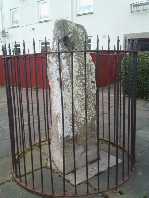
Ravenswood Avenue submitted by crannog on 27th Feb 2012. Closer look.
(View photo, vote or add a comment)
Log Text: Ravenswood Avenue Standing Stone, Edinburgh: Our third stop of the day, and another ‘not impressive’ one. Definitely not in situ, at the end of a heavily parked-up cul-de-sac, outside a small block of flat, protected by a tall circular iron railing.
I was glad to escape from this site – it felt very depressing and I surprised not to see any graffiti on the stone. One source I’d seen said there were a couple of cup marks, but I could only see any, only natural weathering and what looked like a heavily worn quarry mark.
Randolphfield Stones
Trip No.108 Entry No.1 Date Added: 8th Nov 2018
Site Type: Standing Stones
Country: Scotland (Stirling)
Visited: Yes on 30th Oct 2018. My rating: Condition 3 Ambience 3 Access 4
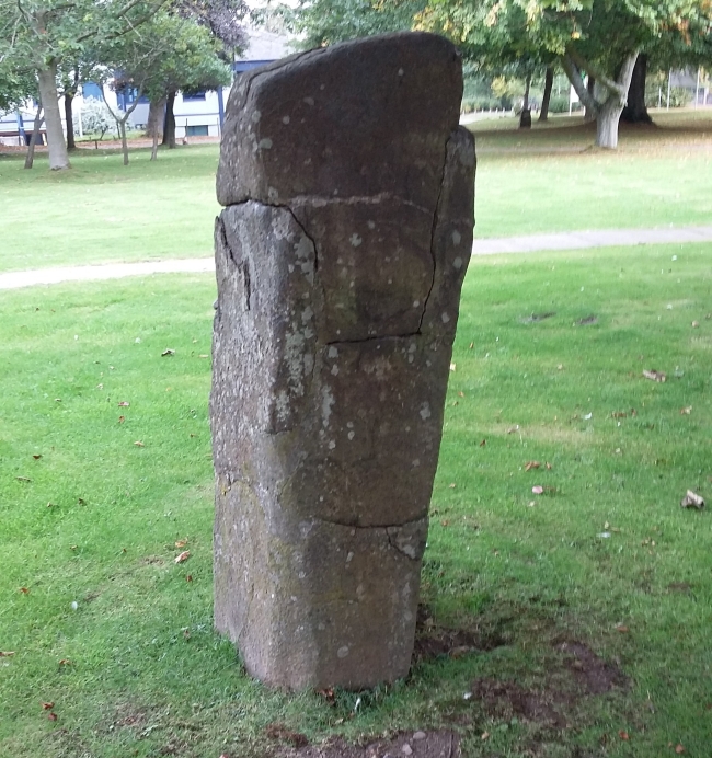
Randolphfield Stones submitted by rogerkread on 16th Oct 2015. The larger stone, showing evidence of destruction and subsequent repair.
(View photo, vote or add a comment)
Log Text: Randolphfield Stones, Sterling: This visit felt really strange, as the stones were literally in front of the police station, and I wondered if I’d get a tap on the shoulder and the memory card from my camera confiscated! No one seemed to turn a hair, though I took a number of photographs of both stones.
Ramsdale
Date Added: 18th Aug 2014
Site Type: Standing Stones
Country: England (Yorkshire (North))
Visited: Yes on 15th Aug 2014. My rating: Condition 3 Ambience 4 Access 3
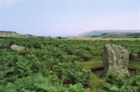
Ramsdale submitted by kelpie on 28th Sep 2002. A small circle overlooking the coast and cliffs at Ravenscar.
NZ 92057 03770
(View photo, vote or add a comment)
Log Text: Having escaped the rain and wind in our part of Northumberland, we headed for the east coast, where it was sunny and warm (although windy). However, it was a real relief to escape the sheer numbers of people in Whitby and head for the relative peace of the moors. Heading out of town on the A171, we followed the directions on the Portal site for the Ramsdale Stone Circle, which were spot on, thanks! Driving down the A171, we spotted the footpath we needed about 400 yards north of the junction of the A171 with the B1416, so turned round at the B1416 junction and parked on the grass verge at the edge of the entrance gateway to the track/footpath leading to Ramsdale House/Ramsdale Holiday Cottages.
We then followed the metalled track down towards Robin Hoods’ Bay; once over the brow of the hill, the views across to Robin Hood’s Bay were spectacular - we could see the waves breaking on the shore of the bay below.
Avoiding being mowed down by the four-wheel drive vehicles which came up and down the track at regular intervals, we missed the track off to the right mentioned in the directions on the Portal (but spotted it on the way back, as it dog-leg’s across the metalled track, rather than going straight across), and ended up following another track down to the gate in the next field boundary. It was then easy to turn and follow the sheep tracks back up the small hill to where the stones where located. The Ramsdale Stones appeared quietly, but suddenly, out of the heather. What a place to build a monument.
It was odd that there were only three stones, and we wondered (like many others) if there had been a fourth. We wandered around looking for stones under the grass, but only found a number of small, loose stones.
There were clear cup marks on the western most stone, and some possible ones on the northern stone.
The A171, which wasn’t far away, was very busy with Friday afternoon traffic, which spoiled the ambience a little, but the site itself is a lovely place to be. It is only a short walk from the main road, and worth stopping to visit, should you be passing.
Raise Howe Cairn
Date Added: 9th Sep 2014
Site Type: Cairn
Country: England (Cumbria)
Visited: Yes on 7th Sep 2014. My rating: Condition 2 Ambience 3 Access 5
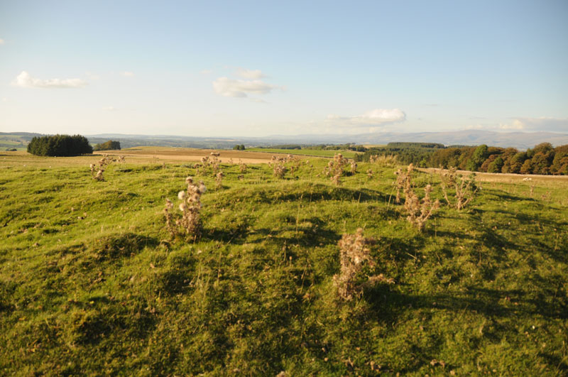
Raise Howe Cairn submitted by Anne T on 9th Sep 2014. Standing on top of Raise Howe Cairn looking north/north-east with Maskriggs Wood at the top right hand side of the picture.
(View photo, vote or add a comment)
Log Text: Raise Howe Cairn, Cumbria: From Gamelands Stone Circle, 1 km east of the village of Orton, we drove back into the village and found the B6260 which heads over the moors towards Crosby Ravensworth and Appleby-in-Westmorland. The road climbs steeply from Orton, leading up onto Orton Scar, Beacon Hill and Gaythorpe Plain. We stopped quickly to see if we could see Gamelands within the context of the landscape, but it seemed to be hidden within a dip beneath Knott Hill in the distance.
The B6260 is a very fast road and once on moorland we needed to be careful of the sheep meandering at the side (and sometimes across) the road. At first glance, you might be forgiven for thinking that Raise Howe Cairn is just a spoil heap next to a quarry, but parking on the verge opposite and walking up to the cairn, its shape and function become apparent. Limestone rubble appears under the soil and turf, and at the top of the mound, there are humps and bumps which make it appear as if the mound has been excavated (although the English Heritage Pastscape records say it has not been).
Our first reaction was “what a spot to be buried in” – there are 360 degree views all around and the landscape as a whole seems too large to take in. The Scale Beck valley lies to the east, the Lyvennet Beck valley to the west and the river Lune in the distance to the south.
Having checked the English Heritage records on my return home, they tell me this is a turf covered, slightly mutilated oval mound of earth and limestone rubble up to 1.2 high, maximum dimensions 23m x 18m and dates from the Bronze Age.
This seems to be a popular picnic spot as there was a lot of rubbish lying around, and a sign next to the quarry says ‘no motor vehicles’ as if someone might drive over the edge of the quarry face.
Not particularly a place to travel to just to see the cairn, but well worth stopping to appreciate the beauty of the landscape and the burial practices of our ancestors.
Queen's Crags Cup Marked Boulders
Date Added: 17th Nov 2014
Site Type: Rock Art
Country: England (Northumberland)
Visited: Yes on 9th Nov 2014. My rating: Condition 3 Ambience 4 Access 3
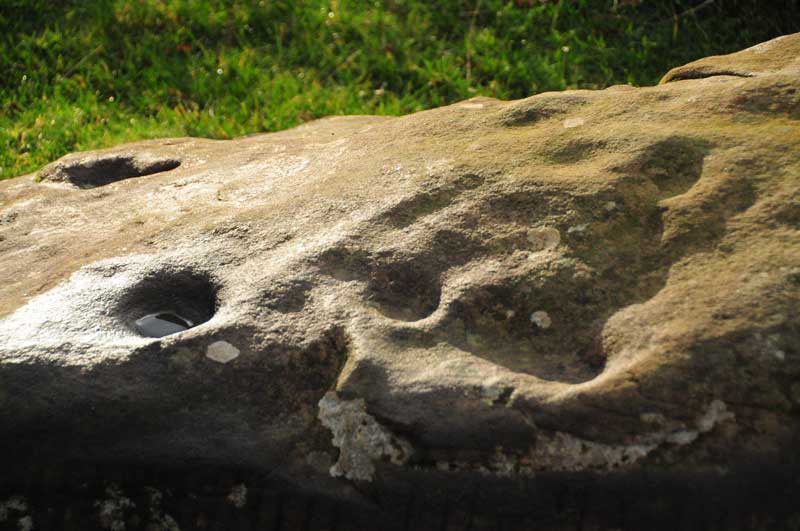
Queen's Crags Cup Marked Boulders submitted by Anne T on 12th Nov 2014. A close up of some of the cup marks on the larger of the two boulders at Queen's Crags. This boulder can be found at grid reference NY 79713 70421.
(View photo, vote or add a comment)
Log Text: Queen's Crags Cup Marked Boulders, Northumberland: We last visited this area, immediately to the north of Sewingshields Crags/Hadrians' Wall in July this year, and I was fascinated and intrigued by what I thought might have been another possible stone row and stone circle/enclosure on the way to Simonburn Stone Circle. We'd met the farmer on this visit and he'd told us the archaeologists had marked out an area for a survey and were due to come back shortly. I then found a short piece in the local Hexham Courant newspaper, and thought I identified SolarMegalith in the photo, so contacted him to find out. Then a subsequent message to him, to try and find out what rock art stones at Goatstones were the best to find, had alerted me to another rock art boulder near Queen's Crags, which put this spot firmly on my 'to re-visit' list. We then spotted an initial report on the area on the Tynedale Archaeological Group web site, so after 2 weeks stuck in the house, both decorating and my husband and his bad back, it was a relief to get on my walking boots and do this gentle walk, mostly along a cobbled track and grassy paths. It was also an exercise in getting used to using our (basic but good) GPS system.
I just wish I had more experience to understand what I was seeing, as this seems to be much larger landscape of monuments, stone circles, cairns and settlements.
Whilst it is well over a kilometre from the road to this spot, through often boggy places, it is well worth a visit just to soak in the atmosphere of this place, with Sewingshields Crags standing guard over the area to the south, and Broomlee Lough shining in the low autumn sunlight to the south west.
Walking up to the top of Queen's Crags, we came upon the cliffs very suddenly - a long drop down to the valley below and my fear of falling took over and I had to retreat down to the cairns lower down the hill.
Since our visit, I've emailled Tynedale Archaeological Group to find out if it will be OK to include a link from the page I've created to submit my photographs, as it is their work that has highlighted these features, and they deserve all the credit - I just took these few photographs. I'm still waiting to hear and will update the page when I do (Update: 17th November at 17:19 - TAG have kindly agreed to a link between the relevant pages on the Portal and their web site, and also invited me along to their AGM tomorrow night to find out more).
Congratulations to SolarMegalith for finding the boulder with 5 cups - I can't imagine how exciting it must be to make a discovery like this. Well done, SolarMegalith!
