

<< Our Photo Pages >> Robin Hood's Well (Chollerton) - Holy Well or Sacred Spring in England in Northumberland
Submitted by coldrum on Monday, 18 October 2010 Page Views: 4084
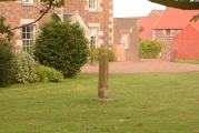
Springs and Holy WellsSite Name: Robin Hood's Well (Chollerton)Country: England County: Northumberland Type: Holy Well or Sacred Spring
Map Ref: NY95397494
Latitude: 55.068905N Longitude: 2.073724W
Condition:
| 5 | Perfect |
| 4 | Almost Perfect |
| 3 | Reasonable but with some damage |
| 2 | Ruined but still recognisable as an ancient site |
| 1 | Pretty much destroyed, possibly visible as crop marks |
| 0 | No data. |
| -1 | Completely destroyed |
| 5 | Superb |
| 4 | Good |
| 3 | Ordinary |
| 2 | Not Good |
| 1 | Awful |
| 0 | No data. |
| 5 | Can be driven to, probably with disabled access |
| 4 | Short walk on a footpath |
| 3 | Requiring a bit more of a walk |
| 2 | A long walk |
| 1 | In the middle of nowhere, a nightmare to find |
| 0 | No data. |
| 5 | co-ordinates taken by GPS or official recorded co-ordinates |
| 4 | co-ordinates scaled from a detailed map |
| 3 | co-ordinates scaled from a bad map |
| 2 | co-ordinates of the nearest village |
| 1 | co-ordinates of the nearest town |
| 0 | no data |
Be the first person to rate this site - see the 'Contribute!' box in the right hand menu.
Internal Links:
External Links:
I have visited· I would like to visit
Anne T visited on 3rd Sep 2014 - their rating: Cond: 1 Amb: 2 Access: 4 Robin Hood's Well, Colwell, Northumberland: I last visited Colwell on 13th June 2014, when we went in search of the old chapel (located in someone’s back garden, so not accessible without permission), the two wells in the centre of the village – Coley’s Well and Pricky’s Well – and Blue Crags Hill Fort (also known as Brecken Hills Fort).
Both Coley’s Well and Pricky’s Well are at the eastern edge of the village at the cross-roads where the northern most side-road from the A68 leads eastwards to meet the B6342. Whilst part of the area’s rich history, neither well is pleasing to the eye (very similar to Meg’s Well in Aydon). They sit alongside a small stream, the Coal Burn.
About 200 yards south of the village is a third well, Robin Hood’s Well. As this is recorded as a holy spring, I was keen to see this, so stopped off whilst I was passing by.
There is parking in a layby by the road junction mentioned above, near to Pricky’s Well. From here, it is a 200 yard walk south down the B6342 to the footpath which leads eastwards towards Well House (grid reference: NY 96641 74198. This is a very busy little road, with no footpaths, so I had to keep stepping up onto the grass verges to avoid the traffic.
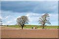
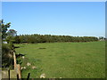
Robin Hood’s Well is almost on the field boundary next to the road. To reach it, on opening the gate to the field by the footpath sign, you need to turn right immediately and walk 50 yards or so to the south (towards the woodland). The first view is of a post sticking up from marsh grass, which looks like a fence post. As you get closer, you will see a stone lying next to the post. A closer look shows a pool of water around the post and stone, and boggy ground surrounding it – a shame it is so unremarkable for such a historic well.
There is a further spring which appears 100 yards further south down the field, which has a clearer water course marked by stones on either side, but was dry (although the ground was very boggy) on the day of my visit.
At (or near) Well House Farm (according to the Hexham Courant and Visitor UK web sites) there is also a fourth sulphurous well, The Bore Well, reputed to improve fertility and which is well cared for with a proper housing.
 (PID:123174)")
From Pastscape:
"One of Coley's three holy wells.
A piped spring. Enclosed by a post and wire fence."
Source: Pastscape
You may be viewing yesterday's version of this page. To see the most up to date information please register for a free account.
 (PID:123177)")
 (PID:123176)")
 (PID:123175)")
Do not use the above information on other web sites or publications without permission of the contributor.
Nearby Images from Geograph Britain and Ireland:
©2015(licence)
©2008(licence)
©2015(licence)
©2013(licence)
©2006(licence)
The above images may not be of the site on this page, they are loaded from Geograph.
Please Submit an Image of this site or go out and take one for us!
Click here to see more info for this site
Nearby sites
Key: Red: member's photo, Blue: 3rd party photo, Yellow: other image, Green: no photo - please go there and take one, Grey: site destroyed
Download sites to:
KML (Google Earth)
GPX (GPS waypoints)
CSV (Garmin/Navman)
CSV (Excel)
To unlock full downloads you need to sign up as a Contributory Member. Otherwise downloads are limited to 50 sites.
Turn off the page maps and other distractions
Nearby sites listing. In the following links * = Image available
371m NNW 346° Pricky's Well* Holy Well or Sacred Spring (NY953753)
484m N 3° Coley's Well* Holy Well or Sacred Spring (NY9541675424)
1.3km NW 323° Brecken Hills* Hillfort (NY946760)
1.7km WSW 256° Swinburne Stone* Standing Stone (Menhir) (NY9375574543)
1.8km W 266° The Kings Seat* Round Cairn (NY9360074824)
2.0km W 260° Swinburne Cairn* Round Cairn (NY93437460)
2.2km W 263° Swinburne Barrow* Round Barrow(s) (NY93207466)
3.3km W 278° Barrasford Common Ancient Village or Settlement (NY92127540)
3.4km NE 47° Cheviot House (Hallington) Rock Art (NY9787077230)
3.8km SW 217° Chollerton Cross* Ancient Cross (NY93117192)
3.8km ENE 77° Hallington Holy Well* Holy Well or Sacred Spring (NY9909775803)
3.9km W 269° Barrasford a & b (Gunner Peak Camp) Rock Art (NY91507490)
4.0km W 269° Gunnar Peak Camp* Promontory Fort / Cliff Castle (NY91407490)
4.0km N 5° Thockrington Cross* Ancient Cross (NY95727894)
4.7km SE 129° Brandy Well (Great Whittingham)* Holy Well or Sacred Spring (NY99087200)
5.5km SE 130° Todley Hill Mound (Great Whittingham)* Misc. Earthwork (NY9956771412)
5.6km SSW 197° St Oswald in Lee (Heavenfield)* Ancient Cross (NY9369669560)
6.0km SSW 212° Hadrian's Wall (Brunton Turret)* Misc. Earthwork (NY9213469846)
6.3km SSW 199° Crag House Cross Base* Ancient Cross (NY9333869021)
6.3km SW 219° Chesters Roman Site b* Rock Art (NY9142070076)
6.3km SW 219° Hadrian's Wall (Chesters Bridge Abutment)* Misc. Earthwork (NY9141970072)
6.3km SW 222° Chesters Roman Site a Rock Art (NY9120770250)
6.8km NW 319° Tone Hall Earthwork Misc. Earthwork (NY909801)
6.8km SSW 210° Wall Crags Settlement* Ancient Village or Settlement (NY920690)
6.9km W 263° Nunwick Park Stone Circle (NY885741)
View more nearby sites and additional images


 We would like to know more about this location. Please feel free to add a brief description and any relevant information in your own language.
 Wir möchten mehr über diese Stätte erfahren. Bitte zögern Sie nicht, eine kurze Beschreibung und relevante Informationen in Deutsch hinzuzufügen.
 Nous aimerions en savoir encore un peu sur les lieux. S'il vous plaît n'hesitez pas à ajouter une courte description et tous les renseignements pertinents dans votre propre langue.
 Quisieramos informarnos un poco más de las lugares. No dude en añadir una breve descripción y otros datos relevantes en su propio idioma.