Contributory members are able to log private notes and comments about each site
Sites Anne T has logged. View this log as a table or view the most recent logs from everyone
Nether Largie Stone Row
Trip No.87 Entry No.11 Date Added: 7th Aug 2018
Site Type: Stone Row / Alignment
Country: Scotland (Argyll)
Visited: Yes on 17th Jul 2018. My rating: Condition 3 Ambience 4 Access 4
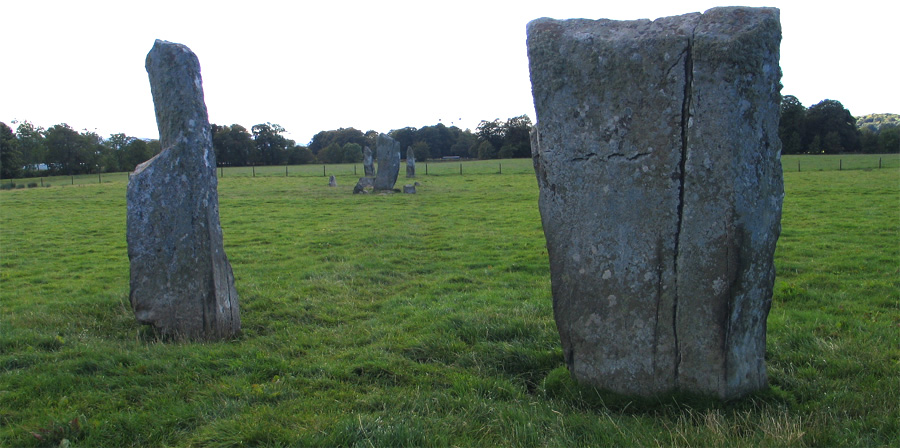
Nether Largie Stone Row submitted by jeffrep on 7th Feb 2013. The Netrher Largie Stones in Kilmartin Glen, Argyll and Bute, Scotland -- five central standing stones, arranged in an "X" shape. The nine foot central stone is accompanied by a number of smaller stones surrounding it. The central stone also has several cup marks.
(View photo, vote or add a comment)
Log Text: Nether Largie Stone Alignment: Ever since I read about this alignment in the early text for the Portal's book "The Old Stones" I've wanted to visit this location. It's in a lovely, lovely, setting, in the Kilmartin Glen. Having got used to Northumberland where you largely only see sheep or cattle around monuments, I was so disappointed by the number of people visiting here. We had two attempts, one being late in the evening, but there were still plenty of folks here. The photographers amongst us 'queued up' to take photographs along the alignment; when it was my turn, a family meandered over and spent half an hour wandering up and down the row, oblivious to me standing there with the camera. I did manage a couple of photographs along the alignment, but had to chose my moments when they were behind one of the stones! Congratulations to the Kilmartin Museum for having a great tourist trail, but I'd like to come back in late January/February, when hopefully there would be less visitors. After this visit, we stuck to sites largely off the main tourist trail.
Nether Largie standing stone
Trip No.87 Entry No.11 Date Added: 7th Aug 2018
Site Type: Standing Stone (Menhir)
Country: Scotland (Argyll)
Visited: Yes on 17th Jul 2018. My rating: Condition 3 Ambience 4 Access 4
Nether Largie standing stone submitted by caradoc68 on 18th Aug 2012. This standing stone is in the middle of a field, a short distance of the footpath. The farmer does not like you being there and might put a angry looking bull in the field to put visitors off. Cant find a lot written about this stone or why it seems to be leaning at 45 degrees and pointing to the southeast.
(View photo, vote or add a comment)
Log Text: Nether Largie Standing Stone/Outlier to the stone alignment: The gate into the field with this standing stone was wired shut and the book we had with us asked us not to intrude into the field. There was also a group of largely, lively bullocks clustered around the gate, so we contented ourselves with looking from afar, from the Nether Largie Stone Alignment.
Temple Wood S
Trip No.87 Entry No.12 Date Added: 4th Aug 2018
Site Type: Stone Circle
Country: Scotland (Argyll)
Visited: Yes on 17th Jul 2018. My rating: Condition 3 Ambience 4 Access 4
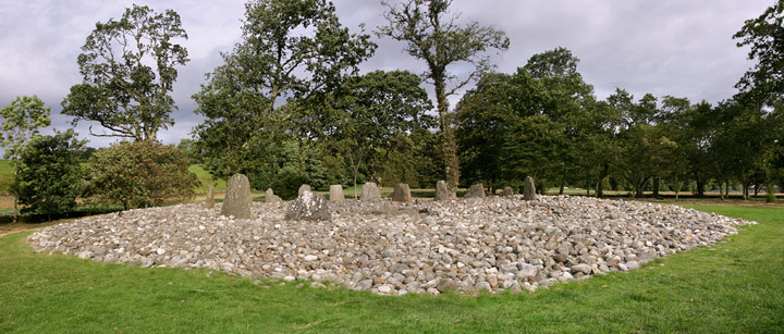
Temple Wood S submitted by funsize on 4th Jun 2007. This is a cracking site. Large cobble mound with slivers of upright slabs and a central cist. Very accessible and one of many impressive sites within a small area of the Kilmartin Valley. This shows the larger cairn, there is a smaller one ringed by trees a stones throw to the south west.
(View photo, vote or add a comment)
Log Text: Temple Wood South West Circle: We had this site all to ourselves for all of five minutes before other parties followed us in. We did look for the rock art quite carefully, but were unable to find it.
Temple Wood N
Trip No.87 Entry No.13 Date Added: 4th Aug 2018
Site Type: Stone Circle
Country: Scotland (Argyll)
Visited: Yes on 17th Jul 2018. My rating: Condition 3 Ambience 4 Access 4
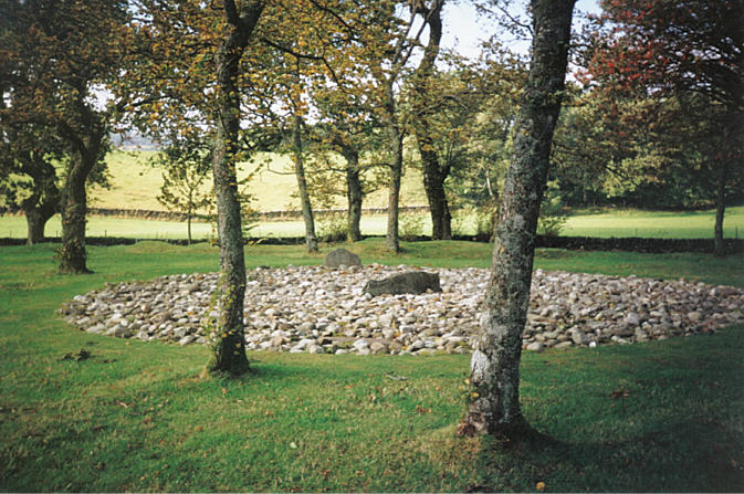
Temple Wood N submitted by hamish on 6th Aug 2005. Temple Wood North. I love this place,enigmatic as always.Being among the trees makes it so different.It's beautiful.
(View photo, vote or add a comment)
Log Text: Temple Wood North East circle: Within sight of the Temple Wood South West circle (I got my bearings all confused here!). This cairn has obviously been recreated, with concrete posts and blocks representing post holes and kerb stones. Nicely done.
Nether Largie South
Trip No.87 Entry No.14 Date Added: 6th Aug 2018
Site Type: Chambered Cairn
Country: Scotland (Argyll)
Visited: Yes on 17th Jul 2018. My rating: Condition 3 Ambience 4 Access 4
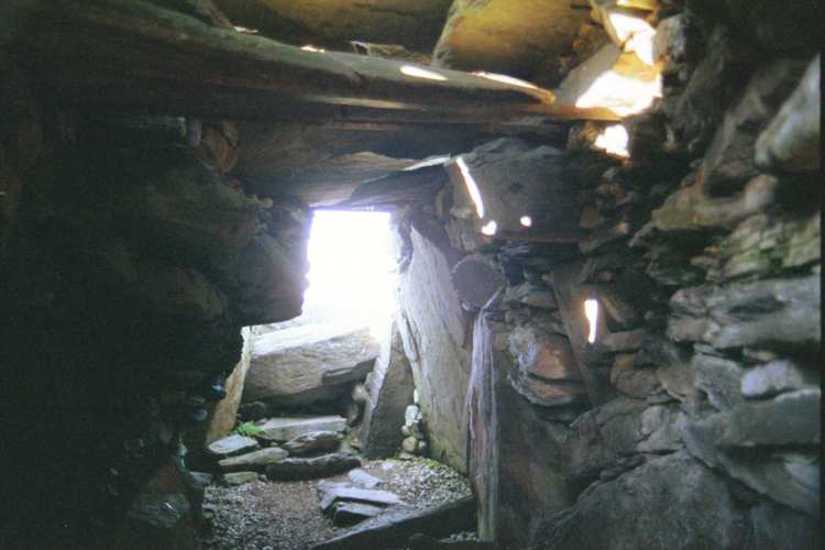
Nether Largie South submitted by Jenny on 10th Jun 2002. Middle-earth Gallery
The Barrow-wight
"He thought there were two eyes, very cold though lit with a pale light..."
Fellowship of the Ring
Book One Chapter VIII
Inside Nether Largie South chambered cairn, Kilmartin, Argyl : a wight's-eye view.
(View photo, vote or add a comment)
Log Text: Nether Largie South: Impressively large, with a chamber you can get into. Have seen other chambered cairns in Northumberland, but all in pretty ruinous condition, nothing like this. Our second stop after the stone alignment. Beautiful location; a lot of other visitors at this time of year.
Nether Largie Mid
Trip No.87 Entry No.15 Date Added: 6th Aug 2018
Site Type: Cairn
Country: Scotland (Argyll)
Visited: Yes on 17th Jul 2018. My rating: Condition 3 Ambience 4 Access 4

Nether Largie Mid submitted by jeffrep on 15th Mar 2008. View from the North of Nether Largie Mid Cairn in Kilmartin Glen.
(View photo, vote or add a comment)
Log Text: Nether Largie Mid-Cairn: This cairn is not quite as impressive as Nether Largie South, but we found it fascinating to look at. Reading Webb's "In The Footsteps of Kings" she says the cairn was originally placed on a slightly raised terrace, but its position has been exaggerated because the ground beyond the fence has been ploughed, and reduced in height over time." The course of the Kilmartin Burn has also been straightened; it once would have meandered around all these cairns in this 'linear cemetery'. By the time we'd reached this cairn, the stream of visitors had slackened off, and we had time to sit and admire this glorious glen.
Despite searching for some time, we didn't find the axehead carving or the cup mark in the southern cist, nor could we seen the cup marked rock 10m to the north west. I did take a number of photos inside the cist, including the inside of the capstone, as sometimes faint carvings show up better on the photos, but nothing was visible. We tried!
The notice boards on site read: “Nether Large Mid lies at the midpoint of Kilmartin Glen’s line of cairns. Its edge is marked by kerbstones. Two important people were buried here 4,000 years ago. In 1929, archaeologist James Hewat Craw found two empty stone graves or ‘cists’ underneath this Bronze Age cairn. The bodies they once contained had dissolved away in the acid soil. An axehead is faintly carved inside the southern grave. Concrete posts show the position of the northern one.”
“The line of cairns stretches for more than 2.5 miles (4km). Look up the glen to Nether Large North and Glebe. Look down to Nether Large South and Ri Cruin, surrounded by trees. A sixth cairn between here and Nether Largie South was destroyed in the 1880s. This was the burial place of the elite. Their power had probably been based on controlling the flow of metal from Ireland up the Great Glen to bronze-working centres in north-east Scotland.”
Nether Largie North
Trip No.87 Entry No.16 Date Added: 6th Aug 2018
Site Type: Cairn
Country: Scotland (Argyll)
Visited: Yes on 17th Jul 2018. My rating: Condition 3 Ambience 4 Access 4
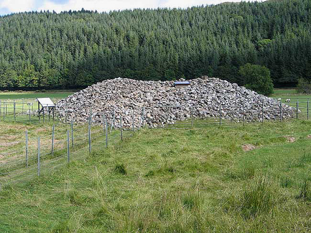
Nether Largie North submitted by jeffrep on 15th Mar 2008. Nether Largie Cairn North, Kilmartin Glen.
(View photo, vote or add a comment)
Log Text: Nether Largie North, Kilmartin: From afar (approaching it from Nether Largie Mid) this cairn had a white square in the middle of its top, which looked like Cairnpapple, which got me thinking you could enter the chamber. This was indeed the case, as the white square was a hatch which could be raised to descend into the chamber.. According to the information board, the capstone has 10 carved axes.
By this time, I think ‘monument overload’ had come over Andrew, who decided to go and get the car, saying he’d meet me at Kilmartin Church, giving me time to visit this cairn and Glebe Cairn before meeting him. I only had one walking pole, and overbalanced whilst trying to climb up the heap so stones so reluctantly gave up. I was disappointed not to be able to see this. We thought we might find time to go back and explore, but there really was so much else to see. One for the next visit.
Glebe Cairn
Trip No.87 Entry No.17 Date Added: 6th Aug 2018
Site Type: Cairn
Country: Scotland (Argyll)
Visited: Yes on 17th Jul 2018. My rating: Condition 3 Ambience 4 Access 3

Glebe Cairn submitted by PaulH on 1st Apr 2003. Kilmartin Valley
Glebe Cairn
NR 833989
Glebe cairn was constructed between 2000 and 1500 BC. It was built on the site of two earlier stone circles, and contained two burial cists
(View photo, vote or add a comment)
Log Text: Glebe Cairn, Kilmartin: By the time I’d walked from Nether Largie Stone Alignment, across to Temple Wood and to Nether Largie, South, Mid, North and Glebe Cairn, I realised it was quite a long way (about 2km the sign post said), but I hadn’t really noticed the distance as the sites were so fascinating to see.
From the lane leading from Nether Largie North Cairn, you need to cross a footbridge over Kilmartin Burn at NR 83147 98870. At this time of evening, the dragon flies were flitting over the water and the sheep were starting to gathered in a line along the fence.
Following the grassy footpath towards this huge heap of stones, I walked all the way around this cairn, which seemed much larger than the others. There were no real distinguishing features, such as cists or cist covers, that were visible. The mound seemed disturbed in places, with stones pushed out in small ‘arms’ here and there along its edges.
Rachel Butter’s Kilmartin book (page 58) says: “The Glebe Cairn: Excavators found two small stone circles beneath the cairn with two finely made pots and a jet necklace placed in two cists. The cairn is smaller than it was a century ago – in 1864 it was at least 4 metres high and 33 metres across.”
Kilmartin Churchyard (Lapidarium)
Trip No.87 Entry No.18 Date Added: 20th Aug 2018
Site Type: Sculptured Stone
Country: Scotland (Argyll)
Visited: Yes on 17th Jul 2018. My rating: Condition 3 Ambience 4 Access 4
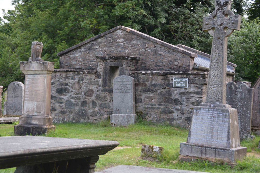
Kilmartin Churchyard (Lapidarium) submitted by Anne T on 20th Aug 2018. The lapidarium, as seen from the path to the left hand side of Kilmartin Church (entering from the main gate by the car park by the A816 opposite the Kilmartin Arms/Hotel).
(View photo, vote or add a comment)
Log Text: Kilmartin Church (Lapidarium): See visit report for Kilmartin Churchyard (MP87.18)
Kilmartin Churchyard (Poltalloch Enclosure)
Trip No.87 Entry No.18 Date Added: 20th Aug 2018
Site Type: Sculptured Stone
Country: Scotland (Argyll)
Visited: Yes on 17th Jul 2018. My rating: Condition 3 Ambience 3 Access 4
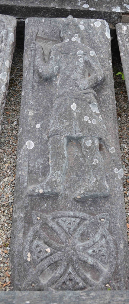
Kilmartin Churchyard (Poltalloch Enclosure) submitted by Anne T on 20th Aug 2018. This tapered slab, in the Poltalloch Enclosure, measures 1.85m by 0.59m. It has an armed figure above a large ring-knot with triquetra knots in the interspaces. At the top there are the added names POLTALLOCH and CA (?MPBELL). Loch Awe School. Dates to the 14th to 15th century.
(View photo, vote or add a comment)
Log Text: The Poltalloch Enclosure, Kilmartin churchyard: See main report for Kilmartin churchyard (MP 87.18).
Kilmartin Churchyard
Trip No.87 Entry No.18 Date Added: 7th Aug 2018
Site Type: Sculptured Stone
Country: Scotland (Argyll)
Visited: Yes on 17th Jul 2018. My rating: Condition 3 Ambience 4 Access 4
Kilmartin Churchyard submitted by Ghriogair on 16th Jul 2009. Kilmartin Churchyard
(View photo, vote or add a comment)
Log Text: Kilmartin Churchyard: Having booked ourselves in for an evening meal at the Kilmartin Arms opposite the church (warning: the portions were huge, but really good), we went across to the churchyard to find the cross slabs in the churchyard that Rachel Butter mentions in her "Kilmartin" book (page 99) and found so much more. This really finished the evening off nicely.
There is also a lapidarium and the Poltalloch Enclosure with some really nice carved grave slabs.
There is a small car park immediately outside the church, and there is disabled access into the church with its crosses inside. The churchyard itself was a little tricky to negotiate, as we had to step over old chest tombs to see some of the carved slabs. Nice views down to the glen below, and a peaceful place to spend time.
Port Nan Athlaich (Craignish)
Trip No.88 Entry No.1 Date Added: 31st Jul 2018
Site Type: Cist
Country: Scotland (Argyll)
Visited: Yes on 18th Jul 2018. My rating: Condition 3 Ambience 4 Access 3
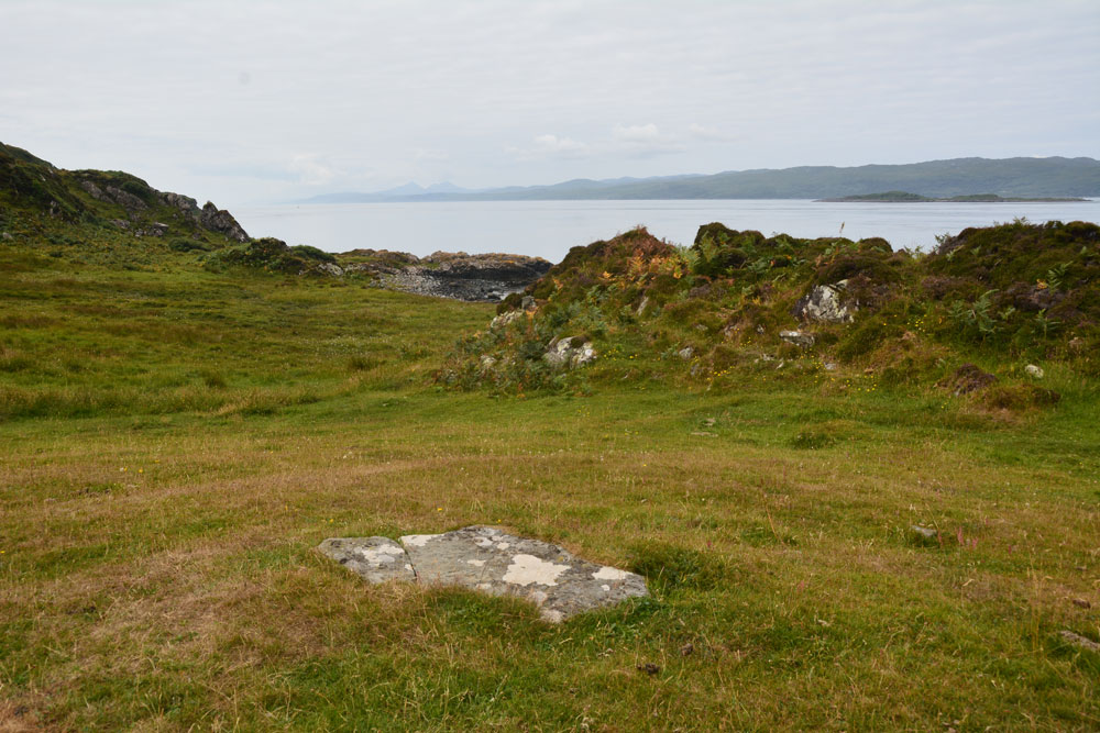
Port Nan Athlaich (Craignish) submitted by Anne T on 31st Jul 2018. The cist cover, looking south west out to the Isle of Jura and the sea.
(View photo, vote or add a comment)
Log Text: Port Nan Athlaich Cist, Aird, Craignish: I counted this as 'a bit more of a walk' as it wasn't a simple walk along a footpath, but involved a large step over a ruinous barbed wire fence and taking a few stepping stones across a stream. The walk is glorious, and is to be recommended.
Since we’d stayed at the small cottage on Aird’s Farm not far away, we’d wanted to come here and watch the sun go down of an evening, but quite a few other visitors also wanted to do that, so we watched from our hillside vantage point above.
Finally, on our last but one day, we made the trip down the track. We parked at the small car park half way down the headland, finding other people already camped out at Aird Jetty, and started to walk down to the end of the peninsula, with map in hand, to try and find the cist marked on the OS map. As we’d had no internet connection in all the time we’d been here, we had no idea of the actual grid reference, or what we might find – all we knew was that ‘cist’ was marked on the OS map.
Apart from clambering over some ruinous fences, fording a small stream and trying not to get bogged down in the marshy bits, the cist wasn’t actually difficult to find, as it was on top of a cairn like mound with a great view out to sea to the south and west.
The cist burial seemed to be completely undisturbed. The capstone was cracked, and when I stood on the smaller section to photograph the crack, the smaller part of the rock moved a few inches. Curious, we very gently eased it out of the way by a couple of inches and had a quick look inside. It was very similar to the recreated cist we saw at the Kilmartin museum.
Looking at the cist from afar, it looked as if the cist was on a natural mound, but enhanced around the burial itself.
Kintraw (Kilmartin)
Trip No.88 Entry No.2 Date Added: 31st Jul 2018
Site Type: Standing Stone (Menhir)
Country: Scotland (Argyll)
Visited: Yes on 18th Jul 2018. My rating: Condition 3 Ambience 5 Access 4
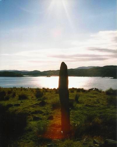
Kintraw (Kilmartin) submitted by Bladup on 25th Apr 2013. Kintraw standing stone.
(View photo, vote or add a comment)
Log Text: Kintraw Standing Stones and Cairns: This standing stone, when we spotted it on the evening of 17th July looked magnificent, but we couldn’t find anywhere to park; approaching this stone from the direction of Ardfern, there was a gateway to the field to pull into, which gave us just room to pull off this busy, fast road.
What a complex site. And what beautiful weather we had to enjoy it.The standing stone first catches your eye, but then the large cairn, with its huge pile of stones, grabs the attention, and then to the north east, with a smaller one by your feet almost next to the gate. Walking closer, we became aware of a ring cairn (?) just to the south east of the standing stone., at first view this looked like a ‘court’ cairn, made up of a ring of small upright stones – all with views over Loch Craignish from this perch on the hillside. Brilliant.
There were also traces of another, flattened cairn, to the north of the ring cairn-standing stone-larger cairn alignment.
To the east-south-east of the larger cairn was what looked like an old stone farm building, which I didn’t photograph as I thought this was modern. According to the OS map which I’m looking at now, it is noted as a ‘fort’.
This is my new ‘favourite spot’. Can I come back soon, please?
Creagantairbh Beag Cairns
Trip No.88 Entry No.4 Date Added: 1st Aug 2018
Site Type: Cairn
Country: Scotland (Argyll)
Visited: Yes on 18th Jul 2018. My rating: Condition 2 Ambience 4 Access 4

Creagantairbh Beag Cairns submitted by Anne T on 1st Aug 2018. This is the larger cairn, near the large tree in the field, before you reach the standing stone. It does look as if it has a kerb or a slight ditch around it, judging by the difference in vegetation around it.
(View photo, vote or add a comment)
Log Text: Creagantaribh Beag Cairns (near gate to the track leading to the Glennan Standing Stones: see report for Glennan Standing Stones. We spotted the larger cairn on the way to the standing stone; these smaller two (nearest the gate) we spotted on the way back to the car.
Creagantairbh Beag
Trip No.88 Entry No.5 Date Added: 1st Aug 2018
Site Type: Standing Stone (Menhir)
Country: Scotland (Argyll)
Visited: Yes on 18th Aug 2018. My rating: Condition 3 Ambience 4 Access 4

Creagantairbh Beag submitted by hamish on 2nd Apr 2002. Creagantairbh Beag
NM859015
Map 55.
Found off the B840 Loch Awe road about 2 miles from the junction with the A816.On the map it is called Creganterve Beg.
(View photo, vote or add a comment)
Log Text: Creagantairbh Beag Standing Stone: I hadn’t spotted these on the OS map as we were driving along, but saw the still standing stone through the fence line. Quickly stopping by the side of the road to take a photograph, I noticed there was also a fallen stone. We decided to stop and investigate further on the way back down the road from Ford village.
On way back from Ford, we turnedthe car onto a track signposted to ‘Kilmichael Glen 7’ we were immediately into the same field as the standing stones(s), only on the right side of the fence. Getting closer we realised that the cracks on both sides of the stone matched almost precisely, so the fallen part must have been the top of the stump. This would have been amazingly tall!
In the field of the house opposite were some brown and black alpacas, and I took a photo to remind me.
Ford Cist
Trip No.88 Entry No.6 Date Added: 1st Aug 2018
Site Type: Cist
Country: Scotland (Argyll)
Visited: Yes on 18th Aug 2018. My rating: Condition 2 Ambience 2 Access 5
Ford Cist submitted by caradoc68 on 20th Feb 2012. Very easy to get to being on the Ford cross roads, with a bus stop within feet of this monument.
(View photo, vote or add a comment)
Log Text: Ford Cist: Not having access to the internet, we thought this was just a cairn which had been marked on the OS map. This monument is in an odd location, just inside the village boundary, tucked between the junction of the road through to Torran and the B840 running along the south shore of Loch Awe, opposite the Crown Hotel and next to a bus stop. Tis mound was fenced off, with no means of accessing the area (apart from climbing the fence) and no information board.
We took some photographs of the mound, but didn’t climb the slope, as we were keen to see the cross-inscribed standing stone at Torran and didn’t know if we’d find it, plus we’d seen another standing stone is a field to the west of the road just before we entered the village and wanted to make time to explore that. The cist was just to the south of a babbling River Ford and a small road bridge over the river.
Torran Standing Stone
Trip No.88 Entry No.7 Date Added: 1st Aug 2018
Site Type: Standing Stone (Menhir)
Country: Scotland (Argyll)
Visited: Yes on 18th Jul 2018. My rating: Condition 3 Ambience 4 Access 4
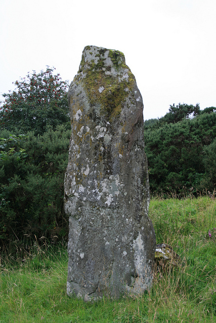
Torran Standing Stone submitted by Jackanol on 7th Sep 2015. We visited in 2012. The stone (which is quite impressive) is basically in the garden of what was then a newly-built and uninhabited house.
(View photo, vote or add a comment)
Log Text: Torran Cross Incised Standing Stone: This was to be the first time we’d seen a cross-inscribed standing stone, so we were pretty keen to locate it. From Ford, we continued up the minor road towards Torran, passing An Lodan Loch to our right hand side. We parked at the wide stony entrance to a small housing estate at NM 87884 04817 and walked up the slight slope. We could see the top of the stone poking up at the front of some tall gorse bushes to our right hand side.
Having a good mobile phone signal here, I brought up the Canmore image to try and find out where the crosses on the stone were, and discovered the stone was originally behind the back fence of one of the gardens. These fences have now been removed. It felt a bit like trespassing, walking into the gardens, but none of the houses were occupied, and there was evidence of building work going on in most of them, so we took a chance. The only person who saw us was the postwoman who was working her way up the estate in her van and she gave us a wave.
On the front of the stone (facing the houses) there were four horizontal lines, which are the remains of the cross on the back face.
To see the back of the stone, we had to clamber up behind another smaller stone to the ‘back’ of the main standing stone (away from the houses) and look down hill. The photography was a bit difficult as this part of the stone was in deep, deep shade. Andrew went and got the flash gun from the car, which I slaved to the camera flash, but it didn’t go off as the light was too bright by the stone. I kept trying at different angles, complete with torch from our mobile phone, and ended up with some good photographs.
I was curious as to the location of the stone, and where it was in relation to the valley. Walking back onto the main road, the stone could clearly be seen from the road, and eastwards looked along a small (what appears to be a) valley, which from the map, leading into An Lodan. The stone, slightly up the hill, would have been in a commanding position for anyone walking by. I had though the stone would be at the top of the hill, but the stone seems to be located near a bend in the current road leading up to Inverliever.
Ford Stone (Kilmartin)
Trip No.88 Entry No.8 Date Added: 1st Aug 2018
Site Type: Standing Stone (Menhir)
Country: Scotland (Argyll)
Visited: Yes on 18th Jul 2018. My rating: Condition 3 Ambience 4 Access 4
Ford Stone (Kilmartin) submitted by cosmic on 30th Aug 2003. The Ford Standing Stone at NM867034
(View photo, vote or add a comment)
Log Text: The Ford Stone, near Torran: We spotted this stone to the west of the road as we drove towards Ford village to see the cairn marked on the OS map and the Torran Cross Incised Stone, but the road was narrow and we could find nowhere to stop, so we decided to look on the way back.
This time, we managed to pull into the side of the road by a gate into a field on the opposite side of the road. Andrew stayed in the car in case it needed to be moved. A man on his ride quad bike and grass mower trailer was mowing up and down near the gate into the field with the standing stone. He stopped when he saw me hovering and I asked if it was OK if I went to take a look at the standing stone. He replied jovially: “This is Scotland, you can go where you want! ….. There’s another gate up there; go in through the right hand one.The horses are friendly.” I walked up the hill, avoiding him whizzing up and down on his mower. High up above the road, on a flat plain, it has lovely views to the east.
As I approached the standing stone, I realised a heap of stones nearby might possibly be a cairn, so photographed this as well.
Kilmartin House
Trip No.88 Entry No.10 Date Added: 18th Aug 2018
Site Type: Museum
Country: Scotland (Argyll)
Visited: Yes on 18th Jul 2018. My rating: Condition 4 Ambience 4 Access 5
Kilmartin House submitted by DrewParsons on 29th Jun 2010. Located in the middle of the village of Kilmartin, the museum has a good display of local finds and interesting descriptions of the prehistoric sites in the neighbourhood. There is also a well stocked museum shop on the premises.
(View photo, vote or add a comment)
Log Text: Kilmartin Museum: We managed to get a space in the car park. From the number of cars parked outside the museum and along the roads, we thought the place would be heaving with people (including a bus tour which had turned up), but the café was quiet and relaxing and there was only one other lady and a younger man who was with her, in the museum.
The museum was small, and a bit disappointing for the £7 entry fee, but it was nicely laid out and they gave you a map of the sites to visit. The lady on reception told us we were allowed to take photographs, but as long as they were not for publication on the internet.
I bought 4 postcards and “In The Footsteps of Kings” book of walks around the Kilmartin area, which gave a lot of information about the area, together with photographs and what to look for, which helped inform our visits greatly – wonderful photos in it, too!
I photographed Glebe Cairn from the path running outside the conservatory.
I have since been in contact with the Visitor Services Office, at the museum, and received the following reply on 14th August 2018 (see private notes).
Kilmichael Glassary Kirk
Trip No.88 Entry No.11 Date Added: 2nd Aug 2018
Site Type: Ancient Cross
Country: Scotland (Argyll)
Visited: Yes on 18th Jul 2018. My rating: Condition 3 Ambience 4 Access 5
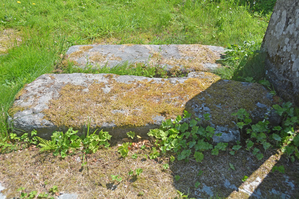
Kilmichael Glassary Kirk submitted by Anne T on 2nd Aug 2018. The cross slab from a different angle trying to capture any inscriptions on it, but it was too heavily moss-covered. We continued to look round the churchyard, as there were many other interesting gravestones and chest tombs; the church was in use for a community event so we were unable to get inside.
(View photo, vote or add a comment)
Log Text: Kilmichael Glassary Kirk, Cross Slab: [note: visit 88:10 was to Kilmartin Museum. Am still awaiting permission to publish some photos.] We parked in the small car park opposite the church and next to the small, very busy, playground. At first glance, this church is very intimidating and Scottish, but on closer inspection parts of it appear very old, particularly the churchyard. There were banners across the gate of the church announcing a “Book Swap” today, and as we approached the church, there were the noises of a large group of people inside laughing and talking. We decided to just explore the churchyard and not disturb them.
I picked this cross slab up from the “In the Footsteps of Kings” book (page 128) that “Look out for the early Christian stone to the right of the gate, which bears a Latin ring headed cross”. We didn’t find the wheel-headed cross, but another, one of three, shaped like a cross, which was referenced in Canmore. The way the sun was shining left part of it in very heavy shade. Even shining a torch on it didn’t eliminate the shadows.
This stone was heavily encrusted in moss, which we did not disturb. The graveyard was full of other interesting gravestones, some from the 14th to 15th century. The church was still busy after we’d finished looking at the rock art, up the hill, so we drove to our next venue. Wish we’d gone back, but then there was so much else to see, and our time here was drawing to a rapid close.
