Contributory members are able to log private notes and comments about each site
Sites Anne T has logged. View this log as a table or view the most recent logs from everyone
St Hilda's Church (Lucker)
Trip No.75 Entry No.1 Date Added: 21st May 2018
Site Type: Ancient Cross
Country: England (Northumberland)
Visited: Yes on 20th May 2018. My rating: Condition 2 Ambience 3 Access 4
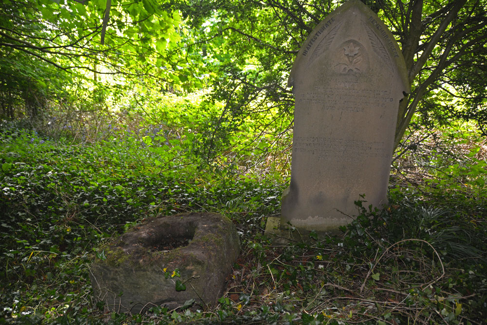
St Hilda's Church (Lucker) submitted by Anne T on 21st May 2018. The cross base is nestled under trees and brambles, next to the grave of a lady called "Janet". This part of the graveyard has been neglected over a number of years. We thought the church might have made more of their socket stone.
(View photo, vote or add a comment)
Log Text: Cross base, St. Hilda's Church, Lucker: We had a walk around the churchyard, but were unable to find a cross base amongst the gravestones. We wandered down as far as the river, Waren Burn, which flowed to the east of the church. Not finding anything, we wandered into the church. There was no guide book, but there were laminated sheets detailing the history of the church and St. Hilda, which I photographed.
Having found the cross base on Pastscape, with the grid reference, I was very reluctant to give up the search. It did indeed take some finding, as it was completely buried under ivy in a very overgrown section of the churchyard. Typically, not having the gps with us when we needed it, common sense said that the cross base should ideally be at the eastern end of the church at the highest point of land before it started to drop down to the river below. I had to clamber over brambles and force my way through trees to get to this part of the churchyard. The cross base was next to the grave of a lady called ‘Janet’.
St Hilda's Church (Hartlepool)
Trip No.156 Entry No.1 Date Added: 11th Feb 2020
Site Type: Early Christian Sculptured Stone
Country: England (County Durham)
Visited: Yes on 5th Feb 2020. My rating: Condition 4 Ambience 4 Access 4
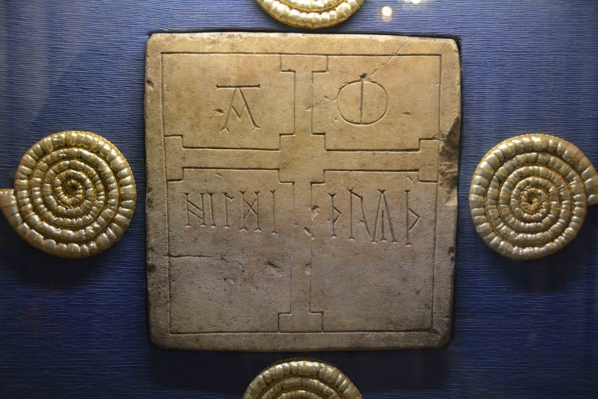
St Hilda's Church (Hartlepool) submitted by Anne T on 11th Feb 2020. The impressive Hildthryth namestone, on display on the eastern wall of the St Nicolas Chapel, on the southern side of the sanctuary. Also recorded as Hartlepool 01 on the Corpus of Anglo Saxon Stone Sculpture. The stone measures 27cms high, 29cms wide and 11cms deep. Poinds tells us: "The west face is decorated with a plain border which surrounds a large cross whose centre is square rather than circular and whose cross arms are square ended. The lettering on each side of the upper vertical arm o...
(View photo, vote or add a comment)
Log Text: St Hilda's, the Headland, Hartlepool: What a magnificent building, with its collection of huge flying buttresses supporting the external walls of the tower. Inside, it is more like a mini-cathedral than a parish church.
We had the pleasure of being greeted by Mr. John Hogg, parishioner with responsibility for Visitor Ministry, and the most knowledgeable guide we could wish to meet.
We spent almost the full hour and a half looking round the church, the fragments in the Brus Chapel and the old south door, plus admiring the Hildthryth stone in the St Nicholas Chapel. I just wish the opening hours of the church had been longer, as I was really interested to see the display boards located around the south and north walls of the nave.
The altar rails are also interesting, as they are made of 1,000 year old oak (but do look Victorian!). A real gem, and well worth a visit.
St Hilda (Ellerburn)
Trip No.7 Entry No.5 Date Added: 2nd Oct 2016
Site Type: Ancient Cross
Country: England (Yorkshire (North))
Visited: Yes on 1st Oct 2016. My rating: Condition 3 Ambience 4 Access 5
St Hilda (Ellerburn) submitted by kelpie on 24th May 2007. Decorative cross fragment
(View photo, vote or add a comment)
Log Text: Anglo Saxon Cross parts at St. Hilda's Church, Ellerburn, North Yorkshire: From Black Howe, with the light rapidly fading, we decided to go to St Hilda’s in Ellerburn. The Corpus of Anglo Saxon Stone Sculpture has added York and East Yorkshire to their catalogue, and I was able to pull all up the Ellerburn pages on my phone prior to visiting. Sadly, there was no signal in the village so it wasn't possible to view them whilst at the location.
Ellerburn is a very pretty hamlet and the church of St Hilda’s looks like an old manor house that has been converted into a church. Pulling into the layby by the church, there were signs asking for a £3 parking fee (but free if visiting the church).
Entering the churchyard through a lych gate, three sheep were cropping the grass. A stile led from near the path into the churchyard (the gate was padlocked) – to be used at your own risk, the sign said. Sadly, the church was already locked up when we arrived (well it was 6pm) so we missed the stones inside. However, we were able to wander round and pick out the cross parts built into the walls.
The Corpus lists nine stones, 9a and 9b of which are the edges of two hog-back tombs. We wandered up the pretty little stream running opposite the church. A noisy campsite at the farm opposite spoiled the peace of the hamlet, but it was still very pretty and worth visiting.
Wandering around the graveyard, I spotted the grave of Isaac Newton and his wife Mary (no, not the famous one, but still made me smile).
Note: the church site says the church is only open between 10am and 4pm each day.
St Helen's Well (Great Asby)
Trip No.6 Entry No.3 Date Added: 2nd Oct 2016
Site Type: Holy Well or Sacred Spring
Country: England (Cumbria)
Visited: Yes on 11th Sep 2016. My rating: Condition 3 Ambience 4 Access 5

St Helen's Well (Great Asby) submitted by MisterBus on 12th Oct 2010. The beautifully restored well in the centre of the village is in full flow. The well was restored by villagers in 2008.
(View photo, vote or add a comment)
Log Text: St Helen's Well, Great Asby, Cumbria: This was our third stop of the day. From (confusingly) St Helen’s Well at Newbeggin-on-Lune, we took a right hand turn back onto the A685 then the next turn right taking the minor road between Crosby Garrett Fell and Ravenstone Moor. Turning right at the T-junction at Middle Bank, we followed the road through Little Asby to Great Asby. We parked next to the little alms cottage about 20 metres to the north west of this well. At first, all I could see was a modern stone wall with some horribly concrete shapes on it’s top, with the Asby Beck beyond. Walking towards the modern stone wall, a huge rush of water could be seen running into the beck, coming from no apart source—just straight out of the ground.
The well itself has a square pool into which water emerges. As we watched, the flow of water was sufficient to move the sand forming the base. Most intriguing.
With a village this old, we decided to investigate the local church, St. Peter’s. The modern building is of no great age, although the ‘short account’ of the church says that the site may have been used from the 7th century onwards (as Peter was a common dedication from this time on).
The Pastscape record for this well says this well "was formerly seated round and of great repute for the medicinal properties of its waters. Consists of a deep pool, approximately 4.0m square, contained by a stone wall, with a drain-off channel at its eastern corner. It is not apparent whether the pool is fed by a natural spring or a piped supply, as the point of issue is below water level. A modern wall partially surrounds the well. "
St Helen's Church (Bilton-in-Ainsty)
Trip No.19 Entry No.2 Date Added: 1st May 2017
Site Type: Ancient Cross
Country: England (Yorkshire (North))
Visited: Yes
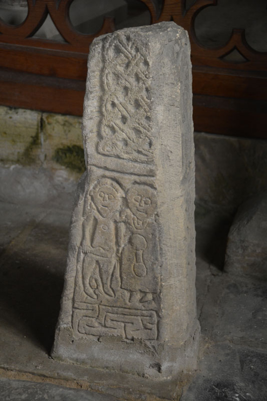
St Helen's Church (Bilton-in-Ainsty) submitted by Anne T on 1st May 2017. The southern face of the eastern-most shaft fragment in the south-east chapel. Said to depict Abraham sacrificing Moses.
(View photo, vote or add a comment)
Log Text: Anglo Saxon Crosses, St. Helen's Church, Bilton-in-Ainsty: We’d tried to visit this church before, but because there was no vicar in post, the church was kept locked. Emails to the York Diocese weren’t helpful.
Knowing we were coming down to Ingelby Arncliffe again, I checked on A Church Near You, and have been corresponding with the vicar, the Reverend Richard Battersby. In the last communication I had with him, he said he had set up a mother and toddler group on a Thursday morning, which met between 10 am and 11.30am. An email to enquire if it was OK to call in after this (so as not to clash with the M&T group) and drop the key off after had no reply, so I phoned and spoke to his mother, who told me the Bishop had sent him to an event so he wasn’t around.
There were three crosses in the small chapel at the south-east end of the church, next to a very interesting set of mass dial/scratch clocks and old graffiti. There was the lovely effigy of a woman in the sanctuary.
I waited until the M&T group had finished before taking photos of the wheelhead cross at the west end of the church. Even though it was a dull day, this proved difficult to get a good image of because the light streamed in above it. In the end, I had to use the flash to compensate. I was unable to get to the notes as the group was closing up and moving everything out of the church, so I grabbed a guide book, thanked them for letting me ‘barge in’ and quietly left.
The Rev. Battersby also recommended visiting Healaugh Church, although we didn’t have time today. Next stop was Bardsey near Leeds.
St Gwyndaf Stones
Date Added: 28th Aug 2014
Site Type: Early Christian Sculptured Stone
Country: Wales (Pembrokeshire)
Visited: Yes on 22nd Aug 2014. My rating: Condition 3 Ambience 4 Access 4

St Gwyndaf Stones submitted by vicky on 8th Jun 2004. One of the five 7th-9th century decorated stones in the exterior walls of Llanwnda Church. This one is decorated with a face beneath the cross of St Andrew.
(View photo, vote or add a comment)
Log Text: St Gwyndaf’s Church, Llanwnda with stone crosses: Husband, Andrew, and I were both intrigued by Vicky’s description of the St. Gwyndaf Stones on the Portal, so after a busy day exploring the St David’s area, we decided to stop off in Fishguard for dinner, taking a detour to Llanwnda on the way.
Despite having a detailed map, we got lost twice, taking the wrong lane and ending up back on the main road, then taking the left hand turn inside of the right where the road splits within Llanwnda village, and ending up at someone’s house and having to reverse down a particularly narrow, windy single track lane, being watched by a curious local lady who came out to watch.
After that, we found the church easily enough. There were even a few parking spaces just by the path leading down to the church. A very pretty spot, although feeling incredibly remote, overlooking the sea.
The whole of this site has a huge sense of age and heritage. The inside of the church is simple, but impressive. There was no church guide available to look at, but there was a copy of the ‘Saints and Stones’ book telling us something about the church. Page 7 of this books tells us: “on the window-sill near the font is a fragment of a medieval stone showing a bishop administering a blessing and holding a staff; it may have been part of an ancient churchyard and cross. Another stone fragment of the same date can be seen on the first window-sill in the south wall. In the chancel is a case containing a copy of the Welsh ‘Parry’ Bible (1620) [although this is well-used and falling apart – impressive non-the-less] .... No fewer than six 7th-9th century Christian marked stones were also discovered in 1881; five of them are set into the exterior walls of the church. Once part of the larger structures, they were carved by stonemasons working under monastic patronage. The most fascinating of these is set into the east end of the south transept. It shows a rudely incised face surrounded by four parallel lines beneath the cross of St. Andrew; the face may be that of a female, a monk or Christ-as-Procrator. High in the south wall is a stone marked with a double-outline cross and another in the east wall of the chancel is decorated with a Latin cross. A fourth stone in the north wall displays a double Latin cross enclosed by a rounded outline, and low in the south wall to the west of the porch is a stone of later date (probably 10th century) with a moulded cross. The base of a decorated cross lies on the north-west side of the churchyard.”
We spotted the five stones set in the wall and the two on the window-sills, but failed to see the cross in the churchyard.
I’d recommend anyone in the area to take an hour to find this church and the stones – a true sense of history and occasion contained within this tiny building and surrounding church yard.
On the next visit, must ensure to take in the Garnwnda Burial Chamber and nearby standing stone.
St Gregory's Church (Bedale)
Trip No.23 Entry No.1 Date Added: 14th May 2017
Site Type: Early Christian Sculptured Stone
Country: England (Yorkshire (North))
Visited: Yes on 11th May 2017. My rating: Condition 3 Ambience 4 Access 5

St Gregory's Church (Bedale) submitted by Sunny100 on 17th Aug 2010. Arched-shaped fragment of a 9th century Viking hogsback tombstone in the crypt of St Gregory's church, Bedale. The carving could depict Christ's crucifixion, or it could be The Tree of Life.
(View photo, vote or add a comment)
Log Text: Anglo-Danish stones, St. Gregory's, Bedale: We’d been to St. Gregory’s a long time ago, but the stone fragments had just been moved into the crypt at the advice of North Yorkshire Police because one stone had been stolen.
So as not to be disappointed this time, I’d been corresponding with ‘Rev Robb’ (Rev. Ian Robinson) to make an appointment to get into the crypt. At the time I’d last contacted him, it was just before Easter. He offered the date of 27th May, when a group was also visiting. I elected to leave it until he returned from holiday, and arranged 11th May, with us attending Holy Communion at 10am, staying on to look round the church and be shown the stones.
The parishioners made us very welcome indeed. After the service, Rev. Robinson came and introduced us and took us round to the crypt (which is on the outside of the church – I’d had visions of climbing down dusty, steep steps!), with a step down into the crypt, which is built under the altar in the sanctuary (note: later exploring the church, climbing up the steps to this altar, you are at least 6 to 8 feet above the congregation; it would not be good if you missed one of the steps!).
I gave Rev. Robinson a printout of the Portal page with the drawings. First of all he told me that since he’d been vicar here (for 6 years) there had only been the two stones – one had ‘gone missing’ and weren’t sure of it’s location (possibly Durham Cathedral?). He helped me identify the half torso. Because of the story associated with this stone, he was torn between keeping the stone because of it’s non-Christian origins vs being part of the church’s history.
The church guide says “A Viking myth tells of a man called Weland (pronounced Wayland), a highly skilled smith. He is captured by a king, who has his hamstrings cut to prevent him from escaping; but he escapes on a flying machine he has made. The caring on the stone …. Shows part of Welland on his machine. You can make out the fan shaped tail and one of the wings as well as his feet, legs and body bound together by Celtic knots. On the ned of the tombstone are the remains of a nativity scene ….. this is part of a hogback tombstone dating from the 10th century. In 2003 it was rediscovered in the crypt and has been identified as the Weland stone of which there are only three known examples in this country. The others are in Leeds Parish church and Sherburn Church, near Filey.”
The other stone “was part of a column or pillar, (and) is a good example of Anglian knotwork.”
Also in the crypt is a curious staircase which leads up to the side of the altar. We were told this was for the Chantry monks to go straight up to the main body of the church. There was also a small ‘arms column’ locked with three enormous, hand-made padlocks. In the vestry, there were numerous examples of chests locked with three keys (each needing a different key). There are five effigies; four at the west end of the nave, one in the vestry. The staircase to the bell tower had a portcullis (you can still see where it used to be raised up), and looking up into the tower there is a hatch; above this, the Reverend told us there was a room with a guard-robe and a fireplace.
St George's Well (Minsteracres)
Trip No.128 Entry No.1 Date Added: 7th May 2019
Site Type: Holy Well or Sacred Spring
Country: England (Northumberland)
Visited: Yes on 6th May 2019. My rating: Condition 3 Ambience 4 Access 4
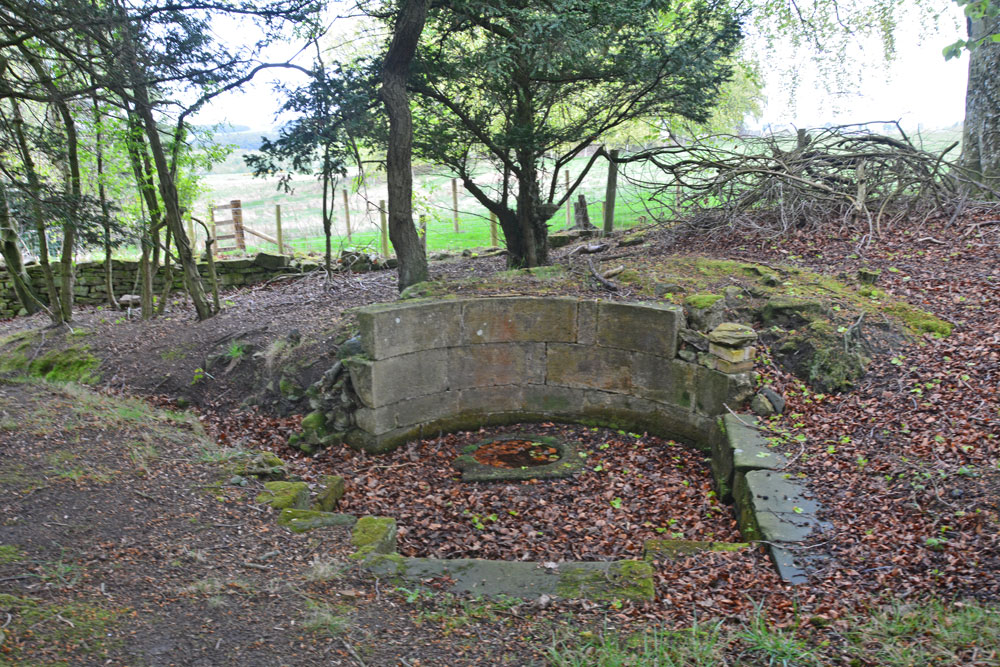
St George's Well (Minsteracres) submitted by Anne T on 7th May 2019. Getting closer, the structure of the well emerges from the surrounding tall trees. There is a semi-circular back wall, which has no exit tap or pipe; water must emerge directly from the ground into the small, circular well basin inside a larger, paved well pool.
(View photo, vote or add a comment)
Log Text: St George's Well, Minsteracres: Minsteracres had an open day today between 11am and 4pm, so we decided to drive up and see if we could find the well. I understood that it was located near to the chapel, but this was mistaken, as we found out on arrival.
Driving up the private road from the A68, we parked just past the cattle grid about 200m away from the main buildings, parked on the grass alongside the vegetable garden to our north, and walked back to The Shrubbery, a woodland with specimen and ornamental trees and two signposted walks.
With only a rough grid reference to guide us, but with the OS map in hand, it quickly became apparent that the well wasn’t in The Shrubbery, so we made our way back to the road and walked a little back towards the A68, heading north-north-east. In a small wood to our right hand side, the well became quickly apparent. I quickly recorded the waypoint on our GPS.
Whilst there was water in the pool, there was no water bubbling into the well pool. The well had a fairly large ditch running from it, so there appears to still be a fair flow of water from it at certain times.
Someone had recently been clearing away weeds and shrubs from the area. Scrapping away some of the leaves at the base of the steps into the well basin, water quickly flowed in to fill up the space where the leaves had been, although there was no evidence of flow.
St George's Well (Kirkwhelpington)
Trip No.118 Entry No.3 Date Added: 15th Feb 2019
Site Type: Holy Well or Sacred Spring
Country: England (Northumberland)
Visited: Yes on 14th Feb 2019. My rating: Condition 3 Ambience 4 Access 4
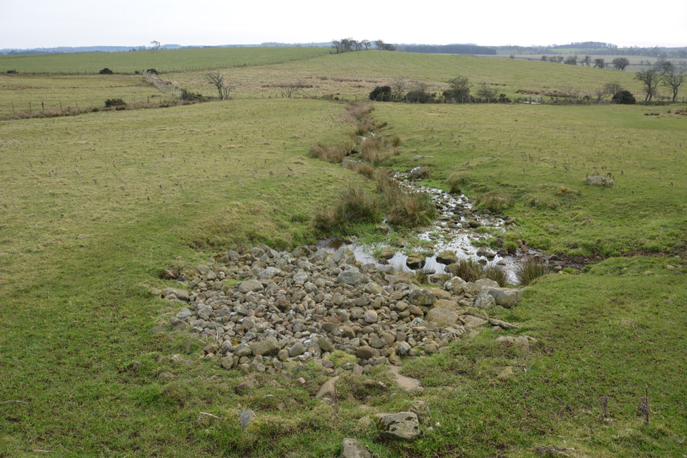
St George's Well (Kirkwhelpington) submitted by Anne T on 15th Feb 2019. Standing just to the north and just upslope from the well, looking down across the pile of stones which protect the spring head, the small pool into which the water comes up into, and the channel down which the water runs to join a small stream running east-west along the bottom of the field.
(View photo, vote or add a comment)
Log Text: St George's Holy Well, Kirkwhelpington: The second stop of four on our short circular walk around Kirkwhelpington. This well is in a lovely location, very peaceful and quiet (once the farmer and his numerous dogs had driven off in his four-wheel drive buggy!). Two holy wells within a couple of hundred yards was a treat, although I'm interested in finding out how they became known as holy wells and what they cured.
The water emerges very peacefully up into a small pool at the base of the stones. By the time the water has gone a couple of metres further downslope, it is quite lively, creating ripples through the grass.
Boulders appear to mark the edge of the pool and water channel, although I couldn't see any signs of a permanent structure.
St George's Well (Edinburgh)
Date Added: 30th Dec 2015
Site Type: Holy Well or Sacred Spring
Country: Scotland (Midlothian)
Visited: Yes on 17th Dec 2015. My rating: Condition 3 Ambience 2 Access 4
St George's Well (Edinburgh) submitted by KiwiBetsy on 12th Sep 2006. The wellhouse was erected in 1810, to celebrate the jubilee of King George III, over the site of a reputed healing spring. Over the years attempts have been made to market the chalybeate water but it proved unpopular due to it's foul taste.
(View photo, vote or add a comment)
Log Text: St George's Well, Edinburgh: An easy walk along the Water of Leith walkway. I wouldn't have recognised this as a well without the Portal. It looks like a very run down stone gardener's house, complete with chimney, sitting between the walkway and the river, which was running very high at the time of my visit. The iron gate was unbolted but the door to the well house was locked. The area surrounding this little building was heavily littered, not only with general rubbish but lots of empty cans and bottles - in dire need of a clean up.
St Fillan's Chapel (Comrie)
Trip No.53 Entry No.5 Date Added: 11th Oct 2017
Site Type: Ancient Cross
Country: Scotland (Perth and Kinross)
Visited: Yes on 28th Sep 2017. My rating: Condition 2 Ambience 4 Access 4

St Fillan's Chapel (Comrie) submitted by Anne T on 11th Oct 2017. The cross slab, lying just to the south of the south wall of the chapel. In 2014 it was found recumbent but, comparing photographs with the Canmore page (24872), it has now been stood upright.
(View photo, vote or add a comment)
Log Text: St. Fillan's Chapel, west of Comrie: From Wester Tullybannocher Stone Circle, we carried on west along the A85, turning left into a road leading down to St. Fillan’s Golf Club and Western Dundurn Farm. Just before the farm buildings, the track splits. The eastern most track is gated off, and the road was very narrow, so we squeezed the car in by the gate intending to run back and move it if it got in the way. There was a herd of cattle in the field, although the churchyard has a dry stone wall around it.
Walking along the track, watched curiously by the golfers on the adjacent course, until I was level with the church ruins (very like Logie Old Kirk), then squidged my way through the wet turf to the far side, where the iron gate to the churchyard was locked, but there was a stone stile into the graveyard.
This is a very, very pretty spot. It is a very old site. Typically, there was no phone signal here so I couldn’t call up the Canmore record. I went round photographing lots of different things. I managed to miss the recumbent cross slab (most of them were overgrown with grass), although there were a couple of other interesting stones and features. Lovely site but disappointing not to have found the cross slab, even though I must have looked at it.
Also known as St Fillian's; Dundurn Burial-ground; Stewarts Of Ardvoirlich Burial-place.
St Edwin's (High Coniscliffe)
Trip No.58 Entry No.3 Date Added: 10th Nov 2017
Site Type: Ancient Cross
Country: England (County Durham)
Visited: Yes on 8th Nov 2017. My rating: Condition 3 Ambience 4 Access 5
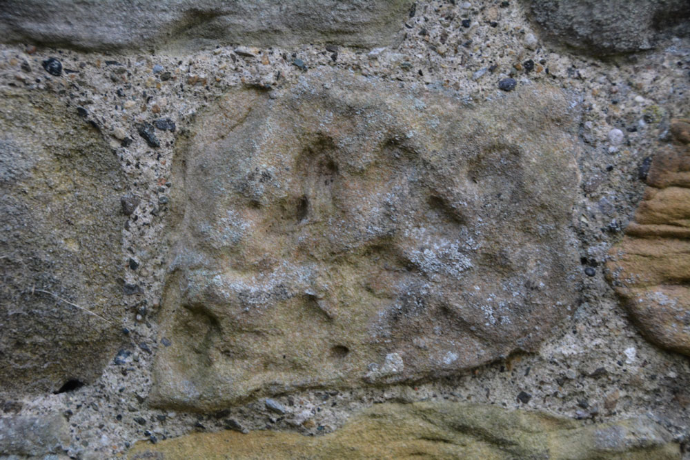
St Edwin's (High Coniscliffe) submitted by Anne T on 9th Nov 2017. This stone is recorded as AS Corpus Coniscliffe 01 and is to be found in the exterior north wall of the tower. It dates from the 10th century.
(View photo, vote or add a comment)
Log Text: Anglo Saxon Fragments, High Coniscliffe: This was a most unexpected location, as my perception was that the church should be within a quiet little village, but the reality was it was just off the main road, the A67 to Bishop Auckland. We parked by the footpath at NZ 22567 15316, and had to walk past the front of the Old Rectory to get to the lych gate.
There were so many stones in the walls of this church. So many of them were greatly weathered sandstone, and looked like any of them could have been carved then worn down. The walls of the church were a real patchwork of colours – light, medium, dark and red sandstone.
We couldn’t get into the porch. A notice on the gate of the church said keys were available at houses nearby, but none of them had lights on, so we headed home, but not before I’d spotted the view from the south western end of the churchyard down to the River Tees below. Great!
St Edmund's Church (Newbeggin)
Trip No.66 Entry No.5 Date Added: 10th Feb 2018
Site Type: Ancient Cross
Country: England (Cumbria)
Visited: Yes on 9th Feb 2018. My rating: Condition 2 Ambience 4 Access 5
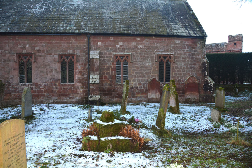
St Edmund's Church (Newbeggin) submitted by Anne T on 10th Feb 2018. Standing to the south of the cross base and shaft fragment, showing its proximity to the south of the nave/chancel.
(View photo, vote or add a comment)
Log Text: Cross base and remains of cross shaft, St. Edmunds Church, Newbeggin (Culgaith): We arrived here as dusk was dropping fast, so all my photos had to be taken with flash. Surprisingly, the church was still open, so we popped inside, but apart from a reading light near the pulpit, couldn't find any light switches. The church is a lot larger than it looks, and the grave yard is very full, so we had to pick our way over the graves and host of snowdrops to get to the cross.
The sundial nearer to the western churchyard wall was also interesting, although part of its lead gnomon had been pulled off.
It was very heavily encrusted in moss, and not wanting to damage it, left it without seeing if there were any carvings or features on it. Another church next to Crowdundle Burn (as is St. Cuthbert's in Milburn). A pretty spot. By the time we'd finished here, it was almost dark, so reluctantly had to set off back home.
St Ebba's Chapel
Trip No.75 Entry No.4 Date Added: 22nd May 2018
Site Type: Ancient Cross
Country: England (Northumberland)
Visited: Yes on 20th May 2018. My rating: Condition 2 Ambience 4 Access 4
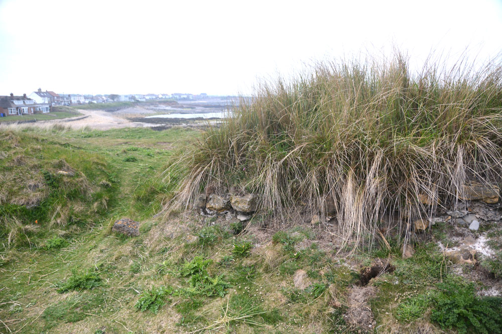
St Ebba's Chapel submitted by Anne T on 22nd May 2018. Inside the ruins of the chapel, looking at the northern doorway and remains of the northern wall.
(View photo, vote or add a comment)
Log Text: St Ebba's Chapel/Early Christian Monastery site: I have long wanted to come to this spot, ever since seeing the Time Team Excavation of this in July 2013. Whilst the rest of Northumberland had a hot day with blue, cloudless skies, this part of the coast was murky. Still, this was a very enigmatic place.
We’d stopped off at a café/restaurant in Beadnell village for refreshments before arriving here, and I’d looked at their guide book “Limekilns and Lobsterpots” before arriving, which intrigued me further.
A lonely spot, largely surrounded by sea on a narrow promontory. I wish I’d been able to see the excavations, but found the Wessex Archaeology report.
St Cuthbert's Well (Mitford)
Trip No.104 Entry No.2 Date Added: 24th Oct 2018
Site Type: Holy Well or Sacred Spring
Country: England (Northumberland)
Visited: Yes on 24th Oct 2018. My rating: Condition 3 Ambience 3 Access 5
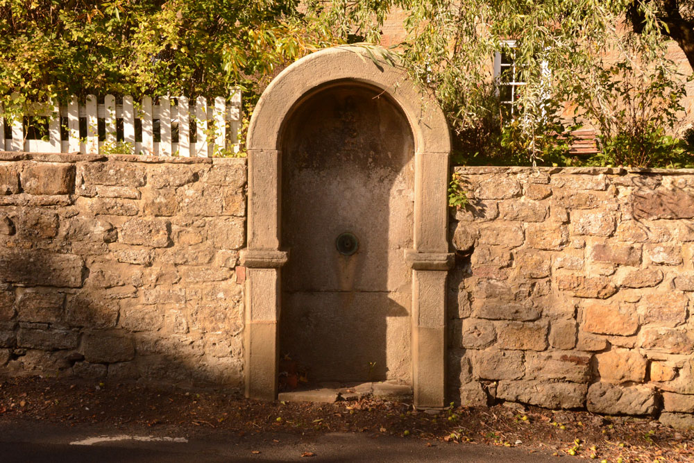
St Cuthbert's Well (Mitford) submitted by Anne T on 24th Oct 2018. The well/fountain housing is built into the wall of the Old Post Office, at the side of the B6343.
(View photo, vote or add a comment)
Log Text: Site of St Cuthbert's Holy Well, Mitford: After having visited Bothal church and spent well over an hour looking around, we stopped off at The Old Chantry tea rooms in Morpeth for a bowl of soup and a cup of tea, then headed off to the small, but very pretty village of Mitford, just over 2.5 km west of Morpeth.
OK, so there is no longer a well here, and the Victorian-era drinking fountain structure that was built in the place where the well was supposed to have been is now dry, it was easy to find. The road is reasonably busy, so I risked getting run over to get a few close up shots. The carving of the impaled dragon's head (I didn't realise what it was until I saw the photos on the larger screen of the computer and read the Historic England description) was pretty gruesome.
We did wander down to the river and walked along a little way. Someone has built what appears to be a very pretty, but very modern, thatched cottage by the side of the footpath along the river.
Note for next time: the pub does special offers on food for pensioners!
St Cuthbert's Well (County Durham)
Trip No.20 Entry No.2 Date Added: 1st May 2017
Site Type: Holy Well or Sacred Spring
Country: England (County Durham)
Visited: Yes on 30th Apr 2017. My rating: Condition 3 Ambience 2 Access 4
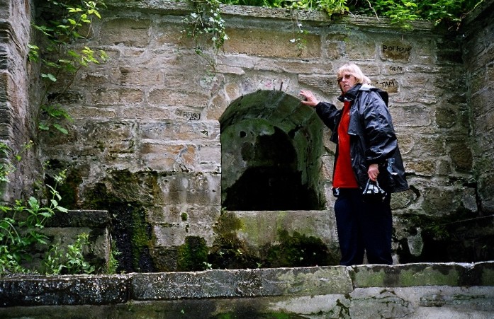
St Cuthbert's Well (County Durham) submitted by kiwiBetsy on 30th Nov 2004. St Cuthbert's Well .... well neglected.
(View photo, vote or add a comment)
Log Text: St. Cuthbert's Well, Durham: We had difficulty in locating this well from the 6 digit grid reference, so I've updated it with the official 10 digit reference from Pastscape.
From the Galilee Well, we took the steps/sloping path down to the riverside, then walked up and down, down and up, past the Old Fulling Mill to Prebend Bridge and back. Mystified by the grid reference, I stood with my phone looking up notes on the internet, trying to get a better grid reference. We knew it was near some steep steps, thanks to the entry by kiwiBetsy, but had difficulty locating the exact site. We must have looked so lost that two passing students heading to the Boat House asked us where we were looking for, but couldn't help, shrugged and walked off!
In the end, husband Andrew ran back up the footpath towards the city and spotted this structure half way up the hillside. There are two sets of steps to it – one almost from the path running next to the river (although these are now so overgrown that the path has disappeared in places); the second set of steps runs from the well structure back up to the cathedral.
There was a flow of water, but a trickle. Against the side of the footpath there was a second well structure, perhaps tapping the water so people who couldn’t make it up the steps could get water.
St Cuthbert's Well (Clifton)
Trip No.146 Entry No.4 Date Added: 29th Aug 2019
Site Type: Holy Well or Sacred Spring
Country: England (Cumbria)
Visited: Yes on 27th Aug 2019. My rating: Condition 3 Ambience 3 Access 5
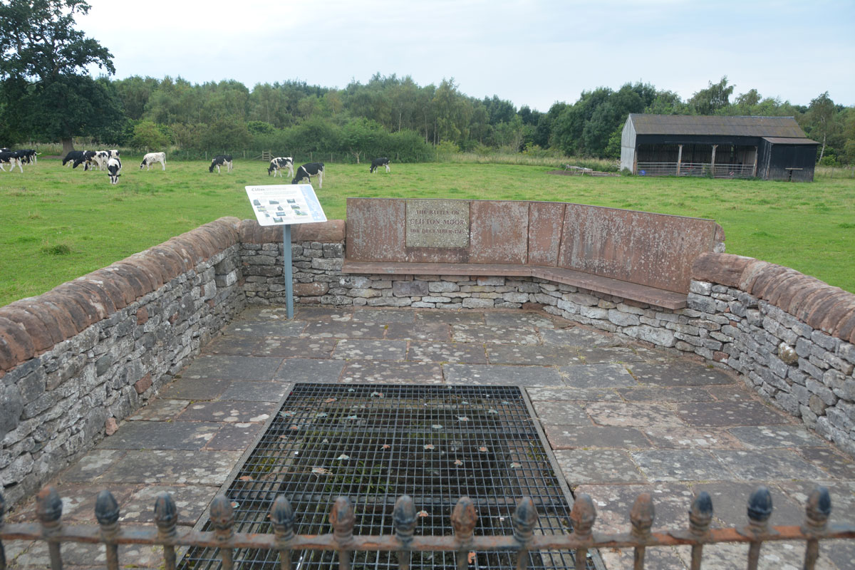
St Cuthbert's Well (Clifton) submitted by Anne T on 29th Aug 2019. The spring/well now covered by a close metal grille, which made taking photographs of the steps and water channel somewhat difficult, despite using manual focus. The enclosure commemorates the last battle on English soil between the Jacobite army and Government troops on 18th December 1745.
(View photo, vote or add a comment)
Log Text: St Cuthbert's Well (or Kelter Well), Clifton: The enclosure for this well is to the western side of the A6, towards the southern end of Clifton village. In some ways, this well is very disappointing, as the grid over it does not allow you to see very much, apart from some stone steps leading down to what appears to be a culvert with a strong flow of water running through it.
The well has been built into an enclosure which commemorates the last battle on English soil between the retreating Jacobite army and Government troops. This took place on 18th December 1745 (the battle of Clifton Moor).
No entry on either Pastscape or Historic England, although a well is shown on their map if you enter the grid reference above.
St Cuthbert's Well (Bellingham)
Trip No.27 Entry No.2 Date Added: 26th May 2017
Site Type: Holy Well or Sacred Spring
Country: England (Northumberland)
Visited: Yes on 25th May 2017. My rating: Condition 3 Ambience 4 Access 5
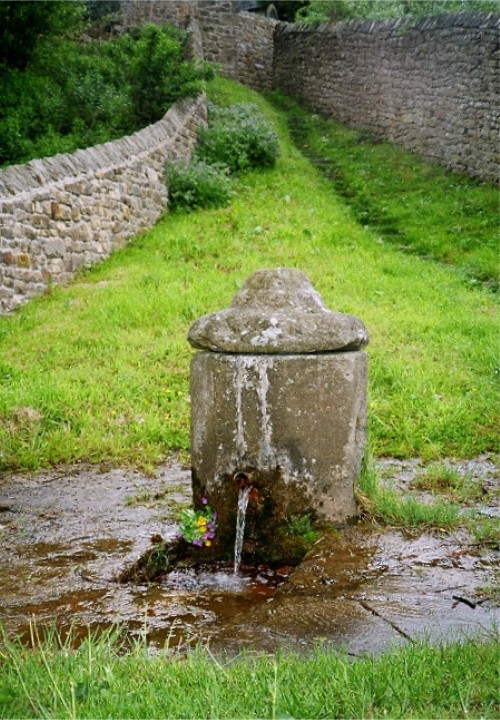
St Cuthbert's Well (Bellingham) submitted by KiwiBetsy on 11th Dec 2004. St Cuthbert, a noted dowser, found and dedicated this abundant spring of clear, pure water quite unlike the brackish marsh water of the area.
Today, the water is contained in a picturesque Georgian pant with it’s ever flowing spout directing the water down through a grill and away to the River Tyne. The upright pant was considered a vast improvement over the older dipping well provided water pressure justified building one.
The water is still used in the church for baptisms. The lo...
(View photo, vote or add a comment)
Log Text: Cuddy's Well (St. Cuthbert's Well, Bellingham): Parking in a small layby at NY 83833 83303, just opposite Manchester Square side road, we headed off to the church. The church was open, so we popped in to have a look. It looked relatively modern, but a plan hooked on the wall told us the sanctuary and chancel dated from the 13th century. Research this afternoon on British Listed Buildings said the church was extensively remodelled in 1609 and bell cote added in 1865. The stone barrelled roof was certainly interesting.
There was a marked grave ‘the lang pack’ in the churchyard, which the ‘A Church Near You’ website says is “the 'Long Pack' grave of a would be house-breaker who was killed by the butler of the house he was trying to rob.”
The well was mentioned briefly on the wooden plaque containing points of interest. To find this, we needed to go out of the church, walk south by the Black Bull, then turn right along the Pennine Way, following the eastern external wall of the churchyard. The path narrowed between two stone walls, but turning round a corner we encountered shallow steps leading down a bank, and there was the well at the bottom. We could hear water gushing from half way down the steps. The water rushed through the grill into the pool below, foaming up with the pressure. I did taste the water; it was fresh, but had no specific taste of any mineral.
On the eastern side of the current well structure there was another hole in the stone, and looked as if at some point either another spout came through, or the current spout had been moved.
Walking back up to the car, we noticed signs for the well and riverside walks from the main square (Manchester Square) in the town, which could be used for disabled access. I didn’t realise until I looked at UK Grid Reference Finder how close we had been to the North Tyne River, as the view was blocked by a very overgrown part of the cemetery.
St Cuthbert's Stone and Well (Waverbridge)
Date Added: 4th Jun 2022
Site Type: Holy Well or Sacred Spring
Country: England (Cumbria)
Visited: Yes on 14th Jun 2020. My rating: Condition 2 Ambience 3 Access 4
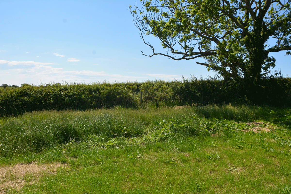
St Cuthbert's Stone and Well (Waverbridge) submitted by Anne T on 4th Jun 2022. Looking at the un-mown section of grass where the site of the well is shown. No water was showing in the field, but there was a pipe under the roots of the tree leading into the drainage ditch at the far side of the tree in the photograph.
(View photo, vote or add a comment)
Log Text: St Cuthbert's Stone & Well: We were making our first (and only for a long time) essential trip out, and passed within 400m of this well, so screeched to a halt at the entrance to the track (Watergate Lonning) at its junction with the B5302 at NY 21277 49139, and took our daily exercise walking down slope towards the well.
There is some sign of the well - in the field as an un-mown area of grass and in the hedge-line under the tree are remnants of a stone structure between the tree roots and along the bank of the ditch. All along the left hand side of the track (eastern side) is a drainage ditch, which we presume took the water from the fields, then when you get to the well, the water from the well joins the ditch. The well was dry at the time of our visit.
The stone was marked on the OS map, but was several fields away, with no gates in sight, so with time pressing, I photographed the well and we set off for our destination. So very odd to be out-and-about after months at home, but lots of other cars on the road, and difficult to rejoin the main road due to the high speed traffic.
St Cuthbert's Holy Well
Date Added: 12th Apr 2016
Site Type: Holy Well or Sacred Spring
Country: England (Cumbria)
Visited: Yes on 28th Feb 2016. My rating: Condition 3 Ambience 3 Access 4
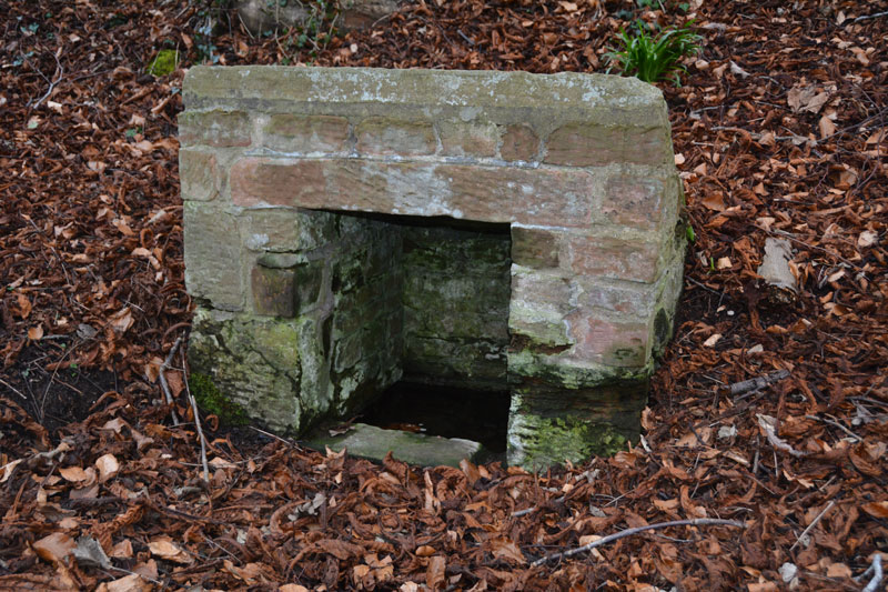
St Cuthbert's Holy Well submitted by Anne T on 2nd Mar 2016. The front and interior of St. Cuthbert's Holy Well. At the time of our visit, whilst the basin inside the well was full of clear water, there was little or no visible flow, unlike the spring opposite Wetheral Priory Gatehouse further up the village.
(View photo, vote or add a comment)
Log Text: St. Cuthbert's Well, Wetheral, Cumbria: I'd tried the (very pretty) walk along the recently flooded River Eden to St. Constantine's Cells, but failed as the path overhangs the river by some 5-6 metres. As a consequence, I was determined to go to this well. Just as you arrive into Wetheral village from the A69, there is a footpath sign leading off to the left, indicating St. Cuthbert’s Well.
There is parking outside the small railway station (there are just a couple of platforms here) and it’s about quarter of a mile down the slope towards the river to the well. A small sign sits to the right of the track as you head towards the river detailing a short history of the well. “According to legend, St Cuthbert’s Well was built long before Norman times when Wetheral Priory was founded. The exact date is not known, but St Cuthbert is thought to have visited Carlisle in 683 and 687.”
From the sign, the well can be seen topped by a concrete slab which has an inscription which reads: “The Holy Well/Called in the 12th century/Fons Sancti Cuthbert/Repaired 1897 and 2001.” A short flight of stone steps leads down to the well itself.
When visiting the village, the Wetheral Priory Gatehouse at the far side of the village is small but worth a visit.
