Contributory members are able to log private notes and comments about each site
Sites Anne T has logged. View this log as a table or view the most recent logs from everyone
Shovel Down row 6
Trip No.135 Entry No.15 Date Added: 1st Aug 2019
Site Type: Multiple Stone Rows / Avenue
Country: England (Devon)
Visited: Yes on 16th May 2019. My rating: Condition 1 Ambience 3 Access 3
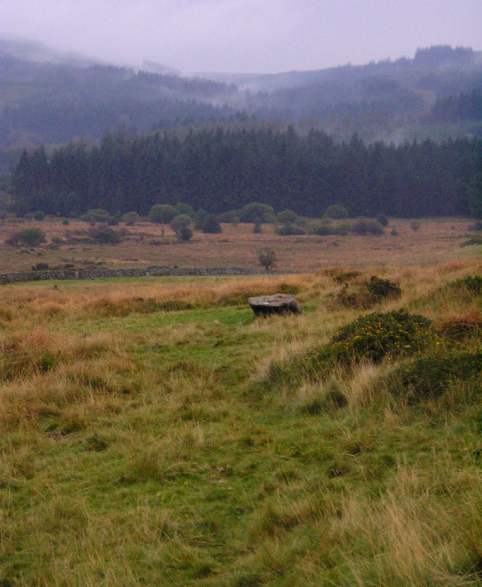
Shovel Down row 6 submitted by thecaptain on 15th Oct 2004. Shovel Down Row 6
View looking south towards the Three Boys Stone. Fernworthy forest in the distance.
(View photo, vote or add a comment)
Log Text: Shovel Down Row 6: Nothing is visible of this row now, although we walked down the line of the row to get to the Three Boys.
Three Boys
Trip No.135 Entry No.16 Date Added: 1st Aug 2019
Site Type: Standing Stone (Menhir)
Country: England (Devon)
Visited: Yes on 16th May 2019. My rating: Condition 3 Ambience 2 Access 3
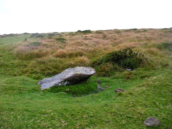
Three Boys submitted by thecaptain on 15th Oct 2004. Nearly 2 metres long, this fairly large, almost fallen stone was probably once a blocking stone at the southern end of Shovel Down row 6.
Viewed looking northwest with a row 6 stone under the gorsebush
(View photo, vote or add a comment)
Log Text: Three Boys: This was our last stop of the three days, and a lot of a let-down as someone had very recently used this stone as a toilet and left a great deal of white toilet paper around it. Yeuk! I think Gordon and/or Dave may have reported this to the authorities to clear up.
After this, we walked steadily back to the car park, took a few final photographs of the group altogether, using Janet and Gordon’s camera on my tripod on a timed setting. Then Andy, Dave, Andrew and myself headed back to Princetown to look inside the Visitor Centre.
Modern Stone Circle near Kestor Rock
Trip No.135 Entry No.3 Date Added: 19th Jul 2019
Site Type: Modern Stone Circle etc
Country: England (Devon)
Visited: Yes on 16th May 2019. My rating: Condition 3 Ambience 4 Access 3
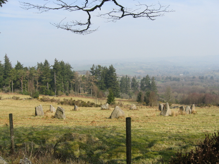
Modern Stone Circle near Kestor Rock submitted by AngieLake on 27th Mar 2011. Looking over wall from south border of field. [NB: All these photos are taken from the open moor.]
(View photo, vote or add a comment)
Log Text: Modern Stone Circle near Kestor Rock: As confirmed by the Dartefacts website, This stone circle is on land that used to the belong to Aid Edmundson and Jennifer Saunders. It is not recorded on Pastscape or Historic England.
The stone circle is on private land, but can be viewed over the fences to the west and southern sides.
We were also lucky enough to be with Janet Daynes and Gordon Fisher who had spent some time on this property doing excavations in years gone by. It was absolutely fascinating to hear them talk about the things they had found. Apparently the whole of the stone circle had, at one time, been surrounded by trees which had blown down or been cut down. The area is surrounded by Historic England List ID 1016691, “Coaxial field system and prehistoric settlements at Kestor”, but this area is not included in the scheduled area.
High Moorland Visitor Centre
Trip No.135 Entry No.17 Date Added: 1st Aug 2019
Site Type: Museum
Country: England (Devon)
Visited: Yes on 16th May 2019. My rating: Condition 3 Ambience 3 Access 4
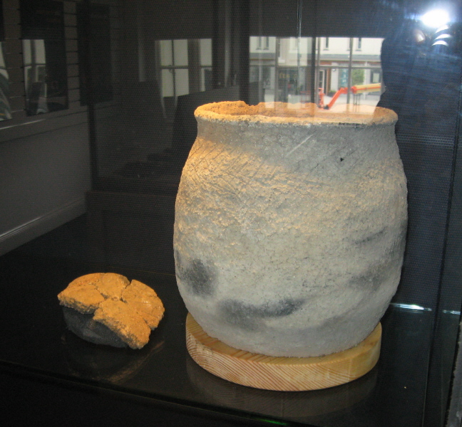
High Moorland Visitor Centre submitted by AngieLake on 5th Feb 2011. A modern replica of a pot from the recent Bellever hut circle excavations. Made by a local lady potter and displayed in the 'Going for Bronze' exhibition in summer 2010.
(View photo, vote or add a comment)
Log Text: Thornworthy Cist and Ter Hill Cross, Princetown National Park Visitor Centre: We had about 15 minutes before the centre closed on the Thursday, so we flew in with Dave Parks for me to see and photograph the Thornworthy Cist and the Ter Hill Cross. There was scaffolding around the back of the building, so I used this to step onto the weedy garden to photograph the cist slab from the top.
By the time I'd taken some photographs, I was being ushered out of the garden as they wanted to close the centre for the night, but I was bid 'you are more than welcome to come back tomorrow if you can".
Bennet's Cross
Trip No.134 Entry No.1 Date Added: 22nd Jun 2019
Site Type: Ancient Cross
Country: England (Devon)
Visited: Yes on 15th May 2019. My rating: Condition 3 Ambience 4 Access 4
Bennet's Cross submitted by thecaptain on 2nd Aug 2006. This is a lovely cross, believed to have been carved from a prehistoric menhir.
It stands about 1.7 metres tall, and is just beside the B3212 road near its high point as it crosses the moor between Moretonhampstead and Postbridge.
(View photo, vote or add a comment)
Log Text: Bennet's Cross, Devon: Not on our schedule for the day, but as we drove right past this cross, we pulled over in the small car park just to the eastern side of the B3212to take a closer look at this cross and to take some photographs. A slight problem on the morning, as the car park, even before 9.30am was chock-a-block with a party of ‘twitchers’, so as our car was blocking some of theirs in, Andrew stayed with the car and I ran over to the cross.
The early morning sunshine was really bright, so parts of the cross were in deep shade. I did see the carved WB on the cross, but the shadows were really deep. The intention was to stop on the way back and photograph the cross in a different light, but we were so tired at the end of the day, I forgot.
St Leonard's Well (Sheepstor)
Trip No.134 Entry No.16 Date Added: 22nd Jun 2019
Site Type: Holy Well or Sacred Spring
Country: England (Devon)
Visited: Yes on 15th May 2019. My rating: Condition 3 Ambience 3 Access 5
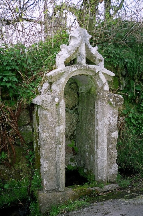
St Leonard's Well (Sheepstor) submitted by KiwiBetsy on 21st Nov 2004. St Leonard's Well is enhanced by a recycled church window.
(View photo, vote or add a comment)
Log Text: St Leonard's Holy Well, Sheepstor: I spotted this well as we were driving down to the car park near Whittenknowles and we stopped to photograph it on the way back.
The sunshine was really, really bright coming over the wall, so the few photos I took worked out best looking at the well from an angle. The well was completely dry, with the well structure full of ferns and weeds.
Our last stop of the day before going for an ice cold drink at Princetown.
Roman Cross (Sheepstor)
Trip No.134 Entry No.15 Date Added: 22nd Jun 2019
Site Type: Ancient Cross
Country: England (Devon)
Visited: Yes on 15th May 2019. My rating: Condition 3 Ambience 4 Access 5
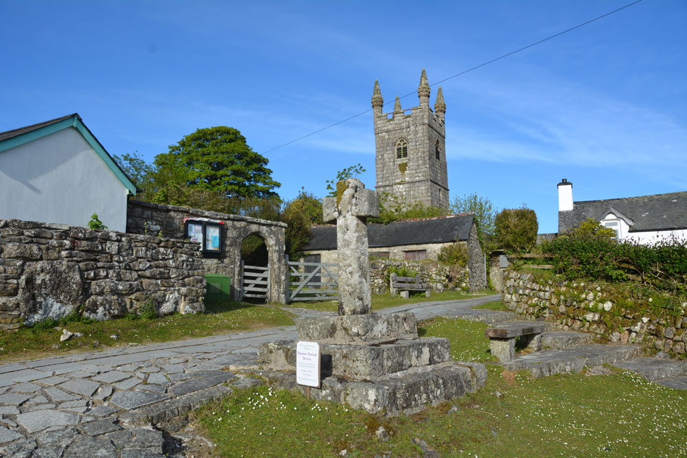
Roman Cross (Sheepstor) submitted by Anne T on 22nd Jun 2019. The Roman/Rumon Cross in Sheepstor, showing its location just outside St Leonard's Church.
(View photo, vote or add a comment)
Log Text: Roman Cross, Sheepstor: After having been to Whittenknowles, Drizzlecomb & Yellowmead, we drove back through Sheepstor and I asked to be able to stop and photograph this cross, which I'd seen on the way, just outside St. Leonard’s Church in Sheepstor village.
The cross has been restored, and almost looks modern, but reading its relatively complicated history, it is fortunate to have survived (see the references in the main site page text).
The cross is in a lovely location, and I would have loved to have had time to pop into the church, but my aching feet and the need for a meal and a drink dictated otherwise!
Standing Stone Near Cairn at Head of Drizzlecombe Row 4
Trip No.134 Entry No.16 Date Added: 16th Jul 2019
Site Type: Standing Stone (Menhir)
Country: England (Devon)
Visited: Yes on 15th May 2019. My rating: Condition 2 Ambience 4 Access 3
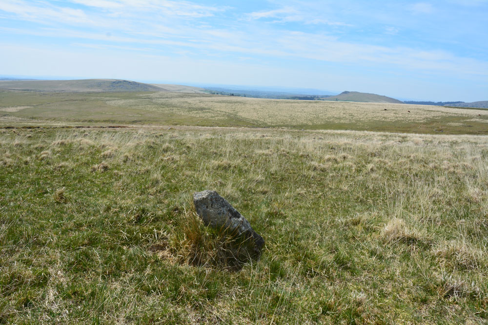
Standing Stone Near Cairn at Head of Drizzlecombe Row 4 submitted by Anne T on 1st Jun 2019. This photo is taken just from the SSW of the stone, showing its north-north-eastern face.
(View photo, vote or add a comment)
Log Text: Drizzlecombe West Standing Stone: Whilst Sandy and the rest of the intrepid "Dartmoor Expedition" were searching lower down the slope for the enigmatic and mysterious Drizzlecome West Stone Row, I'd wandered up slope, stopping at this stone and looking at the nearby cairn. Failing to attract the attention of my fellow explorers, I wandered off to look at the large cairn near the southern and smaller of the two pounds. When I came back, I found Sandy in full 'Bronze Age Mode' with his ranging pole standing by this stone.
We photographed it and took a grid reference with our GPS. More research to be done on this stone - not apparently recorded in Butler or any of the other Dartmoor Archaeology books I now possess. Have asked the rest of the group to contribute to the information on this stone, if they are able. Sandy plans to return in September 2019, so more information to follow.
Whittenknowles Rocks
Trip No.134 Entry No.2 Date Added: 11th Jul 2019
Site Type: Ancient Village or Settlement
Country: England (Devon)
Visited: Yes on 15th May 2019. My rating: Condition 2 Ambience 4 Access 3
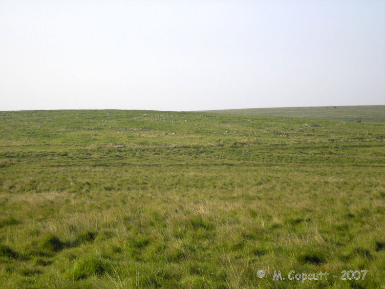
Whittenknowles Rocks submitted by thecaptain on 15th Jun 2008. To the west of the Drizzlecombe sites, on a southern facing hillside, can be found the remains of the very large Whittenknowles Rocks ancient settlement.
(View photo, vote or add a comment)
Log Text: Whittenknowles Rocks Enclosed Settlement: We parked in the small car park at SX 57880 67316 next to a small stream and a ford. Walking across the road bridge, we dived off across a small stream and walked next to a small wood, entering the moorland and continuing in a southerly direction, following an old dry stone wall, then turning eastwards. Most of the walking was really easy, even though this was rough moorland.
We started to come across wall lines and groups of stones, and as I started to ‘get my eye in’, the hut circles and compounds became much clearer (see Butler’s plan, “Dartmoor Atlas of Antiquities”, volume 3, page 126). The hut circles and enclosures were inter-dispersed with uncleared lines of rocks, which Sandy said were natural, and the occupants had just left them as they were.
Towards the southern side of the site, towards the long houses, we came across a small leat, where Sandy explained there had been ‘in the past, a natural disaster’ and all the soil had come down the slope, presumably leaving no soil for growing crops.
I couldn’t believe how far this site extends – some 4.7 hectares (11.61 acres).
I took photographs, blithely thinking the external GPS device on my camera was capturing the locations of the photographs. It wasn't until a couple of days later that I realised there was no lat/long information on the photographs, so I've had to guess, from Butler's plan, more or less where the photos were taken.
Drizzlecombe Brook
Trip No.134 Entry No.3 Date Added: 17th Jul 2019
Site Type: Marker Stone
Country: England (Devon)
Visited: Yes on 15th May 2019. My rating: Condition 3 Ambience 3 Access 3
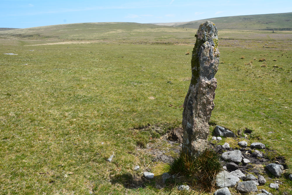
Drizzlecombe Brook submitted by Anne T on 11th Jul 2019. This is the 'standing stone' at SX 5870966946, in between Whittenknowles Rocks Settlement and Drizzlecombe Brook with its old tin workings.
(View photo, vote or add a comment)
Log Text: Drizzlecombe Brook 'Standing Stone': This stone was between the settlement an the tin works that Sandy showed us and I was hopeful of having spotted another monument on the moors not on today's list of sites to visit.
Not having a grid reference from the camera, we’ve tracked it down to one of six stones (one of which I photographed later, but which turns out to be the abandoned gate post!). Looking at the photograph and how near we are to the tin-works at the stream, this stone is at SX 58709 66946.
Judging by the photograph with the group, I estimate it to be just taller than Janet – 1.7m or just over.
Drizzlecombe row 1
Trip No.134 Entry No.4 Date Added: 2nd Aug 2019
Site Type: Multiple Stone Rows / Avenue
Country: England (Devon)
Visited: Yes on 15th May 2019. My rating: Condition 3 Ambience 4 Access 3
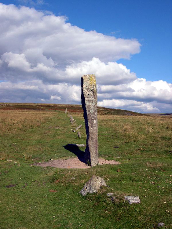
Drizzlecombe row 1 submitted by Karen on 27th Oct 2003. Drizzlecombe SE row looking up the row from its longstone
(View photo, vote or add a comment)
Log Text: Drizzlecombe 1 Stone Row: Having been able to glimpse these stones rows as we walked across the moorland from Whittenknowles Rocks settlement, I couldn’t wait to see these rows at last. But, my goodness, what a richness and complexity of sites all in one small-ish area. I made careful notes throughout the day of which photographs belonged to which row, and hopefully these now all make sense.
Stone Row 1, similar in some ways to the Merrivale Rows, but then again not, had a much, much taller pillar stone. Located at the SW end of the row, this pillar stone can be seen on UK Grid reference finder: SX 59053 66858.
The stone row is unusual because it starts off as a single row (74.5m), then becomes a double row (for 47m), then back to a single row (28m to the cairn) – total length 149.5m.
I was surprised to see quite a few walkers stroll along this valley bottom, some along the row, others not. With the River Plym to our east, the water shimmered in the afternoon light. There were also a lot of cattle in the field, but all seemed used to people and just carried on grazing.
Drizzlecombe menhir 1
Trip No.134 Entry No.5 Date Added: 2nd Aug 2019
Site Type: Standing Stone (Menhir)
Country: England (Devon)
Visited: Yes on 15th May 2019. My rating: Condition 3 Ambience 4 Access 3

Drizzlecombe menhir 1 submitted by thecaptain on 1st Feb 2008. Drizzlecombe menhir 1 viewed from the southwest, with the row running away to the left.
(View photo, vote or add a comment)
Log Text: Drizzlecombe Menhir 1: I counted this pillar stone as part of the stone row, although Prehistoric Dartmoor Walks and Pastscape record it separately. I have switched some of my photographs over to this site page. Beautiful stone, and lovely location.
Drizzlecombe Giant's Basin
Date Added: 17th Jul 2019
Site Type: Cairn
Country: England (Devon)
Visited: Yes on 15th May 2019. My rating: Condition 3 Ambience 4 Access 3
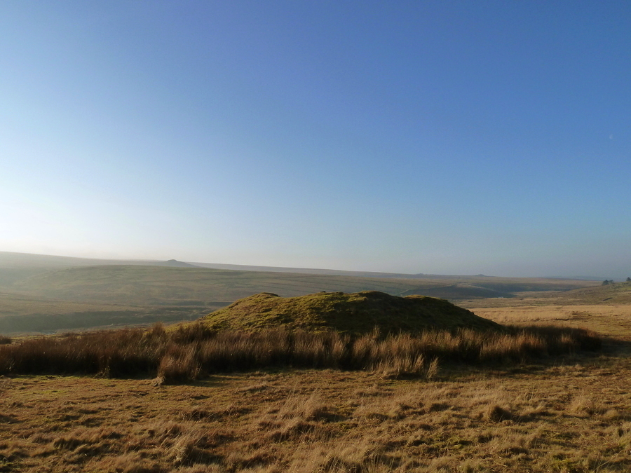
Drizzlecombe Giant's Basin submitted by Bladup on 12th May 2017. The large Giant's Basin.
(View photo, vote or add a comment)
Log Text: Giant's Basin and associated smaller cairns: Before we arrived at the stone rows, despite having printed off the Pastscape and Historic England entries for these sites, I hadn’t really got the full picture of how complex and interesting this area of Drizzlecombe was.
The Giant’s Basin, to the south east of the cairn at the top of Drizzlecombe Stone Row 1/A, is enormous, and reminiscent of the large cairns at Kilmartin, albeit covered in grass.
Thanks to Dave P and his trusty GPS (along with vast knowledge of Dartmoor, of course!) took me over and pointed at the three cairns at its western side.
I walked half way up the slope to the top of the cairn and photographed part of the the robbed out interior.
Drizzlecombe menhir 2
Trip No.134 Entry No.7 Date Added: 2nd Aug 2019
Site Type: Standing Stone (Menhir)
Country: England (Devon)
Visited: Yes on 15th May 2019. My rating: Condition 3 Ambience 4 Access 3
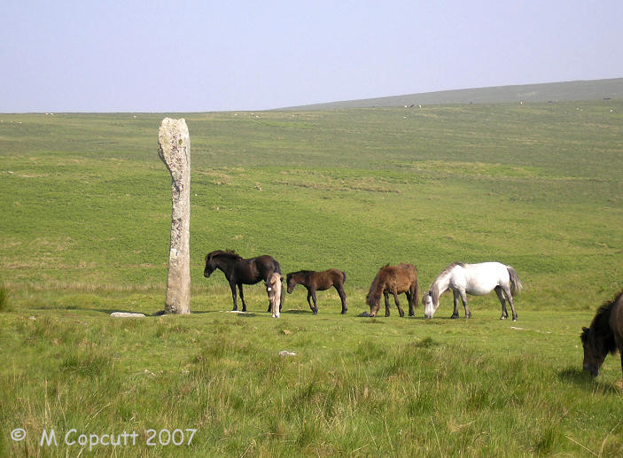
Drizzlecombe menhir 2 submitted by TheCaptain on 13th Jun 2007. This magnificent menhir at the downhill end of row 2 (or C) at Drizzlecombe is the largest on Dartmoor, and said to be "by far the finest in the west of England".
I wouldnt argue with that.
(View photo, vote or add a comment)
Log Text: Drizzlecombe Menhir 2: I took this to be an integral part of Drizzlecombe Stone Row 2, so have moved a couple of my photos over to this site page.
Drizzlecombe Cist 6
Trip No.134 Entry No.6 Date Added: 17th Jul 2019
Site Type: Cairn
Country: England (Devon)
Visited: Yes on 15th May 2019. My rating: Condition 3 Ambience 4 Access 3
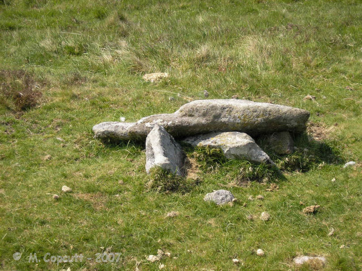
Drizzlecombe Cist 6 submitted by thecaptain on 23rd Feb 2008. Drizzlecombe Cist 6 has a capstone 1.8 m by 1.2 m sitting on top of a broken box, which is now three side set slabs, probably two side slabs and a single end stone.
(View photo, vote or add a comment)
Log Text: Giant's Basin Cist (Drizzlecombe Cist 6): This cist was pointed out to me by Dave Parks and Sandy G, but I only seem to have one photograph of it, although I remember standing over it and taking photos from different angles. Perhaps I've got muddled up with all the other wonderful stone settings and cairns in the area. A brilliant area to visit. So much to see, all in very close proximity.
Drizzlecombe menhir 3
Trip No.134 Entry No.10 Date Added: 2nd Aug 2019
Site Type: Standing Stone (Menhir)
Country: England (Devon)
Visited: Yes on 15th May 2019. My rating: Condition 3 Ambience 4 Access 3
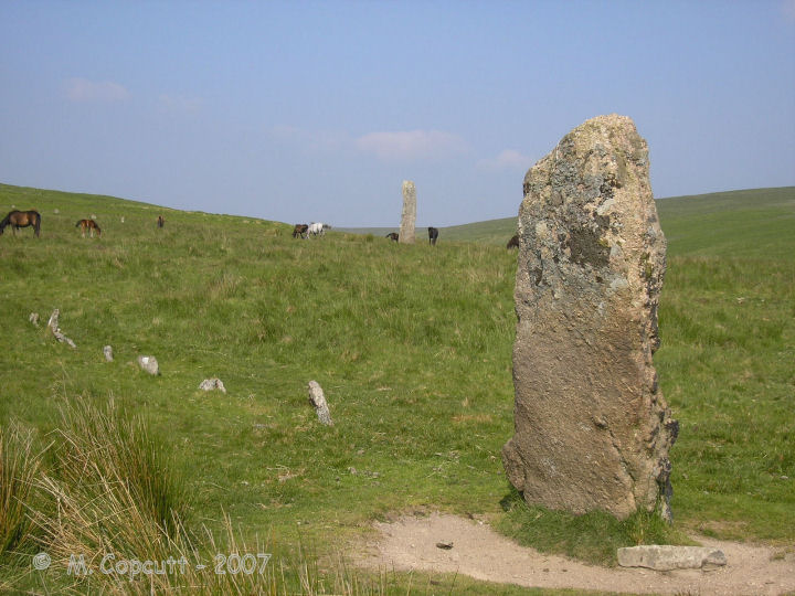
Drizzlecombe menhir 3 submitted by thecaptain on 15th Feb 2008. Drizzlecombe menhir 3 seen from the west.
Many of the stones of row 3 can be seen running away from this terminal longstone to the left.
In the background is the glorious menhir 2.
(View photo, vote or add a comment)
Log Text: Drizzlecombe Menhir 3: Again, I took this to be an integral part of Drizzlecombe Stone Row 3, so I've swapped some of my photos to this site page. I've duplicated the trip/order number with row 3 to match my walk/photo journal.
Drizzlecombe row 2
Trip No.134 Entry No.7 Date Added: 17th Jul 2019
Site Type: Stone Row / Alignment
Country: England (Devon)
Visited: Yes on 15th May 2019. My rating: Condition 3 Ambience 4 Access 3
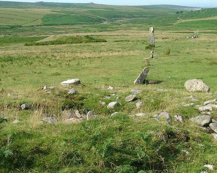
Drizzlecombe row 2 submitted by Brian Byng on 7th Feb 2002. View of what the natives call row C the one with the 14ft (4.3m) high
terminal stone in Burls book page 114. The chinese graphic is on the largest
stone that can be seen at the far end & is facing the camera.
(View photo, vote or add a comment)
Log Text: Drizzlecombe 2: Having three stone rows, their cairns, cists and longstones all in a very close proximity was quite stunning. As we walked up and down this row with Sandy G and the rest of the Intrepid Dartmoor Expedition Group, I was barely able to take it all in - so much to see and understand.
When we started off at the longstone at the western end of the row, there was blue sky and whispy clouds; by the time we'd wandered up to the cairn at the eastern end of the row, a mist/clag had started to descend, so the views from/around the stone row weren't quite as good as earlier, but the atmosphere of this place was just amazing.
The longstone is a really peculiar shape. Butler, volume 3 of "Dartmoor Atlas of Antiquities", page 138, says "According to Worth, it was probably dragged here from Higher Hartor Tor, about a kilometre away".
Drizzlecombe cairn 2
Trip No.134 Entry No.8 Date Added: 17th Jul 2019
Site Type: Ring Cairn
Country: England (Devon)
Visited: Yes on 15th May 2019. My rating: Condition 2 Ambience 4 Access 3
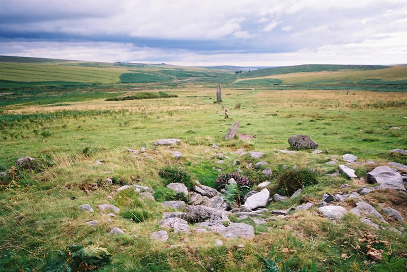
Drizzlecombe cairn 2 submitted by simcon on 27th Aug 2003. SX593671 Drizzle Combe Cairn East, Dartmoor Devon. This cairn is at the top end of the rightmost row at this site. The view in this picture is looking back down the row in a south westerly direction. Left of centre is a huge cairn called Giant's Basin Cairn (so it says on the OS map).
(View photo, vote or add a comment)
Log Text: Drizzlecombe Cairn 2: After a most satisfactory and pleasant morning, we sat at the edges of the cairns heading up rows 2 and 3 and had a quick lunch break. It really is an amazing spot, and so pleased to have visited, although correctly cataloguing my photos to the right site proved a little challenging at the end of the day.
Drizzlecombe cairn 3
Trip No.134 Entry No.9 Date Added: 17th Jul 2019
Site Type: Ring Cairn
Country: England (Devon)
Visited: Yes on 15th May 2019. My rating: Condition 2 Ambience 4 Access 3

Drizzlecombe cairn 3 submitted by simcon on 27th Aug 2003. SX593671 Drizzle Combe Cairn West, Dartmoor Devon. This cairn is at the top end of the leftmost row at this site. The view in this picture is looking back down the row in a south westerly direction. You can clearly see the other row in the left of this picture extending way down the hill.
(View photo, vote or add a comment)
Log Text: Drizzlecombe Cairn 3: cairn at the head of Drizzlecombe Stone Row 3. The stone row is just offset from the centre of the cairn. Butler, in his "Dartmoor Atlas of Antiquities, page 138, says: "the third row descends from cairn 3 surrounded by an outer ring of slabs 8.6m across mostly in contact with its base ... probably only three stones are missing out of t10, the largest of those remaining standing about a metre high facing the row". Of the three cairns at the eastern end of the row, this cairn has the tallest stones protruding out of it, and the most character. See Butler's diagram of it on page 139 (fig. 49.19.3).
After looking at the eastern end of the row, we proceeded up the slope, looking for the Drizzlecombe Cist and the settlements at the top of the slope, meandering back along stone row 3 as we came back.
Drizzlecombe row 3
Trip No.134 Entry No.10 Date Added: 2nd Aug 2019
Site Type: Stone Row / Alignment
Country: England (Devon)
Visited: Yes on 15th May 2019. My rating: Condition 3 Ambience 4 Access 3
Drizzlecombe row 3 submitted by ernar on 17th Oct 2004. The NW stone row at Drizzlecombe begins at the center cairn (of a 3-cairn group oriented SE just downhill the settlement) and is aligned at 235º.
(View photo, vote or add a comment)
Log Text: Drizzlecombe Stone Row 3: The last of the stone rows we visited today (although there was to be a minor, minor surprise at Yellowmead to end the afternoon). This surprising row, the same length as Row 1, and bends in the middle (it’s not straight).
We split the visit to this row into two; the first part was looking at the eastern end of the row and the cairn; the second was after we’d wandered up slope to look at the larger cist, the settlements and another large cairn. We then meandered back down Row 3. It was on the way back that I found a compass between the tussocks of grass, covered in heavy dew and I thought the moisture had got inside the mechanism and was ruined. I was going to leave it by the stones in case anyone collected it, but given where it was, we concluded no-one was likely to walk along this particular spot between the rows. I later found out that it was a military compass, probably dropped by one of the many soldiers who carry out exercises in this location.
The longstone at the eastern end of the row was intriguing. It appeared to be undressed granite, and bore some sort of resemblance to the marker stone seen earlier today, but is most definitely part of row 3. The large, but friendly, cattle in the field liked to lean against it, presumably because it absorbed the heat of the sun, or to scratch.
