Contributory members are able to log private notes and comments about each site
Sites Anne T has logged. View this log as a table or view the most recent logs from everyone
Newbeggin Stone Row
Trip No.96 Entry No.1 Date Added: 12th Sep 2018
Site Type: Stone Row / Alignment
Country: England (Cumbria)
Visited: Yes on 11th Sep 2018. My rating: Condition 3 Ambience 3 Access 4
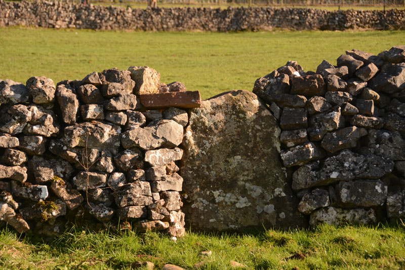
Newbiggin Stone Row (Stone 5) submitted by Anne T on 28th Mar 2017. This stone, number 5 on Dr. Rich's map, also sits on the wall to the left of the footpath running between Newbeggin and the A66. It is somewhat more obvious than the others. It is sited at NY 46849 28893.
(View photo, vote or add a comment)
Log Text: Newbeggin Stone Row: We went along to Newbeggin armed with permission from a number of landowners to walk along their boundary stone walls to look for other possible standing stones. We found a few more, but these looked more like erratics which had been shaped and used in the stone walls. I will document these and send them off to Sandy G for comment.
We got to see the stones outside Sycamore View/House with the farmer, who said the archaeologists said they were probably rubbing stones, although the farmer said they weren't (currently) tall enough even for sheep to rub against. There were certainly no signs of animals having trodden away earth at the base of the stones.
Motherby (Cumbria)
Trip No.96 Entry No.4 Date Added: 13th Sep 2018
Site Type: Holy Well or Sacred Spring
Country: England (Cumbria)
Visited: Yes on 11th Sep 2018. My rating: Condition 3 Ambience 4 Access 5
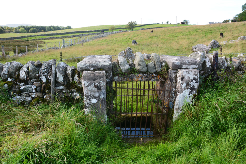
Motherby (Cumbria) submitted by Anne T on 13th Sep 2018. The well chamber is some 10+ metres further along the wall towards Motherby village, with the well chamber directly underneath the wall. An iron gate on either side of the wall gives access to the well itself.
(View photo, vote or add a comment)
Log Text: Well, Motherby, Cumbria: This is a very old village, with very picturesque cottages and farm houses. The well is not recorded on either Pastscape or Historic England.
The ‘wall’ is a strange structure. Following the line of stones up the hill, it ends in what seems to be a building platform and possibly an old quarry. The footpath at the village end of the footpath was closed due to building work, so we couldn’t investigate further.
I have emailed Mark Brennand at Cumbria County Council to see if he has any information. The line of stones follows an old footpath on the 1860 OS map, together with the letter 'T' (troughs?) where the troughs are currently located. No mention of the well.
Kells Well (Newbeggin)
Trip No.96 Entry No.5 Date Added: 13th Sep 2018
Site Type: Holy Well or Sacred Spring
Country: England (Cumbria)
Visited: Yes on 11th Sep 2018. My rating: Condition 2 Ambience 1 Access 5
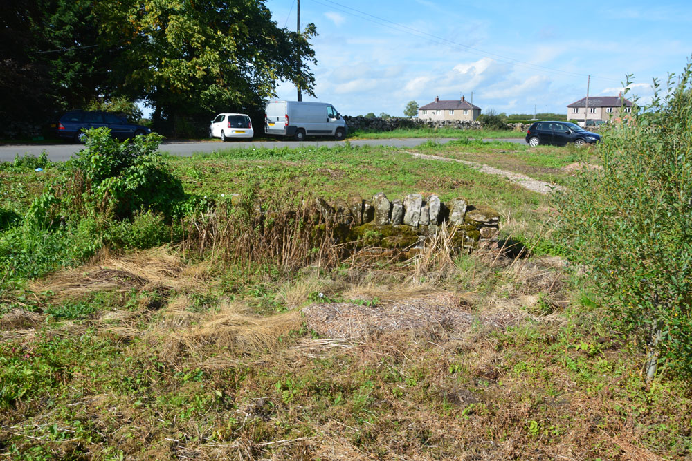
Kells Well (Newbeggin) submitted by Anne T on 13th Sep 2018. Standing to the east of the well, looking back across the road which leads into Newbeggin to the left and to the junction with the B5288 to the right. There doesn't appear to be a well trough any more, although all the ground around here is wet and spongy, indicating its the site of a spring.
(View photo, vote or add a comment)
Log Text: Kells Well, Newbeggin: This well is located opposite a house called Rockholme on the OS map, and near the Clickem Inn, just south of the B5288
The farmer from Sycamore View told us about the well, saying it had recently been “done up and claimed for the village” by the villagers. This was more like a glorified rubbish tip – the place was horrible, one of the worst places we’ve stopped at in years.
There was an old pebbled path leading round the well, together with the remains of an old stone structure, now largely covered in weeds and falling down. There was a pool of water to its northern side, and the whole of the central area around the stone structure was boggy and puddled; a small stream ran to a partly culverted ditch just to the north. Horrible. Glad to escape.
Redhills Rock Art
Trip No.96 Entry No.6 Date Added: 14th Sep 2018
Site Type: Rock Art
Country: England (Cumbria)
Visited: Yes on 11th Sep 2018. My rating: Condition -1 Ambience 4 Access 4
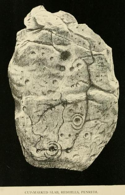
Redhills Rock Art submitted by durhamnature on 29th Oct 2012. Photograph from "Transactions of the Cumberland Archaeological Society" via archive.org
(View photo, vote or add a comment)
Log Text: Sockbridge / Redhills cist, small stone circle and round cairn (now all destroyed): We went to see this site as part of our amateur investigation of the possible Newbeggin Stone Alignment. Whilst the location is glorious, overlooking a steep scarp slope to the River Eamont below, and views to the hills of the North Lakes to the south, nothing can be seen here at all.
Just to the north of the scarp slope, there is a faint, very shallow, sub circular area, with one very broken stone at its edge, now almost buried in nettles. This stone is very unlike any of the others around Newbeggin in shape, almost looking like a mudstone rather than sandstone or limestone. This stone did have veins of quartz running through it, along with a few inclusions.
It was worth coming to this site for the walk and the scenery. We approached using the footpath from Sockbridge village, walking through a field of enormous Friesian cows, then a huge field of recently harvested sileage, then using the footbridge over the River Eamont, and up the hill, veering off to our left after the limestone pavement that ran along the top of the scarp slope.
Carlisle Cross
Trip No.114 Entry No.1 Date Added: 10th Jan 2019
Site Type: Ancient Cross
Country: England (Cumbria)
Visited: Yes on 9th Jan 2019. My rating: Condition 3 Ambience 4 Access 4

Carlisle Cross submitted by Anne T on 10th Jan 2019. The Carlisle Cross, with its base and steps in deep shade. Taken on my mobile phone, as its about the first time I've not seen anyone sat or playing around its base. Will try and get some better photos on our next trip to Carlisle. Standing just over 100m to the east of the eastern wall of the cathedral, the cross stands on the site of an earlier cross and marks the centre of Carlisle City.
(View photo, vote or add a comment)
Log Text: Carlisle Cross: in a visit to Carlisle, we decided not to make an hour to visit what we thought was a cross in Rickerby Park (turned out to be the carved stump of a tree trunk!) and a holy well nearby. This was the first time I've not seen anyone sitting or playing around the base of the cross, and not having my camera, took some photos using my mobile phone. Will return on our next trip to Carlisle and get some better photos.
Didn't realise this cross stands on the base of an earlier cross (the five steps look much older than the 1682 top), marks the centre of the City of Carlisle and stands where the Roman Forum used to stand - see the HE and Pastscape entries for more info.
Homeacres Holy Well (Stanwix)
Trip No.114 Entry No.2 Date Added: 5th Jun 2022
Site Type: Holy Well or Sacred Spring
Country: England (Cumbria)
Visited: Yes on 9th Jan 2019. My rating: Condition 2 Ambience 2 Access 4
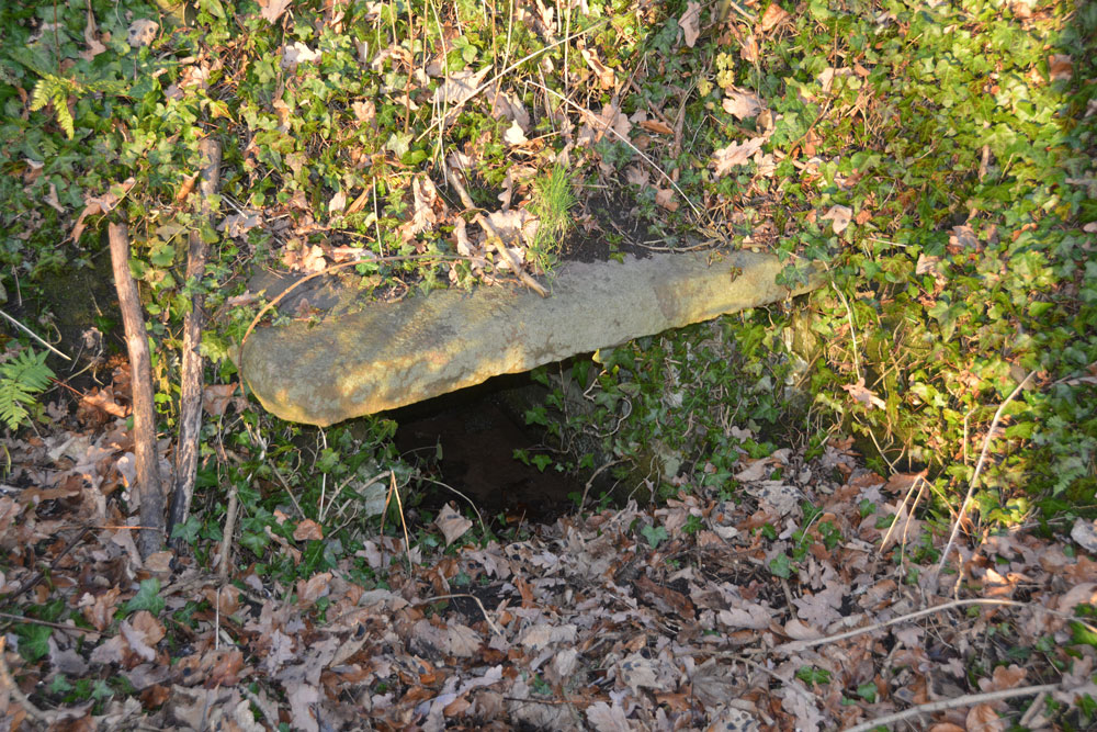
Homeacres Holy Well (Stanwix) submitted by Anne T on 10th Jan 2019. My husband was brave enough to slide down one of the old paths to the well, from the small road leading to the Rickerby Park car park. This path starts at approx. NY 40399 57112, at the top of the slope and almost immediately due north of the well.
(View photo, vote or add a comment)
Log Text: Homeacres Holy Well, Rickerby Park, Carlisle: We just about had time to stop off and find this well on our way home. Parking by the lawn tennis club just down the road, we walked to see what we thought was the stump of an old cross at approx. NY 40142 56900, but it turned out to be the stump of an old tree trunk which had been carved into what looked like an old boundary marker.
We headed off north east until we reached the junction of Well Lane and the B6264 (Brampton Road), then walked down the road leading to the car park in Rickerby Park. Reaching the junction with the footpath leading almost due west at NY 40510 57081, we walked past a marshy/boggy area which had wooden boarding at one end and a sign saying ‘deep water’.
Walking through the gate across the footpath, we peered deep into the undergrowth and eventually spotted what looked like a railway sleeper running about 6-8ft horizontally across the bank with a black void underneath. We tried to walk across the grassy area to the fence to get nearer to take a photograph, but the land was very waterlogged and we retreated.
Going back up towards Brampton Road, just past the cattle grid, there are faint traces of a footpath which runs down towards the well. Andrew made it down to the well and took some photographs. Having hurt my shoulder, I decided to stay on (this very busy) road. Andrew said there were also traces of another footpath running towards the well from the southern side of Brampton Road, just opposite Well Lane, but we would have had to climb over the metal railing to access it; the path was just visible, but very overgrown.
The well still had water in it. A couple of passers by on the lower path looked us with curiosity, one man asking us what we were looking at. When we told him a holy well, he looked at us in disbelief. I thought the nearby 'Well Lane' might have been a clue, although we initially thought the well was located down Well Lane and not in the park.
Casterton
Trip No.144 Entry No.5 Date Added: 13th Aug 2019
Site Type: Stone Circle
Country: England (Cumbria)
Visited: Yes on 8th Aug 2019. My rating: Condition 2 Ambience 3 Access 3
Casterton submitted by WindC on 26th Feb 2012. Looking eastwards, a moment when the cloud base lifted..
26/2/12
(View photo, vote or add a comment)
Log Text: Casterton Stone Circle and Settlement: I found this walk VERY difficult once we were in the field containing the stone circle, largely due to the steepness of the slope, but mainly due to all the stones and boulders hidden under the turf. I did not enjoy this visit at all, despite having really wanted to visit this stone circle.
We parked at SD 64084 79316 and walked northwards up the lane towards Brownthwaite Pike, a steady uphill plod, passing a spring which emerged from just the other side of the wall, and piped under the footpath to the field beyond.
Reaching the gate into the field with the stone circle, which the farmer allows access to, we had to wade through the first 10-15m, as water was trickling down the slope from across the footpath and pooling around the gate. I was quite astonished at all the heaps of stones (clearance cairns) and part-walls all across the field. It reminded me of the ‘5,000 tons of stones’ site in County Durham that Time Team looked at but couldn’t work out what it was.
On (finally) reaching the stone circle, which took the best part of 40 minutes, my interpretation was that this was a ring cairn, not a stone circle.
On the way back up the slope, did we find a boulder with cup mark? The interior was very smooth, unlike the solution holes, which have a rim. There was also another boulder with a large ‘solution hole’ on its side – an odd location for a solution hole.
St Anne's Well (Cotehill)
Trip No.146 Entry No.3 Date Added: 28th Aug 2019
Site Type: Holy Well or Sacred Spring
Country: England (Cumbria)
Visited: Yes on 27th Aug 2019. My rating: Condition 3 Ambience 3 Access 4
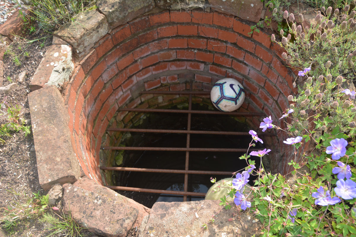
St Anne's Well (Cotehill) submitted by Anne T on 28th Aug 2019. Taking a closer look, there is a proper, brick-lined well, topped with a substantial metal grille.
(View photo, vote or add a comment)
Log Text: St Anne's Well, Cotehill: We squeezed on the odd little road junction that led to a small, new housing development, under the footpath sign.
We followed the footpath sign, which led straight through someone’s garden. We got a bit lost at this point, as several tracks through the grass had been mown flatter than others. Andrew followed two of them but could not see the well structure at all. As we were standing looking more closely at the map, the lady of the house and her children came out. I asked her if she knew where St. Anne’s Well was, and she said she had never heard of it.
Looking more closely, Andrew said the circle for the well was on the edge of the courtyard enclosed by the houses, before the footpath went through the garden of the house, so we retraced our steps a few metres.
There, in the house to our right hand side (facing the footpath and the meadows/open farmland beyond), was a circular brick flower bed. Andrew pronounced “that’s it”. I said ‘surely not’.
The structure was about 10m on private property within the garden, and I was to go up and knock on the door of the house and ask for permission to take photographs, but there no signs of life. “Who can run quickest?” I asked Andrew jokingly, and took a few steps into the garden, feeling very guilty.
There, inside the circular brick structure was a heavy iron grate, with a pool of water inside. This was definitely a well. I took three photographs very quickly, retreating back to the courtyard.
No mention in Pastscape or Historic England, although the well is shown as a blue circle on the HE map.
St Cuthbert's Well (Clifton)
Trip No.146 Entry No.4 Date Added: 29th Aug 2019
Site Type: Holy Well or Sacred Spring
Country: England (Cumbria)
Visited: Yes on 27th Aug 2019. My rating: Condition 3 Ambience 3 Access 5
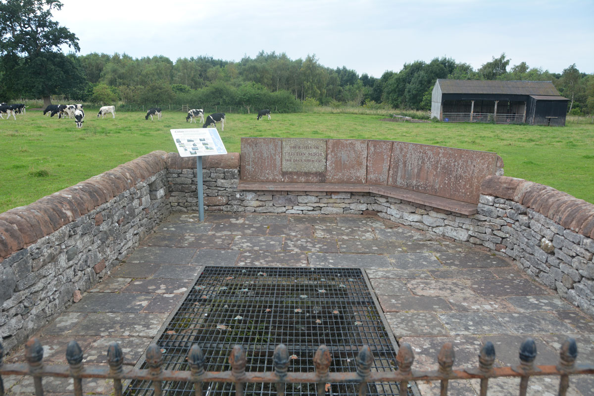
St Cuthbert's Well (Clifton) submitted by Anne T on 29th Aug 2019. The spring/well now covered by a close metal grille, which made taking photographs of the steps and water channel somewhat difficult, despite using manual focus. The enclosure commemorates the last battle on English soil between the Jacobite army and Government troops on 18th December 1745.
(View photo, vote or add a comment)
Log Text: St Cuthbert's Well (or Kelter Well), Clifton: The enclosure for this well is to the western side of the A6, towards the southern end of Clifton village. In some ways, this well is very disappointing, as the grid over it does not allow you to see very much, apart from some stone steps leading down to what appears to be a culvert with a strong flow of water running through it.
The well has been built into an enclosure which commemorates the last battle on English soil between the retreating Jacobite army and Government troops. This took place on 18th December 1745 (the battle of Clifton Moor).
No entry on either Pastscape or Historic England, although a well is shown on their map if you enter the grid reference above.
Eye Keld Well
Trip No.146 Entry No.5 Date Added: 29th Aug 2019
Site Type: Holy Well or Sacred Spring
Country: England (Cumbria)
Visited: Yes on 27th Aug 2019. My rating: Condition 2 Ambience 3 Access 4
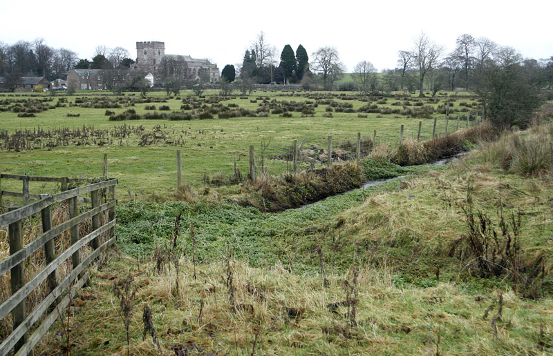
Eye Keld Well submitted by MisterBus on 28th Nov 2010. Eyekeld well, Greystoke, Cumbria, UK. The spring is in the foreground but is a neglected state. In the background is St Andrews Church, Greystoke
(View photo, vote or add a comment)
Log Text: Eyekeld Well, Greystoke: On the eastern side of the B5288 Icold Road which runs south from the village centre. The spring is only visible by peering over the dry stone wall, and the channel is covered with weeds and bracken, although there is a plentiful supply of water running from it, judging by the sounds of trickling water. There is also a long, straight water channel which runs east from the spring.
The Springs of Living Water, page 22 (with a photograph on page 25) has a couple of references to two wells in Greystoke, telling us they are dedicated to St Kentigern (aka St Mungo):
“The site of the well at Greystoke is on the roadside when entering the village from the south. This could well have been the place of a preaching stop … There was a well to the north of Greystoke, called Thanet Well after the name of St. Kentigern’s mother St. Tenue. The well is now covered by a concrete slab in a barn/garage belonging to the house next to the holiday park. The name of the well is preserved in the name of the park”.
In McIntire's "Holy Wells of Cumbria", he mentions a visit by Bishop Nicholson on 26th July 1705: "In ye morning we walk'd out to view (and taste) several extraordinary springs about the Town of Greystock; one of which they call Eye-Keld, Mary-Keld, Tolly-Keld." McIntire notes: "Eye Cold Spring still exists as Icold spring; "Mary-Keld" has had its name corrupted to Marigold. It rises in the park. "Tolly Keld" is a small stream discharging into the Petteril."
Borrowdale Stone Monument
Trip No.155 Entry No.1 Date Added: 15th Jan 2020
Site Type: Standing Stones
Country: England (Cumbria)
Visited: Yes on 12th Jan 2020. My rating: Condition 3 Ambience 4 Access 3
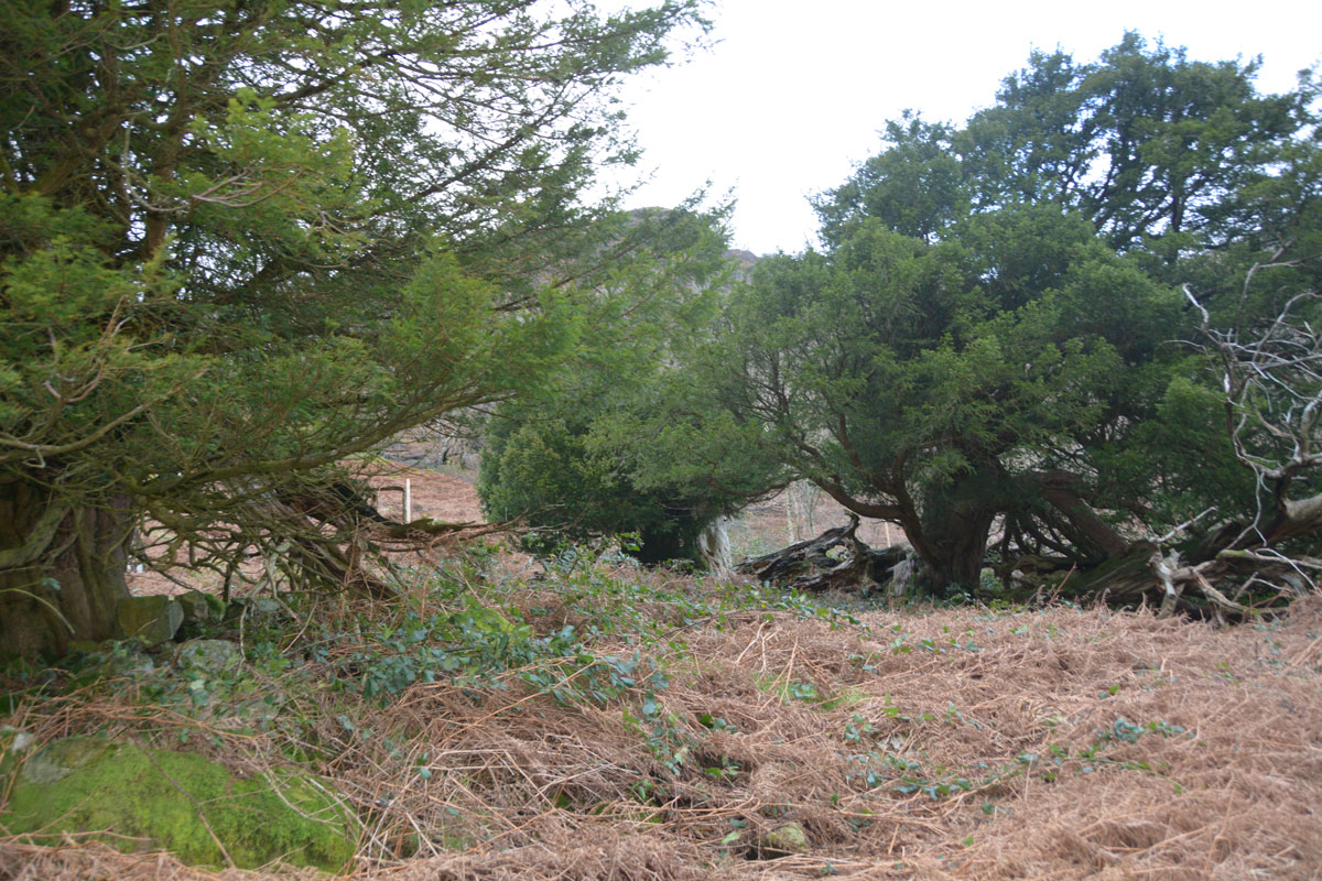
Borrowdale Stone Monument submitted by Anne T on 15th Jan 2020. Some of the smaller boulders have been cleared and piled up around the base of these ancient yew trees. Certainly very impressive trees and very old indeed. Well worth a visit. Photograph by Andrew T.
(View photo, vote or add a comment)
Log Text: Borrowdale Yews and the possible stone monument: Our first trip out for several months, and a way of escaping the windy and wet weather here in Northumberland. However, we arrived in a Cumbria that had experienced very heavy rain over recent days, and the small stream were swollen and many of the roads were flooded, although still passable.
We parked in the small car park near Seathwaite Farm, which is also a camping site and walked through the fields to the two bridges crossing the river(s). There are also a number of other streams to be crossed between here and the yew tree enclosure; at times of dry weather these would be easy to cross. On this occasion, a bit of balancing on convenient ‘stepping stones’ was in order!
The slope up to the yew tree enclosure was very slippery, so I sent Andrew up with the camera to explore. He came back saying the stones are definitely aligned in what seems to be a row, although I remained very sceptical, as there are a huge number of other boulders (large and small) on the hillside. Looking at the site from the south of river, by the car park, there seems to be the remains of the lower half of a double stone circle to the south west of the yew tree enclosure, although this could also just be coincidence.
This area was very heavily mined for graphite from 1555 onwards, and the remains of some of the industrial buildings can still be seen.
Sorry, but I remain unconvinced this is a stone row or alignment – there were so many other short rows of seemingly aligned stones on the hillside, this seemed like coincidence to me.
Bowder Stone
Trip No.155 Entry No.2 Date Added: 15th Jan 2020
Site Type: Natural Stone / Erratic / Other Natural Feature
Country: England (Cumbria)
Visited: Yes on 12th Jan 2020. My rating: Condition 3 Ambience 4 Access 4
Bowder Stone submitted by maigo on 25th Jun 2013. May2009
(View photo, vote or add a comment)
Log Text: The Bowder Stone, Borrowdale: We parked in the car park (there is a small charge) and walked the quarter of a mile to this enormous boulder. The last time we came here, some time ago, we walked through the quarry and I remember photographing all the old tree roots emerging from the rock and forming strange and complex patterns. Not so now, a recent path runs uphill, following the western side of the boundary for the quarry.
As usual, there was a party of young people, complete with mattresses, bouldering underneath the overhang. It was amusing to stand and watch them, although some of the tumbles looked a bit painful.
Andrew headed up the ladder to the platform at the top, whilst I wandered round the other side of the stone, a megalith catching my eye.
Askham Fell Cairn Stone Row
Trip No.173 Entry No.4 Date Added: 16th May 2022
Site Type: Stone Row / Alignment
Country: England (Cumbria)
Visited: Yes on 14th May 2022. My rating: Condition 3 Ambience 4 Access 4
Askham Fell Cairn Stone Row submitted by SandyG on 7th Jan 2018. The two western stones and nearby kerbed cairn. View from south (Scale 1m).
(View photo, vote or add a comment)
Log Text: Askham Fell Cairn and stone row: Using M. Waistell Taylor's Antiquarian paper from 1885, plus Sandy Gerrard's notes from the Stone Rows of Great Britain, we parked at the end of a row of cars at the junction of the single track road and the footpath which runs across it, near the Cop Stone. We set off with our trusty GPS to walk up to this amazing cairn to find the associated stone row.
We've visited this area before (28th June 2014), but more recently, Sandy G has been along to this area and surveyed the 2 verified stone rows in this area. We were unable to join him on this survey, but we're curious to find out more.
Thankfully we had Sandy G's diagram of the 4 small stones in this row (I thought they were just part of the kerb). Andrew very gracefully modelled the location of the smaller 2 stones using my walking poles.
Given the number of walkers around, I was amazed how many people were sticking to the paths and bridleways, rather than look at the archaeology. So much to see in such a concentrated area.
Cop Stone
Trip No.173 Entry No.3 Date Added: 17th May 2022
Site Type: Standing Stone (Menhir)
Country: England (Cumbria)
Visited: Yes on 14th May 2022. My rating: Condition 3 Ambience 4 Access 4
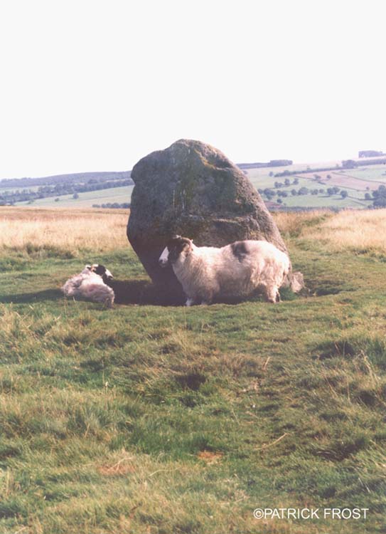
Cop Stone submitted by Patrick Frost on 14th Oct 2002. The Cop Stone in Cumbria at GR: 496216
(View photo, vote or add a comment)
Log Text: The Cop Stone, Askham Fell: Our second visit to this area, which has a wealth of archaeological sites, and reminds me very much of Dartmoor (in places). The weather was gloriously hot, and with many other walkers on the moor, we joined the row of cars parked by the side of the road at around NY 49586 21586.
Nothing much has changed about the Cop Stone since our last visit in 2014, although I was amazed at the number of people who just walked straight on by, without stopping. I had forgotten that the Cop Stone lies on the South Eastern border of a ring cairn, which has been described and illustrated by W. Waistell Taylor in his 1885 Antiquarian paper "Prehistoric Remains on Moordivock". Most of the stones in the ring are largely hidden, or just peeping above, the turf.
Fairy Well (Aikton)
Date Added: 4th Jun 2022
Site Type: Holy Well or Sacred Spring
Country: England (Cumbria)
Visited: Yes on 14th Jun 2020. My rating: Condition 2 Ambience 1 Access 5

Fairy Well (Aikton) submitted by Anne T on 4th Jun 2022. Parking at the side of the small road running west-east past the site of this well, referring to the old OS map from the National Library of Scotland, the well is located where the white arrow is pointing - in a ditch, but well hidden by both the hedge and the surrounding foliage.
(View photo, vote or add a comment)
Log Text: Fairy Well (Aikton): just after lockdown rules were relaxed marginally, and it was possible to travel short distances for reasons other than work or exercise, we needed to travel very near to Aikton, so took a short detour to try and find this well. There were plenty of walkers and other cars, but, as defined by lockdown law, no shops open, and no well to find!
Actually, not quite true, as peering down into the ditch, some water was visible bubbling up from the ground, running along a ditch to the south side of the hedge running along the northern edge of the field, but it was very difficult to find.
The gate into the field was open, so we looked along the other side of the hedge - all we could see were huge lumps of stone and concrete, which had been dumped along the ditch-line. Apart from a large lump of stone by the field gate, which looked as if it had simple architectural carving on it.
St Cuthbert's Stone and Well (Waverbridge)
Date Added: 4th Jun 2022
Site Type: Holy Well or Sacred Spring
Country: England (Cumbria)
Visited: Yes on 14th Jun 2020. My rating: Condition 2 Ambience 3 Access 4
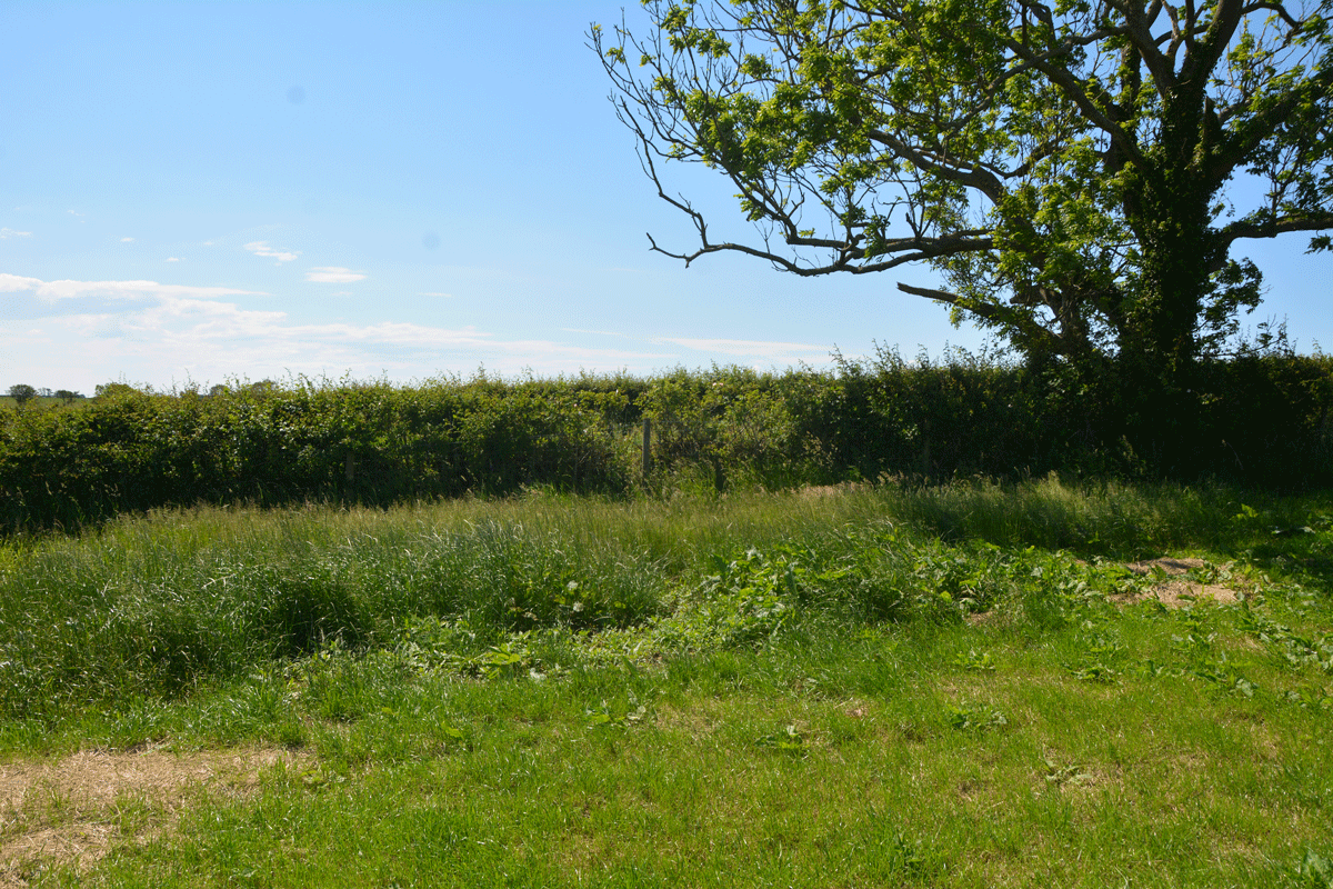
St Cuthbert's Stone and Well (Waverbridge) submitted by Anne T on 4th Jun 2022. Looking at the un-mown section of grass where the site of the well is shown. No water was showing in the field, but there was a pipe under the roots of the tree leading into the drainage ditch at the far side of the tree in the photograph.
(View photo, vote or add a comment)
Log Text: St Cuthbert's Stone & Well: We were making our first (and only for a long time) essential trip out, and passed within 400m of this well, so screeched to a halt at the entrance to the track (Watergate Lonning) at its junction with the B5302 at NY 21277 49139, and took our daily exercise walking down slope towards the well.
There is some sign of the well - in the field as an un-mown area of grass and in the hedge-line under the tree are remnants of a stone structure between the tree roots and along the bank of the ditch. All along the left hand side of the track (eastern side) is a drainage ditch, which we presume took the water from the fields, then when you get to the well, the water from the well joins the ditch. The well was dry at the time of our visit.
The stone was marked on the OS map, but was several fields away, with no gates in sight, so with time pressing, I photographed the well and we set off for our destination. So very odd to be out-and-about after months at home, but lots of other cars on the road, and difficult to rejoin the main road due to the high speed traffic.
St Mary's Well (Heversham)
Trip No.179 Entry No.4 Date Added: 22nd Jun 2022
Site Type: Holy Well or Sacred Spring
Country: England (Cumbria)
Visited: Yes on 21st Jun 2022. My rating: Condition 3 Ambience 3 Access 4
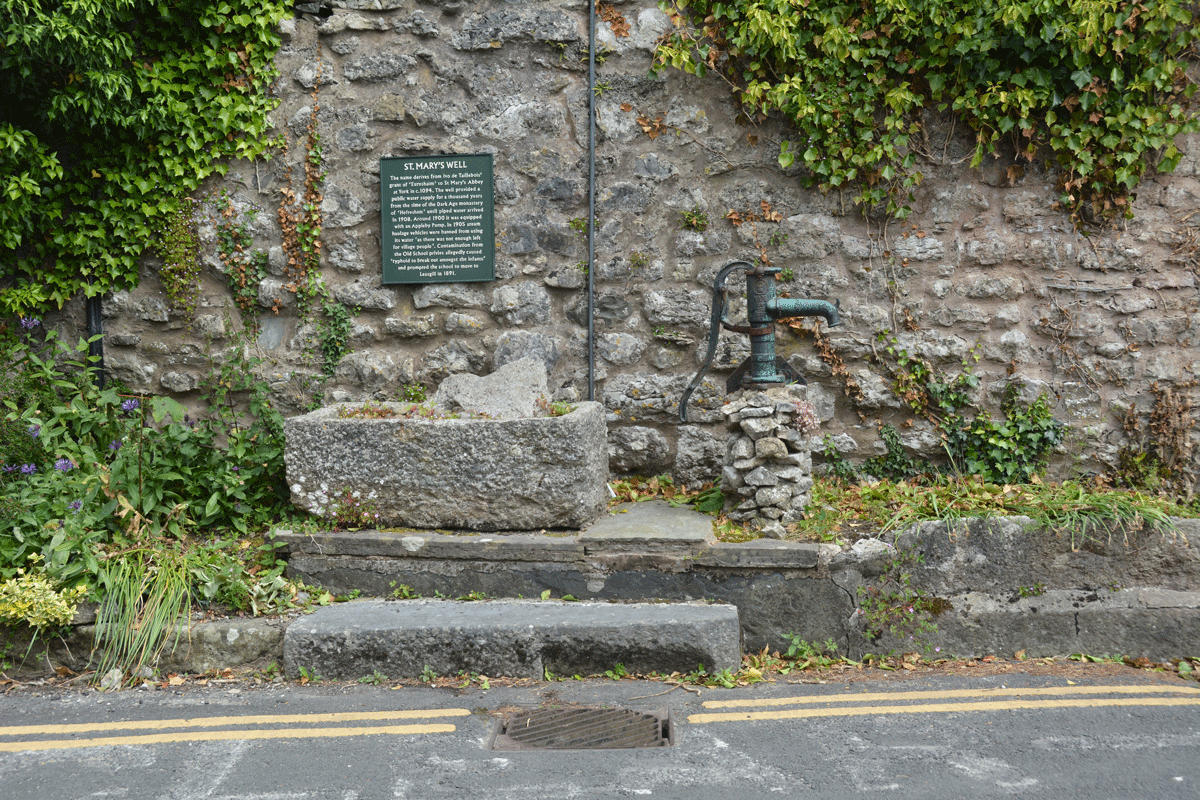
St Mary's Well (Heversham) submitted by Anne T on 22nd Jun 2022. Standing across the road from the well, looking at the pump and well trough (both now appear to be dry).
(View photo, vote or add a comment)
Log Text: St Mary's Well, Heversham: Spotted the blue 'W' on the HE map search when looking up information for St Peter's Church, so decided to have a look. Actually found the well purely by chance, when we drove past looking for a parking spot, then doubled back and parked near the lych gate, walking back to the well after we'd photographed the Anglo-Saxon stone fragments.
Having escaped the noise of building work (and radios) at home, we arrived to find the builders in the house opposite the well blasting out very loud rap music. Not a great visit as a result, as we couldn't hear ourselves think, but good to have added another well to the list I've seen.
St Michael's Well (Shawk)
Date Added: 10th Jul 2022
Site Type: Holy Well or Sacred Spring
Country: England (Cumbria)
Visited: Yes on 25th Jun 2020. My rating: Condition 3 Ambience 3 Access 3
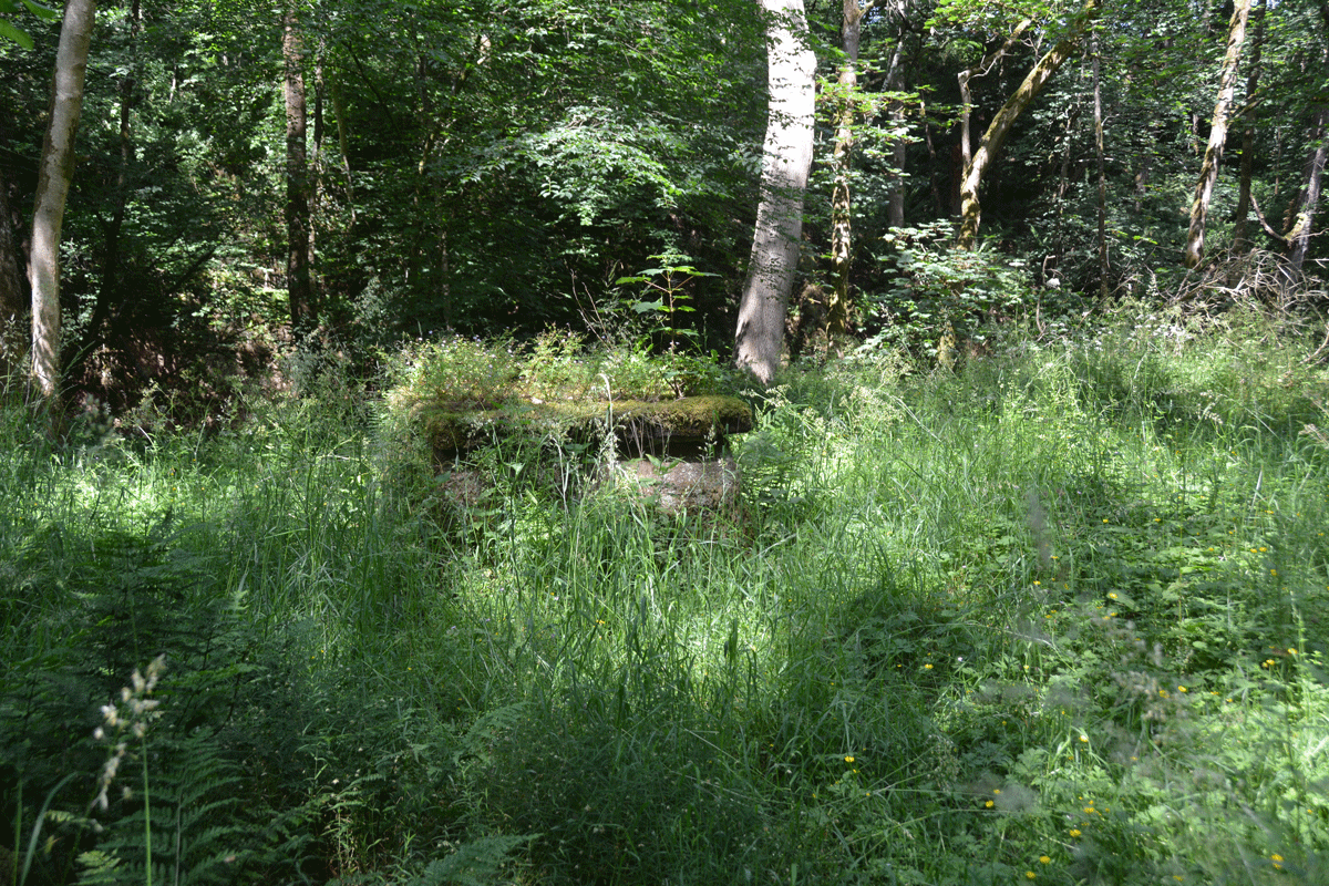
St Michael's Well (Shawk) submitted by Anne T on 10th Jul 2022. Looking back towards the footpath down through the wood (approached from the western side of the woodland).
(View photo, vote or add a comment)
Log Text: St Michael's Well, Shawk: Situated in a very lovely, heavily wooded area, to the east of a stream, Chalk Beck, which has stepping stones over it (these appear to move and be replaced when the stream floods, as there are several sets).
There is no mention on Pastscape or HE, although the HE map search shows a ‘W’ at the location of the well.
To reach the well, we parked on the grass verge at NY 33234 47664, and walked down the (private?) lane leading first south, then largely eastwards, past a number of properties, including the first which is called ‘Farthings’. At NY 33679 47362, the footpath carries on eastwards, through a gate; there is a private road which continues to the south. Our OS map indicated the well was nearer a footpath which started at NY 33653 47097, and which ran largely eastwards, but after 150m or so, it became so overgrown, we turned back.
We proceeded down the marked footpath at NY 33679 47362, where there are now a couple of wooden stables/sheds. There is an old hollow way which runs alongside the western side of the wood here, and we continued along this, through another gate, and followed the path which ran downhill, with a steep gorge to our right hand side. This path winds downhill, eventually coming to some stones laid across the course of Chalk Beck. We gingerly crossed this (wouldn’t like to try when the river is in flood or after it had been raining heavily). The well is immediately to our right hand side, about 20m to the east of the beck, largely hidden by tall grass and bracken.
The well structure is stone, with an opening in the top. The well was about 1/3 full of water, although we didn’t try and sample the water, as someone had thrown in a beer/lager can (a real shame). No visible signs of any ornamentation on the well housing.
The bedding planes on what we thought are red sandstone here were very clear, with a cliff on the western side of the river. Impressive!
St Oswald's Church (Dean)
Trip No.184 Entry No.3 Date Added: 31st Jul 2022
Site Type: Rock Art
Country: England (Cumbria)
Visited: Yes on 24th Jul 2022. My rating: Condition 3 Ambience 4 Access 5
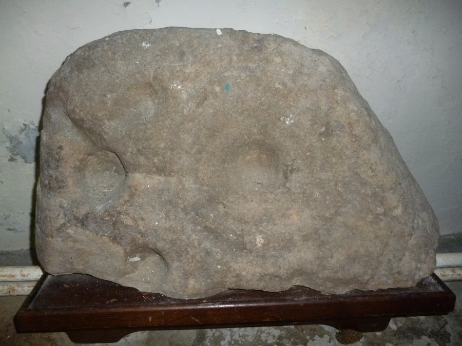
St Oswald's Church (Dean) submitted by SumDoood on 7th Mar 2018. The church is a most unusual and, I'd suggest, attractive building, C12th in origin, or older? Enter through the main door and turn right to find the carved boulder a few yards away. Taken 18-02-2018 and viewed from straight ahead.
(View photo, vote or add a comment)
Log Text: St Oswald's Church (Dean): Having left St Michael and All Angels at Isel, we visited the well in Eaglesfield and tried to find the Singing Well just outside Deanscales. The latter we could see over the hedge, but were unable to gain access to the field it sits in from the road. Parking by the lych gate of the church, walking along the southern side of the church, the preaching cross is easily visible, sitting on what looks like the base of a large market cross, with seven steps. The cross at the top is topped by a 'modern' (18th century) sundial.
We spent some considerable time in the church with the notes provided, tracking and photographing the medieval grave slabs that were visible. Enjoyed this visit.
Long Meg And Her Daughters
Trip No.185 Entry No.2 Date Added: 21st Aug 2022
Site Type: Stone Circle
Country: England (Cumbria)
Visited: Yes on 7th Aug 2022. My rating: Condition 4 Ambience 4 Access 4
Long Meg And Her Daughters submitted by Iain_P on 12th Aug 2017. Another. It was the only sun we saw all week!
(View photo, vote or add a comment)
Log Text: Long Meg and Her Daughters: We walked along the quiet, shady old hollow ways from St Michael's and All Angels, Addingham to Long Meg and her daughters, coming across a well by the side of the track, plus a solitary standing stone in a field just north of Long Meg. The latter was too close to the field boundary to be a rubbing stone. It wasn't marked on the OS map, nor is it mentioned on the Historic England map search or the entry for Long Meg.
We took my daughter-in-law, son and their two dogs along, and they were amazed it was 'a proper stone circle'. The base of Long Meg itself is currently being used as a shrine, with people leaving offerings even as we walked up to this stone - including flowers, key rings and even a pair of sunglasses!
The rock art on Long Meg stood out well in the bright sunlight. The site was very busy today, and the field full of large cattle, who fortunately kept their distance.
