Contributory members are able to log private notes and comments about each site
Sites Anne T has logged. View this log as a table or view the most recent logs from everyone
The Longstone (Shovel Down)
Trip No.135 Entry No.14 Date Added: 1st Aug 2019
Site Type: Standing Stone (Menhir)
Country: England (Devon)
Visited: Yes on 16th May 2019. My rating: Condition 3 Ambience 4 Access 3
The Longstone (Shovel Down) submitted by cazzyjane on 16th Apr 2012. The longstone at Shovel Down with Kestor Rock behind.
(View photo, vote or add a comment)
Log Text: The Longstone: A welcoming standing stone, very prominent in the landscape, sitting between rows 5 and 6. I had fun posing the group for photographs around the stone.
Shovel Down row 5
Trip No.135 Entry No.13 Date Added: 1st Aug 2019
Site Type: Multiple Stone Rows / Avenue
Country: England (Devon)
Visited: Yes on 16th May 2019. My rating: Condition 3 Ambience 4 Access 3
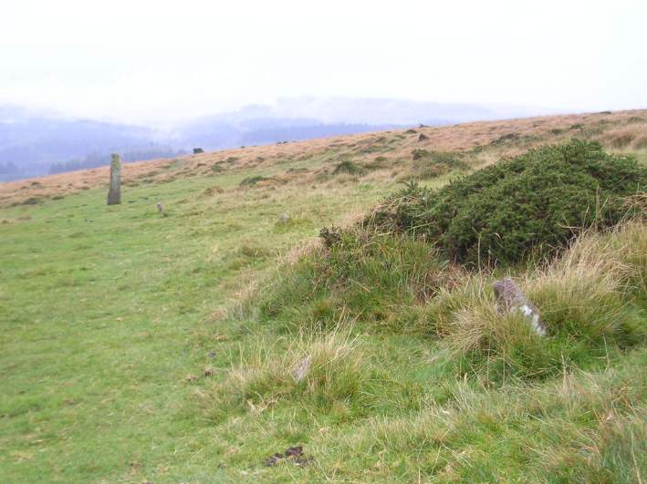
Shovel Down row 5 submitted by thecaptain on 15th Oct 2004. Shovel Down Row 5.
Although most of the stones in this avenue are either small or have been removed, traces of the row can be seen right to the Longstone.
View looking southwest at the lower end of the row, with Fernworthy forest in the distance.
(View photo, vote or add a comment)
Log Text: Shovel Down Row 5: Having been a little mystified by trying to find Rows 3 and 1, and having to rely on Sandy G to point out a few of the ground-level small stones, to find this stone row, running towards the Longstone, was really good. Glorious views over to Kes Tor, although it was still a little misty to get great photos.
Shovel Down row 1
Trip No.135 Entry No.12 Date Added: 1st Aug 2019
Site Type: Stone Row / Alignment
Country: England (Devon)
Visited: Yes on 16th May 2019. My rating: Condition 1 Ambience 3 Access 3

Shovel Down row 1 submitted by thecaptain on 14th Oct 2004. Shovel Down row 1.
At the northern end of this ruinous single stone row can be seen a few stones larger than the majority of theose remaining. Most of the remaining stones are very small and difficult to spot under the grass
This view is looking southwards along the general direction of the row.
(View photo, vote or add a comment)
Log Text: Shovel Down Row 1: My goodness, this row was difficult to spot! Thank goodness for Sandy’s patience, his wellington boots and his pole in pointing out a few of the stones!
Shovel Down stone circle
Trip No.135 Entry No.11 Date Added: 1st Aug 2019
Site Type: Stone Circle
Country: England (Devon)
Visited: Yes on 16th May 2019. My rating: Condition 2 Ambience 3 Access 3
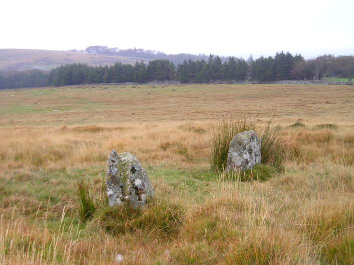
Shovel Down stone circle submitted by thecaptain on 13th Oct 2004. Two of the remaining standing stones viewed looking east.
The northern end of row 3 is just down to the right of this picture somewhere.
(View photo, vote or add a comment)
Log Text: Shovel Down Stone Circle: Before we visited this site, I thought there would be nothing to see, but I was wrong. Whilst there are just three stones remaining, they appear to the eye to sit along the arc of a circle. However, the authenticity of this stone circle is queried by Pastscape.
The stones are sited in deep, tussocky grass, I was very pleased to be able to reach this stone circle, not far off the main footpath, using my walking poles to balance.
Our GPS recorded the three stones at:
SX 65830 86187, SX 65822 86196 and SX 65823 86199
Shovel Down row 3
Trip No.135 Entry No.10 Date Added: 1st Aug 2019
Site Type: Multiple Stone Rows / Avenue
Country: England (Devon)
Visited: Yes on 16th May 2019. My rating: Condition 2 Ambience 3 Access 3
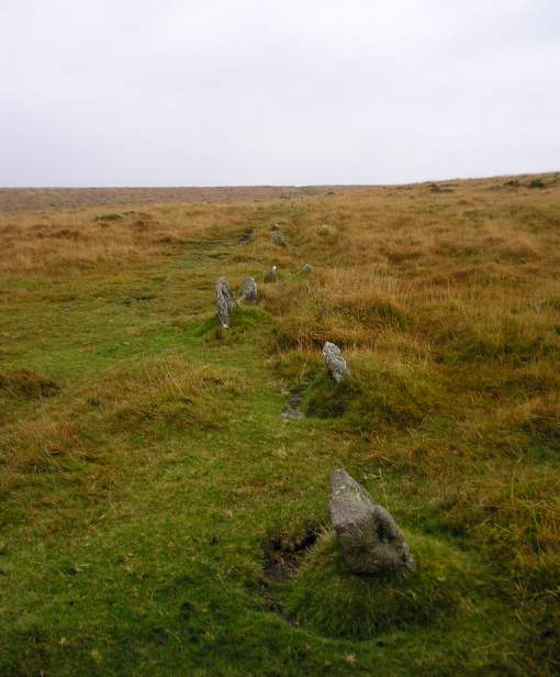
Shovel Down row 3 submitted by thecaptain on 16th Oct 2004. Shovel Down row 3 lseen here looking south from the northern part.
The row continues over the crest in the foreground and down into the dip, where it ends beside the Fourfold Circle.
(View photo, vote or add a comment)
Log Text: Shovel Down Row 3: To the west of stone row 2, and to the north of row 4, there was not much left to see of this row, which I tried to trace (without much success due to the high, tussocky grass on this part of the moor) as we walked down towards the stone circle.
Now writing up my photojournal, I’m pleased to see that Sandy G’s photographs, whilst showing a lot more stones, are a little similar to mine, largely showing the tops of stones peeking out of the grass. Good job for our superb guide, who pointed out the row to me.
Shovel Down Fourfold Circle
Trip No.135 Entry No.8 Date Added: 1st Aug 2019
Site Type: Stone Circle
Country: England (Devon)
Visited: Yes on 16th May 2019. My rating: Condition 3 Ambience 5 Access 3
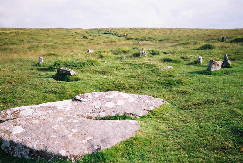
Shovel Down Fourfold circle submitted by simcon on 29th Aug 2003. SX659861 Shovel Down Stone Circle, Dartmoor Devon. I see this Web site lists two circles here, SE and NW. I only saw this circle which matches the description of Shovel Down SE Stone Circle. The view is looking south where the row continues to a large standing stone. Notice the two large standing stones fallen at the bottom of this picture. One has CP carved into it and the large stone over the hill has DC using the same size and style of letters. I do not know what this means. I parked in Fernw...
(View photo, vote or add a comment)
Log Text: Shovel Down Fourfold Stone Circle: Again, so many monuments in such a short walk – but by now, I should have stopped being surprised! At Kes Tor, Sandy G had spotted AngieLake, who had arrived a little later than us at the car park, and who had wandered about looking for us. By this time, it was lunchtime, and we were pleased to re-group and sit and take a welcome break, using the two large stones as the head of row 2 as a convenient picnic spot.
Whilst everyone was sharing out their sandwiches and tea/coffee, I took a few minutes to try and photograph the small-ish stones of the fourfold stone circle, largely hidden by the grassy tussocks, but none-the-less still recognisable as a kerbed cairn, although a little similar (if smaller) than Yellowmead.
With its proximity to row 2 and row 4, and other rows and features I'd not yet seen, this was an amazing spot.
Shovel Down row 4
Trip No.136 Entry No.7 Date Added: 1st Aug 2019
Site Type: Multiple Stone Rows / Avenue
Country: England (Devon)
Visited: Yes on 16th May 2019. My rating: Condition 3 Ambience 4 Access 3
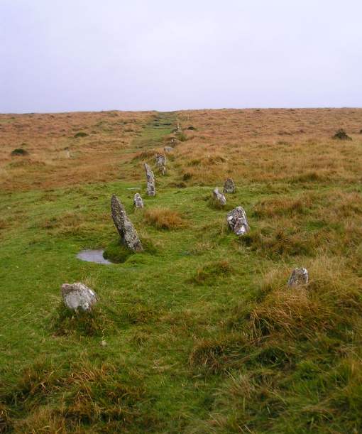
Shovel Down row 4 submitted by thecaptain on 16th Oct 2004. A typical Dartmoor avenue, seen here from the northern end, running off up the hillside to the south.
(View photo, vote or add a comment)
Log Text: Shovel Down Row 4: From Shovel Down Cairn Row 4, this row started just to the north west, the stones ‘marching’ steadily downhill. These stones were similar in size to the Drizzlecombe Stone Rows 1 & 2, but largely hidden in tall grass.
Whilst everyone else walked down to the Fourfold Stone Circle to start a well deserved lunch break, and see the start of Shovel Down Row 2, I paused to take photographs of row 4. The row reminded me more than a little of Standingstone Rigg in Northumberland, with the size of the stones and the steepness of the slope down which the stones ran (not literally!).
Shovel Down Cairn Row 4
Date Added: 1st Aug 2019
Site Type: Cairn
Country: England (Devon)
Visited: Yes on 16th May 2019. My rating: Condition 2 Ambience 4 Access 3
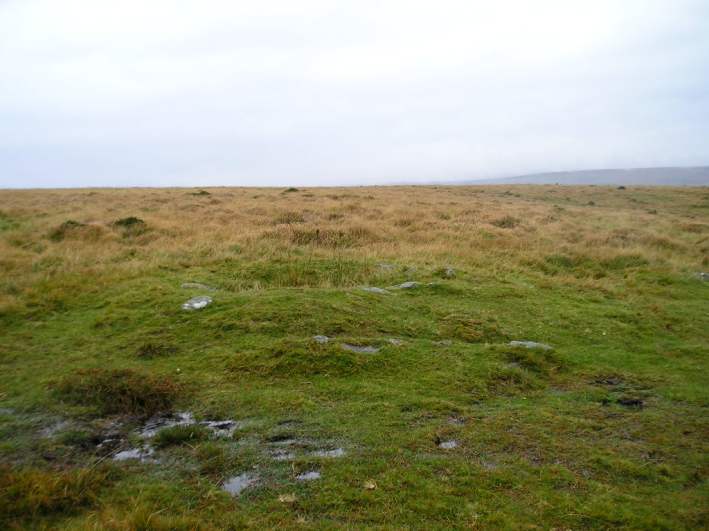
Shovel Down row 4 Cairn submitted by thecaptain on 16th Oct 2004. At the southern end of row 4 is a 7 metre diameter cairn with a central pit. This is the view looking west.
(View photo, vote or add a comment)
Log Text: Shovel Down Row 4 Cairn: Walking from Kes Tor across the moorland trackway, we came across this 'stony lump' at the top of a slope. Looking to my right (north), there was a double stone row running downslope at 90 degrees to the track. Only a small cairn, but interesting, particularly given its context. The group spent some time checking to see if any trace of the cist was visible, but we didn't find it.
St Ninian's Well (Brisco)
Trip No.39 Entry No.2 Date Added: 31st Jul 2019
Site Type: Holy Well or Sacred Spring
Country: England (Cumbria)
Visited: Yes on 17th Aug 2017. My rating: Condition 3 Ambience 3 Access 4
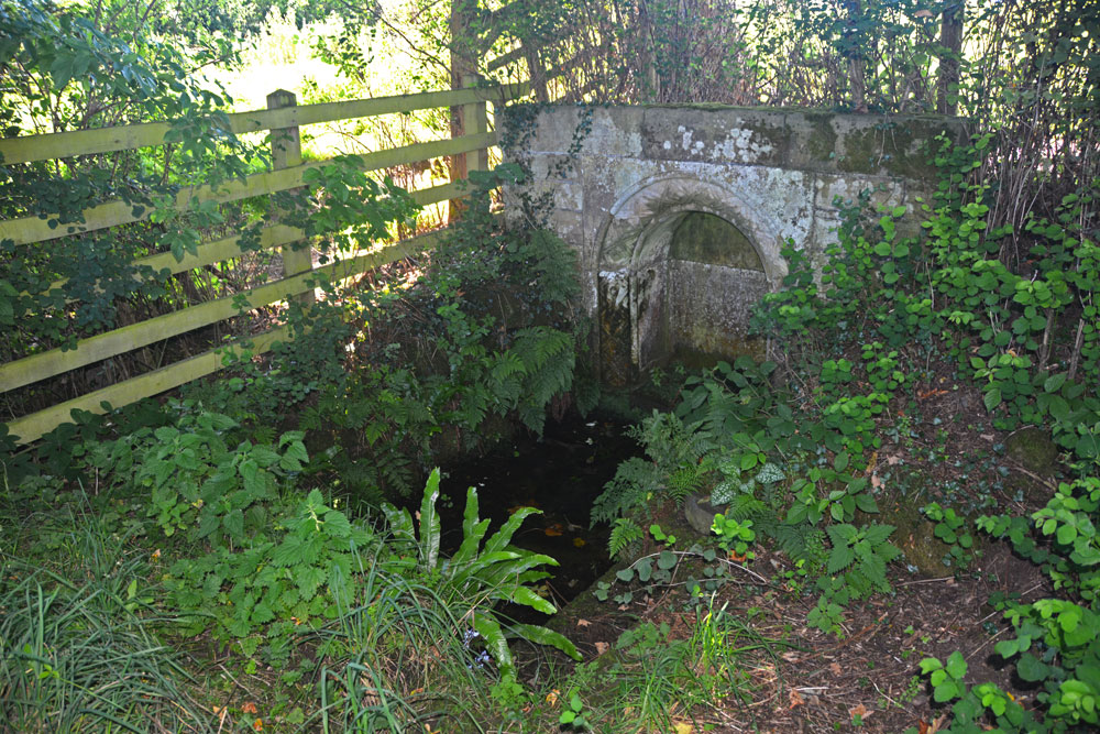
St Ninian's Well (Brisco) submitted by Anne T on 18th Aug 2017. First view of St Ninian's Well as we turned the corner of the dog-leg in the footpath.
(View photo, vote or add a comment)
Log Text: St Ninian's Well, Brisco, Cumbria: From Carlatton Demesne Standing Stone, heading back onto the A69, we took the M6 to junction 42, then the third exit towards Durdar. Brisco (Briscoe according to Pastscape) is the first turn to the right. The village is a line of houses on both sides of the road. We parked where the road widened slightly at Brisco Hall farm and walked back southwards to the footpath, which runs to the north of Well View cottage (they have a sign on the side of the house saying their drive is Elvis Presley Boulevard!), and followed the grassy lane down towards the railway line. Where the path does a right hand turn, there is a small set of stone steps. The footpath then turns north east towards the railway line, going through a gate into a field. The well is in this small enclosed area, tucked away at its south eastern end, mostly hidden by shrubs and brambles.
There is an arched well head that looks Victorian, and Pastscape and Historic England says was erected in the 1830s to 1840s. A step goes down to the well basin, in which, under the water, is a circular structure with a circular hole in its middle. In the corner of the fence facing the well is a small wooden bench, covered by brambles when we visited, but we used sticks to move these away and sit and admire this spot.
From the well, a gate leads through a fence-line down into a field of pasture below (the ground drops by 3-4 feet and there are steps down to the new ground level). This ground is wet and boggy and in line with the well head and pool is a cattle truck. A steady trickle of water comes through the bottom of the trough into a pool which has large boulders pushed around it in a partial circle, now partly destroyed. It looks like this might have been the original well pool. At the bottom of the field, the main west coast railway line runs and we watched several intercity trains and a steam train go by before returning to go into Carlisle for a late lunch then onto our next stop – a wheel-headed cross north west of Carlisle in Rockcliffe.
Kes Tor Cairn
Trip No.135 Entry No.5 Date Added: 31st Jul 2019
Site Type: Cairn
Country: England (Devon)
Visited: Yes on 16th May 2019. My rating: Condition 2 Ambience 3 Access 3
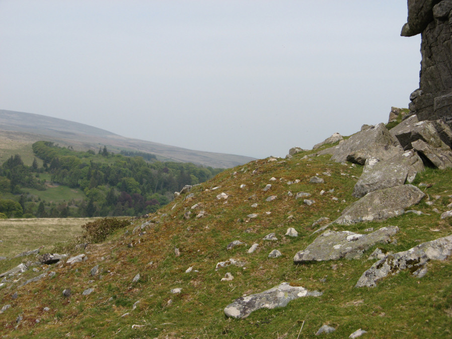
Kes Tor Cairn submitted by davep on 31st Jul 2019. Photograph taken 16th May 2019. Kes Tor Reported Cairn from Prehistoric Dartmoor Walks (site 1923).
(View photo, vote or add a comment)
Log Text: Kes Tor Cairn: As the group gathered around the western side of the tor, we saw what I initially thought was a tumble of smaller rocks from the side of the Tor, but as I walked around photographing it, thought it resembled a cairn. Walking back to join the group, Sandy and Dave were in conversation, concluding it was indeed probably a cairn. Dave took a gps with his garmin, remarkably similar to mine with my basic model, and has now included the cairn on Prehistoric Dartmoor Walks as a 'reported cairn' (site 1923).
Kes Tor Rock Basin
Trip No.135 Entry No.4 Date Added: 31st Jul 2019
Site Type: Natural Stone / Erratic / Other Natural Feature
Country: England (Devon)
Visited: Yes on 16th May 2019. My rating: Condition 3 Ambience 4 Access 3
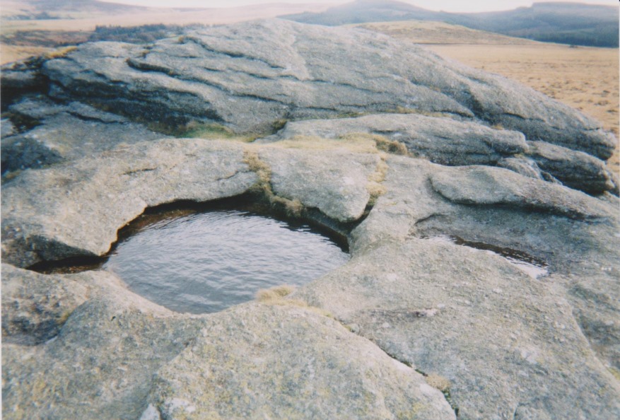
Kes Tor Rock Basin submitted by AngieLake on 28th Jul 2017. Another view of the rock basin here. Probably taken in 2002 on old film camera.
(View photo, vote or add a comment)
Log Text: Kes Tor Outcrop: My fear of falling stopped me from going to the top of this amazing outcrop to see the rock basin (I saw another walker trip over and narrowly miss going over the edge whilst I was there), but I admired the outcrop from down below. I hope I can still tick this site off my Dartmoor list as having visited!
Kestor Settlement
Trip No.135 Entry No.2 Date Added: 31st Jul 2019
Site Type: Ancient Village or Settlement
Country: England (Devon)
Visited: Yes on 16th May 2019. My rating: Condition 3 Ambience 4 Access 4
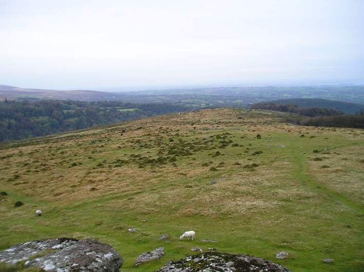
Kestor Settlement submitted by thecaptain on 24th Oct 2004. View northeast from Kestor rocks overlooking Kestor Settlement. The entire hilltop and hillsides here are covered in the ancient remains of ancient huts and field systems.
(View photo, vote or add a comment)
Log Text: Kestor Settlement (of which Round Pound is part of): Only across the road from the Round Pound, which I learned later was part of this settlement and not separate from it, as we walked up the slope to the east of Round Pound, I couldn’t believe the amount, and quality, of the structures that remained here.
At first, it was all a little mind-boggling, but then Sandy G produced a plan of the site, and I kept asking where we were on the plan, so I could sort my photographs accordingly. The views to the east and north east would have been quite amazing, had it not been for the mist around that day.
At home, I poured over Butler's "Dartmoor Atlas of Antiquities", volume 2, pages 170 onwards, which has a map of the settlement and descriptions of the field systems and the individual houses and enclosures within it. Brilliant!
Modern Stone Circle near Kestor Rock
Trip No.135 Entry No.3 Date Added: 19th Jul 2019
Site Type: Modern Stone Circle etc
Country: England (Devon)
Visited: Yes on 16th May 2019. My rating: Condition 3 Ambience 4 Access 3
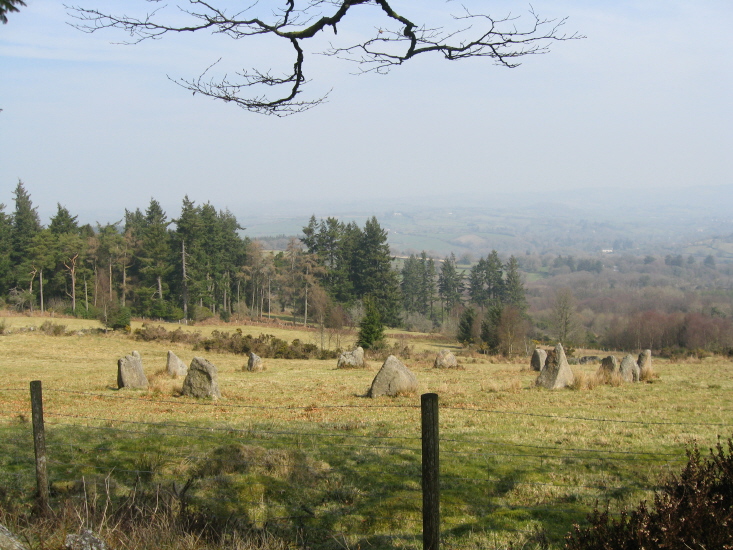
Modern Stone Circle near Kestor Rock submitted by AngieLake on 27th Mar 2011. Looking over wall from south border of field. [NB: All these photos are taken from the open moor.]
(View photo, vote or add a comment)
Log Text: Modern Stone Circle near Kestor Rock: As confirmed by the Dartefacts website, This stone circle is on land that used to the belong to Aid Edmundson and Jennifer Saunders. It is not recorded on Pastscape or Historic England.
The stone circle is on private land, but can be viewed over the fences to the west and southern sides.
We were also lucky enough to be with Janet Daynes and Gordon Fisher who had spent some time on this property doing excavations in years gone by. It was absolutely fascinating to hear them talk about the things they had found. Apparently the whole of the stone circle had, at one time, been surrounded by trees which had blown down or been cut down. The area is surrounded by Historic England List ID 1016691, “Coaxial field system and prehistoric settlements at Kestor”, but this area is not included in the scheduled area.
The Round Pound
Trip No.135 Entry No.1 Date Added: 19th Jul 2019
Site Type: Ancient Village or Settlement
Country: England (Devon)
Visited: Yes on 15th May 2019. My rating: Condition 3 Ambience 5 Access 4
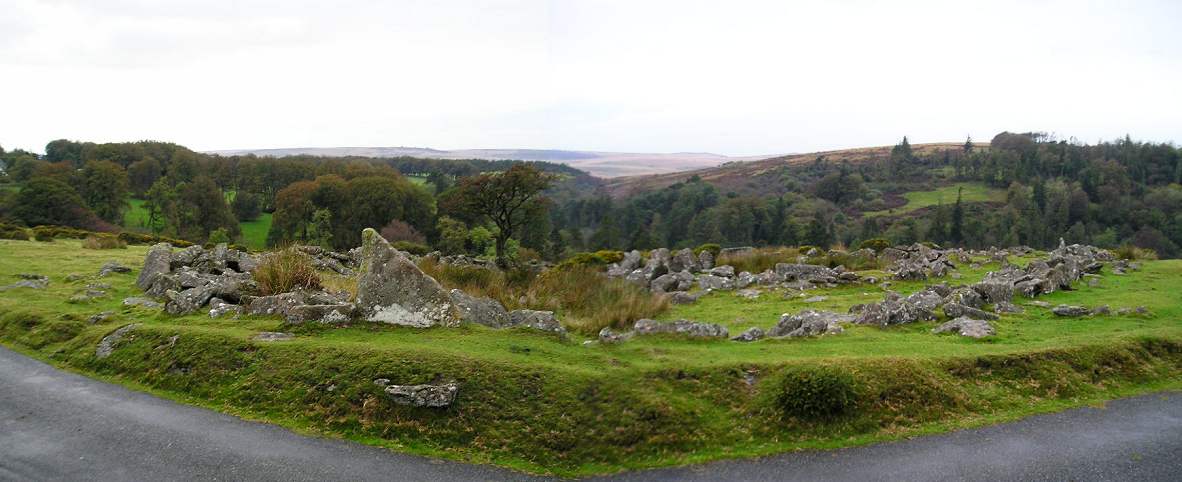
The Round Pound submitted by thecaptain on 23rd Oct 2004. The Round Pound, looking northwest from across the road which has been curved to pass around it.
(View photo, vote or add a comment)
Log Text: Round Pound Enclosure (part of the Kes Tor Settlement): For our first stop of the day, this was only a very short walk north-eastwards from the car park, and so visible from the single track road, I was left with open-mouthed and couldn’t wait to get over to this monument to take a closer look.
With Sandy knowing this site so well, we had an almost intimate walk-round this impressive part of the Kes Tor settlement. Little did I appreciate, until we walked over the road to the east, that so much more lay in store.
A superb area, and so easy to reach!
Yellowmead cairn
Trip No.134 Entry No.20 Date Added: 19th Jul 2019
Site Type: Cairn
Country: England (Devon)
Visited: Yes on 15th May 2019. My rating: Condition 2 Ambience 3 Access 3
Yellowmead cairn submitted by caradoc68 on 25th Aug 2011. EN cairn ( yellowmead group ) SX 575 679. 48m EEN of Yellowmead rings. This lovely little cairn circle, no more then five meters in diameter with five stones remaining in the circle.The centre as been completely robbed out and silted back up again leaving a different coloured grass. Easy to miss but worth a look
(View photo, vote or add a comment)
Log Text: Yellowmead Cairn: Whilst we started walking back to the car park, trying a different path mown through the grass, first running uphill then eastwards then south, we passed this cairn and stopped to take a closer look.
Whilst we were doing this, someone mentioned that the photo of the stone row on the Portal wasn’t the row we’d just looked at, but looked more like a line of stones running above, and parallel to the leat to the south west of the circle, and which we’d crossed to reach it. Some of the group split off to look at this more closely, and decided that the stones in the photo were of tin workings and an old track.
There was not much left of this cairn at all, although the slight mound did stand out nicely at the top of the slope.
Yellowmead row
Trip No.134 Entry No.19 Date Added: 19th Jul 2019
Site Type: Multiple Stone Rows / Avenue
Country: England (Devon)
Visited: Yes on 15th May 2019. My rating: Condition 2 Ambience 3 Access 3
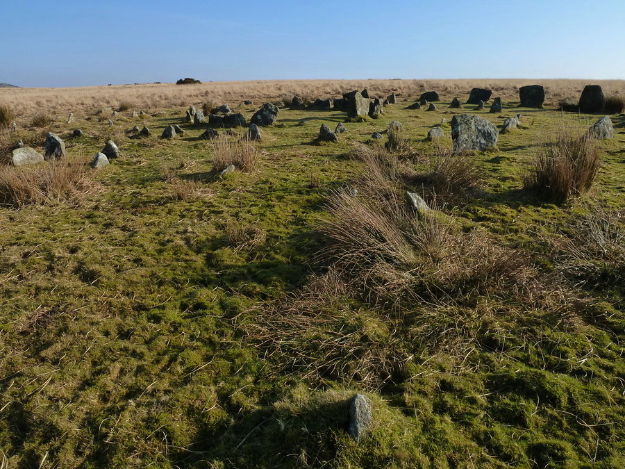
Yellowmead row submitted by Bladup on 12th May 2017. Yellowmead. This row leaves the circles at the south west.
(View photo, vote or add a comment)
Log Text: Yellomead Stone Row: Without Sandy G and Dave P I would not have known this stone row was here at all. Dave and Gordon F disappeared into the long grass towards the south/south west of the circle to see if they could find any more stones. I focussed on trying to understand what I was seeing nearer to the circle. Having Sandy's diagram, along with the information from Butler and other websites, has helped to clarify my understanding. To think that stone rows may have radiated from this fourfold stone circle. Absolutely fascinating!
Merrivale row 4
Trip No.133 Entry No.8 Date Added: 17th Jul 2019
Site Type: Stone Row / Alignment
Country: England (Devon)
Visited: Yes on 14th May 2019. My rating: Condition 2 Ambience 3 Access 4
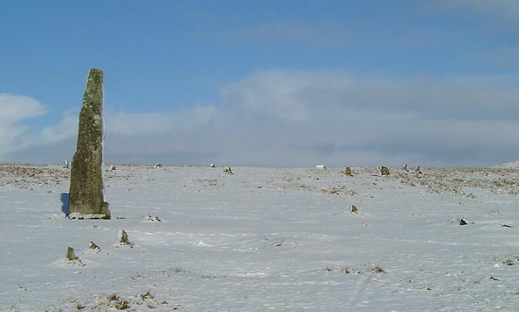
Merrivale row 4 submitted by Brian Byng on 7th Feb 2002. Row 4 azimuth 6 length 7m GR 5535 7458 Burl calls this E
A short row of 4 small stones next to the single standing stone.
It shows up rather well in this winter photo taken a few days ago.
(View photo, vote or add a comment)
Log Text: Merrivale 4 stone row: Without Sandy G and Dave P’s guidance on this, I would probably have looked at these stones and not thought much about them, but in association with the other two short rows (5 and 6), the tall, impressive menhirs and the fallen stone and cairn nearby, it was a jumble to unpick, so I was very grateful for the explanations!
Merrivale 5
Trip No.133 Entry No.9 Date Added: 17th Jul 2019
Site Type: Stone Row / Alignment
Country: England (Devon)
Visited: Yes on 14th May 2019. My rating: Condition 2 Ambience 3 Access 4
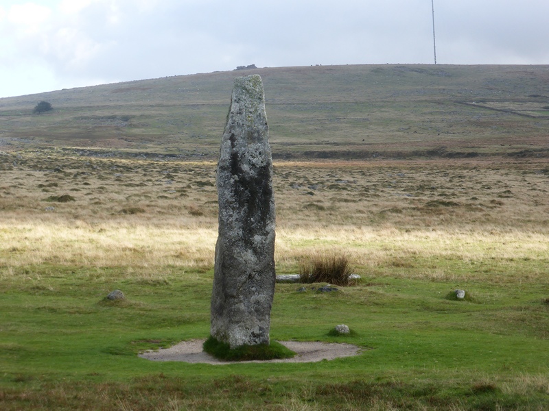
Merrivale 5 submitted by SandyG on 4th Mar 2017. View looking along the row from the western end. Hollow Tor on the horizon sits above the tall stone at the end of the row. 6 July 2016.
(View photo, vote or add a comment)
Log Text: Merrivale 5 stone row: I was getting really 'dazed and confused' about the different stone rows here and what I was photographing, so I asked Sandy, Dave and Andrew to each place a foot on or near each stone of this row!
Hadrian's Wall (Heddon on the Wall)
Date Added: 17th Jul 2019
Site Type: Misc. Earthwork
Country: England (Northumberland)
Visited: Yes on 20th Sep 2018. My rating: Condition 3 Ambience 4 Access 5
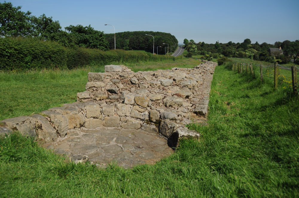
Hadrian's Wall (Heddon on the Wall) submitted by Anne T on 8th Jul 2019. This round structure, built into the body of the wall, is thought to be a medieval corn drying kiln. A creative use of this stone structure! Photo taken 14th June 2014. Looking east down the stretch of wall, with the B6528 running parallel, to the west of the line of the Wall.
(View photo, vote or add a comment)
Log Text: Section of Hadrian's Wall at Heddon-on-the-Wall: This well preserved section of the 'wide' wall can be found a few hundred metres to the east of the church, and comes as quite a surprise as I turned the corner from The Towne Gate, heading east.
There are some structures built into the body of the wall, one said to be medieval corn drying kiln. I saw quite a few tourists passing this spot on the other side of the B6528, but none stopped to walk into this part of the wall and take a closer look.
Merrivale Menhir
Trip No.133 Entry No.11 Date Added: 17th Jul 2019
Site Type: Standing Stone (Menhir)
Country: England (Devon)
Visited: Yes on 14th May 2019. My rating: Condition 3 Ambience 4 Access 4
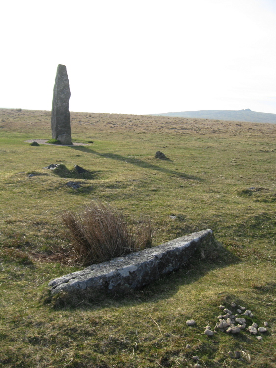
Merrivale Menhir submitted by AngieLake on 10th Apr 2015. This shot shows the "smaller pillar" that Butler describes, in relation to the menhir and the cairn 6 pit. He says: "The menhir, 3.1 m high, still stands in its original position, 42 m almost due south from the centre of the stone circle. There is no evidence that the smaller pillar, 2 m long, lying a few meters away ever stood upright, but it was erected in 1895 in the pit alongside, toppling again a few years later. Between these two stones cairn C6 (3.0 x 0.3 m) has a central pit. Three st...
(View photo, vote or add a comment)
Log Text: Merrivale Menhir: This tall stone made up for the small size of the stones of the stone circle, and I enjoyed visiting here. My goodness, with the three stone rows, the fallen menhirs, the cairn and the pits, it was certainly interesting here. I'd taken my notes for this site with me, but the wind was so strong I was unable to get them out and read them! Now having the Butler series of "Dartmoor Atlas of Antiquities" has made it much easier to understand the layout and complexities of the site, as far as I'm able.
